Category:Fields in Anglesey
Jump to navigation
Jump to search
Media in category "Fields in Anglesey"
The following 200 files are in this category, out of 320 total.
(previous page) (next page)-
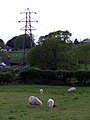
 A Cow, a field and some wind turbines - geograph.org.uk - 197454.jpg 480 × 640; 62 KB
-
 A crop of maize on Yr Allt Farm - geograph.org.uk - 836909.jpg 640 × 480; 75 KB
-
 A Curious Knoll - geograph.org.uk - 232112.jpg 640 × 480; 111 KB
-

-
 A field full of grazing black sheep - geograph.org.uk - 153131.jpg 640 × 480; 84 KB
-
 A field of beet - geograph.org.uk - 523473.jpg 640 × 480; 109 KB
-
 A field of cultivated grass - geograph.org.uk - 492588.jpg 640 × 302; 38 KB
-

-
 A field of grain west of the B5111 - geograph.org.uk - 1400191.jpg 640 × 480; 68 KB
-
 A field of kale - geograph.org.uk - 1060809.jpg 640 × 480; 97 KB
-
 A field of maize at Yr-allt Farm - geograph.org.uk - 841343.jpg 640 × 480; 72 KB
-

-
 A freshly-cut field - geograph.org.uk - 200407.jpg 640 × 480; 94 KB
-
 A Grazing Horse - geograph.org.uk - 186690.jpg 640 × 480; 75 KB
-
 A Green field in the countryside - geograph.org.uk - 193455.jpg 640 × 480; 81 KB
-

-
 A hayfield near Tyddyn Drain - geograph.org.uk - 841355.jpg 640 × 480; 62 KB
-
 A herd of cattle at Treffos Farm - geograph.org.uk - 946352.jpg 640 × 480; 56 KB
-
-

-
 A tin shack on rough ground - geograph.org.uk - 519645.jpg 640 × 464; 89 KB
-
 A tree in the field - geograph.org.uk - 179343.jpg 640 × 480; 72 KB
-
 A tree-sheltered field at Marian - geograph.org.uk - 374722.jpg 640 × 480; 64 KB
-

-

-

-
 A View Towards Dulas Bay - geograph.org.uk - 232115.jpg 640 × 480; 104 KB
-
 A wooded boss behind Tan y Graig Farm - geograph.org.uk - 521416.jpg 640 × 480; 111 KB
-
 Aberffraw.jpg 3,504 × 2,336; 483 KB
-
 Afon Menai, near Moel-y-don - geograph.org.uk - 237319.jpg 600 × 450; 68 KB
-
 All wrapped up - geograph.org.uk - 73066.jpg 640 × 480; 93 KB
-
-
 An area of rough pasture - geograph.org.uk - 785108.jpg 640 × 338; 42 KB
-
 Anglesey Is Beautiful - geograph.org.uk - 247408.jpg 640 × 480; 107 KB
-
 Black sheep of the family - geograph.org.uk - 193439.jpg 640 × 480; 101 KB
-
 Black, Brown and White Cattle grazing - geograph.org.uk - 200356.jpg 640 × 480; 106 KB
-

-
 Bridge near Llangaffo - geograph.org.uk - 222643.jpg 600 × 450; 143 KB
-
 Bryn Farm, Rhoscolyn - geograph.org.uk - 833880.jpg 640 × 480; 40 KB
-
 Buildings by grazing land - geograph.org.uk - 180813.jpg 640 × 480; 115 KB
-
 Cattle Feeder - geograph.org.uk - 153183.jpg 640 × 480; 126 KB
-
 Cattle Grazing - geograph.org.uk - 153192.jpg 640 × 480; 118 KB
-
 Cattle in a field - geograph.org.uk - 198024.jpg 640 × 480; 53 KB
-
 Cattle in a field - geograph.org.uk - 198030.jpg 640 × 480; 117 KB
-
-

-
 Clai Mawr - geograph.org.uk - 73043.jpg 640 × 480; 86 KB
-
 Cliff top fields - geograph.org.uk - 748693.jpg 640 × 480; 75 KB
-
 Clifftop farmland at Cerrig Duon - geograph.org.uk - 373244.jpg 640 × 322; 49 KB
-

-
 Coastal farmland - geograph.org.uk - 404489.jpg 640 × 480; 61 KB
-
 Coastal Pasture - geograph.org.uk - 38777.jpg 640 × 480; 65 KB
-

-
 Cow grazing near to small pond - geograph.org.uk - 186732.jpg 640 × 480; 75 KB
-
 Cows Grazing - geograph.org.uk - 153190.jpg 640 × 480; 115 KB
-
 Cows in a field - geograph.org.uk - 180228.jpg 640 × 480; 102 KB
-
 Cows in a field - geograph.org.uk - 200290.jpg 640 × 480; 101 KB
-

-
 Crop land at Frondeg-uchaf - geograph.org.uk - 842024.jpg 640 × 480; 76 KB
-
 Cropland east of Bryngwyn - geograph.org.uk - 845338.jpg 640 × 480; 51 KB
-
 Cropland east of Tanpencefnbach - geograph.org.uk - 848530.jpg 640 × 480; 119 KB
-

-
 Cultivated grass at Ty Fry - geograph.org.uk - 521000.jpg 640 × 283; 58 KB
-
 Farmland - geograph.org.uk - 38883.jpg 640 × 480; 49 KB
-
 Farmland - geograph.org.uk - 38886.jpg 640 × 480; 63 KB
-

-
 Farmland at Cae Mawr - geograph.org.uk - 523680.jpg 640 × 298; 50 KB
-
 Farmland at Llansadwrn - geograph.org.uk - 679212.jpg 640 × 480; 89 KB
-
 Farmland at Taihirion - geograph.org.uk - 521007.jpg 640 × 292; 56 KB
-
 Farmland below Penmon Priory - geograph.org.uk - 377572.jpg 640 × 480; 79 KB
-
 Farmland east of the B5111 - geograph.org.uk - 1402268.jpg 640 × 480; 50 KB
-
 Farmland east of Trefadog bay - geograph.org.uk - 1406101.jpg 640 × 481; 61 KB
-
 Farmland near Bodgylched - geograph.org.uk - 680638.jpg 640 × 480; 93 KB
-
 Farmland near Plas Llandegfan - geograph.org.uk - 679164.jpg 640 × 480; 92 KB
-
 Farmland near Pont Cefn Coch - geograph.org.uk - 916106.jpg 640 × 480; 40 KB
-
 Farmland near Porthamel Hall - geograph.org.uk - 237314.jpg 600 × 450; 97 KB
-

-
 Farmland Round Llyn Alaw Reservoir - geograph.org.uk - 236380.jpg 640 × 480; 100 KB
-
 Farmland west of Glan Gors Farm - geograph.org.uk - 1400162.jpg 640 × 372; 43 KB
-
 Farmland west of Maenir cottage - geograph.org.uk - 1408650.jpg 640 × 480; 87 KB
-
 Farmland, Beaumaris - geograph.org.uk - 240567.jpg 640 × 480; 56 KB
-
 Field alongside road - geograph.org.uk - 152507.jpg 640 × 480; 135 KB
-
 Field alongside the airfield - geograph.org.uk - 200414.jpg 640 × 480; 90 KB
-
 Field alongside the B4421 - geograph.org.uk - 169731.jpg 640 × 480; 120 KB
-
 Field and Gate at Hafod-Leci - geograph.org.uk - 323647.jpg 640 × 480; 247 KB
-
 Field and roof tops of farm buildings - geograph.org.uk - 169014.jpg 640 × 480; 124 KB
-
 Field at Bryncryd - geograph.org.uk - 193443.jpg 640 × 480; 90 KB
-
 Field at Llangristiolus - geograph.org.uk - 180230.jpg 640 × 480; 92 KB
-
 Field beside a country road - geograph.org.uk - 180225.jpg 640 × 480; 94 KB
-
 Field beside the railway - geograph.org.uk - 186751.jpg 640 × 480; 80 KB
-
 Field boundaries in sheep country - geograph.org.uk - 993405.jpg 640 × 480; 77 KB
-
 Field by the sea - geograph.org.uk - 171799.jpg 480 × 640; 127 KB
-

-
 Field full of Cows - geograph.org.uk - 161462.jpg 640 × 480; 91 KB
-
 Field near Tai Hirion - geograph.org.uk - 120714.jpg 640 × 480; 58 KB
-
 Field near to Angora Farm - geograph.org.uk - 152505.jpg 640 × 480; 112 KB
-
 Field near to Frogwy Bach - geograph.org.uk - 152500.jpg 640 × 480; 154 KB
-
 Field near to Llanfaethlu - geograph.org.uk - 197437.jpg 640 × 480; 100 KB
-
 Field near to Llanynghenedl - geograph.org.uk - 197940.jpg 640 × 480; 86 KB
-
 Field near to Penmynydd - geograph.org.uk - 179576.jpg 640 × 480; 92 KB
-

-
 Field near to Tre Angharad - geograph.org.uk - 200294.jpg 640 × 480; 88 KB
-
 Field next to Bodwyn farm - geograph.org.uk - 197439.jpg 640 × 480; 98 KB
-
 Field North of Newborough - geograph.org.uk - 169645.jpg 640 × 480; 126 KB
-
 Field opposite Dyffryn - geograph.org.uk - 179596.jpg 640 × 480; 73 KB
-
 Field to the West of Llanfachraeth - geograph.org.uk - 197935.jpg 640 × 480; 97 KB
-
 Field wall west of Caer-glaw - geograph.org.uk - 878075.jpg 640 × 336; 28 KB
-
 Field with pylon near to Bryngwran - geograph.org.uk - 193669.jpg 640 × 480; 66 KB
-
 Fields alongside road - geograph.org.uk - 119508.jpg 640 × 480; 50 KB
-

-
 Fields at Tan-y-graig Farm - geograph.org.uk - 513036.jpg 640 × 374; 77 KB
-
 Fields beside the B5110 - geograph.org.uk - 180227.jpg 640 × 480; 77 KB
-

-
 Fields By The B5109 - geograph.org.uk - 1437534.jpg 640 × 480; 158 KB
-
 Fields Near Pont Cefn Coch - geograph.org.uk - 1436275.jpg 640 × 480; 142 KB
-
 Fields near to Castellior farm - geograph.org.uk - 179313.jpg 640 × 480; 93 KB
-
 Fields near to Llanddaniel Fab - geograph.org.uk - 149421.jpg 640 × 480; 144 KB
-
 Fields near Ty Gwyn - geograph.org.uk - 152496.jpg 640 × 480; 110 KB
-
 Fields north of Cornelyn - geograph.org.uk - 435474.jpg 640 × 480; 91 KB
-
 Fields to the rear of The Lodge - geograph.org.uk - 1402645.jpg 640 × 411; 59 KB
-
 Fields to the west of Capel Newydd - geograph.org.uk - 1402922.jpg 640 × 480; 71 KB
-

-
 Footpath to the Llanfechell Triangle - geograph.org.uk - 1260743.jpg 593 × 640; 70 KB
-
 Four Cows and Four Wind turbines - geograph.org.uk - 193464.jpg 640 × 480; 59 KB
-
 Foxgloves in a hedge - geograph.org.uk - 193222.jpg 640 × 480; 114 KB
-
 Gate into a field - geograph.org.uk - 193224.jpg 640 × 480; 88 KB
-
 Gorse Bushes on Tywyn Trewan Common - geograph.org.uk - 186716.jpg 640 × 480; 79 KB
-

-
 Grazing - geograph.org.uk - 73070.jpg 640 × 480; 82 KB
-
 Grazing cattle - geograph.org.uk - 169631.jpg 640 × 480; 140 KB
-
 Grazing cattle - geograph.org.uk - 186744.jpg 640 × 480; 56 KB
-
 Grazing cattle near to the A55 - geograph.org.uk - 186670.jpg 640 × 480; 105 KB
-
 Grazing land above Porth y Gwyddel - geograph.org.uk - 1438932.jpg 640 × 480; 57 KB
-
 Grazing land alongside Lon Plas - geograph.org.uk - 1438140.jpg 640 × 404; 40 KB
-

-
 Grazing land at Castellior Farm - geograph.org.uk - 750797.jpg 640 × 278; 24 KB
-
 Grazing land at Plas Uchaf - geograph.org.uk - 1408548.jpg 640 × 481; 53 KB
-

-
 Grazing land near to farm buildings - geograph.org.uk - 200374.jpg 640 × 480; 82 KB
-
 Grazing land near to Newborough Forest - geograph.org.uk - 169651.jpg 640 × 480; 147 KB
-
 Grazing land south of Pengorffwysfa - geograph.org.uk - 1408837.jpg 640 × 480; 61 KB
-

-

-
 Grazing land west of Hebron - geograph.org.uk - 1323888.jpg 640 × 318; 26 KB
-
 Grazing sheep - geograph.org.uk - 169355.jpg 640 × 480; 121 KB
-
 Grazing sheep - geograph.org.uk - 180140.jpg 640 × 480; 92 KB
-
 Grazing Sheep - geograph.org.uk - 186730.jpg 640 × 480; 81 KB
-
 Grazing sheep and a pylon - geograph.org.uk - 180231.jpg 480 × 640; 71 KB
-
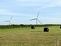
 Grazing Sheep and a windfarm - geograph.org.uk - 197453.jpg 640 × 480; 96 KB
-
 Grazing sheep at Maenaddwyn - geograph.org.uk - 1323884.jpg 640 × 237; 16 KB
-
 Grazing sheep near to rock outcrop - geograph.org.uk - 193433.jpg 640 × 480; 101 KB
-
 Harvest near Llanddona - geograph.org.uk - 105705.jpg 640 × 433; 111 KB
-

-
 Hay bales in a field - geograph.org.uk - 200315.jpg 640 × 480; 104 KB
-
 Hay bales wrapped in plastic - geograph.org.uk - 200428.jpg 640 × 480; 78 KB
-
 Hay field north of Caer-glaw Farm - geograph.org.uk - 898232.jpg 640 × 480; 41 KB
-
 Hay making on land fringing the marsh - geograph.org.uk - 515498.jpg 640 × 267; 49 KB
-
 Hay meadow at Clorach Fawr Farm - geograph.org.uk - 1399615.jpg 640 × 480; 61 KB
-
 Hay-field near Cae'r glaw, Gwalchmai - geograph.org.uk - 1441893.jpg 640 × 334; 32 KB
-
 Haymaking at Tyddyn Bach - geograph.org.uk - 523091.jpg 640 × 338; 53 KB
-
 Horse on rough grazing land - geograph.org.uk - 155797.jpg 640 × 480; 170 KB
-
 Horses grazing on the hillside - geograph.org.uk - 193469.jpg 640 × 480; 104 KB
-
 Horses in a field - geograph.org.uk - 193227.jpg 640 × 480; 87 KB
-

-
 Improved grassland - geograph.org.uk - 520854.jpg 640 × 279; 59 KB
-
 Iron gate leading into a field - geograph.org.uk - 152494.jpg 640 × 480; 164 KB
-
 Land to the East of Clegir Mawr - geograph.org.uk - 200385.jpg 640 × 480; 98 KB
-

-
 Llanbabo - geograph.org.uk - 171257.jpg 640 × 480; 81 KB
-

-
-
 Metal gate into a field - geograph.org.uk - 186685.jpg 640 × 480; 100 KB
-
 Mixed grazing - geograph.org.uk - 405732.jpg 640 × 457; 48 KB
-
 Mole infested field below Coed 'Refail - geograph.org.uk - 420646.jpg 640 × 480; 103 KB
-

-
 Off The Tourist Track - geograph.org.uk - 247413.jpg 640 × 480; 94 KB
-

-
 Part of the defence wall of Din Sylwy - geograph.org.uk - 949138.jpg 640 × 480; 54 KB
-
 Pasture - geograph.org.uk - 38875.jpg 640 × 480; 59 KB
-
 Pasture - geograph.org.uk - 42259.jpg 640 × 480; 57 KB
-
 Pasture and beyond - geograph.org.uk - 38870.jpg 640 × 480; 46 KB
-
 Pasture and Cleifiog Isaf - geograph.org.uk - 38783.jpg 640 × 480; 60 KB
-
 Pasture and Deer Park Wall - geograph.org.uk - 490159.jpg 640 × 480; 157 KB
-
 Pasture and Woods - geograph.org.uk - 38786.jpg 640 × 480; 61 KB
-
 Pasture at Church Bay - geograph.org.uk - 38397.jpg 640 × 480; 121 KB
-
 Pasture land - geograph.org.uk - 38858.jpg 640 × 480; 52 KB
-

-
 Pasture land grazed by horses - geograph.org.uk - 767575.jpg 640 × 359; 25 KB
-

-
 Pasture land west of Fedw Fawr - geograph.org.uk - 435492.jpg 640 × 480; 72 KB
-

-
-
 Path through sheep's pasture - geograph.org.uk - 420696.jpg 640 × 480; 85 KB
-
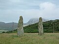 Penrhos Feilw - geograph.org.uk - 216.jpg 640 × 480; 32 KB
-

-

-
 Ploughed fields at Castellior Farm - geograph.org.uk - 751452.jpg 640 × 259; 33 KB
-
 Ploughed land at Plas Lligwy Farm - geograph.org.uk - 752623.jpg 640 × 480; 85 KB
-
 Ponies grazing - geograph.org.uk - 152644.jpg 640 × 480; 158 KB
-
 Pony grazing amongst the gorse bushes - geograph.org.uk - 200431.jpg 640 × 480; 162 KB


