Category:Fetter Lane Moravian Church
Jump to navigation
Jump to search
Fetter Lane Moravian Church.
Original chapel in Fetter Lane, City of London, was destroyed by bombing during the Second World War.
The community has been re-established at Moravian Close, 381 Kings Road, Chelsea, London SW10 0LP.
| Object location | | View all coordinates using: OpenStreetMap |
|---|
church in Royal Borough of Kensington and Chelsea, UK  | |||||
| Upload media | |||||
| Instance of | |||||
|---|---|---|---|---|---|
| Location | Royal Borough of Kensington and Chelsea, Greater London, London, England | ||||
 | |||||
Media in category "Fetter Lane Moravian Church"
The following 6 files are in this category, out of 6 total.
-
 ONL (1887) 1.097 - Interior of the Moravian Chapel in Fetter Lane.jpg 1,797 × 1,379; 1.02 MB
-
 Fetter Lane church.jpg 2,923 × 3,897; 4.49 MB
-
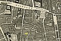 John Rocque 1746 1d (cropped).jpg 2,683 × 1,821; 1.8 MB
-

-
 Moravian church plaque London.jpg 1,438 × 906; 1.12 MB
-
 The Moravian Chapel, Old Chelsea (14591660760) (cropped).jpg 1,227 × 826; 224 KB
_1.097_-_Interior_of_the_Moravian_Chapel_in_Fetter_Lane.jpg)
.jpg)
.png)

_(cropped).jpg)