Category:Fernham
Jump to navigation
Jump to search
village and civil parish in Vale of White Horse district, Oxfordshire, England  | |||||
| Upload media | |||||
| Instance of | |||||
|---|---|---|---|---|---|
| Location | Vale of White Horse, Oxfordshire, South East England, England | ||||
| official website | |||||
 | |||||
English: Fernham is a village and civil parish about south of Faringdon in the Vale of White Horse. Fernham was historically part of the parish of Shrivenham. It was part of Berkshire until the 1974 local authority boundary changes transferred the Vale of White Horse to Oxfordshire.
Subcategories
This category has the following 2 subcategories, out of 2 total.
C
- Corner Cottage, Fernham (2 F)
Media in category "Fernham"
The following 61 files are in this category, out of 61 total.
-

-
 Approaching Fernham, with White Horse Hill in the distance - geograph.org.uk - 6194151.jpg 4,000 × 3,000; 4.69 MB
-
 B4508 towards Fernham - geograph.org.uk - 6267690.jpg 640 × 480; 54 KB
-
 Barrowbush Barn - geograph.org.uk - 2283469.jpg 3,744 × 2,468; 1.31 MB
-
 Barrowbush Barn - geograph.org.uk - 3984617.jpg 640 × 428; 93 KB
-
 Barrowbush Barn, near Fernham - geograph.org.uk - 3044009.jpg 640 × 480; 105 KB
-
 Bins out for collection, Silver Street, Fernham - geograph.org.uk - 6228092.jpg 2,000 × 1,230; 3.93 MB
-
 Celia's Coppice, Fernham - geograph.org.uk - 5276331.jpg 4,500 × 3,000; 2.03 MB
-
 Church of St John, Fernham, Oxfordshire - geograph.org.uk - 4520792.jpg 675 × 800; 168 KB
-
 Clear path through wheat - geograph.org.uk - 5063461.jpg 1,024 × 768; 265 KB
-
 Coming into Fernham - geograph.org.uk - 1125277.jpg 640 × 427; 44 KB
-
 Corner Cottage, Fernham - geograph.org.uk - 6267768.jpg 800 × 533; 80 KB
-
 Dismtd Rly - geograph.org.uk - 2299665.jpg 3,548 × 2,592; 2 MB
-
 Elmside - geograph.org.uk - 6228106.jpg 2,000 × 1,199; 2.82 MB
-
 Entrance to Fernham - geograph.org.uk - 6228088.jpg 2,000 × 972; 2 MB
-
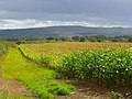
 Farmland off Fernham Road (B4508) - geograph.org.uk - 6267687.jpg 800 × 600; 69 KB
-
 Farmland, Fernham - geograph.org.uk - 2815954.jpg 640 × 480; 164 KB
-
 Farmland, Fernham - geograph.org.uk - 2815970.jpg 640 × 480; 154 KB
-
 Fernham Church and Pump - geograph.org.uk - 5277207.jpg 2,971 × 2,015; 1.17 MB
-
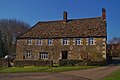 Fernham Farmhouse - geograph.org.uk - 4418089.jpg 1,024 × 682; 163 KB
-
 Fernham Road to Shellingford - geograph.org.uk - 4218587.jpg 1,500 × 999; 124 KB
-
 Fernham Road to Shellingford - geograph.org.uk - 4218589.jpg 1,500 × 999; 238 KB
-
 Fernham Village from Barrowbush Hill - geograph.org.uk - 2283476.jpg 3,888 × 2,592; 1.26 MB
-
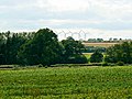
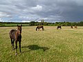
 Grazing off Fernham Road (B4508) - geograph.org.uk - 6267773.jpg 800 × 600; 84 KB
-
 High Street (B4508), Fernham - geograph.org.uk - 6267771.jpg 800 × 600; 91 KB
-
 High Street, Fernham - geograph.org.uk - 6228100.jpg 2,000 × 1,103; 2.71 MB
-
 Maize crop, south of Fernham - geograph.org.uk - 3044022.jpg 640 × 480; 98 KB
-
 Maize in a field west of Fernham - geograph.org.uk - 6228111.jpg 2,000 × 1,331; 3.5 MB
-
 Pasture, Fernham - geograph.org.uk - 2815957.jpg 640 × 480; 145 KB
-
 Public bridleway approaching the River Ock during flooding - geograph.org.uk - 6319471.jpg 4,500 × 3,375; 2.48 MB
-
 Raspberry Copse, near Fernham - geograph.org.uk - 6193875.jpg 4,000 × 3,000; 4.82 MB
-
 Remains of a Railway Bridge - geograph.org.uk - 2284849.jpg 1,946 × 1,450; 907 KB
-
 Road to Little Coxwell - geograph.org.uk - 4218545.jpg 1,500 × 999; 166 KB
-
 Road to Nightingale Farm, Fernham - geograph.org.uk - 6228078.jpg 2,000 × 1,201; 2.59 MB
-
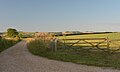
 Road to South Farm House - geograph.org.uk - 6267776.jpg 800 × 600; 123 KB
-
 Rural road to Fernham - geograph.org.uk - 4218574.jpg 1,500 × 999; 156 KB
-
 Rural road to Little Coxwell - geograph.org.uk - 4218552.jpg 1,500 × 999; 134 KB
-
 Sign for the Woodman Inn, Fernham - geograph.org.uk - 6267697.jpg 634 × 800; 81 KB
-
 Silver Street - geograph.org.uk - 6228095.jpg 2,000 × 1,331; 3.65 MB
-
 Snowdrops by the roadside - geograph.org.uk - 5277541.jpg 1,600 × 1,200; 972 KB
-
 St John's Church on High Street - geograph.org.uk - 4218580.jpg 1,500 × 999; 200 KB
-
 St Mary's Priory - geograph.org.uk - 307334.jpg 640 × 480; 95 KB
-
 St. John's Church, Fernham - geograph.org.uk - 6267764.jpg 800 × 552; 93 KB
-
 Stile near Fernham Farm, Fernham - geograph.org.uk - 6228104.jpg 1,331 × 2,000; 3 MB
-
 Straw bales west of Fernham - geograph.org.uk - 6228108.jpg 2,000 × 1,107; 2.63 MB
-

-
 The B4508 to Fernham - geograph.org.uk - 4218541.jpg 1,500 × 999; 158 KB
-
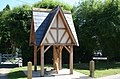 The covered pump in Fernham - geograph.org.uk - 2693580.jpg 640 × 423; 87 KB
-
 The road into Fernham - geograph.org.uk - 4218548.jpg 999 × 1,500; 199 KB
-
 The road to Little Coxwell - geograph.org.uk - 4218546.jpg 999 × 1,500; 211 KB
-
 The Woodman Inn on Chapel Lane - geograph.org.uk - 4218577.jpg 1,500 × 999; 133 KB
-
 The Woodman Inn, Fernham - geograph.org.uk - 6267693.jpg 800 × 474; 70 KB
-
 Track to Nightingale Farm - geograph.org.uk - 6267688.jpg 800 × 600; 110 KB
-
 Uffington Down - geograph.org.uk - 1458599.jpg 640 × 426; 119 KB
-
 Vanished Bridge - geograph.org.uk - 2286739.jpg 2,048 × 1,536; 644 KB
-
 Water pump on The Green - geograph.org.uk - 4218582.jpg 999 × 1,500; 181 KB
-
 White Horse View, Fernham - geograph.org.uk - 6193885.jpg 4,000 × 3,000; 5 MB
-
 Approaching T junction - geograph.org.uk - 307327.jpg 640 × 480; 82 KB
-
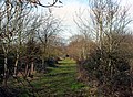
 Barrowbush bridleway - geograph.org.uk - 351176.jpg 640 × 480; 107 KB
-
 Entrance to Fernham Farm House - geograph.org.uk - 307335.jpg 640 × 480; 98 KB
-
 Long Lane - geograph.org.uk - 307330.jpg 640 × 480; 101 KB


_-_geograph.org.uk_-_6267687.jpg)


_-_geograph.org.uk_-_6267773.jpg)
,_Fernham_-_geograph.org.uk_-_6267771.jpg)


