Category:Fences in Leicestershire
Jump to navigation
Jump to search
Subcategories
This category has only the following subcategory.
R
- Railings in Leicestershire (17 F)
Media in category "Fences in Leicestershire"
The following 38 files are in this category, out of 38 total.
-
 Brentingby, near Melton - geograph.org.uk - 68288.jpg 640 × 480; 137 KB
-
 Cotesbach - geograph.org.uk - 81142.jpg 640 × 480; 104 KB
-
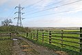
 Countryside near Rolleston - geograph.org.uk - 753262.jpg 640 × 616; 114 KB
-
 Edmondthorpe & Wymondham station remains geograph-3451669-by-Ben-Brooksbank.jpg 2,273 × 1,494; 3.22 MB
-
 Fence and fields - geograph.org.uk - 687408.jpg 443 × 640; 126 KB
-
 Fence and fields - geograph.org.uk - 725488.jpg 640 × 480; 92 KB
-
 Footpath, Blaby - geograph.org.uk - 1259364.jpg 480 × 640; 118 KB
-
 From Chalk Pool Hill - geograph.org.uk - 144445.jpg 640 × 427; 119 KB
-
 Gilmorton - geograph.org.uk - 163107.jpg 640 × 480; 74 KB
-
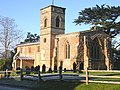
 Former church of St Leonard, Hoton. - geograph.org.uk - 750250.jpg 640 × 480; 275 KB
-
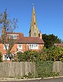
 Hugglescote StJohnBaptist north.JPG 2,660 × 1,900; 1.93 MB
-
 John o'Gaunt station site geograph-3705955-by-Ben-Brooksbank.jpg 2,394 × 1,433; 2.85 MB
-
 John o'Gaunt station site geograph-3705976-by-Ben-Brooksbank.jpg 2,378 × 1,473; 2.63 MB
-
 Kościół od strony parku.jpg 2,592 × 1,456; 1.61 MB
-
 Lime Kiln Lock, Leicester - geograph.org.uk - 473565.jpg 640 × 414; 134 KB
-
 New fence at Brooksby Grange Farm - geograph.org.uk - 144385.jpg 640 × 427; 168 KB
-
 No unauthorised persons - geograph.org.uk - 557867.jpg 640 × 452; 103 KB
-
 Old Fence New Fence - geograph.org.uk - 239114.jpg 640 × 480; 67 KB
-
 Pastures by Langton Caudle - geograph.org.uk - 726031.jpg 640 × 480; 137 KB
-
 Perimeter fence and concreted area - geograph.org.uk - 327832.jpg 640 × 480; 92 KB
-
 Public footpath to Arnesby - geograph.org.uk - 737102.jpg 640 × 500; 136 KB
-
 Remains of an old aeroplane - geograph.org.uk - 327809.jpg 640 × 480; 85 KB
-
 Make your mind up time - geograph.org.uk - 417409.jpg 640 × 480; 146 KB
-
 St Nicholas Church, South Kilworth - geograph.org.uk - 592899.jpg 497 × 640; 123 KB
-
 St. Mary's Mill Lock in Aylestone. - geograph.org.uk - 377427.jpg 640 × 423; 109 KB
-

-
 Unusual Decorations Blaby - geograph.org.uk - 1072506.jpg 640 × 480; 89 KB
-
 Watermead Country Park, Leicester. - geograph.org.uk - 377514.jpg 640 × 439; 122 KB
-
 Wigston United Reformed Church.jpg 5,250 × 3,500; 5.45 MB
-
 Colby Drive, Thurmaston, Leicester - geograph.org.uk - 72993.jpg 640 × 480; 121 KB
-
 Countryside near Burrough on the Hill - geograph.org.uk - 693894.jpg 640 × 480; 88 KB
-
 Countryside north of Thurlaston Lane - geograph.org.uk - 677953.jpg 640 × 480; 110 KB
-
 End of the world - geograph.org.uk - 187648.jpg 640 × 480; 66 KB
-
 Fields near John O'Gaunt - geograph.org.uk - 520489.jpg 640 × 449; 93 KB
-
 Leaning Fence - geograph.org.uk - 146686.jpg 640 × 543; 124 KB
-

-
 The Mowbray Way - geograph.org.uk - 594112.jpg 640 × 427; 99 KB
-


