Category:Fences in Ceredigion
Jump to navigation
Jump to search
Media in category "Fences in Ceredigion"
The following 46 files are in this category, out of 46 total.
-
 A44 round the bend - geograph.org.uk - 759047.jpg 640 × 480; 203 KB
-
 Banc Clawddmelyn - geograph.org.uk - 26719.jpg 640 × 480; 132 KB
-
 Banc Troedrhiwseiri - geograph.org.uk - 26729.jpg 640 × 480; 111 KB
-
 Bridleway to Nant Llwyd, Ceredigion - geograph.org.uk - 511030.jpg 640 × 438; 120 KB
-
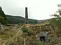 Chimney, Cwmsymlog Mine - geograph.org.uk - 36428.jpg 640 × 480; 140 KB
-
 Cwm Doethie Fawr in March, Ceredigion - geograph.org.uk - 1229779.jpg 640 × 480; 152 KB
-
 Cwmsymlog Mine - geograph.org.uk - 958205.jpg 640 × 480; 75 KB
-
 Cwmsymlog mine mill - geograph.org.uk - 925593.jpg 640 × 427; 52 KB
-
 Cwmsymlog mine reservoir - geograph.org.uk - 925560.jpg 640 × 427; 60 KB
-
 Drovers Road to Soar y Mynydd - geograph.org.uk - 359824.jpg 640 × 447; 96 KB
-

-
 Eastern approach to Cefn Llwyd - geograph.org.uk - 1774933.jpg 640 × 424; 99 KB
-

-
 Forestry land at Banc y Garn - geograph.org.uk - 1040238.jpg 640 × 480; 128 KB
-

-
 Gelli and Cors Fochno - geograph.org.uk - 9792.jpg 640 × 429; 53 KB
-
 Grassland near Penycefn - geograph.org.uk - 17512.jpg 640 × 480; 152 KB
-
 Grazing above Cwm Erfyn - geograph.org.uk - 1130034.jpg 640 × 428; 125 KB
-
 Lane towards Banc-y-Darren - geograph.org.uk - 924552.jpg 640 × 480; 65 KB
-

-
 Minor road east of Pen-rhiw-newydd - geograph.org.uk - 1130088.jpg 640 × 428; 116 KB
-
 Minor road in Cwm Erfyn - geograph.org.uk - 1130043.jpg 640 × 428; 132 KB
-
 Minor road near Capel Madog - geograph.org.uk - 1262267.jpg 640 × 428; 153 KB
-
 Minor road on Banc Troedrhiwseiri - geograph.org.uk - 1206364.jpg 640 × 428; 75 KB
-
 Minor road south of Elgar farm - geograph.org.uk - 1206377.jpg 640 × 428; 109 KB
-
 Minor road to Pen-rhiw-newydd - geograph.org.uk - 1130079.jpg 640 × 428; 84 KB
-
 Nant Silo near Cwmerfyn - geograph.org.uk - 36438.jpg 640 × 480; 153 KB
-
-

-
 Pasture near Garn-wen - geograph.org.uk - 1109005.jpg 640 × 480; 143 KB
-
 Pasture, Llwyn Prysg - geograph.org.uk - 26720.jpg 640 × 480; 141 KB
-
 Ridge lane rising beyond Cefn Llwyd - geograph.org.uk - 924537.jpg 640 × 393; 52 KB
-

-

-
 Road to Brynog - geograph.org.uk - 742534.jpg 640 × 427; 68 KB
-
 Sheep fencing next to the Afon Aeron - geograph.org.uk - 742509.jpg 640 × 427; 105 KB
-

-
 The most useless fence ever - geograph.org.uk - 704450.jpg 640 × 479; 60 KB
-
 Track heading for Banc Llechwedd Ddu - geograph.org.uk - 1206338.jpg 640 × 428; 90 KB
-
 Tree by the road - geograph.org.uk - 1130080.jpg 640 × 428; 106 KB
-
 Ty mawr, Cilcennin - geograph.org.uk - 695184.jpg 640 × 480; 121 KB
-
 Upper Doethie valley - geograph.org.uk - 81330.jpg 480 × 640; 115 KB
-
 Valley scene, Darren Bank - geograph.org.uk - 924563.jpg 640 × 480; 74 KB
-
 View of Aberystwyth from Y Consti at Celtic Knot Conference 2018 - 02.jpg 4,032 × 2,268; 3 MB
-
 Western approach to Banc y Darren - geograph.org.uk - 1262322.jpg 640 × 428; 96 KB
-
 Woolly fence - geograph.org.uk - 747353.jpg 480 × 640; 51 KB


