Category:Fences in Aberdeenshire
Jump to navigation
Jump to search
Council areas (municipalities) of Scotland: Aberdeenshire · Angus · Argyll and Bute · Clackmannanshire · Dumfries and Galloway · East Ayrshire · East Dunbartonshire · East Lothian · East Renfrewshire · Edinburgh · Falkirk · Fife · Highland · Inverclyde · Midlothian · Moray · North Ayrshire · North Lanarkshire · Outer Hebrides · Orkney Islands · Perth and Kinross · Renfrewshire · Scottish Borders · Shetland Islands · South Ayrshire · South Lanarkshire · Stirling · West Dunbartonshire · West Lothian
Subcategories
This category has only the following subcategory.
T
Media in category "Fences in Aberdeenshire"
The following 52 files are in this category, out of 52 total.
-
 'Bull in Field' - geograph.org.uk - 1385402.jpg 640 × 480; 53 KB
-

-
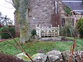
 A garden fence in summer - geograph.org.uk - 1382863.jpg 640 × 423; 70 KB
-

-
 Abandoned Farm - geograph.org.uk - 28655.jpg 640 × 480; 104 KB
-
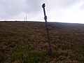
 An Ineffective Fence Post - geograph.org.uk - 551049.jpg 353 × 640; 249 KB
-
 An old railway metal fencepost - geograph.org.uk - 1014394.jpg 640 × 480; 104 KB
-
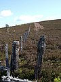 Boundary fence up Redhill - geograph.org.uk - 440062.jpg 480 × 640; 101 KB
-
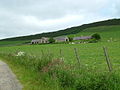
 Bulwark Croft - geograph.org.uk - 833559.jpg 640 × 480; 55 KB
-
 Cairn, top of Tampie - geograph.org.uk - 1049398.jpg 640 × 480; 95 KB
-
 Capercaillie fence - geograph.org.uk - 19167.jpg 640 × 480; 161 KB
-
 Creag Bheag - geograph.org.uk - 374928.jpg 640 × 512; 63 KB
-
 Damage to Deer Fence - geograph.org.uk - 340012.jpg 640 × 480; 104 KB
-
 Deer Fence and Gate - geograph.org.uk - 970207.jpg 640 × 427; 210 KB
-
 Edge of Turk Wood - geograph.org.uk - 413635.jpg 640 × 480; 122 KB
-
 Ellon station (remains) geograph-3455202-by-Ben-Brooksbank.jpg 2,268 × 1,539; 3.35 MB
-
 Fence and Wall - geograph.org.uk - 452215.jpg 476 × 640; 201 KB
-

-

-

-
 Fence on Cairn O'Mount ridge - geograph.org.uk - 1384707.jpg 640 × 480; 62 KB
-
 Fence on Knock Hill - geograph.org.uk - 418714.jpg 640 × 427; 220 KB
-
 Fence Post - geograph.org.uk - 461454.jpg 480 × 640; 112 KB
-
 Fence Post - geograph.org.uk - 575722.jpg 427 × 640; 302 KB
-
 Fence Post Face - geograph.org.uk - 575726.jpg 640 × 427; 293 KB
-
 Gate in deer fence - geograph.org.uk - 418587.jpg 640 × 480; 168 KB
-

-
 Lady Douglas's Grave - geograph.org.uk - 1103451.jpg 640 × 480; 128 KB
-
 Lady Douglas's Grave - geograph.org.uk - 1103466.jpg 640 × 480; 92 KB
-
 Lichen covered fence - geograph.org.uk - 439993.jpg 480 × 640; 109 KB
-
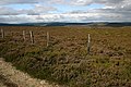
 Moorland fence - geograph.org.uk - 414598.jpg 480 × 640; 100 KB
-
 Near Penelopefield - geograph.org.uk - 998078.jpg 640 × 427; 248 KB
-
 Old fence posts - geograph.org.uk - 1496706.jpg 640 × 480; 60 KB
-
 Road to Wardend - geograph.org.uk - 891752.jpg 640 × 480; 66 KB
-
 Skule Hoose - geograph.org.uk - 547615.jpg 640 × 427; 123 KB
-
 Stile to Cairncatto - geograph.org.uk - 399211.jpg 640 × 480; 90 KB
-
 Summit of Shillofad - geograph.org.uk - 576995.jpg 640 × 480; 77 KB
-
 The Fence Post - geograph.org.uk - 435751.jpg 480 × 640; 112 KB
-
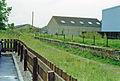
 The Old Station - geograph.org.uk - 517389.jpg 640 × 480; 114 KB
-
 Top of the Feardar Glen - geograph.org.uk - 103857.jpg 640 × 480; 108 KB
-
 View of railway embankments - geograph.org.uk - 517101.jpg 640 × 430; 47 KB
-
 View SSE from Cotter Hill - geograph.org.uk - 625775.jpg 640 × 480; 54 KB
-
 Wettyfoot - geograph.org.uk - 480884.jpg 640 × 427; 288 KB
-
 You are Here - geograph.org.uk - 1441895.jpg 640 × 480; 80 KB
-
 Carn Dearg - a new fence - geograph.org.uk - 723987.jpg 640 × 431; 117 KB
-
 Converging fences - geograph.org.uk - 1425569.jpg 640 × 427; 95 KB
-
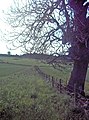
 Fence and Tree - geograph.org.uk - 414844.jpg 474 × 640; 138 KB
-

-
 Muirs of Kildrummy - geograph.org.uk - 441691.jpg 480 × 640; 125 KB
-
 Old Fence Post - geograph.org.uk - 439677.jpg 480 × 640; 76 KB
-
 Parkhill Farm - geograph.org.uk - 242549.jpg 640 × 480; 61 KB
-
 Track leading towards Pannanich Hill - geograph.org.uk - 548774.jpg 640 × 480; 85 KB


_geograph-3455202-by-Ben-Brooksbank.jpg)


