Category:Felthorpe
Jump to navigation
Jump to search
village in the United Kingdom  | |||||
| Upload media | |||||
| Instance of | |||||
|---|---|---|---|---|---|
| Location | Broadland, Norfolk, East of England, England | ||||
| Area |
| ||||
 | |||||
Subcategories
This category has the following 3 subcategories, out of 3 total.
F
- Felthorpe Village sign (3 F)
M
Media in category "Felthorpe"
The following 200 files are in this category, out of 217 total.
(previous page) (next page)-
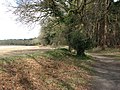 A field-woodland boundary - geograph.org.uk - 1205702.jpg 640 × 480; 123 KB
-
 A gap in the hedge - geograph.org.uk - 1205680.jpg 640 × 480; 136 KB
-
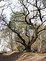
 A gnarled old oak - geograph.org.uk - 1205727.jpg 640 × 480; 153 KB
-
 A lone pine tree - geograph.org.uk - 1205856.jpg 600 × 571; 174 KB
-
 A ride in Houghen Plantation - geograph.org.uk - 1205801.jpg 640 × 480; 140 KB
-
 A track with obstacles - geograph.org.uk - 1205712.jpg 640 × 480; 137 KB
-
 A very wide field gate - geograph.org.uk - 1205668.jpg 640 × 480; 72 KB
-
 A warm day in mid-March - geograph.org.uk - 1205818.jpg 574 × 600; 177 KB
-

-
 An ancient sunken path - geograph.org.uk - 1205730.jpg 480 × 640; 154 KB
-
 An ancient sunken track - geograph.org.uk - 1205822.jpg 640 × 480; 142 KB
-
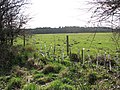
 An empty cattle pasture - geograph.org.uk - 1205705.jpg 640 × 480; 68 KB
-
 Approach to Reepham Road on Furze Lane - geograph.org.uk - 5048145.jpg 640 × 360; 319 KB
-
 B1149 Holt Road - geograph.org.uk - 2363402.jpg 3,072 × 2,304; 1.33 MB
-
 B1149 Holt Road - geograph.org.uk - 2363430.jpg 3,072 × 2,304; 1.39 MB
-
 B1149 Holt Road - geograph.org.uk - 3676362.jpg 3,072 × 2,304; 1.5 MB
-
 B1149 Holt Road - geograph.org.uk - 3676827.jpg 3,072 × 2,304; 1.35 MB
-
 B1149 Holt Road - geograph.org.uk - 3676842.jpg 2,983 × 2,241; 1.34 MB
-
 B1149 Holt Road, Haveringland - geograph.org.uk - 4573694.jpg 3,072 × 2,304; 1.74 MB
-
 B1149 Holt Street, Hevingham - geograph.org.uk - 3471006.jpg 3,072 × 2,304; 1.35 MB
-
 Bilney Lane sign - geograph.org.uk - 6232073.jpg 4,608 × 3,456; 3.91 MB
-
 Bilney Lane, Felthorpe - geograph.org.uk - 4514893.jpg 1,024 × 768; 295 KB
-
 Bilney Lane, Felthorpe - geograph.org.uk - 6230142.jpg 4,608 × 3,456; 3.96 MB
-
 Bilney Lane, Felthorpe - geograph.org.uk - 6230149.jpg 4,608 × 3,456; 3.91 MB
-
 Bilney Lane, Felthorpe - geograph.org.uk - 6230215.jpg 4,608 × 3,456; 3.85 MB
-
 Bilney Lane, Felthorpe - geograph.org.uk - 6230225.jpg 4,608 × 3,456; 3.99 MB
-
 Bilney Lane, Felthorpe - geograph.org.uk - 6232078.jpg 4,000 × 3,000; 5.08 MB
-
 Bilney Lane, Felthorpe - geograph.org.uk - 6232110.jpg 3,974 × 2,842; 5.09 MB
-
 Biplane at Felthorpe Flying Club - geograph.org.uk - 2240754.jpg 747 × 480; 167 KB
-
 Birches beside the path - geograph.org.uk - 1205717.jpg 480 × 640; 139 KB
-
 Birches in Houghen Plantation - geograph.org.uk - 1205860.jpg 480 × 640; 151 KB
-
 Boundary House - geograph.org.uk - 302165.jpg 640 × 453; 114 KB
-
 Brands Lane sign - geograph.org.uk - 6230291.jpg 4,608 × 3,456; 3.8 MB
-
 Brands Lane, Felthorpe - geograph.org.uk - 6230243.jpg 4,000 × 3,000; 4 MB
-
 Brands Lane, Felthorpe - geograph.org.uk - 6230249.jpg 4,608 × 3,456; 3.92 MB
-
 Brands Lane, Felthorpe - geograph.org.uk - 6232080.jpg 4,000 × 2,948; 3.97 MB
-
 Brands Lane, Felthorpe - geograph.org.uk - 6232105.jpg 4,608 × 3,456; 3.87 MB
-
 Brands Lane, Felthorpe - geograph.org.uk - 6232355.jpg 3,456 × 4,608; 4.06 MB
-
 Brick Kiln Road sign - geograph.org.uk - 3471015.jpg 3,072 × 2,304; 1.44 MB
-
 Brick Kiln Road, Heveningham - geograph.org.uk - 6036067.jpg 3,456 × 2,592; 2.02 MB
-
 Brick Kiln Road, Hevingham - geograph.org.uk - 3471012.jpg 3,072 × 2,304; 1.31 MB
-
 Brick Kiln Road, Hevingham - geograph.org.uk - 3471932.jpg 3,072 × 2,304; 1.45 MB
-
 Bridleway to Houghen Plantation - geograph.org.uk - 1205674.jpg 640 × 480; 121 KB
-
 Can't see the wood for trees - geograph.org.uk - 1205866.jpg 480 × 640; 151 KB
-
 Chapel Lane, Felthorpe - geograph.org.uk - 3600612.jpg 3,264 × 2,448; 2.32 MB
-
 Church Lane sign - geograph.org.uk - 6232070.jpg 4,608 × 3,456; 3.87 MB
-
 Church Lane sign - geograph.org.uk - 6233889.jpg 4,608 × 3,456; 3.73 MB
-
 Church Lane, Felthorpe - geograph.org.uk - 6230160.jpg 4,608 × 3,456; 4.02 MB
-
 Church Lane, Felthorpe - geograph.org.uk - 6233888.jpg 4,608 × 3,456; 3.8 MB
-
 The Church Room - geograph.org.uk - 667380.jpg 640 × 480; 150 KB
-
 Conifers in Houghen Plantation - geograph.org.uk - 1205708.jpg 640 × 480; 153 KB
-
 Crop field beside Mill Lane - geograph.org.uk - 5890093.jpg 800 × 600; 134 KB
-
 Crop field beside Mill Lane - geograph.org.uk - 5890103.jpg 800 × 600; 164 KB
-
 Drain in Houghen Plantation - geograph.org.uk - 1205790.jpg 480 × 640; 141 KB
-
 Entering Felthorpe on Taversham Road - geograph.org.uk - 6232205.jpg 4,608 × 3,456; 3.84 MB
-
 Entering Felthorpe on The Street - geograph.org.uk - 3672311.jpg 3,072 × 2,304; 1.28 MB
-
 Entering Felthorpe on The Street - geograph.org.uk - 4574134.jpg 3,072 × 2,304; 1.84 MB
-
 Entrance to Felthorpe Forest Nursery - geograph.org.uk - 745557.jpg 480 × 640; 190 KB
-
 Entrance to Felthorpe Pavilion - geograph.org.uk - 4574091.jpg 2,935 × 2,199; 1.95 MB
-
 Entrance to Felthorpe Pavilion - geograph.org.uk - 4574109.jpg 2,253 × 2,773; 1.38 MB
-
 Entrance to Houghen Farm - geograph.org.uk - 3677099.jpg 3,072 × 2,304; 1.48 MB
-
 Entrance to the Car Park ^ Picnic area at Houghen Plantation - geograph.org.uk - 3677109.jpg 3,072 × 2,304; 2.61 MB
-
 Felthorpe Forest Nursery sign - geograph.org.uk - 2363453.jpg 3,072 × 2,304; 1.63 MB
-
 Felthorpe Hall - geograph.org.uk - 5785093.jpg 2,649 × 1,987; 3.31 MB
-
 Felthorpe name sign - geograph.org.uk - 3672333.jpg 2,304 × 3,072; 1.67 MB
-
 Felthorpe Pavilion sign - geograph.org.uk - 4574088.jpg 2,724 × 2,043; 2.27 MB
-
 Felthorpe Pavilion, Felthorpe - geograph.org.uk - 4574086.jpg 2,857 × 2,140; 1.97 MB
-
 Felthorpe Playing Field - geograph.org.uk - 4574095.jpg 3,072 × 2,304; 1.83 MB
-
 Felthorpe Road, Felthorpe - geograph.org.uk - 4574143.jpg 3,072 × 2,304; 1.98 MB
-
 Felthorpe Roll of Honour for WW1 - geograph.org.uk - 4773731.jpg 2,592 × 3,456; 3.23 MB
-
 Felthorpe Telephone Box - geograph.org.uk - 3672917.jpg 2,215 × 2,956; 2.06 MB
-
 Felthorpe Village Name sign on Taversham Road - geograph.org.uk - 6232222.jpg 3,892 × 2,919; 3.65 MB
-
 Felthorpe Village Name sign on The Street - geograph.org.uk - 4574136.jpg 3,072 × 2,304; 1.97 MB
-

-
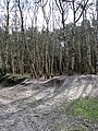
 Footpath in Houghen Plantation - geograph.org.uk - 1205816.jpg 640 × 480; 159 KB
-
 Footpath junction in Houghen Plantation - geograph.org.uk - 1205894.jpg 640 × 480; 144 KB
-
 Furze Lane sign - geograph.org.uk - 6232181.jpg 4,608 × 3,456; 4.17 MB
-
 Furze Lane, Felthorpe - geograph.org.uk - 6232178.jpg 4,608 × 3,456; 3.96 MB
-
 G-AIBR (32864388575).jpg 1,200 × 800; 802 KB
-
 G-ASCH - Beagle A.61 Terrier 2.jpg 1,200 × 800; 708 KB
-
 G-MYGR - Rans S-6ESD Coyote II - 120217.jpg 1,200 × 800; 934 KB
-

-
 Haveringland Road - geograph.org.uk - 3672287.jpg 3,072 × 2,304; 1.35 MB
-
 Haveringland Road - geograph.org.uk - 3677081.jpg 2,983 × 2,127; 944 KB
-

-

-
 Haveringland Road sign - geograph.org.uk - 3672291.jpg 2,568 × 1,929; 1.43 MB
-
 Haveringland Road, Horsford - geograph.org.uk - 3677075.jpg 3,072 × 2,304; 2.66 MB
-
 Haveringland Road, near Felthorpe - geograph.org.uk - 3600593.jpg 3,264 × 2,448; 2.32 MB
-
 Hidden in the trees - geograph.org.uk - 971051.jpg 480 × 640; 197 KB
-
 Houghen Farm sign - geograph.org.uk - 3677102.jpg 3,072 × 2,304; 1.67 MB
-
 Larter Farm - geograph.org.uk - 302167.jpg 640 × 461; 105 KB
-
 Maize field off Bilney Lane - geograph.org.uk - 4571032.jpg 640 × 480; 119 KB
-
 Marriott's Way - geograph.org.uk - 347197.jpg 640 × 480; 149 KB
-
 Marriott's Way - geograph.org.uk - 347200.jpg 640 × 480; 148 KB
-
 Marriott's Way from Bridge - geograph.org.uk - 347207.jpg 640 × 480; 131 KB
-
 Marsham Lodge Holt Road Postbox - geograph.org.uk - 4573891.jpg 3,072 × 2,304; 1.97 MB
-
 Marsham Lodge Holt Road Postbox - geograph.org.uk - 4573897.jpg 3,072 × 2,304; 1.98 MB
-
 Marsham Lodge Holt Road Postbox - geograph.org.uk - 4573900.jpg 3,072 × 2,304; 2.02 MB
-
 Marsham Lodge Holt Road Postbox - geograph.org.uk - 4573902.jpg 2,304 × 3,072; 4.03 MB
-
 Mill Farmhouse - geograph.org.uk - 3672533.jpg 3,072 × 2,304; 1.44 MB
-
 Mill Farmhouse, Felthorpe - geograph.org.uk - 4574108.jpg 2,517 × 2,097; 1.47 MB
-
 Mill Lane sign - geograph.org.uk - 3672487.jpg 2,965 × 2,228; 2.53 MB
-
 Mill Lane, Felthorpe - geograph.org.uk - 3672484.jpg 3,072 × 2,304; 1.42 MB
-
 Mill Lane, near Felthorpe - geograph.org.uk - 3600609.jpg 3,264 × 2,448; 2.33 MB
-
 Mill Lane, near Felthorpe - geograph.org.uk - 3600610.jpg 3,264 × 2,448; 1.97 MB
-
 N3957S (32021397664).jpg 1,200 × 800; 971 KB
-
 Norfolk Farmland - geograph.org.uk - 302166.jpg 640 × 426; 73 KB
-
 Norfolk Farmland - geograph.org.uk - 302169.jpg 640 × 555; 116 KB
-
 Northwestern edge of Burns Allotment - geograph.org.uk - 745566.jpg 480 × 640; 159 KB
-
 Old oaks growing beside ancient path - geograph.org.uk - 1205805.jpg 640 × 480; 126 KB
-
 Old Track Through Horsford Woods - geograph.org.uk - 4831545.jpg 640 × 480; 152 KB
-
 Path crossing drain - geograph.org.uk - 1205793.jpg 480 × 640; 136 KB
-
 Path on woodland edge - geograph.org.uk - 1205709.jpg 480 × 640; 143 KB
-
 Path to Bilney Lane - geograph.org.uk - 1205724.jpg 480 × 640; 138 KB
-
 Path to St Faith's Common - geograph.org.uk - 1205721.jpg 640 × 480; 132 KB
-
 Path to Whinny Hills - geograph.org.uk - 1205808.jpg 640 × 480; 160 KB
-
 Private track - geograph.org.uk - 758347.jpg 480 × 640; 181 KB
-
 Private track with warning sign - geograph.org.uk - 745573.jpg 640 × 413; 133 KB
-
 Public footpath leading east - geograph.org.uk - 758313.jpg 480 × 640; 163 KB
-
 Public footpath leading west - geograph.org.uk - 758320.jpg 480 × 640; 187 KB
-
 Reepham Road, Felthorpe - geograph.org.uk - 6232154.jpg 4,000 × 3,000; 5.87 MB
-
 Reepham Road, Felthorpe - geograph.org.uk - 6232183.jpg 4,000 × 3,000; 4.87 MB
-
 Reepham Road, Felthorpe - geograph.org.uk - 6232185.jpg 4,608 × 3,456; 3.98 MB
-
 Rhododendron in a private driveway - geograph.org.uk - 5785112.jpg 3,456 × 2,592; 4.03 MB
-
 Road Name sign on Brands Lane - geograph.org.uk - 6232072.jpg 4,608 × 3,456; 3.95 MB
-
 Road signs on the B1149 Holt Road - geograph.org.uk - 2363403.jpg 3,072 × 2,304; 1.51 MB
-
 Road through Gilham's Heath Plantation - geograph.org.uk - 3600615.jpg 3,264 × 2,448; 2.31 MB
-
 Road through Gilham's Heath Plantation - geograph.org.uk - 3600620.jpg 3,264 × 2,448; 2.27 MB
-
 Road to Swannington - geograph.org.uk - 4575505.jpg 3,072 × 2,304; 1.88 MB
-
 Roadsign on The Street - geograph.org.uk - 3672301.jpg 2,304 × 3,072; 1.19 MB
-
 Roadsign on The Street - geograph.org.uk - 3677090.jpg 2,304 × 3,072; 1.29 MB
-
 Roadsign on The Street - geograph.org.uk - 4574229.jpg 2,216 × 2,947; 3.71 MB
-
 Roadsigns on the B1149 Holt Road - geograph.org.uk - 3676824.jpg 2,189 × 2,922; 2.18 MB
-
 School Road to Swannington - geograph.org.uk - 4574225.jpg 3,072 × 2,304; 1.79 MB
-
 Shaded track - geograph.org.uk - 745636.jpg 640 × 460; 199 KB
-
 Short -Thorn Road - geograph.org.uk - 2363393.jpg 3,072 × 2,304; 1.64 MB
-
 Short -Thorn Road - geograph.org.uk - 2363396.jpg 3,072 × 2,304; 1.36 MB
-
 Short -Thorn Road sign - geograph.org.uk - 2363417.jpg 3,072 × 2,304; 1.67 MB
-
 Short -Thorn Road, Felthorpe - geograph.org.uk - 2363445.jpg 3,072 × 2,304; 1.32 MB
-
 Short -Thorn Road, Felthorpe - geograph.org.uk - 2364044.jpg 3,072 × 2,304; 1.66 MB
-
 Short Thorn Road - geograph.org.uk - 3672277.jpg 3,029 × 2,276; 1.01 MB
-
 Short Thorn Road - geograph.org.uk - 3677085.jpg 3,072 × 2,304; 1.32 MB
-
 Signpost on Reepham Road - geograph.org.uk - 6232165.jpg 3,456 × 4,608; 3.92 MB
-
 Soggy track - geograph.org.uk - 745618.jpg 640 × 480; 192 KB
-
 Southeast towards Millhill Plantation - geograph.org.uk - 745621.jpg 480 × 640; 151 KB
-
 Storage clamps and silo at Bull Farm - geograph.org.uk - 3760963.jpg 640 × 480; 179 KB
-
 Sunken lane traversing woodland - geograph.org.uk - 1205828.jpg 640 × 480; 159 KB
-
 Sunlight and shadows - geograph.org.uk - 745627.jpg 480 × 640; 203 KB
-
 Taverham Road, Felthorpe - geograph.org.uk - 3672537.jpg 2,857 × 2,146; 945 KB
-
 Taversham Road, Felthorpe - geograph.org.uk - 6232363.jpg 4,000 × 3,000; 5.56 MB
-
 Taversham Road, Felthorpe - geograph.org.uk - 6233886.jpg 4,608 × 3,456; 3.97 MB
-
 Taversham Road, Felthorpe - geograph.org.uk - 6234035.jpg 4,608 × 3,456; 3.79 MB
-
 The entrance to Felthorpe Forest Nursery - geograph.org.uk - 2363450.jpg 3,072 × 2,304; 1.63 MB
-
 The entrance to Felthorpe Forest Nursery - geograph.org.uk - 2363457.jpg 3,072 × 2,304; 1.66 MB
-
 The going gets muddy - geograph.org.uk - 1205736.jpg 480 × 640; 148 KB
-
 The Mariners public house at Felthorpe - geograph.org.uk - 5321627.jpg 3,456 × 2,592; 3.75 MB
-
 The Mariners Public House, Felthorpe - geograph.org.uk - 2365284.jpg 3,072 × 2,304; 1.15 MB
-
 The Mariners Public House, Felthorpe - geograph.org.uk - 2365287.jpg 3,072 × 2,304; 1.13 MB
-
 The Old Kings Head - geograph.org.uk - 752746.jpg 640 × 465; 117 KB
-
 The Rectory - geograph.org.uk - 1205673.jpg 640 × 479; 118 KB
-
 The Street - geograph.org.uk - 6022920.jpg 1,224 × 1,632; 518 KB
-
 The Street former Post Office Postbox - geograph.org.uk - 3672578.jpg 3,072 × 2,304; 2.16 MB
-
 The Street former Post Office Postbox - geograph.org.uk - 3672893.jpg 2,304 × 3,072; 1.48 MB
-
 The Street former Post Office Postbox - geograph.org.uk - 3672895.jpg 2,304 × 3,072; 1.53 MB
-
 The Street former Post Office Postbox - geograph.org.uk - 3672896.jpg 2,304 × 3,072; 1.46 MB
-
 The Street ^ Mill Farmhouse - geograph.org.uk - 4575504.jpg 3,072 × 2,304; 1.89 MB
-
 The Street ^ The Street former Post Office Postbox - geograph.org.uk - 3673341.jpg 3,072 × 2,304; 1.41 MB
-
 The Street, Felthorpe - geograph.org.uk - 3672553.jpg 2,788 × 2,094; 958 KB
-
 The Street, Felthorpe - geograph.org.uk - 4514896.jpg 1,024 × 768; 359 KB
-
 The Street, Felthorpe - geograph.org.uk - 4574104.jpg 3,072 × 2,304; 1.77 MB
-
 The Street, Felthorpe - geograph.org.uk - 4574135.jpg 3,072 × 2,304; 1.83 MB
-
 The Street, Felthorpe - geograph.org.uk - 4574218.jpg 3,072 × 2,304; 1.85 MB
-
 The Street, Felthorpe - geograph.org.uk - 6233891.jpg 4,608 × 3,456; 3.97 MB
-
 The western edge of Houghen Plantation - geograph.org.uk - 1205693.jpg 577 × 600; 156 KB
-
 This way to Alderford - geograph.org.uk - 758332.jpg 640 × 480; 162 KB
-
 This way to Dole Plantation - geograph.org.uk - 1205711.jpg 480 × 640; 150 KB
-
 This way to St Faith's Common - geograph.org.uk - 1205686.jpg 480 × 640; 120 KB
-
 To Holt 14 - geograph.org.uk - 1703465.jpg 1,600 × 1,200; 750 KB
-
 To Holt 15 - geograph.org.uk - 1703490.jpg 1,600 × 1,200; 822 KB
-
 Trail for mountain bikers - geograph.org.uk - 1205715.jpg 640 × 480; 124 KB
-
 Trig point in Horsford Woods - detail - geograph.org.uk - 971062.jpg 480 × 640; 139 KB
-
 Trig point in Horsford Woods - geograph.org.uk - 971058.jpg 480 × 640; 179 KB
-
 Uprooted poplar beside bridge - geograph.org.uk - 752759.jpg 480 × 640; 135 KB
-
 VAD Hospital memorial plaque - geograph.org.uk - 5782174.jpg 1,907 × 2,543; 1.43 MB
-
 Varieties of nettles - geograph.org.uk - 752821.jpg 480 × 640; 191 KB
-
 View across Bilney Lane - geograph.org.uk - 745546.jpg 640 × 480; 152 KB
-
 View across nameless stream - geograph.org.uk - 752775.jpg 480 × 640; 184 KB
-
 View across Reepham Road - geograph.org.uk - 758337.jpg 640 × 480; 137 KB
-
 View along Hall Lane - geograph.org.uk - 5890098.jpg 800 × 600; 224 KB
-
 View along Short-Thorn Road - geograph.org.uk - 745550.jpg 640 × 480; 113 KB
-
 View into Houghen Plantation - geograph.org.uk - 1205795.jpg 480 × 640; 141 KB
-

-
 View north across pastureland - geograph.org.uk - 745644.jpg 480 × 640; 204 KB
-
 View north along farm track - geograph.org.uk - 752823.jpg 640 × 480; 99 KB
-
 View north along Mill Lane - geograph.org.uk - 5890102.jpg 800 × 600; 164 KB
-
 View north along nameless stream - geograph.org.uk - 752771.jpg 480 × 640; 161 KB
-

-
 View northwest along Mill Lane - geograph.org.uk - 745602.jpg 480 × 640; 177 KB
-
 View SE on Haveringland Road - geograph.org.uk - 745561.jpg 640 × 464; 134 KB


.jpg)


.jpg)


