Category:February 2010 in Lancashire
Jump to navigation
Jump to search
Deutsch: Bilder, die im Februar 2010 in Lancashire aufgenommen worden sind. Bitte beachten Sie, dass dies weder das Datum des Uploads noch das Datum des Scannens eines Fotos ist.
English: Images/pictures taken in Lancashire during February 2010. Note this is not the date of the upload, nor the date a photo was scanned.
Español: Fotografías o imágenes tomadas en Lancashire durante febrero 2010. No es la fecha de subida ni escaneo, sino la fecha en que las fotografías o imágenes se crearon.
Esperanto: Bildoj faritaj en Lancashire en februaro 2010. Tio ne estas la dato, kiam la bildoj estis alŝutitaj aŭ skanitaj.
Français : Photographies ou images prises en Lancashire durant février 2010. Ce n'est pas la date du téléchargement ou du scan.
Galego: Fotografías ou imaxes tomadas en Lancashire durante febreiro 2010. Non é a data de subida nin escaneamento, senón a data na que se crearon as fotografías ou imaxes.
Italiano: Fotografie o immagini scattate a Lancashire nel febbraio 2010. Nota bene: la data non si riferisce né a quella di upload né a quella in cui la foto è stata digitalizzata.
Norsk bokmål: Bilder tatt i Lancashire i løpet av februar 2010. Merk at dette ikke er datoen for opplasting, eller når et bilde har blitt skannet.
Norsk nynorsk: Bilete teke i Lancashire i løpet av februar 2010. Merk at dette ikkje er datoen for opplasting, eller når eit bilete har vorte skanna.
Русский: Изображения, сделанные в Lancashire в течение февраль 2010 (не дата загрузки изображения).
Українська: Зображення, зроблені в Lancashire протягом лютий 2010. Зауважте, що це не дата завантаження чи дата сканування фотографії.
| February 2009 | ← | February 2010 | → | February 2011 | |||||||
| Jan | Feb | Mar | Apr | May | Jun | Jul | Aug | Sep | Oct | Nov | Dec |
| 55 | 60 | 52 | 37 | 25 | 144 | 185 | 46 | 64 | 23 | 41 | 24 |
|---|---|---|---|---|---|---|---|---|---|---|---|
Subcategories
This category has the following 2 subcategories, out of 2 total.
Media in category "February 2010 in Lancashire"
The following 58 files are in this category, out of 58 total.
-
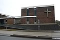 "Sion Baptist Church" Church Street, Burnley, BB11 2DW - geograph.org.uk - 1726610.jpg 1,626 × 1,073; 467 KB
-
 5643 on the swing bridge - geograph.org.uk - 1697655.jpg 480 × 640; 46 KB
-
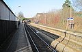 Adlington railway station, Lancashire, 2010 (geograph 3231008).jpg 800 × 507; 105 KB
-
 Bacup and Rawtenstall Grammar School - geograph.org.uk - 1706336.jpg 3,872 × 2,592; 5 MB
-
 Boathouse On The Lancaster Canal - geograph.org.uk - 1733359.jpg 800 × 600; 174 KB
-
 Bridge over the Lune Cycle Way - geograph.org.uk - 1718319.jpg 640 × 480; 140 KB
-
 Burrow Beck almost at the Lune - geograph.org.uk - 1704682.jpg 640 × 480; 101 KB
-
 Carnforth war memorial - geograph.org.uk - 1714165.jpg 640 × 480; 98 KB
-
 Colne Snooker Club - geograph.org.uk - 1703872.jpg 3,186 × 2,370; 2.13 MB
-
 Colne, 1 to 7, Bankfield Street - geograph.org.uk - 1703923.jpg 3,186 × 2,364; 2.23 MB
-
 Colne, Albert Road - geograph.org.uk - 1701218.jpg 2,816 × 2,112; 1.3 MB
-
 Colne, Back Albert Road - geograph.org.uk - 1701158.jpg 2,816 × 2,112; 1.72 MB
-
 Colne, Back of Hargreaves Street - geograph.org.uk - 1704515.jpg 3,264 × 2,448; 2.28 MB
-
 Colne, Burnley Road - geograph.org.uk - 1704709.jpg 3,264 × 2,448; 2.05 MB
-
 Colne, Cross Street West - geograph.org.uk - 1701620.jpg 3,264 × 2,448; 2.15 MB
-
 Colne, Cross Street West - geograph.org.uk - 1703960.jpg 3,264 × 2,448; 2.17 MB
-
 Colne, Greenfield Road - geograph.org.uk - 1701711.jpg 3,264 × 2,448; 2.51 MB
-
 Colne, Greenfield Road - geograph.org.uk - 1704521.jpg 3,264 × 2,448; 2.18 MB
-
 Colne, Greenfield Road - geograph.org.uk - 1704582.jpg 3,264 × 2,448; 3.79 MB
-
 Colne, Hargreaves Street - geograph.org.uk - 1704518.jpg 3,264 × 2,448; 2.53 MB
-
 Colne, Knotts Lane - geograph.org.uk - 1701760.jpg 3,264 × 2,448; 2.16 MB
-
 Colne, Peel Road - geograph.org.uk - 1701613.jpg 3,264 × 2,448; 2.19 MB
-
 Colne, Queen Street - geograph.org.uk - 1701144.jpg 2,816 × 2,112; 1.57 MB
-
 Colne, Queens Chippy and the end of Knotts Lane - geograph.org.uk - 1701731.jpg 3,171 × 2,339; 1.82 MB
-
 Colne, Trees at the top of Bankfield Street - geograph.org.uk - 1703949.jpg 3,264 × 2,448; 2.77 MB
-
 Colne, View down Bridge Street - geograph.org.uk - 1701166.jpg 2,816 × 2,112; 1.58 MB
-

-
 Cottages and mills in Haslingden - geograph.org.uk - 1708661.jpg 3,872 × 2,592; 3.46 MB
-
 Footbridge at Accrington Railway Station - geograph.org.uk - 1709380.jpg 640 × 480; 115 KB
-
 Former Conservative Club, Cannon Street - geograph.org.uk - 1709353.jpg 640 × 480; 154 KB
-
 Former Conservative Club, Doorway - geograph.org.uk - 1709357.jpg 480 × 640; 85 KB
-
 Gateway above Stodday - geograph.org.uk - 1704707.jpg 640 × 480; 86 KB
-
 Lemonius Street, Accrington - geograph.org.uk - 1709340.jpg 640 × 480; 128 KB
-
 Lostock railway station, Lancashire, 2010 (geograph 3230895).jpg 800 × 508; 120 KB
-
 Mill Hall, Lancaster - geograph.org.uk - 1712970.jpg 480 × 640; 89 KB
-
 Oswald Street, Blackburn - geograph.org.uk - 3275678.jpg 640 × 480; 119 KB
-
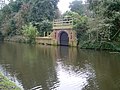
 Outlet and Weir - geograph.org.uk - 1733314.jpg 800 × 600; 149 KB
-
 Pair of Cottages, Broadhead Road, Edgworth - geograph.org.uk - 1709735 (cropped).jpg 1,134 × 1,134; 285 KB
-
 Pair of Cottages, Broadhead Road, Edgworth - geograph.org.uk - 1709735.jpg 1,600 × 1,200; 380 KB
-
 Pastures, Aldcliffe - geograph.org.uk - 1704161.jpg 640 × 480; 65 KB
-
 Rawtenstall Road, Haslingden, Lancashire - geograph.org.uk - 1713975.jpg 1,630 × 1,108; 409 KB
-
 Rawtenstall Road, Haslingden, Lancashire - geograph.org.uk - 1713987.jpg 1,632 × 1,224; 460 KB
-
 Shear Brow, Blackburn - geograph.org.uk - 3275659.jpg 640 × 480; 125 KB
-

-
 St Peter's Church, Heysham - geograph.org.uk - 1726657.jpg 3,008 × 2,000; 2.97 MB
-
 The "Co-Op" buildings, Upper Deardengate - geograph.org.uk - 1702404.jpg 1,600 × 995; 302 KB
-
 The Blackamoor Inn - geograph.org.uk - 1719012.jpg 3,872 × 2,592; 3.19 MB
-
 The Globe Arena takes shape - geograph.org.uk - 1710865.jpg 640 × 425; 182 KB
-
 The Globe Arena takes shape - geograph.org.uk - 1710866.jpg 640 × 425; 162 KB
-
 The highest point of Cribden Hill - geograph.org.uk - 1717953.jpg 3,872 × 2,592; 3.1 MB
-
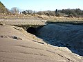
 The Lune is a salmon river - geograph.org.uk - 1704674.jpg 640 × 480; 106 KB
-
 The Lune near Aldcliffe - geograph.org.uk - 1704633.jpg 640 × 480; 70 KB
-
 The Pack Horse, Belthorn - geograph.org.uk - 1719079.jpg 3,872 × 2,592; 4.21 MB
-
 The Royal Hotel, Main Street, Heysham - geograph.org.uk - 1726652.jpg 3,008 × 2,000; 861 KB
-

-
 Towpath of the Lancaster Canal, in Galgate, Lancashire.jpg 800 × 600; 199 KB
-
 Turton UDC Road Sign, Edgeworth - geograph.org.uk - 1709734.jpg 1,600 × 1,200; 314 KB
-
 X41 on Broadway, Haslingden - geograph.org.uk - 1714028.jpg 1,630 × 962; 477 KB


.jpg)


.jpg)


.jpg)


