Category:Fairbourne
Jump to navigation
Jump to search
Cymraeg: Mae Fairbourne yn bentref yn ne Gwynedd Yn anarferol iawn i bentref yng Ngwynedd, nid oes iddo enw Cymraeg. Defnyddir Friog weithiau fel enw Cymraeg am Fairbourne, ond mewn gwirionedd mae Friog yn bentref ar wahân. Gelwid yr ardal yn Morfa Henddol cyn adeiladu'r pentref, a chredir fod yr enw Rowen wedi ei ddefnyddio am y pentref ar un adeg.
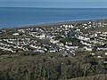
English: Fairbourne is a village on the coast of Barmouth Bay to the south of the estuary of the River Mawddach in Gwynedd, surrounded by the Snowdonia National Park. Before the seaside resort was built the coastal area was known as Morfa Henddol, while the outcrop now occupied by the Fairbourne Hotel was called Ynysfaig. Fairbourne was founded as a seaside resort by Arthur McDougall (of flour making fame.)
village in Gwynedd, Wales, United Kingdom  | |||||
| Upload media | |||||
| Instance of | |||||
|---|---|---|---|---|---|
| Location | Arthog, Gwynedd, Wales | ||||
 | |||||
Subcategories
This category has the following 5 subcategories, out of 5 total.
Media in category "Fairbourne"
The following 60 files are in this category, out of 60 total.
-

-
 Beach at Fairbourne - geograph.org.uk - 1459592.jpg 640 × 426; 88 KB
-
 Beach at Fairbourne - geograph.org.uk - 216692.jpg 640 × 480; 35 KB
-
 Beach at Fairbourne - geograph.org.uk - 217373.jpg 640 × 480; 53 KB
-
 Beacon - geograph.org.uk - 129502.jpg 640 × 480; 137 KB
-
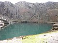
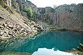 Blue Lake near Friog - geograph.org.uk - 464907.jpg 640 × 425; 132 KB
-
 By accident or design? - geograph.org.uk - 217104.jpg 640 × 480; 127 KB
-
 Cottage at Gest Ddu - geograph.org.uk - 202281.jpg 640 × 480; 168 KB
-
 Cow above Fairbourne and Friog - geograph.org.uk - 1413219.jpg 640 × 480; 83 KB
-
 Dragon's teeth, Fairbourne - geograph.org.uk - 1312796.jpg 640 × 485; 100 KB
-
 Failing Dragon's teeth. - geograph.org.uk - 313953.jpg 640 × 480; 100 KB
-
 Fairbourne & Barmouth from the train. (29284207783).jpg 4,128 × 2,322; 1.84 MB
-
 Fairbourne - geograph.org.uk - 129511.jpg 640 × 480; 58 KB
-
 Fairbourne - panoramio (8).jpg 4,000 × 3,000; 3.67 MB
-
 Fairbourne 01 2022.jpg 5,184 × 3,888; 10.54 MB
-
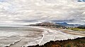
 Fairbourne from Golwen Quarry - geograph.org.uk - 392904.jpg 640 × 480; 125 KB
-
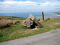
 Fairbourne pillbox - geograph.org.uk - 75557.jpg 640 × 420; 73 KB
-
 Fairbourne Village.jpg 640 × 480; 119 KB
-
 Farm gate beside a mountain road - geograph.org.uk - 217113.jpg 640 × 480; 165 KB
-

-
 Footpath towards Cyfannedd-fawr - geograph.org.uk - 1413176.jpg 480 × 640; 106 KB
-
 Gate and Stile near Pant Einon Hall - geograph.org.uk - 217041.jpg 640 × 480; 170 KB
-

-
 Llwyngwril - geograph.org.uk - 248790.jpg 640 × 480; 124 KB
-

-
 Mountain Road at Waen Oer - geograph.org.uk - 216603.jpg 640 × 480; 130 KB
-
 Old barn at Fairbourne - geograph.org.uk - 1709534.jpg 640 × 490; 117 KB
-
 Pen y Garn - geograph.org.uk - 1439200.jpg 640 × 480; 78 KB
-
-
 Pretty, carved door. - geograph.org.uk - 313976.jpg 442 × 640; 107 KB
-
 Queen of all she surveys^ - geograph.org.uk - 1413221.jpg 640 × 480; 54 KB
-
 Ruined Building above Golwen Quarry - geograph.org.uk - 217057.jpg 1,024 × 768; 696 KB
-
 Standing Stone and modern fence - geograph.org.uk - 319355.jpg 640 × 480; 66 KB
-
 Standing Stone and Tremadog Bay - geograph.org.uk - 319380.jpg 640 × 640; 108 KB
-
 Standing Stone by track - geograph.org.uk - 319362.jpg 480 × 640; 50 KB
-
 Track at Rhydcriw - geograph.org.uk - 203378.jpg 640 × 480; 116 KB
-
 View from Gest Ddu - geograph.org.uk - 202292.jpg 640 × 480; 94 KB
-

-
 Aligned stones - geograph.org.uk - 1187889.jpg 640 × 427; 70 KB
-
 Anti-tank defences - geograph.org.uk - 1088782.jpg 480 × 640; 219 KB
-
 Arthog Outdoor Education Centre - geograph.org.uk - 130007.jpg 640 × 480; 68 KB
-
 Beach at Fairbourne - geograph.org.uk - 1431020.jpg 640 × 480; 97 KB
-

-
 Blue Lake above Friog - geograph.org.uk - 392897.jpg 640 × 480; 130 KB
-

-
 Dragons Teeth - Fairbourne Beach - geograph.org.uk - 1413179.jpg 640 × 480; 76 KB
-
 Fairbourne - geograph.org.uk - 129501.jpg 640 × 480; 48 KB
-
 Fairbourne - geograph.org.uk - 129503.jpg 480 × 640; 84 KB
-
 Fairbourne - geograph.org.uk - 130035.jpg 640 × 480; 140 KB
-
 Fairbourne Beach from coast road - geograph.org.uk - 751692.jpg 640 × 480; 45 KB
-
 Fairbourne from Cyfannedd-fawr - geograph.org.uk - 1413202.jpg 640 × 480; 58 KB
-
 Five directions - geograph.org.uk - 1413278.jpg 640 × 480; 91 KB
-
 Footbridge sign near Barmouth Bridge - geograph.org.uk - 391159.jpg 480 × 640; 114 KB
-
 Friog Telephone exchanges. - geograph.org.uk - 313984.jpg 640 × 480; 83 KB
-
 Henddol Cottage. - geograph.org.uk - 313963.jpg 640 × 480; 109 KB
-
 Henddol farmhouse. - geograph.org.uk - 313959.jpg 640 × 480; 126 KB
-
 Mawddach estuary - geograph.org.uk - 626881.jpg 640 × 480; 55 KB
-
 Old farm building at Henddol. - geograph.org.uk - 313980.jpg 640 × 402; 146 KB
-
 Pen y Garn Trigpoint - geograph.org.uk - 318934.jpg 640 × 640; 119 KB
-
 Retaining wall breach. - geograph.org.uk - 240821.jpg 640 × 480; 147 KB


.jpg)

.jpg)


