Category:Exterior of the Franciscan monastery in Katowice Panewniki
Jump to navigation
Jump to search
| Object location | | View all coordinates using: OpenStreetMap |
|---|
Wikimedia category | |||||
| Upload media | |||||
| Instance of | |||||
|---|---|---|---|---|---|
| Category combines topics | |||||
| Franciscan Monastery in Panewniki | |||||
complex of monastic buildings in Katowice, catholic religious community .jpg)  | |||||
| Instance of |
| ||||
| Part of |
| ||||
| Location |
| ||||
| Street address |
| ||||
| Diocese | |||||
| Owned by |
| ||||
| Has part(s) | |||||
| Heritage designation |
| ||||
| Inception |
| ||||
| Religion or worldview | |||||
| official website | |||||
 | |||||
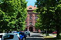
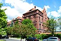
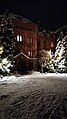
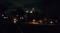
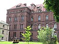
English:  Exterior of the Franciscan monastery in Katowice Panewniki, Poland.
Polski: Zdjęcia zewnątrz klasztoru franciszkanów w katowickich Panewnikach.
Media in category "Exterior of the Franciscan monastery in Katowice Panewniki"
The following 43 files are in this category, out of 43 total.
-
 2022-07 Katowice - Ligota-Panewniki 164.jpg 3,872 × 2,592; 4.85 MB
-
 2022-07 Katowice - Ligota-Panewniki 172.jpg 3,872 × 2,592; 6.77 MB
-
 2022-07 Katowice - Ligota-Panewniki 192.jpg 3,872 × 2,592; 7.14 MB
-
 20221130 Garden of the Franciscan monastery in Katowice Panewniki 13.jpg 4,000 × 3,000; 5.06 MB
-
 20221130 view roof monastery Katowice Panewniki 01.jpg 4,000 × 3,000; 3.99 MB
-
 20221130 view roof monastery Katowice Panewniki 02.jpg 4,000 × 3,000; 4.51 MB
-
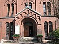
 20221203 entrance Panewniki Franciscan Monastery.jpg 2,893 × 3,857; 2.21 MB
-
 20221203 Klasztorny Square in Katowice evening.jpg 1,584 × 2,816; 1.11 MB
-
 20221219 Exterior of the Franciscan monastery in Katowice Panewniki.jpg 1,584 × 2,816; 1.16 MB
-
 20230115 Exterior of the Franciscan monastery in Katowice Panewniki 01.jpg 4,000 × 3,000; 1.57 MB
-
 20230115 Exterior of the Franciscan monastery in Katowice Panewniki 02.jpg 1,584 × 2,816; 1.25 MB
-
 20230201 Exterior of the Franciscan monastery in Katowice Panewniki 01.jpg 2,816 × 1,584; 1.01 MB
-
 20230201 Exterior of the Franciscan monastery in Katowice Panewniki 02.jpg 2,816 × 1,584; 1,000 KB
-
 20231226 Modern Christmas crib Katowice Panewniki.jpg 3,000 × 4,000; 5.11 MB
-
 20240504 Polish flag Panewniki Katowice Poland 01.jpg 3,000 × 4,000; 3.24 MB
-
 20240504 Polish flag Panewniki Katowice Poland 02.jpg 3,000 × 4,000; 4.33 MB
-
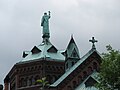
 Exterior of the Basilica in Katowice Panewniki Poland.JPG 2,816 × 2,112; 3.14 MB
-
 Exterior of the Franciscan monastery in Katowice Panewniki 01.jpg 8,000 × 6,000; 7.38 MB
-
 Exterior of the Franciscan monastery in Katowice Panewniki 02.jpg 4,000 × 3,000; 4.72 MB
-
 Exterior of the Franciscan monastery in Katowice Panewniki 03.jpg 3,000 × 4,000; 4.34 MB
-
 Exterior of the Franciscan monastery in Katowice Panewniki 2010 (Poland).jpg 3,648 × 2,736; 4.75 MB
-
 Exterior of the Franciscan monastery in Katowice Panewniki.jpg 6,000 × 8,000; 8.17 MB
-
 Franciscan monastery in Katowice Panewniki 2010 (Poland).jpg 3,648 × 2,736; 4.86 MB
-
 Franciscan monastery in Katowice Panewniki 2010.jpg 500 × 375; 192 KB
-
 Franciscan monastery in Katowice Panewniki 2011.JPG 2,816 × 2,112; 3.38 MB
-
 Franciscan monastery in Katowice Panewniki 2011a.JPG 2,816 × 2,112; 3.36 MB
-
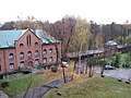
 Franciscan monastery in Katowice Panewniki laundry.JPG 2,816 × 2,112; 4.09 MB
-
 Franciscan monastery in Katowice Panewniki Poland 060.JPG 2,816 × 2,112; 3.57 MB
-
 Furta Katowice Panewniki flaga ukraińska.jpg 3,000 × 4,000; 4.77 MB
-
 Furta Katowice Panewniki.jpg 500 × 375; 251 KB
-
 Garden of the Franciscan monastery in Katowice Panewniki 053.JPG 2,112 × 2,816; 3.11 MB
-
 Garden of the Franciscan monastery in Katowice Panewniki 2012 006.JPG 2,816 × 2,112; 3.61 MB
-
 Monument St Hedwig Katowice Panewniki .jpg 500 × 375; 233 KB
-
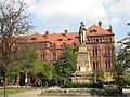
 Monument St Hedwig Katowice Panewniki 5.JPG 2,112 × 2,816; 2.36 MB
-
 Panewnicka Street in Katowice 001.JPG 2,816 × 2,112; 4.07 MB
-
 Panewniki Hedwig.jpg 2,848 × 2,136; 1.49 MB
-
 Panewniki Klasztor wiosna 2014 13.JPG 2,816 × 2,112; 2.29 MB
-
 Panewniki Klasztor wiosna 2014 15.JPG 2,816 × 2,112; 3.57 MB
-
 Panewniki Klasztor wiosna 2014 18.JPG 2,816 × 2,112; 3.69 MB
-
 Panewniki Klasztor wiosna 2014 19.JPG 2,816 × 2,112; 3.55 MB
-
 Panewniki Klasztor wiosna 2014 20.JPG 2,816 × 2,112; 3.78 MB
-
 Panewniki Klasztor wiosna 2014 21.JPG 2,816 × 2,112; 3.55 MB
-
 Portiernia przy Fodzie Panewniki.jpg 3,000 × 4,000; 5.92 MB


.jpg)


