Category:Examples of map making
Jump to navigation
Jump to search
Deutsch: Karten mit beispielhaftem Inhalt zur Kartenherstellung
English: Maps with exemplary content about the making of maps
Subcategories
This category has only the following subcategory.
S
Media in category "Examples of map making"
The following 51 files are in this category, out of 51 total.
-
 Bolu-test.jpg 229 × 510; 56 KB
-
 Clip recortar.jpg 1,865 × 1,576; 1.57 MB
-
 Comparison SRTM3 vs ASTER.jpg 4,407 × 5,562; 1.05 MB
-
 Creating maps with Qgis.svg 2,302 × 1,723; 2.2 MB
-
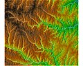 Elevation with streams.jpg 500 × 401; 56 KB
-
 Erosiegevoeligheidskartering3.PNG 1,300 × 863; 3.36 MB
-
 FM Tree Raster Figure 1.jpeg 782 × 752; 199 KB
-
 Gabor en omgeving voorbeeld classificatie puntobjecten legenda items.PNG 1,215 × 529; 94 KB
-
 Geo visualisatie met een gis op drie wijzen.PNG 1,157 × 389; 35 KB
-
 Geo visualisatie met een gis op twee wijzen.PNG 1,065 × 510; 32 KB
-
 GIS-bewerkingen afh van projectie.png 1,000 × 263; 602 KB
-
 Gis-data-voorbeeld.PNG 1,252 × 917; 49 KB
-
 Gis-reken-voorbeelden.PNG 1,538 × 390; 56 KB
-
 Gislayers.jpg 997 × 657; 300 KB
-
 Hellingklassenkaart voorbeeld.jpg 500 × 964; 192 KB
-
 Kartographische Freistellung.jpg 200 × 146; 28 KB
-
 Lineair Refereren input voorbeeld bestanden A50.PNG 884 × 552; 37 KB
-
 Lineair Refereren output voorbeeld bestanden A50.PNG 1,126 × 567; 37 KB
-
 Maßstab-ausschnitt.png 905 × 356; 23 KB
-
 OJWs SVG cropping test.svg 1,662 × 1,864; 249 KB
-
 Photo interpretation corine land cover.PNG 902 × 320; 319 KB
-
 Pinatubo map-fr.png 1,572 × 825; 1.72 MB
-
 Resolutie vergelijking 300dpi 100dpi 30dpi.PNG 1,280 × 960; 172 KB
-
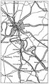 Rouankrt.jpg 1,232 × 2,132; 543 KB
-
 TIN voorbeeld.jpg 600 × 1,188; 304 KB
-
 Totaalkarteringdalendorp.PNG 916 × 835; 57 KB
-
 Tutorial assemblate a map 2.jpg 550 × 446; 56 KB
-
 Tutorial assemblate a map.jpg 1,000 × 825; 266 KB
-
 Vb geaggregeerd choropleet.PNG 654 × 282; 8 KB
-
 Vb geaggregeerd figuratief.PNG 655 × 282; 11 KB
-
 Vb geaggregeerd isolijnen.PNG 692 × 293; 11 KB
-
 Vb geaggregeerd stippenkaart.PNG 654 × 281; 34 KB
-
 Vb geaggregeerd uitgangswaarden.PNG 654 × 281; 12 KB
-
 Vector-raster-conversie.PNG 910 × 1,279; 87 KB
-
 Vector-raster-vector-conversie.PNG 910 × 2,000; 272 KB
-
 Vervoer van stoffen over de weg.PNG 739 × 763; 35 KB
-
 Visuale hiërarchie foute versie.PNG 981 × 771; 60 KB
-
 Wegen lijn objecten met merge en met join.PNG 298 × 503; 7 KB
-
 Wegen lijn objecten zonder merge en met join.PNG 297 × 504; 7 KB
-
 Wegen lijn objecten zonder merge en zonder join.PNG 306 × 505; 7 KB
-
 Wereld generalisatie simplify line3.PNG 1,668 × 686; 127 KB
-
 Étapes de création de carte avec QGIS.svg 512 × 383; 608 KB
-
 П-ов Муравьёв-Амурский-0.jpg 950 × 1,300; 127 KB
-
 П-ов Муравьёв-Амурский-0a.jpg 990 × 1,090; 45 KB
-
 П-ов Муравьёв-Амурский-1.jpg 990 × 1,090; 68 KB
-
 П-ов Муравьёв-Амурский-2.jpg 961 × 1,048; 175 KB
-
 Хребет Флиндерс-0.jpg 975 × 1,250; 70 KB
-
 Хребет Флиндерс-0a.jpg 950 × 1,200; 173 KB
-
 Хребет Флиндерс-2.jpg 968 × 1,121; 219 KB
-
 Хребет Флиндерс-3.jpg 1,000 × 1,200; 229 KB
-
 Хребет Флиндерс.jpg 986 × 1,120; 111 KB


