Category:Evangelische Kirche Romanshorn
Jump to navigation
Jump to search
| Object location | | View all coordinates using: OpenStreetMap |
|---|
  | |||||
| Upload media | |||||
| Instance of | |||||
|---|---|---|---|---|---|
| Part of | |||||
| Location |
| ||||
| Street address |
| ||||
| Heritage designation |
| ||||
| Inception |
| ||||
 | |||||
|
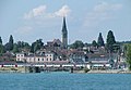
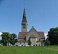
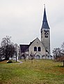
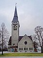
This is a category about a cultural property of regional significance in Switzerland with KGS number 13785
|
Media in category "Evangelische Kirche Romanshorn"
The following 21 files are in this category, out of 21 total.
-
 ETH-BIB-Romanshorn (Kanton Thurgau) v. S. aus 300 m-Inlandflüge-LBS MH01-004108.tif 5,850 × 3,637; 60.95 MB
-
 Ev. Kirche - panoramio (7).jpg 2,600 × 2,120; 1.37 MB
-
 Evangelische Kirche - panoramio (10).jpg 2,552 × 2,069; 1.33 MB
-
 Johanneskirche - panoramio (6).jpg 2,281 × 1,582; 1.16 MB
-
 Kirche in Romanshorn - panoramio.jpg 4,608 × 2,958; 3.78 MB
-
 Ref. Kirche - panoramio.jpg 2,816 × 2,120; 1.53 MB
-
 Reformierte Kirche - panoramio (1).jpg 2,816 × 2,120; 1.44 MB
-
 Reformierte Kirche - panoramio.jpg 2,630 × 1,822; 1.36 MB
-
 Romanshorn - panoramio (100).jpg 4,272 × 2,848; 8.01 MB
-
 Romanshorn - panoramio (101).jpg 2,848 × 4,272; 7.85 MB
-
 Romanshorn - panoramio (6).jpg 2,848 × 4,272; 12.67 MB
-
 Romanshorn - panoramio (97).jpg 2,848 × 4,272; 6.71 MB
-
 Romanshorn - panoramio (98).jpg 4,272 × 2,848; 6.5 MB
-
 Romanshorn Ev.Kirche.JPG 2,315 × 2,120; 1.26 MB
-
 RomanshornEvangeKirche.jpg 3,959 × 5,150; 13.24 MB
-
 RomanshornEvangelischeKirche.jpg 2,027 × 2,936; 2.86 MB
-
 RomanshornEvangelKirche.jpg 3,888 × 4,247; 7.24 MB
-
 RomanshornEvanKircheStiege.jpg 3,617 × 5,055; 10.48 MB
-
 RomanshornEvKirche.jpg 3,730 × 4,877; 12.86 MB
-
 RomanshornEvKircheFrontal.jpg 3,298 × 4,436; 11 MB
-
 RomanshornHausVulkan1.jpg 3,306 × 3,294; 7.6 MB
.jpg)
.jpg)
.jpg)

.jpg)

.jpg)
.jpg)
.jpg)
.jpg)
.jpg)


