Category:Evang. Pfarrkirche A.B., Steyr
Jump to navigation
Jump to search
| Object location | | View all coordinates using: OpenStreetMap |
|---|
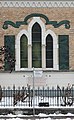
| This category shows the protected monument with the number 121376 in Austria. (Commons, de, Wikidata) |
church building in Steyr, Austria  | |||||
| Upload media | |||||
| Instance of | |||||
|---|---|---|---|---|---|
| Location | Steyr, Upper Austria, Austria | ||||
| Street address |
| ||||
| Heritage designation | |||||
 | |||||
Media in category "Evang. Pfarrkirche A.B., Steyr"
The following 10 files are in this category, out of 10 total.
-
 Evangelische Kirche Steyr.jpg 1,662 × 2,276; 1.87 MB
-
 Evangelische-Kirche-Steyr-17.jpg 1,000 × 750; 279 KB
-
 Kriegerdenkmal der Evangelischen Pfarrkirche Steyr 1.jpg 2,484 × 4,036; 8 MB
-
 Kriegerdenkmal der Evangelischen Pfarrkirche Steyr 2.jpg 6,983 × 4,655; 23.73 MB
-
 Steyr 2023 01.jpg 3,648 × 5,472; 6.86 MB
-
 Steyr Bahnhofstraße 20 (3).JPG 4,000 × 3,000; 4.93 MB
-
 Steyr Bahnhofstraße 20 (4).JPG 3,000 × 4,000; 4.05 MB
-
 Steyr Bahnhofstraße 20 (5).JPG 3,000 × 4,000; 4.09 MB
-
 Steyr Bahnhofstraße 20 (7).JPG 3,000 × 4,000; 4.53 MB
-
 Steyr Bahnhofstraße Evang. Pfarrkirche (01).JPG 1,839 × 2,490; 2.84 MB


.JPG)
.JPG)
.JPG)
.JPG)
.JPG)