Category:Elton, Herefordshire
Jump to navigation
Jump to search
village in Herefordshire, United Kingdom  | |||||
| Upload media | |||||
| Instance of | |||||
|---|---|---|---|---|---|
| Location | Herefordshire, West Midlands, England | ||||
 | |||||
Subcategories
This category has the following 2 subcategories, out of 2 total.
E
- Elton Hall, Elton (6 F)
S
Media in category "Elton, Herefordshire"
The following 95 files are in this category, out of 95 total.
-
 Above The Goggin - geograph.org.uk - 6332079.jpg 1,024 × 683; 273 KB
-
 Below Brush Wood - geograph.org.uk - 4980806.jpg 1,000 × 664; 671 KB
-
 Below Brush Wood - geograph.org.uk - 4980812.jpg 1,000 × 664; 660 KB
-
 Below Brush Wood - geograph.org.uk - 5814290.jpg 1,000 × 665; 765 KB
-
 Below Brush Wood - geograph.org.uk - 5814296.jpg 1,000 × 665; 706 KB
-
 Below Brush Wood - geograph.org.uk - 5814304.jpg 1,000 × 665; 737 KB
-
 Below Brush Wood - geograph.org.uk - 5814307.jpg 1,000 × 665; 767 KB
-
 Churchyard at St. Mary's Church (Elton) - geograph.org.uk - 6389962.jpg 3,648 × 2,736; 4.76 MB
-
 Churchyard at St. Mary's Church (Elton) - geograph.org.uk - 6389968.jpg 3,648 × 2,736; 4.39 MB
-
 Churchyard at St. Mary's Church (Elton) - geograph.org.uk - 6389982.jpg 3,648 × 2,736; 4.72 MB
-
 Churchyard at St. Mary's Church (Elton) - geograph.org.uk - 6390008.jpg 3,648 × 2,736; 4.35 MB
-
 Cottage at Elton - geograph.org.uk - 992143.jpg 640 × 480; 97 KB
-
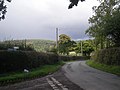
 Country road near Elton - geograph.org.uk - 6033392.jpg 1,024 × 768; 406 KB
-
 Decommissioned logging road - geograph.org.uk - 3929753.jpg 640 × 480; 361 KB
-
 Elton Hall - geograph.org.uk - 6389979.jpg 3,648 × 2,736; 4.25 MB
-
 Elton Hall - geograph.org.uk - 6389988.jpg 3,648 × 2,736; 3.75 MB
-
 Elton Hall - geograph.org.uk - 6390024.jpg 3,648 × 2,736; 4.58 MB
-
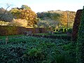 Elton Hall Gardens - geograph.org.uk - 6389977.jpg 3,648 × 2,736; 4.61 MB
-
 Elton Hall Gardens - geograph.org.uk - 6389991.jpg 3,648 × 2,736; 4.47 MB
-
 Elton village sign - geograph.org.uk - 1182009.jpg 640 × 480; 88 KB
-
 Entrance Gate to St. Mary's Church (Elton) - geograph.org.uk - 6389954.jpg 3,648 × 2,736; 4.66 MB
-
 Entrance to Brush Wood - geograph.org.uk - 4980890.jpg 1,000 × 664; 1.16 MB
-
 Entrance to Elton Farm - geograph.org.uk - 1182020.jpg 640 × 481; 117 KB
-
 Entrance to Elton Hall - geograph.org.uk - 6389998.jpg 3,648 × 2,736; 4.16 MB
-
 Entrance to Petchfield Farm - geograph.org.uk - 1181992.jpg 640 × 480; 69 KB
-
 Fallen ash branch - geograph.org.uk - 4217045.jpg 800 × 600; 549 KB
-
 Field near Vallets - geograph.org.uk - 4448499.jpg 800 × 530; 519 KB
-
 Field off Killhorse Lane - geograph.org.uk - 4980904.jpg 1,000 × 664; 801 KB
-
 Field, Vallets - geograph.org.uk - 2212118.jpg 640 × 480; 314 KB
-
 Gate, Hanway Common - geograph.org.uk - 4672665.jpg 800 × 600; 528 KB
-
 Gazebo at Elton Hall - geograph.org.uk - 6390012.jpg 2,001 × 1,501; 609 KB
-
 Gazebo at Elton Hall Gardens - geograph.org.uk - 6389990.jpg 3,648 × 2,736; 4.78 MB
-
 Grassland south of Burrington - geograph.org.uk - 1324289.jpg 640 × 480; 101 KB
-
 Hanway Common - geograph.org.uk - 4449897.jpg 800 × 530; 420 KB
-
 Hanway Common - geograph.org.uk - 4672677.jpg 800 × 600; 500 KB
-
 Holly Cottage - geograph.org.uk - 1248401.jpg 640 × 426; 86 KB
-
 Killhorse Lane (The real one) - geograph.org.uk - 3929758.jpg 640 × 480; 348 KB
-
 Killhorse Lane - geograph.org.uk - 4980920.jpg 1,000 × 664; 805 KB
-
 Killhorse Lane - geograph.org.uk - 4980924.jpg 1,000 × 664; 988 KB
-
 Killhorse Lane near Elton (1) - geograph.org.uk - 6033394.jpg 885 × 1,024; 821 KB
-
 Killhorse Lane near Elton (2) - geograph.org.uk - 6033398.jpg 880 × 1,024; 710 KB
-
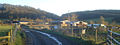
 Knighton-Tref-y-Clawdd from the air - geograph.org.uk - 4783594.jpg 3,264 × 2,448; 4.73 MB
-
 Lane at Elton - geograph.org.uk - 1182013.jpg 640 × 636; 160 KB
-
 Lane at Elton - geograph.org.uk - 6319858.jpg 3,648 × 2,736; 4.8 MB
-
 Lane at Elton - geograph.org.uk - 6390021.jpg 3,648 × 2,736; 4.14 MB
-
 Lane junction near Elton - geograph.org.uk - 1181999.jpg 640 × 483; 69 KB
-
 Lane near Petchfield Farm - geograph.org.uk - 1181989.jpg 640 × 468; 52 KB
-
 Lane to Elton - geograph.org.uk - 1181996.jpg 640 × 463; 62 KB
-
 Lane to Ludlow - geograph.org.uk - 992137.jpg 640 × 480; 71 KB
-
 Larches, The Hope - geograph.org.uk - 4672672.jpg 800 × 600; 516 KB
-
 Ludlow Anticline, Aston Copse - geograph.org.uk - 2212096.jpg 640 × 480; 272 KB
-
 Marlbrook Hall - geograph.org.uk - 992152.jpg 640 × 480; 95 KB
-
 Monkey Puzzle Tree at St. Mary's Church (Elton) - geograph.org.uk - 6389987.jpg 3,648 × 2,736; 4.66 MB
-
 Muddy track at the top of The Hope - geograph.org.uk - 4672662.jpg 800 × 600; 516 KB
-
 Newly ploughed arable land east of Marlbrook Hall - geograph.org.uk - 3743133.jpg 4,000 × 3,000; 2.57 MB
-
 Sign at St. Mary's Church (Elton) - geograph.org.uk - 6389952.jpg 3,648 × 2,736; 4.18 MB
-
 St. Mary's Church (Bell Tower ^ Elton) - geograph.org.uk - 6389960.jpg 3,648 × 2,736; 4.3 MB
-
 St. Mary's Church (Bell Tower ^ Porch ^ Elton) - geograph.org.uk - 6389983.jpg 2,736 × 3,648; 3.8 MB
-
 St. Mary's Church (Close-Up of the Bell Tower ^ Elton) - geograph.org.uk - 6389985.jpg 3,648 × 2,736; 3.21 MB
-
 St. Mary's Church (Elton) - geograph.org.uk - 6319354.jpg 3,648 × 2,736; 4.07 MB
-
 St. Mary's Church (Elton) - geograph.org.uk - 6389958.jpg 3,648 × 2,736; 4.51 MB
-
 St. Mary's Church (Elton) - geograph.org.uk - 6389971.jpg 3,648 × 2,736; 3.39 MB
-
 St. Mary's Church (Elton) - geograph.org.uk - 6390000.jpg 3,648 × 2,736; 3.4 MB
-
 St. Mary's Church (Porch ^ Elton) - geograph.org.uk - 6389967.jpg 3,648 × 2,736; 4.01 MB
-
 St. Mary's Church (Porch ^ Elton) - geograph.org.uk - 6389997.jpg 2,048 × 1,536; 853 KB
-
 The Sheep Palace, Elton Hall - geograph.org.uk - 2449220.jpg 3,280 × 2,180; 4.87 MB
-
 The top of The Goggin - geograph.org.uk - 6332081.jpg 1,024 × 683; 253 KB
-
 Towards High Vinnalls - geograph.org.uk - 4980814.jpg 1,000 × 664; 625 KB
-
 Towards High Vinnalls - geograph.org.uk - 5814300.jpg 1,000 × 665; 703 KB
-
 Towards the Vale of Wigmore - geograph.org.uk - 5813621.jpg 1,000 × 665; 718 KB
-
 Track between the commons - geograph.org.uk - 2212120.jpg 640 × 480; 332 KB
-
 Track between the commons - geograph.org.uk - 2212123.jpg 640 × 480; 339 KB
-
 Track to Elton Farm - 1 - geograph.org.uk - 1327070.jpg 640 × 480; 164 KB
-
 Track to Elton Farm - 2 - geograph.org.uk - 1327088.jpg 640 × 480; 155 KB
-
 Track to Elton Farm - 3 - geograph.org.uk - 1327114 (cropped).jpg 580 × 218; 45 KB
-
 Track to Elton Farm - 3 - geograph.org.uk - 1327114.jpg 640 × 480; 100 KB
-
 Trees at Elton Hall - geograph.org.uk - 6389966.jpg 3,648 × 2,736; 4.66 MB
-
 Trees at St. Mary's Church (Elton) - geograph.org.uk - 6389956.jpg 3,648 × 2,736; 4.64 MB
-
 Trees at St. Mary's Church (Elton) - geograph.org.uk - 6389995.jpg 3,648 × 2,736; 4.7 MB
-
 Trees at St. Mary's Church (Elton) - geograph.org.uk - 6390014.jpg 3,648 × 2,736; 3.73 MB
-
 Vallets - geograph.org.uk - 4449874.jpg 800 × 530; 462 KB
-
 Vallets - geograph.org.uk - 4449880.jpg 800 × 530; 406 KB
-
 Vallets - geograph.org.uk - 5026901.jpg 1,000 × 664; 662 KB
-
 Victorian post box - geograph.org.uk - 1248410.jpg 426 × 640; 118 KB
-
 Wet field south of Burrington - geograph.org.uk - 1324296.jpg 640 × 480; 105 KB
-
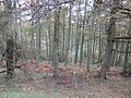
 Woodlands - geograph.org.uk - 2364447.jpg 640 × 425; 104 KB
-
 Woodlands - geograph.org.uk - 2366600.jpg 425 × 640; 118 KB
-
 Woodlands - geograph.org.uk - 5814287.jpg 665 × 1,000; 645 KB
-
 Above Elton - geograph.org.uk - 70677.jpg 640 × 480; 114 KB
-
 Corner of Hanway Common. - geograph.org.uk - 53379.jpg 640 × 480; 114 KB
-
 Forest road, Goggin - geograph.org.uk - 314612.jpg 640 × 480; 135 KB
-
 Hidden valley above Elton - geograph.org.uk - 60526.jpg 640 × 480; 128 KB
-
 Killhorse Lane - geograph.org.uk - 300416.jpg 640 × 480; 119 KB
-
 Petchfield - geograph.org.uk - 206277.jpg 480 × 640; 115 KB
-
 The Goggin - geograph.org.uk - 298205.jpg 640 × 480; 86 KB


_-_geograph.org.uk_-_6389962.jpg)
_-_geograph.org.uk_-_6389968.jpg)
_-_geograph.org.uk_-_6389982.jpg)
_-_geograph.org.uk_-_6390008.jpg)


_-_geograph.org.uk_-_6389954.jpg)


_-_geograph.org.uk_-_3929758.jpg)


_-_geograph.org.uk_-_6033394.jpg)
_-_geograph.org.uk_-_6033398.jpg)


_-_geograph.org.uk_-_6389987.jpg)


_-_geograph.org.uk_-_6389952.jpg)
_-_geograph.org.uk_-_6389960.jpg)
_-_geograph.org.uk_-_6389983.jpg)
_-_geograph.org.uk_-_6389985.jpg)
_-_geograph.org.uk_-_6319354.jpg)
_-_geograph.org.uk_-_6389958.jpg)
_-_geograph.org.uk_-_6389971.jpg)
_-_geograph.org.uk_-_6390000.jpg)
_-_geograph.org.uk_-_6389967.jpg)
_-_geograph.org.uk_-_6389997.jpg)


_-_geograph.org.uk_-_6389956.jpg)
_-_geograph.org.uk_-_6389995.jpg)
_-_geograph.org.uk_-_6390014.jpg)


.jpg)