Category:Elmore, Gloucestershire
Jump to navigation
Jump to search
village and civil parish, located in the Stroud district of Gloucestershire, England  | |||||
| Upload media | |||||
| Instance of | |||||
|---|---|---|---|---|---|
| Location | Stroud, Gloucestershire, South West England, England | ||||
| Said to be the same as | Elmore (Wikimedia duplicated page, civil parish) | ||||
| official website | |||||
 | |||||
English: For other places with the same name, see Elmore.
Subcategories
This category has the following 3 subcategories, out of 3 total.
E
- Elmore War Memorial (3 F)
Media in category "Elmore, Gloucestershire"
The following 99 files are in this category, out of 99 total.
-
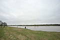
 A twilight Severn Bore - geograph.org.uk - 3529147.jpg 1,024 × 680; 92 KB
-
 Abandoned cottage near Elmore Back - geograph.org.uk - 783944.jpg 640 × 426; 74 KB
-
 Abandoned house on Minsterworth Ham - geograph.org.uk - 784593.jpg 426 × 640; 61 KB
-

-
 Abandoned trailer - geograph.org.uk - 1331660.jpg 640 × 426; 133 KB
-

-
 After the Bore - geograph.org.uk - 4405358.jpg 4,256 × 2,832; 3.55 MB
-
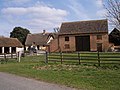
 Barn at Elmore - geograph.org.uk - 1938319.jpg 640 × 480; 104 KB
-
 Bend in the River Severn - geograph.org.uk - 683428.jpg 480 × 640; 158 KB
-
 By Hanging Covert - geograph.org.uk - 1938320.jpg 640 × 480; 115 KB
-
 Church Farm, Farley's End - geograph.org.uk - 784463.jpg 640 × 426; 64 KB
-

-

-
 Dead end lane to Velthouse - geograph.org.uk - 5267813.jpg 1,600 × 901; 615 KB
-
 Debris on the river bank - geograph.org.uk - 683449.jpg 640 × 480; 146 KB
-
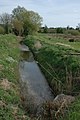
 Deep ditch near Highcross Farm - geograph.org.uk - 683409.jpg 480 × 640; 126 KB
-
 Drainage ditch at Farley's End - geograph.org.uk - 784464.jpg 426 × 640; 84 KB
-
 Drainage ditch, Elmore Back - geograph.org.uk - 783504.jpg 640 × 426; 84 KB
-
-
 Dyke near Elmore Back - geograph.org.uk - 791065.jpg 640 × 426; 94 KB
-
 Elmore Farm - geograph.org.uk - 5267786.jpg 1,600 × 901; 701 KB
-
 Elmore from the air - geograph.org.uk - 1221162.jpg 480 × 640; 61 KB
-
 Elmore Lane - geograph.org.uk - 5267763.jpg 1,600 × 901; 639 KB
-
 Elmore Lane at Weir Lane junction - geograph.org.uk - 5267784.jpg 1,600 × 901; 638 KB
-
 Entrance to Elmore Court - geograph.org.uk - 4124582.jpg 800 × 484; 68 KB
-
 Farley Corner - geograph.org.uk - 1938329.jpg 640 × 480; 114 KB
-
 Farley Corner - geograph.org.uk - 5267906.jpg 1,600 × 901; 675 KB
-
 Farley's End - geograph.org.uk - 140785.jpg 640 × 479; 79 KB
-
 Farm at Elmore - geograph.org.uk - 784468.jpg 640 × 426; 56 KB
-
 Farm at Elmore - geograph.org.uk - 784473.jpg 640 × 426; 93 KB
-
 Farm at Elmore Back - geograph.org.uk - 783926.jpg 640 × 426; 78 KB
-
 Farmhouse at Elmore Back - geograph.org.uk - 783481.jpg 640 × 426; 70 KB
-
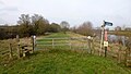
 Footpath at Farley Corner. 1 - geograph.org.uk - 5267900.jpg 1,600 × 901; 687 KB
-
 Footpath at Farley Corner. 2 - geograph.org.uk - 5267902.jpg 1,600 × 901; 666 KB
-
 Galanthus nivalis, Common Snowdrop - geograph.org.uk - 5267926.jpg 1,600 × 1,324; 939 KB
-
 Groundless Pool - geograph.org.uk - 1938180.jpg 640 × 426; 80 KB
-
 Groundless Pool, near Elmore - geograph.org.uk - 783955.jpg 640 × 426; 53 KB
-
 Kenton Green, Elmore, 1 - geograph.org.uk - 5267892.jpg 1,600 × 901; 567 KB
-
 Kenton Green, Elmore, 2 - geograph.org.uk - 5267895.jpg 1,600 × 901; 678 KB
-
 Lane at Kenton Green - geograph.org.uk - 1938325.jpg 640 × 480; 107 KB
-
 Looking across the Severn from Weir Green - geograph.org.uk - 5267775.jpg 1,600 × 901; 651 KB
-
 Lost footpath - geograph.org.uk - 1938327.jpg 640 × 480; 140 KB
-
 Madam's End Farm - geograph.org.uk - 140808.jpg 640 × 480; 66 KB
-
 Meadow land at Lake Street, 1 - geograph.org.uk - 5267912.jpg 1,600 × 901; 713 KB
-
 Meadow land at Lake Street, 2 - geograph.org.uk - 5267916.jpg 1,600 × 901; 709 KB
-
 Mid-summer twilight Severn Bore - geograph.org.uk - 3529158.jpg 1,024 × 680; 107 KB
-
 Midsummer evening sky - geograph.org.uk - 3529162.jpg 680 × 1,024; 72 KB
-
 Orchard, Farley's End - geograph.org.uk - 1938340.jpg 640 × 480; 116 KB
-
 Ploughed fields at Elmore - geograph.org.uk - 784458.jpg 640 × 426; 87 KB
-
 Ponds at Elmore - geograph.org.uk - 5267804.jpg 1,600 × 901; 721 KB
-
 River Severn at Minsterworth - geograph.org.uk - 1812900.jpg 3,008 × 2,000; 1.55 MB
-
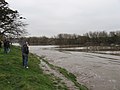
 River Severn at Stonebench, 2 - geograph.org.uk - 5267743.jpg 1,600 × 901; 705 KB
-
 River Severn south of Calcott's Green - geograph.org.uk - 683401.jpg 640 × 480; 131 KB
-
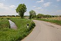
 Road junction at Farley's End - geograph.org.uk - 791369.jpg 640 × 426; 76 KB
-
 Severn Bank Farm at Elmore Back - geograph.org.uk - 790942.jpg 640 × 426; 59 KB
-
 Severn Bore near Minsterworth - geograph.org.uk - 2277203.jpg 2,816 × 2,112; 1.66 MB
-
 Severn Way LDF at Weir Green - geograph.org.uk - 5267769.jpg 1,600 × 901; 700 KB
-
 Severn Way LDF at Weir Green - geograph.org.uk - 5267779.jpg 1,600 × 901; 671 KB
-
 St. John the Baptist's church, Elmore - geograph.org.uk - 5267920.jpg 1,600 × 901; 696 KB
-
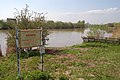
 St. John's noticeboard - geograph.org.uk - 5267923.jpg 1,200 × 1,600; 902 KB
-
 Stonebench Tidal Road - geograph.org.uk - 3803715.jpg 3,872 × 2,592; 4.7 MB
-
 Strolling by the river Severn - geograph.org.uk - 141737.jpg 640 × 480; 89 KB
-
 The 'Severn Voyager' at Elmore - geograph.org.uk - 784595.jpg 426 × 640; 74 KB
-
 The 'Severn Voyager' at Elmore - geograph.org.uk - 784596.jpg 640 × 426; 74 KB
-
 Track and footpath to Brookfield House - geograph.org.uk - 5267757.jpg 1,600 × 901; 728 KB
-
 Track from the river to the road - geograph.org.uk - 1834633.jpg 4,288 × 2,848; 3.09 MB
-
 Track near Farley's End - geograph.org.uk - 784467.jpg 426 × 640; 81 KB
-
 Tree by the Severn - geograph.org.uk - 1938163.jpg 640 × 480; 118 KB
-
 View across Corn Ham - geograph.org.uk - 1331638.jpg 640 × 426; 111 KB
-
 View from St. John's churchyard - geograph.org.uk - 5267922.jpg 1,600 × 901; 716 KB
-
 Waiting for the Severn Bore - geograph.org.uk - 4358924.jpg 2,560 × 1,920; 2.83 MB
-
 Washed up after the floods - geograph.org.uk - 683125.jpg 640 × 480; 204 KB
-
 Abandoned cottage by the river Severn - geograph.org.uk - 139501.jpg 640 × 480; 86 KB
-
 Abandoned stone wheel and trough. - geograph.org.uk - 141751.jpg 640 × 480; 111 KB
-

-
 Approaching Calcott's Green - geograph.org.uk - 683917.jpg 640 × 480; 154 KB
-
 Building by the River Severn - geograph.org.uk - 683104.jpg 640 × 480; 199 KB
-
 Dead end near Minsterworth Ham - geograph.org.uk - 683952.jpg 640 × 480; 144 KB
-
 Deep furrows by a ditch - geograph.org.uk - 683444.jpg 640 × 456; 180 KB
-
 Derelict cottage by the Severn - geograph.org.uk - 683418.jpg 640 × 480; 206 KB
-
 Drainage channel on Minsterworth Ham - geograph.org.uk - 683901.jpg 430 × 640; 165 KB
-
 Farleys End Gloucestershire - geograph.org.uk - 140049.jpg 640 × 480; 94 KB
-
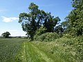
 Farmland at Longney - geograph.org.uk - 688033.jpg 640 × 426; 94 KB
-
 Fields by the Severn - geograph.org.uk - 759256.jpg 640 × 480; 49 KB
-
 Getting rid of the dead wood - geograph.org.uk - 683387.jpg 640 × 429; 187 KB
-

-
 Groundless Pool by the river Severn - geograph.org.uk - 139494.jpg 640 × 480; 103 KB
-
 Ham Green - geograph.org.uk - 141184.jpg 640 × 479; 96 KB
-
 Hockley Hill - geograph.org.uk - 122794.jpg 640 × 480; 138 KB
-
 Hockley wood - geograph.org.uk - 123794.jpg 640 × 480; 107 KB
-
 Kenton Green - geograph.org.uk - 140782.jpg 640 × 479; 109 KB
-
 Nature, the sculptress - geograph.org.uk - 683888.jpg 640 × 413; 203 KB
-
 One wheel on my wagon - geograph.org.uk - 683908.jpg 640 × 436; 162 KB
-
 Power lines cross the River Severn - geograph.org.uk - 683415.jpg 640 × 470; 124 KB
-
 Severn Way footpath at Weir Green - geograph.org.uk - 120977.jpg 640 × 480; 86 KB
-
 The last tree in the orchard - geograph.org.uk - 683390.jpg 640 × 442; 130 KB
-
 Track to Corn Ham - geograph.org.uk - 683896.jpg 480 × 640; 170 KB
-
 Underneath the arches - geograph.org.uk - 683883.jpg 640 × 480; 241 KB
-


