Category:Elford
Jump to navigation
Jump to search
village and civil parish in Staffordshire, United Kingdom  | |||||
| Upload media | |||||
| Instance of | |||||
|---|---|---|---|---|---|
| Location | Lichfield, Staffordshire, West Midlands, England | ||||
 | |||||
Subcategories
This category has the following 2 subcategories, out of 2 total.
E
- St Peter's Church, Elford (39 F)
- Elford Loop (46 F)
Media in category "Elford"
The following 92 files are in this category, out of 92 total.
-
 A Field of Rape A513 - geograph.org.uk - 2507910.jpg 640 × 428; 84 KB
-
 A513 at Elford - geograph.org.uk - 156024.jpg 640 × 480; 85 KB
-
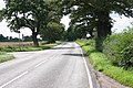 A513 Near Elford (1) - geograph.org.uk - 1882420.jpg 3,072 × 2,048; 3.84 MB
-
 A513 Near Elford (6) - geograph.org.uk - 1882663.jpg 3,072 × 2,048; 4.11 MB
-
 A513 towards Tamworth - geograph.org.uk - 5335523.jpg 640 × 480; 112 KB
-
 A513 towards Tamworth - geograph.org.uk - 5335542.jpg 640 × 480; 49 KB
-
 A513 towards Tamworth - geograph.org.uk - 5335553.jpg 640 × 480; 69 KB
-
 A513 towards Tamworth - geograph.org.uk - 5335583.jpg 640 × 480; 50 KB
-
 Across to the pylons - geograph.org.uk - 433017.jpg 640 × 480; 64 KB
-
 Arable fields - geograph.org.uk - 429024.jpg 640 × 480; 76 KB
-
 Arches, Derby to Birmingham Railway - geograph.org.uk - 5335547.jpg 640 × 480; 65 KB
-
 Black and White Cottage, Elford.jpg 2,000 × 1,441; 705 KB
-
 Breath In - geograph.org.uk - 433006.jpg 640 × 480; 73 KB
-
 Burnt out Building by Railway on A513 - geograph.org.uk - 2507135.jpg 640 × 428; 124 KB
-
 Church Road - geograph.org.uk - 2418090.jpg 3,072 × 2,048; 4.26 MB
-
 Church Road, Elford - geograph.org.uk - 5335559.jpg 640 × 480; 67 KB
-

-
 Downstream - geograph.org.uk - 428953.jpg 640 × 480; 47 KB
-
 Driveway from St Peter's Church - geograph.org.uk - 2418121.jpg 3,072 × 2,048; 3.16 MB
-
 Driveway to St Peter's Church - geograph.org.uk - 2423085.jpg 2,048 × 3,072; 3.5 MB
-
 Driveway to the church, Elford - geograph.org.uk - 1914023.jpg 2,000 × 1,500; 1.05 MB
-
 Elford Stores.jpg 640 × 480; 90 KB
-
 Elford Bridge - geograph.org.uk - 155612.jpg 640 × 480; 90 KB
-
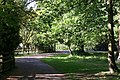
 Elford Park - geograph.org.uk - 1207024.jpg 640 × 480; 48 KB
-
 Elford Stores - geograph.org.uk - 1914100.jpg 2,000 × 1,339; 648 KB
-
 Elford, Staffordshire, St Peter - geograph.org.uk - 5916231.jpg 4,608 × 3,456; 3.99 MB
-
 Farmland access from the A513 - geograph.org.uk - 2841313.jpg 640 × 425; 96 KB
-
 Farmland north east of Elford - geograph.org.uk - 3200876.jpg 800 × 540; 106 KB
-
 Farmland, Greendales Farm - geograph.org.uk - 3407401.jpg 1,600 × 1,263; 316 KB
-
 Field entrance off the A513 - geograph.org.uk - 5335550.jpg 640 × 480; 66 KB
-
 For Sale - geograph.org.uk - 433012.jpg 640 × 480; 111 KB
-
 Hay Field on Brickhouse Lane - geograph.org.uk - 2507445.jpg 640 × 428; 70 KB
-
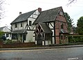
 House by the church gates, Elford - geograph.org.uk - 1914046.jpg 2,000 × 1,388; 612 KB
-
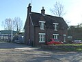 House on the A513 - geograph.org.uk - 5335544.jpg 640 × 480; 69 KB
-
 House on The Shrubbery, Elford - geograph.org.uk - 5335556.jpg 640 × 480; 55 KB
-
 HST train - geograph.org.uk - 428095.jpg 640 × 480; 59 KB
-
 Junction at Mill View Cottages - geograph.org.uk - 2507477.jpg 640 × 428; 69 KB
-

-

-
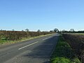
 Looking south on the A513 - geograph.org.uk - 5335586.jpg 640 × 480; 73 KB
-
 Mere Pits Cottages - geograph.org.uk - 5335588.jpg 640 × 480; 82 KB
-
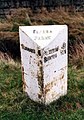
 Milepost at SK 19570813.jpg 480 × 640; 113 KB
-
 Milepost at SK1941909695.jpg 492 × 701; 65 KB
-
 Milepost at SK1966110923.jpg 492 × 701; 60 KB
-
 Mill View Cottages - geograph.org.uk - 5335584.jpg 640 × 480; 59 KB
-
 Oilseed rape crop, Greendales - geograph.org.uk - 5335552.jpg 640 × 480; 83 KB
-
 Oilseed rape crop, near Upfields - geograph.org.uk - 5335585.jpg 640 × 480; 89 KB
-

-

-
 Park Farm - geograph.org.uk - 429014.jpg 640 × 480; 66 KB
-
 Passing place - geograph.org.uk - 433014.jpg 640 × 480; 99 KB
-
 Playground, Elford - geograph.org.uk - 726513.jpg 640 × 480; 106 KB
-
 Railway bridge over the A513 - geograph.org.uk - 5335545.jpg 640 × 480; 65 KB
-
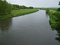
 River Tame - geograph.org.uk - 122886.jpg 640 × 480; 120 KB
-
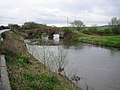
 River Tame, Elford Bridge - geograph.org.uk - 5335574.jpg 640 × 480; 42 KB
-
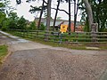
 Road junction - geograph.org.uk - 433000.jpg 640 × 480; 65 KB
-
 South Elford - geograph.org.uk - 428949.jpg 640 × 480; 98 KB
-
 St Peter's Church, Elford - geograph.org.uk - 4461545.jpg 640 × 432; 527 KB
-
-

-

-

-

-

-
-
 The Crown, Elford - geograph.org.uk - 2507435.jpg 640 × 428; 86 KB
-
 The Crown, Elford - geograph.org.uk - 726507.jpg 640 × 480; 81 KB
-
 The Forge, Elford.jpg 2,000 × 1,500; 901 KB
-
 The Limes, The Shrubbery, Elford - geograph.org.uk - 2507465.jpg 640 × 428; 99 KB
-
 The Orchard, Park Farm - geograph.org.uk - 2507461.jpg 640 × 428; 103 KB
-
 The Shrubbery, Elford - geograph.org.uk - 5335573.jpg 640 × 480; 117 KB
-
 Trees beside the A513 - geograph.org.uk - 5335554.jpg 640 × 480; 102 KB
-
 Wetleyhay Stream - geograph.org.uk - 429008.jpg 640 × 480; 108 KB
-
 Wetleyhay Wood - geograph.org.uk - 433019.jpg 640 × 480; 98 KB
-
 Wheat Field next the A513 - geograph.org.uk - 1882499.jpg 3,072 × 2,048; 3.28 MB
-
 Farmland - geograph.org.uk - 327309.jpg 579 × 472; 81 KB
-
 Field, Ewe Hill - geograph.org.uk - 428607.jpg 640 × 427; 83 KB
-
 Fisherwick Park Farm - geograph.org.uk - 266206.jpg 640 × 480; 80 KB
-
 Public bridleway at Snear Law - geograph.org.uk - 327303.jpg 640 × 480; 89 KB
-
 Public bridleway on Snear Law - geograph.org.uk - 329150.jpg 595 × 467; 85 KB
-
 Public Bridleway, Ewe Hill - geograph.org.uk - 427136.jpg 640 × 427; 75 KB
-
 Road Junction, Near Westfield - geograph.org.uk - 428662.jpg 640 × 427; 55 KB
-
 Sheep Pasture, Elford - geograph.org.uk - 427160.jpg 640 × 427; 65 KB
-
 Sittles - geograph.org.uk - 429028.jpg 640 × 480; 75 KB
-
 Stubble field - geograph.org.uk - 327305.jpg 640 × 480; 88 KB
-
 Stubby Lea Farm - geograph.org.uk - 266193.jpg 640 × 480; 91 KB
-
 Tamhorn Farm Bridge, and Farm - geograph.org.uk - 3150.jpg 640 × 480; 64 KB
-
 Tamhorn House - geograph.org.uk - 3149.jpg 640 × 480; 76 KB
-
 The road to Pasturehill Farm - geograph.org.uk - 327359.jpg 640 × 480; 66 KB
-
 Tree-lined road in Elford - geograph.org.uk - 155611.jpg 480 × 640; 72 KB
-
 Turnip field at Cross Hill - geograph.org.uk - 322638.jpg 571 × 431; 93 KB
-
 Upfields - geograph.org.uk - 155614.jpg 640 × 480; 73 KB


_-_geograph.org.uk_-_1882420.jpg)
_-_geograph.org.uk_-_1882663.jpg)


.jpg)


_-_geograph.org.uk_-_4461569.jpg)
_-_geograph.org.uk_-_4461571.jpg)
_-_geograph.org.uk_-_4461577.jpg)

_-_geograph.org.uk_-_4461556.jpg)


