Category:Electricity pylons in Leicestershire
Jump to navigation
Jump to search
Ceremonial counties of England: Bedfordshire · Berkshire · Buckinghamshire · Cambridgeshire · Cheshire · Cornwall · Cumbria · Derbyshire · Devon · Dorset · Durham · East Riding of Yorkshire · East Sussex · Essex · Gloucestershire · Greater London · Greater Manchester · Hampshire · Herefordshire · Hertfordshire · Isle of Wight · Kent · Lancashire · Leicestershire · Lincolnshire · Merseyside · Norfolk · North Yorkshire · Northamptonshire · Northumberland · Nottinghamshire · Oxfordshire · Rutland · Shropshire · Somerset · South Yorkshire · Staffordshire · Suffolk · Surrey · Tyne and Wear · Warwickshire · West Midlands · West Sussex · West Yorkshire · Wiltshire · Worcestershire
City-counties:
Former historic counties:
Other former counties:
City-counties:
Former historic counties:
Other former counties:

Main category: Electricity pylons
Media in category "Electricity pylons in Leicestershire"
The following 67 files are in this category, out of 67 total.
-

-
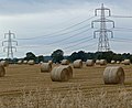 Bales and pylons near Stoney Stanton - geograph.org.uk - 940475.jpg 640 × 521; 78 KB
-
 Bishop's Meadow 2.jpg 2,272 × 1,704; 1.15 MB
-
 Bishop's Meadow 4.jpg 2,272 × 1,704; 1.16 MB
-
 Bishop's Meadow 5.jpg 2,272 × 1,704; 1.18 MB
-
 Bus shelter on Broad Rushes - geograph.org.uk - 1229105.jpg 640 × 480; 51 KB
-

-
 Electricity Pylon - geograph.org.uk - 481730.jpg 480 × 640; 103 KB
-
 Electricity Pylons - geograph.org.uk - 522674.jpg 425 × 640; 105 KB
-

-
 Electricity pylons near Barlestone - geograph.org.uk - 1300611.jpg 640 × 439; 67 KB
-

-

-

-
 Farmland near Tilton on the Hill - geograph.org.uk - 752627.jpg 629 × 640; 81 KB
-
 Farmland near Wymeswold - geograph.org.uk - 146378.jpg 640 × 427; 106 KB
-
 Farmland south of Tilton on the Hill - geograph.org.uk - 752973.jpg 640 × 465; 98 KB
-
 Field with pylon - geograph.org.uk - 395715.jpg 640 × 480; 77 KB
-

-
 From Chalk Pool Hill - geograph.org.uk - 144445.jpg 640 × 427; 119 KB
-
 Powerlines across Open Country. - geograph.org.uk - 337479.jpg 640 × 480; 85 KB
-
 Pylon from M69 - geograph.org.uk - 568718.jpg 640 × 480; 69 KB
-
 Pylons and farmland - geograph.org.uk - 858955.jpg 640 × 492; 88 KB
-
 Pylons and farmland near Skeffington - geograph.org.uk - 885676.jpg 640 × 562; 90 KB
-
 Pylons at Potters Marston - geograph.org.uk - 284997.jpg 640 × 480; 52 KB
-

-
 Pylons near Brooksby Grange Farm - geograph.org.uk - 1208481.jpg 640 × 537; 60 KB
-

-
 Pylons north of Earl Shilton - geograph.org.uk - 699802.jpg 413 × 640; 41 KB
-
 Pylons north of Leire Lane - geograph.org.uk - 718827.jpg 640 × 469; 46 KB
-
 Pylons north of Thrussington - geograph.org.uk - 884140.jpg 640 × 458; 81 KB
-
 Pylons north of Thrussington - geograph.org.uk - 884148.jpg 640 × 480; 71 KB
-
 Pylons to the Corner - geograph.org.uk - 239178.jpg 480 × 640; 67 KB
-
 Pylons west of Wartnaby - geograph.org.uk - 909598.jpg 640 × 541; 66 KB
-
 Reflections on the Aylestone Meadows - geograph.org.uk - 676633.jpg 640 × 503; 68 KB
-

-
 Ross Bridge on the Grand Union Canal - geograph.org.uk - 417548.jpg 532 × 640; 132 KB
-
 Showmen's base - geograph.org.uk - 1436812.jpg 640 × 479; 75 KB
-
 St. Mary's Mill Lock in Aylestone. - geograph.org.uk - 377427.jpg 640 × 423; 109 KB
-
 Swinford - geograph.org.uk - 167652.jpg 640 × 480; 130 KB
-
 Swinford - geograph.org.uk - 59957.jpg 480 × 640; 85 KB
-

-
 View from Fox Hill - geograph.org.uk - 721092.jpg 640 × 480; 67 KB
-
-
 Aylestone Gasometer - geograph.org.uk - 357508.jpg 637 × 403; 92 KB
-
 Countryside near Enderby - geograph.org.uk - 144374.jpg 640 × 427; 120 KB
-
 Electricity Pylon - geograph.org.uk - 144074.jpg 481 × 640; 72 KB
-
 Electricity pylon - geograph.org.uk - 489805.jpg 468 × 640; 93 KB
-
 Electricity Pylons - geograph.org.uk - 504639.jpg 545 × 640; 143 KB
-
 Electricity Pylons - geograph.org.uk - 505560.jpg 420 × 640; 73 KB
-
 Electricity Pylons - geograph.org.uk - 511594.jpg 537 × 640; 109 KB
-
 Electricity Pylons - geograph.org.uk - 572695.jpg 554 × 640; 106 KB
-
 Electricity Pylons - geograph.org.uk - 752722.jpg 407 × 640; 61 KB
-
-

-
 Farmland and pylons - geograph.org.uk - 720219.jpg 545 × 640; 78 KB
-
 Field at Earl Shilton - geograph.org.uk - 362204.jpg 640 × 480; 88 KB
-
 Footpath and pylon - geograph.org.uk - 505550.jpg 487 × 640; 102 KB
-

-
 Lawn Farm near Enderby - geograph.org.uk - 144356.jpg 640 × 427; 110 KB
-
 M1 J24a - geograph.org.uk - 3936.jpg 640 × 480; 49 KB
-

-
 Pylons at Ashby Pastures near Gaddesby - geograph.org.uk - 144466.jpg 640 × 427; 130 KB
-
 Pylons east of Langton Caudle - geograph.org.uk - 232697.jpg 640 × 480; 75 KB
-
 Pylons near Ashby Pastures - geograph.org.uk - 144467.jpg 640 × 427; 111 KB
-

-
 Well graded land - geograph.org.uk - 165265.jpg 640 × 445; 58 KB


