Category:Election maps of Staffordshire
Jump to navigation
Jump to search
This category contains election maps for the ceremonial county of Staffordshire.
Media in category "Election maps of Staffordshire"
The following 80 files are in this category, out of 80 total.
-
 2023 Tamworth Borough Council election.svg 512 × 614; 77 KB
-
 Cannock (42140583115).png 1,536 × 1,252; 113 KB
-
 CANNOCK CHASE (49910742801).png 2,160 × 1,080; 342 KB
-
 Cannock Chase District Council election 2012 map.svg 1,055 × 1,305; 210 KB
-
 Cannock Chase District Council election 2014 map.svg 1,055 × 1,305; 210 KB
-
 Cannock Chase District Council election 2015 map.svg 1,055 × 1,305; 210 KB
-
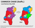
 Cannock Chase District Council election 2018 map.svg 1,055 × 1,305; 210 KB
-
 Cannock Chase District Council election 2019 map.svg 1,055 × 1,305; 210 KB
-
 Cannock Chase District Council election 2021 map.svg 1,055 × 1,305; 210 KB
-
 Cannock Chase District Council election 2023 map.svg 1,055 × 1,305; 210 KB
-
 Cannock Chase UK local election 2011 map.svg 1,055 × 1,305; 210 KB
-
 Cannock Chase UK ward map 2010 (blank).svg 1,055 × 1,305; 210 KB
-
 Cannock Chase UK ward map 2022.svg 1,055 × 1,305; 211 KB
-
 Cannock Chase wards 2016.svg 1,055 × 1,305; 210 KB
-
 EAST STAFFORDSHIRE (49911038132).png 2,160 × 1,080; 394 KB
-
 East Staffordshire UK ward map 2010 (blank).svg 1,151 × 1,305; 602 KB
-
 East Staffordshire UK ward map 2023.svg 645 × 735; 330 KB
-
 LICHFIELD (49911037072).png 2,160 × 1,080; 450 KB
-
 Lichfield UK ward map 2010 (blank).svg 1,286 × 1,305; 489 KB
-
 Lichfield UK ward map 2015 (blank).svg 1,286 × 1,305; 475 KB
-
 Lichfield UK ward map 2015.svg 699 × 681; 324 KB
-
 Lichfield UK ward map 2019.svg 699 × 681; 324 KB
-
 Lichfield UK ward map 2023.svg 699 × 681; 324 KB
-
 NEWCASTLE UNDER LYME (43193615992).png 1,200 × 1,000; 176 KB
-
 Newcastle-under-Lyme UK local election 2012 map.svg 982 × 1,305; 409 KB
-
 Newcastle-under-Lyme UK ward map 2010 (blank).svg 982 × 1,305; 409 KB
-
 SOUTH STAFFORDSHIRE (49911035147).png 2,160 × 1,080; 146 KB
-
 South Staffordshire UK ward map 2010 (blank).svg 812 × 1,306; 591 KB
-
 South Staffordshire UK ward map 2023.svg 406 × 708; 358 KB
-
 Stafford UK ward map 2010 (blank).svg 1,425 × 1,283; 688 KB
-
 Stafford UK ward map 2015 (blank).svg 1,425 × 1,283; 656 KB
-
 Stafford UK ward map 2015.svg 583 × 529; 454 KB
-
 Stafford UK ward map 2019.svg 583 × 529; 454 KB
-
 Stafford UK ward map 2023.svg 583 × 529; 453 KB
-
 Staffordshire County Council election 2021 map.svg 1,024 × 1,305; 1.21 MB
-
 STAFFORDSHIRE MOORLANDS (49911035027).png 2,160 × 1,080; 574 KB
-
 Staffordshire Moorlands UK local election 2011 map.svg 1,223 × 1,305; 943 KB
-
 Staffordshire Moorlands UK local election 2015 map.svg 1,223 × 1,305; 893 KB
-
 Staffordshire Moorlands UK ward map 2010 (blank).svg 1,223 × 1,305; 701 KB
-
 Staffordshire Moorlands UK ward map 2019.svg 1,223 × 1,305; 709 KB
-
 Staffordshire Moorlands UK ward map 2023.svg 1,223 × 1,305; 752 KB
-
 Staffordshire UK local election 2013 map.svg 1,024 × 1,305; 1.21 MB
-
 Staffordshire UK local election 2017 map.svg 1,024 × 1,305; 1.21 MB
-
 Staffordshire wards 2009.svg 1,024 × 1,305; 1.5 MB
-
 StaffordshireParliamentaryConstituency1885Results.svg 1,312 × 1,976; 95 KB
-
 StaffordshireParliamentaryConstituency1886Results.svg 1,312 × 1,976; 95 KB
-
 StaffordshireParliamentaryConstituency1892Results.svg 1,312 × 1,976; 95 KB
-
 StaffordshireParliamentaryConstituency1895Results.svg 1,311 × 1,976; 95 KB
-
 StaffordshireParliamentaryConstituency1900Results.svg 1,312 × 1,976; 95 KB
-
 StaffordshireParliamentaryConstituency1906Results.svg 1,312 × 1,976; 95 KB
-
 StaffordshireParliamentaryConstituency1910DResults.svg 1,312 × 1,976; 95 KB
-
 StaffordshireParliamentaryConstituency1910JResults.svg 1,312 × 1,976; 95 KB
-
 StaffordshireParliamentaryConstituency1918Results.svg 1,033 × 1,507; 88 KB
-
 StaffordshireParliamentaryConstituency1922Results.svg 1,032 × 1,507; 88 KB
-
 StaffordshireParliamentaryConstituency1923Results.svg 1,032 × 1,507; 88 KB
-
 StaffordshireParliamentaryConstituency1924Results.svg 1,033 × 1,507; 88 KB
-
 StaffordshireParliamentaryConstituency1929Results.svg 1,032 × 1,508; 88 KB
-
 StaffordshireParliamentaryConstituency1931Results.svg 1,032 × 1,507; 88 KB
-
 StaffordshireParliamentaryConstituency1935Results.svg 1,032 × 1,507; 88 KB
-
 StaffordshireParliamentaryConstituency1945Results.svg 1,032 × 1,507; 88 KB
-
 StaffordshireParliamentaryConstituency2005Results2.png 200 × 298; 33 KB
-
 StaffordshireParliamentaryConstituency2010Results2.png 213 × 310; 33 KB
-
 StaffordshireParliamentaryConstituency2017Results.png 213 × 310; 34 KB
-
 Stoke-on-Trent City Council election, 2008.svg 990 × 1,306; 308 KB
-
 Stoke-on-Trent City Council election, 2010.svg 990 × 1,306; 473 KB
-
 Stoke-on-Trent UK ward map 2010 (blank).svg 990 × 1,306; 306 KB
-
 Stoke-on-Trent UK ward map 2011 (blank).svg 990 × 1,306; 464 KB
-
 Stoke-on-Trent UK ward map 2011.svg 990 × 1,306; 467 KB
-
 Stoke-on-Trent UK ward map 2015.svg 990 × 1,306; 467 KB
-
 Stoke-on-Trent UK ward map 2019.svg 990 × 1,306; 467 KB
-
 Stoke-on-Trent UK ward map 2023.svg 480 × 733; 328 KB
-
 Tamworth (42993276442).png 1,534 × 1,086; 96 KB
-
 TAMWORTH (49910219353).png 2,160 × 1,080; 411 KB
-
 Tamworth 2006 election map.png 436 × 480; 32 KB
-
 Tamworth 2007 election map.png 436 × 480; 34 KB
-
 Tamworth 2008 election map.png 432 × 480; 34 KB
-
 Tamworth UK local election 2021 map.svg 1,187 × 1,305; 163 KB
-
 Tamworth UK local election 2022 map.svg 1,187 × 1,305; 163 KB
-
 Tamworth UK ward map 2010 (blank).svg 1,187 × 1,305; 162 KB
-
 Tamworth18s.svg 545 × 600; 36 KB

.png)
.png)


.png)

.png)


.png)

.png)


.png)


.png)
.png)


.svg)
.svg)
.svg)
.svg)
.svg)
.svg)
.svg)
.svg)
.svg)
.svg)
.svg)
.svg)