Category:Edzell
Jump to navigation
Jump to search
village in Angus, Scotland, UK  | |||||
| Upload media | |||||
| Instance of | |||||
|---|---|---|---|---|---|
| Location |
| ||||
| Population |
| ||||
 | |||||
Subcategories
This category has the following 9 subcategories, out of 9 total.
D
- Dalbog Farm, Edzell (4 F)
E
- Edzell Blue Door Walk (8 F)
- Edzell Golf Club (35 F)
G
- Gannochy Bridge (6 F)
L
- Lindsay Burial Aisle (3 F)
R
- RAF Edzell (13 F)
Media in category "Edzell"
The following 95 files are in this category, out of 95 total.
-
 Angus House, Edzell - geograph.org.uk - 511442.jpg 640 × 480; 115 KB
-
 Approaching Gannochy Bridge from Edzell - geograph.org.uk - 1033104.jpg 640 × 428; 118 KB
-
 Art deco house - geograph.org.uk - 1286453.jpg 640 × 426; 60 KB
-

-
 B966 running through Edzell Wood - geograph.org.uk - 77573.jpg 640 × 475; 106 KB
-
 Burial Ground at Dunlappie near Edzell - geograph.org.uk - 1000715.jpg 640 × 427; 153 KB
-
 Burial Ground near Edzell - geograph.org.uk - 1000707.jpg 640 × 427; 145 KB
-
-
 Cordyline Tree at Edzell - geograph.org.uk - 94027.jpg 640 × 480; 103 KB
-

-

-

-
 Edzell - panoramio.jpg 1,600 × 1,200; 464 KB
-
 Edzell arch. - panoramio.jpg 1,600 × 1,200; 472 KB
-
 Edzell football pitch - geograph.org.uk - 1283850.jpg 640 × 426; 48 KB
-
 Edzell Post Office - geograph.org.uk - 1000613.jpg 640 × 427; 104 KB
-
 Edzell River (20).jpg 1,500 × 1,125; 461 KB
-
 Edzell River (32).jpg 1,000 × 750; 241 KB
-
 Edzell River (37).jpg 1,000 × 750; 150 KB
-
 Edzell Scotland (10).jpg 539 × 960; 163 KB
-
 Edzell Scotland (11).jpg 960 × 539; 118 KB
-
 Edzell Scotland (13).jpg 539 × 960; 155 KB
-
 Edzell Scotland (4).jpg 960 × 539; 109 KB
-
 Edzell Shaky Bridge.jpg 1,125 × 1,500; 416 KB
-
 Edzell Tweed Warehouse - geograph.org.uk - 1000643.jpg 640 × 427; 68 KB
-
 Edzell Village from the southwest - geograph.org.uk - 939178.jpg 640 × 427; 52 KB
-
 Edzell village Scotland. - panoramio.jpg 1,600 × 1,200; 444 KB
-
 Edzell Wood on approach to Edzell - geograph.org.uk - 1033100.jpg 640 × 427; 81 KB
-
 Electricity Sub Station - geograph.org.uk - 71495.jpg 640 × 475; 45 KB
-
 Entry into Angus - geograph.org.uk - 258433.jpg 640 × 480; 86 KB
-
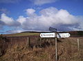
 Fettercairn-Edzell-Glen Esk junction - geograph.org.uk - 647172.jpg 640 × 480; 112 KB
-
 Fields and Burn - geograph.org.uk - 111364.jpg 640 × 475; 70 KB
-
 Floral display - geograph.org.uk - 1283826.jpg 640 × 426; 85 KB
-
 From the bridge - panoramio (3).jpg 4,608 × 3,072; 8.06 MB
-
 Gannochy Hamlet - geograph.org.uk - 1008847.jpg 640 × 428; 72 KB
-
 Glen Esk Hotel, Edzell - geograph.org.uk - 511431.jpg 640 × 480; 116 KB
-
 Glenesk Hotel, Edzell - geograph.org.uk - 1000598.jpg 640 × 428; 64 KB
-
 Glenesk Hotel, Edzell - geograph.org.uk - 253987.jpg 640 × 480; 114 KB
-
 High Street, Edzell - geograph.org.uk - 1779038.jpg 640 × 480; 95 KB
-
 High Street, Edzell at Ramsay Street - geograph.org.uk - 1000604.jpg 640 × 428; 76 KB
-
-
 Inchbare Village from Stracathro - geograph.org.uk - 939121.jpg 640 × 426; 45 KB
-
 Inglis Memorial Hall (197114341).jpeg 2,048 × 1,365; 911 KB
-
 Junction on Noranside to Brechin Road - geograph.org.uk - 126035.jpg 640 × 475; 96 KB
-
 Little Wynd, Edzell - geograph.org.uk - 1170407.jpg 640 × 427; 78 KB
-
 Mains of Edzell Doocot-geograph-3497226.jpg 532 × 345; 153 KB
-

-
 Memorial drinking fountain, Edzell - geograph.org.uk - 253982.jpg 480 × 640; 110 KB
-
 Moraines at the end of Glen Esk - geograph.org.uk - 114853.jpg 640 × 475; 74 KB
-
 Morning Moon - geograph.org.uk - 327487.jpg 640 × 481; 59 KB
-
 Panmure Arms - geograph.org.uk - 511422.jpg 640 × 480; 119 KB
-
 Panmure Arms Hotel, Edzell - geograph.org.uk - 1008784.jpg 640 × 427; 75 KB
-
 Pirner's Brig, Edzell - geograph.org.uk - 1018708.jpg 640 × 426; 151 KB
-
 Scotia Depicta - Gannachie Bridge -Plate-.jpg 2,500 × 1,729; 3.74 MB
-
 Shakky Brig - geograph.org.uk - 821051.jpg 640 × 425; 91 KB
-
 Shops in High Street, Edzell - geograph.org.uk - 1008794.jpg 640 × 427; 73 KB
-

-

-

-
 Station House, Edzell - geograph.org.uk - 1000586.jpg 640 × 427; 74 KB
-
-
 The Esk - panoramio.jpg 4,608 × 3,072; 9.39 MB
-
 The Road to Edzell (from Brechin) - geograph.org.uk - 1000631.jpg 480 × 640; 78 KB
-
 Trig Point - geograph.org.uk - 111333.jpg 640 × 475; 76 KB
-
 Warning Sign at Pirner's Brig, Edzell - geograph.org.uk - 1018696.jpg 640 × 427; 148 KB
-
 A herd of deer on Craigancash - geograph.org.uk - 1107538.jpg 481 × 640; 77 KB
-
 Blair Hill trig pillar - geograph.org.uk - 338378.jpg 640 × 480; 103 KB
-
 Blair Muir - geograph.org.uk - 374827.jpg 640 × 480; 91 KB
-
 Brewston Cottage - geograph.org.uk - 78794.jpg 640 × 475; 105 KB
-
 Craig of Shanno (410m) - geograph.org.uk - 258455.jpg 640 × 480; 90 KB
-
 Edzell Coffee Shop - geograph.org.uk - 511446.jpg 640 × 480; 118 KB
-
 Edzell from Edzell Hill - geograph.org.uk - 301631.jpg 640 × 432; 72 KB
-
 Edzell to Fettercairn road - geograph.org.uk - 600263.jpg 640 × 485; 108 KB
-
 Field of Bales - geograph.org.uk - 78704.jpg 640 × 475; 114 KB
-
 Garden feature at Edzell Castle - geograph.org.uk - 286228.jpg 640 × 480; 147 KB
-
 Hallhill farm - geograph.org.uk - 600086.jpg 640 × 480; 103 KB
-
 Kirkton of Balfour - geograph.org.uk - 600058.jpg 640 × 480; 128 KB
-
 Kirkton of Balfour - geograph.org.uk - 600065.jpg 640 × 480; 72 KB
-
 Lochan - geograph.org.uk - 273174.jpg 640 × 480; 77 KB
-
 Lodge gate for The Burn - geograph.org.uk - 511415.jpg 640 × 480; 114 KB
-

-
 New House Being Built by Reidhall - geograph.org.uk - 111371.jpg 640 × 475; 67 KB
-

-
 North from Gannochy Bridge - geograph.org.uk - 267870.jpg 481 × 640; 139 KB
-

-
 Path to Rocks of Solitude - geograph.org.uk - 258429.jpg 640 × 480; 53 KB
-
 Pirners Brig near Edzell Castle - geograph.org.uk - 157056.jpg 640 × 427; 135 KB
-
 River North Esk Loups - geograph.org.uk - 301611.jpg 425 × 640; 80 KB
-

-

-
 Road to Lundie Castle - geograph.org.uk - 78793.jpg 640 × 475; 164 KB
-
 The Crannel trig pillar - geograph.org.uk - 338392.jpg 640 × 480; 124 KB
-
 West Water just outside Edzell - geograph.org.uk - 78796.jpg 640 × 475; 102 KB
-

-
 Woodside Cottage - geograph.org.uk - 78789.jpg 640 × 475; 57 KB


.jpg)
.jpg)
.jpg)
.jpg)
.jpg)
.jpg)
.jpg)


.jpg)


.jpeg)


_-_geograph.org.uk_-_1000631.jpg)


_-_geograph.org.uk_-_258455.jpg)


