Category:Edinburgh Trams maps (parts of the line)
Jump to navigation
Jump to search
Maps relating to parts of the Edinburgh Trams system - for maps of the full line, see Category:Edinburgh Trams maps (full line).
Subcategories
This category has only the following subcategory.
E
- Edinburgh Trams maps (stops) (36 F)
Media in category "Edinburgh Trams maps (parts of the line)"
The following 21 files are in this category, out of 21 total.
-
 Edinburgh trams map 2023.png 2,824 × 1,607; 3.45 MB
-
 Edinburgh trams map.png 2,022 × 1,104; 1.53 MB
-
 Edinburgh Trams track - former busway section.jpg 1,424 × 716; 185 KB
-
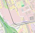
 Map of Gogar Tram Depot (OSM standard, zoom 16).jpg 744 × 462; 52 KB
-
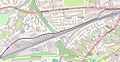
 Map of Gogar Tram Depot (OSM standard, zoom 17).jpg 958 × 482; 81 KB
-
 Map of Gogar Tram Depot (OSM standard, zoom 18).jpg 1,274 × 686; 100 KB
-

-

-

-

-
-

-

-

-

-
-

-

-
-
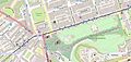
 Map of St Andrew Square tram stop (OSM standard, zoom 16).jpg 518 × 439; 60 KB
-
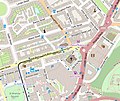 Map of York Place tram terminus (OSM standard, zoom 16).jpg 520 × 437; 61 KB


.jpg)
.jpg)
.jpg)
.jpg)
_(OSM_standard,_zoom_16).jpg)
_(OSM_standard,_zoom_16).jpg)
_(OSM_standard,_zoom_16).jpg)
_(OSM_standard,_zoom_16).jpg)
_(OSM_standard,_zoom_16).jpg)
_(OSM_standard,_zoom_16).jpg)
_(OSM_standard,_zoom_16).jpg)
_(OSM_standard,_zoom_16).jpg)
_(OSM_standard,_zoom_16).jpg)
_(OSM_standard,_zoom_16).jpg)
_(OSM_standard,_zoom_16).jpg)
_(OSM_standard,_zoom_16).jpg)
.jpg)
.jpg)