Category:Eastshore State Park
Jump to navigation
Jump to search
Also known as McLaughlin Eastshore State Park or the Eastshore Park Project, the park occupies over 8 miles of the eastern San Francisco Bay shoreline, California, USA, from Richmond to the Bay Bridge.
Media in category "Eastshore State Park"
The following 19 files are in this category, out of 19 total.
-
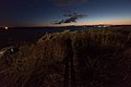 Bay at night with long shadow on rocky outcrop (7611277550).jpg 7,165 × 4,782; 19.08 MB
-
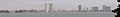
 Berkeleycalusa.jpg 2,592 × 1,944; 323 KB
-
 Birds and waves.jpg 1,920 × 2,560; 826 KB
-
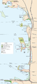 EastshoreSPmap.png 672 × 1,508; 196 KB
-
 Emerycalusa (cropped).jpg 2,393 × 342; 119 KB
-
 Emerycalusa.jpg 2,592 × 1,944; 622 KB
-
 Inlet in bay surrounded by rocky shore (7608421430).jpg 7,360 × 4,912; 12.36 MB
-
 Large tire on rocky beach (7607933344).jpg 7,360 × 4,912; 13.04 MB
-
 Men dancing on rocky outcrop in front of setting sun (7608180846).jpg 7,360 × 4,912; 7.28 MB
-
 People on outcrop at Eastshore State Park near sunset (7607880594).jpg 7,360 × 3,911; 8.59 MB
-
 Plants and people on rocky outcrop in front of setting sun (7608158218).jpg 6,082 × 3,573; 5.59 MB
-
 Point emery tidelands with birds.jpg 2,560 × 1,920; 888 KB
-
 Point emery waves.jpg 2,560 × 1,920; 914 KB
-
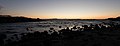 Rocky bay shore silhouetted against sunset (7611215310).jpg 7,360 × 2,839; 5.01 MB
-
 Sun and people behind plant on rocky outcrop (7608111844).jpg 6,213 × 4,146; 6.47 MB
-
 Tires at bay shore (7611204198).jpg 7,259 × 4,845; 14.37 MB
-
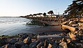 Tree-lined bay shore from rocky outcrop with man standing (7608140824).jpg 7,185 × 4,112; 9.27 MB
-
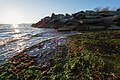 Waves at rocky bay shore (7608089942).jpg 7,360 × 4,912; 12.23 MB
-
 Waves crashing on rocks at bay shore at sunset (7611313822).jpg 7,084 × 4,729; 9.23 MB
.jpg)


.jpg)
.jpg)
.jpg)
.jpg)
.jpg)


.jpg)
.jpg)
.jpg)
.jpg)
.jpg)
.jpg)
.jpg)