Category:East Hagbourne
Jump to navigation
Jump to search
village and civil parish in South Oxfordshire, England  | |||||
| Upload media | |||||
| Instance of | |||||
|---|---|---|---|---|---|
| Location | South Oxfordshire, Oxfordshire, South East England, England | ||||
| Area |
| ||||
| official website | |||||
 | |||||
English: East Hagbourne is a large village and civil parish in Oxfordshire, England. It is south of Oxford. In 1974 it was transferred from Berkshire.
Subcategories
This category has the following 8 subcategories, out of 8 total.
A
C
E
H
M
S
V
Media in category "East Hagbourne"
The following 182 files are in this category, out of 182 total.
-

-
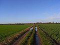
 Along the track to the bridge - geograph.org.uk - 2789822.jpg 1,024 × 683; 119 KB
-
 B4016 entering Didcot - geograph.org.uk - 3923778.jpg 640 × 460; 65 KB
-
 Benchmark on St Andrew's - geograph.org.uk - 4420560.jpg 533 × 800; 204 KB
-
 Benchmark on ^24A Main Street - geograph.org.uk - 2355023.jpg 1,024 × 683; 327 KB
-
 Benchmark on ^53 New Road - geograph.org.uk - 2838838.jpg 683 × 1,024; 227 KB
-
 Bend to New Road - geograph.org.uk - 1690029.jpg 1,024 × 683; 175 KB
-
 Blewbury Road - geograph.org.uk - 2679659.jpg 640 × 480; 86 KB
-

-
 Bridge for B4016 over Mill Brook - geograph.org.uk - 2856739.jpg 1,024 × 683; 287 KB
-
 Buckels, East Hagbourne, Oxfordshire - geograph.org.uk - 4731225.jpg 640 × 601; 156 KB
-
 Cables ^ Corn - geograph.org.uk - 3085990.jpg 3,648 × 2,736; 2.23 MB
-
 Carving on the arch - geograph.org.uk - 4417420.jpg 1,024 × 683; 139 KB
-
 Close up of Three - geograph.org.uk - 4421454.jpg 1,024 × 683; 234 KB
-
 Coat of arms - geograph.org.uk - 4417404.jpg 1,024 × 683; 131 KB
-
 Commemoration Plaque - geograph.org.uk - 4417739.jpg 533 × 800; 83 KB
-
 Crook behind the Pulpit - geograph.org.uk - 4420211.jpg 1,024 × 683; 58 KB
-

-
 Date on the Pulpit - geograph.org.uk - 4418765.jpg 1,024 × 683; 178 KB
-
 Dead Leaves ^ Snowdrops - geograph.org.uk - 4421462.jpg 1,024 × 683; 306 KB
-
 Railway Bridge - geograph.org.uk - 658424.jpg 640 × 480; 99 KB
-
 East Hagbourne - geograph.org.uk - 129930.jpg 640 × 480; 82 KB
-
 East Hagbourne - geograph.org.uk - 2789820.jpg 1,024 × 683; 217 KB
-
 East Hagbourne - geograph.org.uk - 5490294.jpg 795 × 559; 179 KB
-
 East Hagbourne - geograph.org.uk - 770312.jpg 640 × 423; 144 KB
-
 East Hagbourne - Village cross - geograph.org.uk - 2059930.jpg 1,000 × 660; 163 KB
-

-
 East Hagbourne Rail Bridge - geograph.org.uk - 2789077.jpg 1,024 × 683; 175 KB
-
 East Hagbourne Village Cross - geograph.org.uk - 5419861.jpg 3,678 × 2,456; 4.79 MB
-

-
 East Hagbourne, Apple Tree Cottage - geograph.org.uk - 5419926.jpg 3,514 × 2,179; 3.67 MB
-
 East Hagbourne, Fleur de Lys PH - geograph.org.uk - 5419914.jpg 3,566 × 4,120; 6.04 MB
-
 East Hagbourne, Fleur de Lys PH - geograph.org.uk - 5419920.jpg 4,783 × 3,106; 7.57 MB
-
 East Hagbourne, Main road from the village cross - geograph.org.uk - 5419904.jpg 3,678 × 2,456; 4.87 MB
-
 East Hagbourne, Reglazing a house on the Main Road - geograph.org.uk - 5419963.jpg 5,125 × 3,216; 7.47 MB
-

-

-

-

-

-
 East Hagbourne, St. Andrew's Church, c13th capital - geograph.org.uk - 4975133.jpg 3,678 × 2,456; 4.78 MB
-

-

-

-

-

-

-

-

-

-
 East Hagbourne, St. Andrew's Church, Small south door - geograph.org.uk - 4975142.jpg 2,450 × 3,680; 6.46 MB
-
 East Hagbourne, St. Andrew's Church, The "pained man" corbel - geograph.org.uk - 4975156.jpg 3,678 × 2,456; 4.03 MB
-

-

-
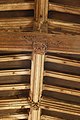
 East Hagbourne, St. Andrew's Church, The nave roof - geograph.org.uk - 4973728.jpg 5,362 × 3,428; 6.57 MB
-

-

-

-
 East Hagbourne, The Old Bakehouse and Bramley Cottage - geograph.org.uk - 5419932.jpg 4,204 × 2,728; 5.3 MB
-
 England 1938 Hagbourne, Upper Cross 7-017 (10690672105).jpg 1,684 × 1,007; 834 KB
-
 Fading Away - geograph.org.uk - 4420553.jpg 533 × 800; 150 KB
-
 Fading Memorial - geograph.org.uk - 4418758.jpg 533 × 800; 120 KB
-
 Farm Work, East Hagbourne - geograph.org.uk - 2651525.jpg 3,648 × 2,736; 2.33 MB
-
 Farmland, Didcot - geograph.org.uk - 2679910.jpg 640 × 480; 165 KB
-
 Farmland, East Hagbourne - geograph.org.uk - 6178722.jpg 1,024 × 768; 275 KB
-
 Farmland, East Hagbourne - geograph.org.uk - 678573.jpg 640 × 480; 108 KB
-
 Farmland, South Moreton - geograph.org.uk - 678549.jpg 640 × 480; 126 KB
-
 Field Near East Hagbourne - geograph.org.uk - 3800526.jpg 1,600 × 1,200; 392 KB
-
 Fieldside, East Hagbourne.jpg 1,200 × 800; 455 KB
-
 Footbridge over Mill Brook at footpath junction - geograph.org.uk - 2856786.jpg 1,024 × 683; 303 KB
-
 Footpath from the Church - geograph.org.uk - 4420665.jpg 1,024 × 683; 216 KB
-
 Garage on New Road - geograph.org.uk - 1690050.jpg 1,024 × 683; 100 KB
-
 Gasometer past the tree - geograph.org.uk - 1113718.jpg 400 × 600; 67 KB
-
 Graves on the east end - geograph.org.uk - 4421459.jpg 1,024 × 683; 258 KB
-
 Great Mead - geograph.org.uk - 1690042.jpg 1,024 × 683; 195 KB
-

-
 Grotesque like a fish - geograph.org.uk - 4420683.jpg 1,024 × 683; 173 KB
-
 Hagbourne Mill Farm sign, Blewbury Road.jpg 900 × 675; 433 KB
-
 Hakka’s Brook - geograph.org.uk - 5648870.jpg 640 × 480; 120 KB
-
 Harwood Memorial - geograph.org.uk - 4418830.jpg 533 × 800; 57 KB
-
 Head on the Arch - geograph.org.uk - 4417423.jpg 1,024 × 683; 139 KB
-
 High up Windows - geograph.org.uk - 4417728.jpg 1,024 × 683; 74 KB
-
 Houses near the Cross - geograph.org.uk - 4421815.jpg 1,024 × 683; 163 KB
-
 Houses on Main Road - geograph.org.uk - 4421811.jpg 1,024 × 683; 135 KB
-
 Houses, East Hagbourne - geograph.org.uk - 2679888.jpg 640 × 480; 114 KB
-
 Into East Hagbourne - geograph.org.uk - 2789845.jpg 1,024 × 683; 130 KB
-
 It's a Pig - geograph.org.uk - 4420692.jpg 1,024 × 683; 223 KB
-
 Ivy on the plate - geograph.org.uk - 2789084.jpg 1,024 × 683; 169 KB
-
 John Phillips Memorial - geograph.org.uk - 4420098.jpg 1,024 × 683; 79 KB
-
 Joseph Humfrey Memorial - geograph.org.uk - 4419032.jpg 1,024 × 683; 71 KB
-
 Kissing gate by the sign - geograph.org.uk - 2791228.jpg 1,024 × 683; 224 KB
-
 Kneelers on the Pews - geograph.org.uk - 4420216.jpg 1,024 × 683; 144 KB
-
 Lady Chapel Window - geograph.org.uk - 4418853.jpg 533 × 800; 123 KB
-
 Lamp over the Font - geograph.org.uk - 4418822.jpg 533 × 800; 66 KB
-
 Lieutenant J.A.Glover - geograph.org.uk - 2789010.jpg 533 × 800; 141 KB
-
 Little Egret (40016250514).jpg 1,232 × 1,614; 1.5 MB
-
 Loder Memorials - geograph.org.uk - 4417736.jpg 533 × 800; 104 KB
-
 Looking to the South Aisle - geograph.org.uk - 4420109.jpg 1,024 × 683; 113 KB
-
 Lost inscription - geograph.org.uk - 4420547.jpg 533 × 800; 173 KB
-
 Lost Memorials - geograph.org.uk - 4420541.jpg 1,024 × 683; 256 KB
-
 Main Road, East Hagbourne, Oxfordshire - geograph.org.uk - 4734833.jpg 640 × 451; 120 KB
-
 Memorial in the North Aisle - geograph.org.uk - 4417564.jpg 533 × 800; 75 KB
-
 Memorial ^ Paintings - geograph.org.uk - 4418849.jpg 533 × 800; 73 KB
-
 Memorials in the Corner - geograph.org.uk - 4419031.jpg 1,024 × 683; 72 KB
-
 Memorials on the South Wall - geograph.org.uk - 4421453.jpg 1,024 × 683; 236 KB
-
 Mill Brook - geograph.org.uk - 5648851.jpg 640 × 480; 131 KB
-
 Mill Brook with blossom, East Hagbourne.jpg 1,200 × 900; 739 KB
-
 Names on the Roll - geograph.org.uk - 4420105.jpg 533 × 800; 110 KB
-
 New Road past the Garage - geograph.org.uk - 1690075.jpg 1,024 × 683; 181 KB
-
 New Road to Didcot - geograph.org.uk - 1690034.jpg 1,024 × 683; 130 KB
-
 North side of the Nave - geograph.org.uk - 4420192.jpg 1,024 × 683; 122 KB
-
 Old Memorial - geograph.org.uk - 4417562.jpg 533 × 800; 76 KB
-

-
 On to Didcot - geograph.org.uk - 2789833.jpg 533 × 800; 112 KB
-
 Organ in the Loft - geograph.org.uk - 4417414.jpg 1,024 × 683; 128 KB
-
 Out in Force - geograph.org.uk - 2789838.jpg 533 × 800; 75 KB
-
 Path heading north towards East Hagbourne - geograph.org.uk - 2354988.jpg 1,024 × 683; 230 KB
-
 Path to Mill Brook - geograph.org.uk - 5648860.jpg 640 × 480; 125 KB
-
 Pillars or Headstones - geograph.org.uk - 4421451.jpg 1,024 × 683; 286 KB
-
 Porch on St Andrew's - geograph.org.uk - 4421792.jpg 1,024 × 683; 213 KB
-
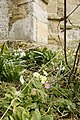 Primroses and Snowdrops - geograph.org.uk - 4421795.jpg 533 × 800; 150 KB
-
 Rainbow over a field near Didcot - geograph.org.uk - 5138483.jpg 1,500 × 937; 169 KB
-
 Ridge and Furrow - geograph.org.uk - 2086487.jpg 1,024 × 761; 219 KB
-
 Rising towards Coscote - geograph.org.uk - 2789814.jpg 1,024 × 683; 123 KB
-
 Road to Didcot - geograph.org.uk - 2224145.jpg 3,648 × 2,736; 1.93 MB
-
 Road to East Hagbourne - geograph.org.uk - 1723722.jpg 640 × 480; 100 KB
-
 Roll of Honour - geograph.org.uk - 4420101.jpg 533 × 800; 90 KB
-
 Roof Detail - geograph.org.uk - 4420209.jpg 533 × 800; 93 KB
-
 Rusty bearing plate - geograph.org.uk - 2789086.jpg 1,024 × 683; 135 KB
-
 Seats on the Old Railway - geograph.org.uk - 2088557.jpg 3,388 × 2,528; 3.25 MB
-
 Second Harwood Memorial - geograph.org.uk - 4418840.jpg 533 × 800; 63 KB
-
 Second Loder Memorial - geograph.org.uk - 4418813.jpg 533 × 800; 78 KB
-
 Snowdrop Covered Grave - geograph.org.uk - 4421461.jpg 1,024 × 683; 255 KB
-
 Snowdrops on the Grave - geograph.org.uk - 4421447.jpg 1,024 × 683; 261 KB
-
 South Side of the Church - geograph.org.uk - 4420669.jpg 1,024 × 683; 210 KB
-
 South West Side - geograph.org.uk - 4420667.jpg 533 × 800; 92 KB
-
 St Andrew's Church Sign - geograph.org.uk - 4420400.jpg 1,024 × 683; 188 KB
-
 St Andrew, East Hagbourne - Corbel - geograph.org.uk - 2059894.jpg 1,000 × 914; 155 KB
-
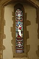
 St Andrew, East Hagbourne - Window - geograph.org.uk - 2059879.jpg 601 × 1,000; 219 KB
-
 St Andrew, East Hagbourne - Window - geograph.org.uk - 2059890.jpg 406 × 1,000; 160 KB
-
 St Andrews Church Tower - geograph.org.uk - 4420556.jpg 533 × 800; 98 KB
-
 Stained Glass - geograph.org.uk - 4418761.jpg 533 × 800; 88 KB
-
 Stained Glass in the room - geograph.org.uk - 4417742.jpg 533 × 800; 130 KB
-
 Steps to the Font - geograph.org.uk - 4418767.jpg 533 × 800; 90 KB
-
 Steps to the line - geograph.org.uk - 2789081.jpg 533 × 800; 115 KB
-
 The Gables, East Hagbourne, Oxfordshire - geograph.org.uk - 4734388.jpg 640 × 474; 102 KB
-
 The Good Shepherd - geograph.org.uk - 4417555.jpg 533 × 800; 85 KB
-
 The Mill Brook - geograph.org.uk - 2332045.jpg 2,048 × 1,536; 1.22 MB
-
 The Phillips Tomb - geograph.org.uk - 4420550.jpg 1,024 × 683; 196 KB
-
 The Preaching Cross - geograph.org.uk - 4421808.jpg 533 × 800; 80 KB
-
 The South Aisle - geograph.org.uk - 4418769.jpg 533 × 800; 83 KB
-
 Tomb by the Step - geograph.org.uk - 4419030.jpg 1,024 × 683; 160 KB
-
 Tomb in the Aisle - geograph.org.uk - 4417729.jpg 533 × 800; 90 KB
-
 Ton in the way - geograph.org.uk - 1055999.jpg 640 × 426; 110 KB
-
 Top of the bridge - geograph.org.uk - 2789830.jpg 1,024 × 683; 178 KB
-
 Top of the Tower - geograph.org.uk - 4421455.jpg 1,024 × 683; 112 KB
-
 Towards Upton - geograph.org.uk - 2789834.jpg 533 × 800; 114 KB
-
 Tudor House, East Hagbourne, Oxfordshire - geograph.org.uk - 4699169.jpg 518 × 640; 200 KB
-
 Under the bridge - geograph.org.uk - 2789080.jpg 1,024 × 683; 177 KB
-
 View of the Altar - geograph.org.uk - 4419035.jpg 1,024 × 683; 72 KB
-
 View of the Roof - geograph.org.uk - 4420206.jpg 533 × 800; 102 KB
-

-
 War memorial at the Main Road junction - geograph.org.uk - 2355379.jpg 1,024 × 683; 169 KB
-
 Wedderburn Memorial - geograph.org.uk - 4418760.jpg 1,024 × 683; 72 KB
-
 West along the South Aisle - geograph.org.uk - 4419029.jpg 1,024 × 683; 96 KB
-
 West on the North Aisle - geograph.org.uk - 4419036.jpg 1,024 × 683; 115 KB
-
 Window in the Chancel - geograph.org.uk - 4417551.jpg 533 × 800; 85 KB
-
 Wood by the road - geograph.org.uk - 1056909.jpg 640 × 426; 86 KB
-
 Woods by the line - geograph.org.uk - 1159895.jpg 640 × 426; 121 KB
-
 Byway to south of East Hagbourne - geograph.org.uk - 274173.jpg 640 × 480; 197 KB
-
 Farm track, Blewbury - geograph.org.uk - 674806.jpg 640 × 480; 107 KB
-
 Farmland at East Hagbourne - geograph.org.uk - 129323.jpg 640 × 480; 83 KB
-
 Farmland near Hagbourne Mill - geograph.org.uk - 129319.jpg 640 × 480; 89 KB
-
 Farmland, Blewbury - geograph.org.uk - 678591.jpg 640 × 480; 169 KB
-
 Farmland, Blewbury - geograph.org.uk - 678596.jpg 640 × 480; 156 KB
-
 Farmland, East Hagbourne - geograph.org.uk - 678558.jpg 640 × 480; 132 KB
-
 Farmland, East Hagbourne - geograph.org.uk - 678561.jpg 640 × 480; 98 KB
-
 Farmland, East Hagbourne - geograph.org.uk - 678565.jpg 640 × 480; 122 KB
-
 Farmland, East Hagbourne - geograph.org.uk - 678571.jpg 640 × 480; 118 KB
-
 Mill Brook, Hagbourne Mill - geograph.org.uk - 129321.jpg 640 × 480; 91 KB
-
 West Hagbourne Moor - geograph.org.uk - 130377.jpg 640 × 480; 93 KB
-
 ^53 New Road - geograph.org.uk - 2838844.jpg 1,024 × 683; 163 KB


.jpg)


.jpg)


