Category:East Guldeford
Jump to navigation
Jump to search
village in United Kingdom  | |||||
| Upload media | |||||
| Instance of | |||||
|---|---|---|---|---|---|
| Location | Rother, East Sussex, South East England, England | ||||
| Area |
| ||||
| Said to be the same as | East Guldeford (Wikimedia duplicated page, civil parish) | ||||
 | |||||
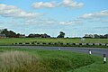
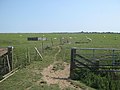
English: East Guldeford is a village and civil parish in the Rother District of East Sussex, England. The village is located one mile (1.6 km) east of Rye on the A259 road. The parish is controlled by a parish meeting.
Subcategories
This category has the following 3 subcategories, out of 3 total.
Media in category "East Guldeford"
The following 200 files are in this category, out of 444 total.
(previous page) (next page)-
 A single tree - geograph.org.uk - 5192807.jpg 640 × 426; 39 KB
-
 A single tree - geograph.org.uk - 5212492.jpg 640 × 426; 50 KB
-
 A259 - geograph.org.uk - 5180412.jpg 640 × 426; 34 KB
-
 A259 - geograph.org.uk - 5180417.jpg 640 × 426; 42 KB
-
 A259 - geograph.org.uk - 5206185.jpg 640 × 426; 41 KB
-
 A259 and drain at Guldeford corner - geograph.org.uk - 2636552.jpg 2,256 × 1,496; 930 KB
-
 A259 at Guldeford Crossing - geograph.org.uk - 5206205.jpg 640 × 487; 56 KB
-
 A259 is behind the hedge - geograph.org.uk - 5206181.jpg 640 × 315; 46 KB
-
 An isolated tree - geograph.org.uk - 4260720.jpg 640 × 430; 44 KB
-
 Barn and track near Moneypenny Farm - geograph.org.uk - 2481151.jpg 3,072 × 2,304; 1.67 MB
-
 Barn at Barn Farm - geograph.org.uk - 1896394.jpg 1,024 × 683; 163 KB
-
 Barn at Moneypenny Farm - geograph.org.uk - 1901533.jpg 1,024 × 683; 211 KB
-
 Barn Farm - geograph.org.uk - 1901694.jpg 1,024 × 683; 233 KB
-
 Barn Farm - geograph.org.uk - 6148833.jpg 640 × 446; 65 KB
-
 Barn near Brooks Bridge - geograph.org.uk - 1753440.jpg 640 × 451; 63 KB
-
 Barn near Brooks Bridge - geograph.org.uk - 1753506.jpg 640 × 387; 56 KB
-
 Barn near Moneypenny farm - geograph.org.uk - 2626959.jpg 2,256 × 1,496; 829 KB
-
 Barn, Collyers Farm - geograph.org.uk - 6150125.jpg 640 × 509; 61 KB
-
 Barn, East Guldeford - geograph.org.uk - 1754426.jpg 640 × 308; 57 KB
-
 Barn, Moneypenny Farm - geograph.org.uk - 6118217.jpg 640 × 480; 61 KB
-
 Beach Field - geograph.org.uk - 6118230.jpg 640 × 480; 50 KB
-
 Bend, Camber Rd - geograph.org.uk - 3758963.jpg 640 × 430; 65 KB
-
 Black House Farm - geograph.org.uk - 1901625.jpg 1,024 × 768; 159 KB
-
 Brewhouse Salts - geograph.org.uk - 6148577.jpg 640 × 480; 54 KB
-
 Bridleway on Romney Marsh - geograph.org.uk - 2626969.jpg 2,256 × 1,496; 922 KB
-
 Bridleway to Black House Farm - geograph.org.uk - 2481094.jpg 3,072 × 2,304; 2.19 MB
-
 Bridleway to Camber Road - geograph.org.uk - 1896383.jpg 1,024 × 768; 304 KB
-
 Bridleway to East Guldeford - geograph.org.uk - 6148811.jpg 480 × 640; 68 KB
-
 Bridleway to Moneypenny Farm - geograph.org.uk - 5206735.jpg 640 × 426; 68 KB
-
 Brook's Piece - geograph.org.uk - 6117804.jpg 640 × 480; 53 KB
-
 Brookgate - geograph.org.uk - 6117800.jpg 640 × 480; 82 KB
-
 Buttercups and grass - geograph.org.uk - 5206734.jpg 640 × 426; 49 KB
-
 Camber Rd - geograph.org.uk - 3758967.jpg 640 × 430; 41 KB
-
 Camber Rd - geograph.org.uk - 4255070.jpg 640 × 466; 70 KB
-
 Camber Rd - geograph.org.uk - 4843035.jpg 640 × 426; 54 KB
-
 Camber Rd - geograph.org.uk - 5180399.jpg 640 × 426; 54 KB
-
 Camber Rd - geograph.org.uk - 5180400.jpg 640 × 426; 41 KB
-
 Camber Rd - geograph.org.uk - 5180402.jpg 640 × 426; 80 KB
-
 Camber Road - geograph.org.uk - 4270582.jpg 4,000 × 3,000; 4.07 MB
-
 Camber Road - geograph.org.uk - 6148675.jpg 480 × 640; 45 KB
-
 Camber Road - geograph.org.uk - 6148705.jpg 480 × 640; 50 KB
-
 Camber Road at the junction of Folkestone Road - geograph.org.uk - 3930657.jpg 2,304 × 1,728; 822 KB
-
 Camber Road from Guldeford Road, East Guldeford - geograph.org.uk - 3934512.jpg 2,304 × 1,728; 845 KB
-
 Camber Road towards Rye - geograph.org.uk - 6349631.jpg 5,456 × 3,632; 2.4 MB
-
 Channel near Guldeford Lane Corner - geograph.org.uk - 1901733.jpg 1,024 × 683; 256 KB
-
 Channel off Guldeford Sewer - geograph.org.uk - 1901620.jpg 1,024 × 768; 250 KB
-
 Channels near Black House Farm - geograph.org.uk - 1901639.jpg 1,024 × 768; 122 KB
-
 Church Field - geograph.org.uk - 6118199.jpg 640 × 480; 62 KB
-
 Church Field - geograph.org.uk - 6150156.jpg 640 × 480; 47 KB
-

-
 Circus by Camber Road, Rye - geograph.org.uk - 5526818.jpg 1,024 × 455; 66 KB
-
 Collyer's Farm - geograph.org.uk - 6150131.jpg 480 × 640; 104 KB
-
 Collyer's Farmhouse - geograph.org.uk - 2480941.jpg 3,072 × 2,304; 1.6 MB
-
 Converted Barn on Guldeford Road - geograph.org.uk - 1901775.jpg 1,024 × 768; 184 KB
-
 Converted barn, East Guldeford - geograph.org.uk - 2479690.jpg 3,072 × 2,304; 1.33 MB
-
 Crop field and Tree on Durlock Street - geograph.org.uk - 1896416.jpg 1,024 × 768; 274 KB
-
 Cycle and footbridge over North Point Sewer - geograph.org.uk - 2482468.jpg 3,072 × 2,304; 2.9 MB
-
 Ditch near Salts Farm - geograph.org.uk - 5206732.jpg 640 × 426; 58 KB
-
 Drain towards Wind Farm - geograph.org.uk - 3419792.jpg 1,632 × 2,464; 1.02 MB
-
 Drain ^ Footpath to Barn Farm - geograph.org.uk - 3419796.jpg 2,464 × 1,632; 968 KB
-
 Drain, Guldeford Level - geograph.org.uk - 6150146.jpg 640 × 480; 69 KB
-
 Drainage channel in East Guldeford Levels - geograph.org.uk - 2480009.jpg 3,072 × 2,304; 2.44 MB
-
 Drainage channel in East Guldeford Levels - geograph.org.uk - 2480024.jpg 3,072 × 2,304; 1.85 MB
-
 Drainage channel in East Guldeford Levels - geograph.org.uk - 2481084.jpg 3,072 × 2,304; 1.97 MB
-
 Drainage channel in East Guldeford Levels - geograph.org.uk - 2481112.jpg 3,072 × 2,304; 1.9 MB
-
 Drainage channel in East Guldeford Levels - geograph.org.uk - 2496458.jpg 3,072 × 2,304; 2.23 MB
-
 Drainage channel junction in East Guldeford Levels - geograph.org.uk - 2481101.jpg 3,072 × 2,304; 1.87 MB
-
 Drainage channel near Brook's Bridge - geograph.org.uk - 2495496.jpg 3,072 × 2,304; 2.26 MB
-
 Drainage channel near Guldeford Crossing - geograph.org.uk - 2479920.jpg 3,072 × 2,304; 1.88 MB
-
 Drainage channel near Moneypenny Farm - geograph.org.uk - 2496473.jpg 3,072 × 2,304; 2.4 MB
-
 Drainage channel near North Farm - geograph.org.uk - 1329445.jpg 640 × 424; 47 KB
-
 Drainage channel towards Black House Farm - geograph.org.uk - 2481163.jpg 3,072 × 2,304; 2.5 MB
-
 Drainage channel towards Moneypenny Farm - geograph.org.uk - 2496462.jpg 3,072 × 2,304; 1.94 MB
-
 Drainage channel towards St.Mary's Church - geograph.org.uk - 2479927.jpg 3,072 × 2,304; 1.89 MB
-
 Drainage Channels - geograph.org.uk - 1896379.jpg 1,024 × 768; 299 KB
-
 Drainage ditch - geograph.org.uk - 3108307.jpg 640 × 430; 77 KB
-
 Drainage ditch in East Guldeford Levels - geograph.org.uk - 2481048.jpg 3,072 × 2,304; 2.05 MB
-
 Driveway to Salts Farm - geograph.org.uk - 1505018.jpg 536 × 640; 94 KB
-
 East Guldeford - 2008 - geograph.org.uk - 3461351.jpg 2,272 × 1,704; 693 KB
-
 East Guldeford - 2008 - geograph.org.uk - 3461353.jpg 2,272 × 1,704; 616 KB
-
 East Guldeford - 2008 - geograph.org.uk - 3461358.jpg 2,272 × 1,704; 713 KB
-
 East Guldeford - 2008 - geograph.org.uk - 3461361.jpg 2,272 × 1,704; 669 KB
-
 East Guldeford - 2008 - geograph.org.uk - 3461365.jpg 2,272 × 1,704; 345 KB
-
 East Guldeford - 2008 - geograph.org.uk - 3461369.jpg 2,272 × 1,704; 647 KB
-
 East Guldeford Level - geograph.org.uk - 4255068.jpg 640 × 430; 35 KB
-
 East Guldeford Level - geograph.org.uk - 5429268.jpg 640 × 426; 49 KB
-
 East Guldeford Level - geograph.org.uk - 5429269.jpg 640 × 426; 34 KB
-
 East Guldeford Level - geograph.org.uk - 6118280.jpg 640 × 480; 41 KB
-
 Eighteen Acres - geograph.org.uk - 6150140.jpg 640 × 480; 81 KB
-
 Embankment beside the Wainway Petty Sewer - geograph.org.uk - 2188171.jpg 3,072 × 2,304; 1.89 MB
-
 Entering East Guldeford, A259 - geograph.org.uk - 5429131.jpg 640 × 426; 66 KB
-
 Entering Rye, A259 - geograph.org.uk - 4843047.jpg 640 × 426; 82 KB
-
 Entering Rye, A259 - geograph.org.uk - 5180418.jpg 640 × 426; 64 KB
-
 Entrance to Salts Farm Shop - geograph.org.uk - 4310664.jpg 1,600 × 755; 172 KB
-
 Fagg Field - geograph.org.uk - 6118187.jpg 640 × 480; 71 KB
-
 Fallow farmland - geograph.org.uk - 4260713.jpg 640 × 430; 49 KB
-
 Fallow field off Camber Rd - geograph.org.uk - 1503591.jpg 640 × 348; 81 KB
-
 Fallow field off the A259 - geograph.org.uk - 1503588.jpg 640 × 430; 82 KB
-
 Farm bridge in East Guldeford Levels - geograph.org.uk - 2480054.jpg 3,072 × 2,304; 1.77 MB
-
 Farm buildings - geograph.org.uk - 3108316.jpg 640 × 430; 60 KB
-
 Farm buildings off Camber Rd - geograph.org.uk - 1505010.jpg 640 × 387; 67 KB
-
 Farm Buildings, Salt's Farm - geograph.org.uk - 1505014.jpg 640 × 347; 81 KB
-
 Farm drain by Camber Rd - geograph.org.uk - 4260717.jpg 640 × 430; 50 KB
-
 Farm Track towards East Guldeford Level - geograph.org.uk - 3419807.jpg 3,696 × 2,448; 2.35 MB
-
 Farm Track, Collyer's Farm - geograph.org.uk - 6150135.jpg 480 × 640; 73 KB
-
 Farmland by Union Channel - geograph.org.uk - 3106106.jpg 640 × 430; 52 KB
-
 Feeding Trough - geograph.org.uk - 1896404.jpg 1,024 × 768; 263 KB
-
 Fence meets drainage channel near Camber - geograph.org.uk - 2188161.jpg 3,072 × 2,304; 2.23 MB
-
 Field at Creek End - geograph.org.uk - 1896408.jpg 1,024 × 768; 254 KB
-
 Field drain - geograph.org.uk - 5192806.jpg 640 × 401; 45 KB
-
 Field drain - geograph.org.uk - 5212489.jpg 640 × 426; 58 KB
-
 Field drain - geograph.org.uk - 5218653.jpg 640 × 426; 66 KB
-
 Field Number 105 - geograph.org.uk - 6148829.jpg 640 × 480; 72 KB
-
 Field Number 112 - geograph.org.uk - 6148826.jpg 640 × 480; 61 KB
-
 Field Number 213 - geograph.org.uk - 6150147.jpg 640 × 480; 77 KB
-
 Fields near East Guldeford - geograph.org.uk - 2432354.jpg 2,256 × 1,496; 950 KB
-
 Fields off the A259 - geograph.org.uk - 1505027.jpg 640 × 430; 69 KB
-
 First Gratten - geograph.org.uk - 6118235.jpg 640 × 480; 57 KB
-
 First Shut - geograph.org.uk - 6148604.jpg 640 × 480; 65 KB
-
 Five Watering Sewer - geograph.org.uk - 443889.jpg 640 × 427; 73 KB
-
 Flat farmland - geograph.org.uk - 4260712.jpg 640 × 430; 54 KB
-
 Flat farmland - geograph.org.uk - 4260718.jpg 640 × 430; 54 KB
-
 Flat farmland - geograph.org.uk - 5212495.jpg 640 × 426; 49 KB
-
 Flat farmland, East Guldeford - geograph.org.uk - 3758960.jpg 640 × 430; 43 KB
-
 Flat farmland, East Guldeford - geograph.org.uk - 3758965.jpg 640 × 430; 54 KB
-
 Flat flood plain of the River Rother - geograph.org.uk - 1754795.jpg 640 × 359; 58 KB
-
 Flat floodplain - geograph.org.uk - 3108274.jpg 640 × 430; 60 KB
-
 Flat floodplain - geograph.org.uk - 3108285.jpg 640 × 430; 66 KB
-
 Flat grazing land - geograph.org.uk - 5206216.jpg 640 × 426; 44 KB
-
 Flat land by the A259 - geograph.org.uk - 4255058.jpg 640 × 430; 46 KB
-
 Flat pasture - geograph.org.uk - 5429128.jpg 640 × 426; 47 KB
-
 Folkestone Road - geograph.org.uk - 1765730.jpg 640 × 427; 55 KB
-
 Folkestone Road - geograph.org.uk - 2737981.jpg 640 × 480; 72 KB
-
 Folkestone Road - geograph.org.uk - 2737986.jpg 640 × 480; 67 KB
-
 Folkestone Road - geograph.org.uk - 6117806.jpg 640 × 558; 56 KB
-
 Folkestone Road, East Guldeford - geograph.org.uk - 6150160.jpg 640 × 480; 75 KB
-
 Folley - geograph.org.uk - 6148670.jpg 640 × 495; 59 KB
-
 Footbridge B1263 - geograph.org.uk - 3001653.jpg 640 × 480; 110 KB
-
 Footbridge near Collyer's Farm - geograph.org.uk - 2480068.jpg 3,072 × 2,304; 2.11 MB
-
 Footbridge near Collyer's Farm - geograph.org.uk - 2480935.jpg 3,072 × 2,304; 1.96 MB
-
 Footbridge near Collyer's Farm - geograph.org.uk - 6150141.jpg 640 × 480; 61 KB
-
 Footbridge near Kent Ditch - geograph.org.uk - 2480949.jpg 3,072 × 2,304; 2.06 MB
-
 Footbridge near Moneypenny Farm - geograph.org.uk - 2496469.jpg 3,072 × 2,304; 2.23 MB
-
 Footbridge near St. Mary's Church - geograph.org.uk - 2479738.jpg 3,072 × 2,304; 2.13 MB
-
 Footbridge over a sewer - geograph.org.uk - 4866193.jpg 3,264 × 2,448; 2.36 MB
-
 Footbridge over Wainway Wall - geograph.org.uk - 4936164.jpg 4,000 × 3,000; 3.69 MB
-
 Footbridge, Wainway Wall - geograph.org.uk - 6118269.jpg 480 × 640; 70 KB
-
 Footpath and drain towards Wind Farm - geograph.org.uk - 3419709.jpg 2,464 × 1,632; 1,001 KB
-
 Footpath junction near North Point Sewer - geograph.org.uk - 2482444.jpg 3,072 × 2,304; 1.81 MB
-
 Footpath junction on Black House Farm bridleway - geograph.org.uk - 2481071.jpg 3,072 × 2,304; 2.26 MB
-
 Footpath to East Guldeford - geograph.org.uk - 2480088.jpg 3,072 × 2,304; 2.26 MB
-
 Fourteen Acre Marsh - geograph.org.uk - 6118209.jpg 640 × 442; 53 KB
-
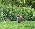 Fox Cub near Salts Farm, East Guldeford - geograph.org.uk - 6148569.jpg 640 × 540; 131 KB
-
 Gate in East Guldeford Levels - geograph.org.uk - 2480002.jpg 3,072 × 2,304; 1.43 MB
-
 Gate near Brook's Bridge - geograph.org.uk - 2495489.jpg 3,072 × 2,304; 2.13 MB
-
 Gate near Salts Farm - geograph.org.uk - 2479681.jpg 3,072 × 2,304; 1.8 MB
-
 Gate near Wainway Wall - geograph.org.uk - 2188190.jpg 3,072 × 2,304; 2.06 MB
-
 Gate on Saxon Shore Way beside the River Rother - geograph.org.uk - 2482831.jpg 3,072 × 2,304; 2.03 MB
-
 Gate on Saxon Shore Way beside the River Rother - geograph.org.uk - 2482865.jpg 3,072 × 2,304; 2.49 MB
-
 Gate, Royal Military Canal Path - geograph.org.uk - 3108251.jpg 640 × 430; 63 KB
-
 Gate, Sussex Border Path - geograph.org.uk - 3108310.jpg 640 × 430; 65 KB
-
 Geese in a field - geograph.org.uk - 5192802.jpg 640 × 426; 52 KB
-
 Grasses, East Guldeford Level - geograph.org.uk - 5429137.jpg 640 × 426; 53 KB
-

-
 Grazing sheep on Romney Marsh - geograph.org.uk - 2626962.jpg 640 × 424; 65 KB
-
 Great Stumps - geograph.org.uk - 6118232.jpg 640 × 480; 55 KB
-
 Guldeford Lane between Offen's Farm and Lamb Farm - geograph.org.uk - 2580306.jpg 2,919 × 1,880; 649 KB
-
 Guldeford Lane Corner - geograph.org.uk - 2580273.jpg 3,001 × 1,937; 897 KB
-
 Guldeford Lane Corner on A259 - geograph.org.uk - 2636555.jpg 640 × 424; 64 KB
-
 Guldeford Road at the junction of Camber Road - geograph.org.uk - 3930338.jpg 2,304 × 1,728; 847 KB
-
 Guldeford Road, East Guldeford - geograph.org.uk - 6150168.jpg 640 × 480; 48 KB
-
 Guldeford Sewer - geograph.org.uk - 1901613.jpg 1,024 × 768; 152 KB
-
 Guldeford sewer - geograph.org.uk - 2626966.jpg 640 × 424; 86 KB
-
 Guldeford Sewer - geograph.org.uk - 2626974.jpg 2,256 × 1,496; 1.44 MB
-
 Guldeford Sewer - geograph.org.uk - 4936744.jpg 7,545 × 2,952; 6.74 MB
-
 Guldeford Sewer - geograph.org.uk - 4936753.jpg 3,728 × 2,796; 3.48 MB
-
 Guldeford Sewer - geograph.org.uk - 4936754.jpg 3,924 × 2,943; 3.24 MB
-
 Guldeford Sewer - geograph.org.uk - 6118185.jpg 480 × 640; 61 KB
-
 Guldeford Sewer - geograph.org.uk - 6118243.jpg 480 × 640; 61 KB
-
 Guldeford Sewer - geograph.org.uk - 6118249.jpg 524 × 640; 54 KB
-
 Guldeford Sewer - geograph.org.uk - 6118271.jpg 480 × 640; 54 KB
-
 Guldeford Sewer - geograph.org.uk - 6150148.jpg 480 × 640; 72 KB
-
 Guldeford Sewer - geograph.org.uk - 6150150.jpg 480 × 640; 62 KB
-
 Hedge on the flood plain - geograph.org.uk - 1754749.jpg 640 × 430; 102 KB
-

-
 House Field - geograph.org.uk - 6118218.jpg 640 × 480; 70 KB
-
 House on the corner - geograph.org.uk - 5429133.jpg 640 × 426; 62 KB
-
 Houses below old Saxon Shore Line - geograph.org.uk - 3108300.jpg 640 × 430; 65 KB
-
 Houses, Royal Military Road, Rye - geograph.org.uk - 6117774.jpg 640 × 480; 61 KB
-
 Isolated tree, East Guldeford - geograph.org.uk - 3758969.jpg 640 × 430; 34 KB
-
 Junction of A259 and Camber Rd - geograph.org.uk - 1505012.jpg 640 × 414; 83 KB
-
 Kent Ditch - geograph.org.uk - 6150107.jpg 480 × 640; 67 KB
-
 Kent Ditch - geograph.org.uk - 6150112.jpg 480 × 640; 68 KB
-
 Kent Ditch in Broomhill Levels - geograph.org.uk - 2188140.jpg 3,072 × 2,304; 1.62 MB
-
 Kent Ditch near Barn Farm - geograph.org.uk - 2480991.jpg 3,072 × 2,304; 2.06 MB
-
 Lambs at Black House Farm - geograph.org.uk - 1896358.jpg 1,024 × 768; 259 KB
-
 Large field south of the A259 - geograph.org.uk - 1503567.jpg 640 × 504; 91 KB
-
 Lavender Creek - geograph.org.uk - 6148678.jpg 640 × 480; 81 KB
-
 Level Crossing near Brook's Bridge - geograph.org.uk - 2495468.jpg 3,072 × 2,304; 2.55 MB
-
 Level Crossing, A259 - geograph.org.uk - 1741586.jpg 640 × 475; 78 KB


_-_geograph.org.uk_-_3926268.jpg)


