Category:Earl Sterndale
Jump to navigation
Jump to search
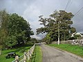
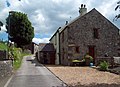
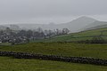
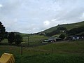
English: Earl Sterndale is a village in Dovedale, Derbyshire, England, UK, situated near the River Dove, 5 miles south of Buxton, and 8 miles west of Bakewell. The farms surrounding the village were medieval monastic granges in the care of the monks of Basingwerk Abbey.
village in Derbyshire, UK  | |||||
| Upload media | |||||
| Instance of | |||||
|---|---|---|---|---|---|
| Location | Hartington Middle Quarter, Derbyshire Dales, Derbyshire, East Midlands, England | ||||
 | |||||
Subcategories
This category has the following 2 subcategories, out of 2 total.
H
- Hindlow railway station (2 F)
M
Media in category "Earl Sterndale"
The following 62 files are in this category, out of 62 total.
-
 "Soft words turneth away wrath" - geograph.org.uk - 5204622.jpg 3,888 × 5,184; 5.51 MB
-

-
 Alderly Cliff - geograph.org.uk - 6727.jpg 640 × 480; 171 KB
-

-
 Barn at Underhill Farm - geograph.org.uk - 599553.jpg 640 × 480; 73 KB
-
 Blast Shelter, Hindlow Quarry - geograph.org.uk - 176964.jpg 640 × 480; 145 KB
-
 Bridleway meets lane - geograph.org.uk - 1231312.jpg 640 × 480; 84 KB
-
 Brierlow Bar Bookshop - geograph.org.uk - 176671.jpg 640 × 480; 114 KB
-
 Chapel in Earl Sterndale - geograph.org.uk - 5835712.jpg 5,184 × 3,888; 5.08 MB
-

-
 Dowal Hall Farm.jpg 1,024 × 683; 196 KB
-
 Earl Sterndale - geograph.org.uk - 1514023.jpg 640 × 480; 89 KB
-
 Earl Sterndale from Hitter Hill - geograph.org.uk - 3357044.jpg 3,872 × 2,592; 5.09 MB
-
 Earl Sterndale Village Scene - geograph.org.uk - 3037480.jpg 3,162 × 2,282; 1.4 MB
-
 Earl Sterndale, on a murky day - geograph.org.uk - 3780702.jpg 4,912 × 3,264; 3.28 MB
-
 Entering Earl Sterndale - geograph.org.uk - 3054045.jpg 800 × 600; 137 KB
-
-

-
 Glutton Grange - erected 1675 - geograph.org.uk - 2861313.jpg 4,152 × 2,768; 2.41 MB
-
 Grazing land near Earl Sterndale - geograph.org.uk - 2858384.jpg 640 × 425; 354 KB
-
 Hindlow Quarry - geograph.org.uk - 176939.jpg 640 × 480; 118 KB
-
 House near Underhill Farm - geograph.org.uk - 599544.jpg 640 × 480; 76 KB
-
 Hurdlow Hall.jpg 5,184 × 2,920; 6.22 MB
-
 Lane view from start of Bridleway - geograph.org.uk - 1231316.jpg 640 × 480; 82 KB
-
 Lane, farm and hillside north of Earl Sterndale - geograph.org.uk - 2760746.jpg 1,024 × 701; 336 KB
-

-
 Near Upper Edge towards Harley Grange - geograph.org.uk - 1292087.jpg 640 × 480; 126 KB
-

-
 Old speed limit sign in Earl Sterndale - geograph.org.uk - 5835905.jpg 5,184 × 3,888; 5.49 MB
-
 Overlooking Earl Sterndale - geograph.org.uk - 3054043.jpg 800 × 600; 186 KB
-
 Overlooking Earl Sterndale - geograph.org.uk - 3054153.jpg 800 × 600; 122 KB
-
 Overlooking Earl Sterndale - geograph.org.uk - 3084596.jpg 1,600 × 1,200; 582 KB
-
 Pennine Bridleway, Dow Low - geograph.org.uk - 351536.jpg 640 × 465; 126 KB
-
 Pond, East Sterndale - geograph.org.uk - 2443547.jpg 640 × 427; 283 KB
-
 Public house in Earl Sterndale - geograph.org.uk - 5835714.jpg 5,184 × 3,888; 6.72 MB
-
 Quiet Woman inn sign - geograph.org.uk - 3054050.jpg 600 × 800; 148 KB
-
 Riding uphill out of Earl Sterndale - geograph.org.uk - 5857796.jpg 1,469 × 1,102; 826 KB
-
 Road junction in Earl Sterndale - geograph.org.uk - 5857794.jpg 1,469 × 1,102; 652 KB
-
 Shady seat in Earl Sterndale, - geograph.org.uk - 4645640.jpg 640 × 480; 118 KB
-
 Sycamore Cottages - geograph.org.uk - 5857790.jpg 1,469 × 1,102; 735 KB
-
 The Climb up from Earl Sterndale - geograph.org.uk - 2443556.jpg 640 × 427; 288 KB
-
 The Hall, Earl Sterndale - geograph.org.uk - 3365024.jpg 3,872 × 2,592; 3.69 MB
-
 The Methodist Church, Earl Sterndale - geograph.org.uk - 3365033.jpg 3,872 × 2,592; 3.68 MB
-
 The Methodist Church, Earl Sterndale - geograph.org.uk - 3924576.jpg 640 × 427; 84 KB
-
 The quarry edge - geograph.org.uk - 1773460.jpg 640 × 480; 59 KB
-
 The Quiet Woman - geograph.org.uk - 3054150.jpg 800 × 600; 120 KB
-
 The Quiet Woman - geograph.org.uk - 4805179.jpg 640 × 363; 76 KB
-
 The Quiet Woman Public House - geograph.org.uk - 1967351.jpg 2,464 × 3,296; 1.13 MB
-
 The Quiet Woman, Earl Sterndale - geograph.org.uk - 599519.jpg 640 × 480; 85 KB
-
 Up to the wire - geograph.org.uk - 1773475.jpg 640 × 480; 83 KB
-
 Walkers congregating on the village green - geograph.org.uk - 3356899.jpg 3,872 × 2,592; 5.15 MB
-
 Walking into Earl Sterndale - geograph.org.uk - 1460951.jpg 640 × 480; 72 KB
-
 What a Hoot - geograph.org.uk - 1773538.jpg 640 × 480; 75 KB
-
 Brierlow Quarry - geograph.org.uk - 176957.jpg 640 × 480; 125 KB
-
 Brierlow Quarry - geograph.org.uk - 176971.jpg 640 × 480; 140 KB
-

-
 Crossroads on B5053 near Earl Sterndale - geograph.org.uk - 6723.jpg 640 × 480; 115 KB
-
 Glutton Bridge - geograph.org.uk - 6710.jpg 640 × 480; 104 KB
-
 Late afternoon on High Wheeldon - geograph.org.uk - 610413.jpg 640 × 480; 30 KB
-

-
 Near Brierlow Quarry - geograph.org.uk - 176969.jpg 480 × 640; 179 KB
-
 Railway bridge, Hindlow - geograph.org.uk - 176977.jpg 640 × 480; 132 KB


_approaching_Glutton_Bridge_-_geograph.org.uk_-_1514068.jpg)


