Category:EVS Precision Island Maps - Aegean Sea
Jump to navigation
Jump to search
EVS Precision Island Maps - Aegean Sea
All island maps are primarily produced from Landsat ETM+ imagery.
Media in category "EVS Precision Island Maps - Aegean Sea"
The following 4 files are in this category, out of 4 total.
-
 Nisida Ioura - EVS Precision and GSHHS WVS (1-65,000).jpg 1,020 × 627; 204 KB
-

-
 Nisos Skiathos - EVS Precision Marplot Map (1-70,000).jpg 1,240 × 904; 263 KB
-
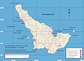 Nisos Skopelos - EVS Precision Map with Roads (1-100,000).jpg 1,240 × 904; 328 KB
.jpg)
.jpg)
.jpg)
.jpg)