Category:Dunragit
Jump to navigation
Jump to search
village in Dumfries and Galloway, Scotland, UK  | |||||
| Upload media | |||||
| Instance of | |||||
|---|---|---|---|---|---|
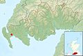
| Location |
| ||||
 | |||||
Cymraeg: Mae Dunragit ( Gaeleg: Dùn Reicheit) yn bentref ar yr A75, rhwng Stranraer a Glenluce yn Dumfries a Galloway (Swydd Wigtown cyn hynny) yn ne-orllewin yr Alban. Tyfodd y pentref presennol oddi amgylch porth gorllewinol Plas Dunragit, sy'n dyddio i'r 18fed ganrif. Tyfodd yn sylweddol yn y 1950au.
English: Dunragit ( Gaelic: Dùn Reicheit) is a village on the A75, between Stranraer and Glenluce in Dumfries and Galloway (previously Wigtownshire) in south-west Scotland. It grew up around the west gate of Dunragit House, an 18th century three-storey four-bay country house. It expanded considerably in the 1950s. The major employer was always the Creamery, but this is no longer in use.
Italiano: Dunragit è un villaggio sulla A75, tra Stranraer e Glenluce, nel Dumfries e Galloway (prima Wigtownshire), nella Scozia sud-occidentale. Si è sviluppato intorno alla porta occidentale della Dunragit House, una country house di XVIII secolo. Si sviluppò in maniera considerevole negli anni cinquanta del XX secolo.
Subcategories
This category has the following 3 subcategories, out of 3 total.
D
- Droughduil Mote, Dunragit (1 F)
- Dunragit railway station (2 F)
G
- Glenwhan Gardens (64 F)
Media in category "Dunragit"
The following 31 files are in this category, out of 31 total.
-
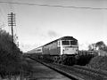 47442 approaches Dunragit level crossing.jpg 1,024 × 768; 305 KB
-

-
 Drochduil Primary School - geograph.org.uk - 163840.jpg 640 × 480; 82 KB
-
 Droughduil - geograph.org.uk - 315288.jpg 640 × 480; 68 KB
-
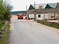
 Drumflower, Dunragit - geograph.org.uk - 746150.jpg 640 × 480; 71 KB
-
 Dunragit House - geograph.org.uk - 596165.jpg 640 × 480; 91 KB
-
 Dunragit level crossing and signalbox. Dumfries & Galloway.jpg 1,920 × 1,080; 673 KB
-
 Dunragit passing loop and old station house. Dumfries & Galloway.jpg 1,920 × 1,080; 758 KB
-
 Dunragit passing loop and signalbox. Dumfries & Galloway.jpg 1,920 × 1,080; 821 KB
-
 Dunragit Signal Box Geograph-2019865-by-Andy-Farrington.jpg 3,648 × 2,736; 4.69 MB
-
 Dunragit signalbox and level crossing, Dumfries and Galloway, Scotland.jpg 1,920 × 1,080; 732 KB
-
 Dunragit, East - geograph.org.uk - 746128.jpg 640 × 480; 89 KB
-
 East Challoch - geograph.org.uk - 163156.jpg 640 × 480; 76 KB
-
 Flooded field near Genoch Mains - geograph.org.uk - 662157.jpg 482 × 640; 117 KB
-
 Genoch Mains - geograph.org.uk - 163831.jpg 640 × 480; 78 KB
-
 Genoch Mains - geograph.org.uk - 313187.jpg 640 × 480; 78 KB
-
 Harebells by stone dyke at Torrs Warren - geograph.org.uk - 307205.jpg 640 × 480; 170 KB
-
 It's a long way to Murrayfield.... - geograph.org.uk - 561588.jpg 640 × 490; 77 KB
-
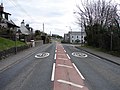
 Junction on the A75 - geograph.org.uk - 163843.jpg 640 × 480; 79 KB
-
 Junction on the A75 - geograph.org.uk - 315290.jpg 640 × 480; 70 KB
-
 Level crossing at Dunragit.jpg 640 × 480; 96 KB
-
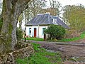 Lodge for Genoch Mains - geograph.org.uk - 313186.jpg 640 × 480; 96 KB
-
 Low Chlenry farmhouse, abandoned - geograph.org.uk - 537570.jpg 640 × 480; 87 KB
-
 Mapa Dhùn Reicheit.jpg 2,004 × 1,363; 599 KB
-
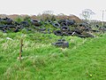 Mountain of old tyres - geograph.org.uk - 163830.jpg 640 × 480; 82 KB
-
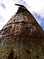 Old bombing target - geograph.org.uk - 561464.jpg 480 × 640; 130 KB
-
 Old bombing target on Luce sands - geograph.org.uk - 560957.jpg 640 × 480; 76 KB
-
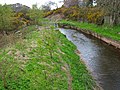 Piltanton Burn - geograph.org.uk - 163836.jpg 640 × 480; 92 KB
-
 Piltanton Burn - geograph.org.uk - 315283.jpg 640 × 480; 69 KB
-

-
 Sand patterns - geograph.org.uk - 561589.jpg 640 × 480; 155 KB


