Category:Dunbar (civil parish)
Jump to navigation
Jump to search
Scottish parish in East Lothian, Scotland, UK | |||||
| Upload media | |||||
| Instance of | |||||
|---|---|---|---|---|---|
| Part of |
| ||||
| Named after | |||||
| Location |
| ||||
| Population |
| ||||
| Area |
| ||||
 | |||||
Subcategories
This category has the following 4 subcategories, out of 4 total.
Media in category "Dunbar (civil parish)"
The following 200 files are in this category, out of 2,727 total.
(previous page) (next page)-

-

-
 "The Castle Hotel", Dunbar - geograph.org.uk - 3631650.jpg 3,505 × 2,629; 1.69 MB
-
 "The Volunteer Arms", Dunbar - geograph.org.uk - 3631715.jpg 2,736 × 3,648; 2.22 MB
-

-
 101 Uses For A Fishbox , No.1 - Vent Cover - geograph.org.uk - 3494739.jpg 1,600 × 1,200; 395 KB
-
 25-pounder Q F Mark II Gun - geograph.org.uk - 5813219.jpg 640 × 414; 74 KB
-
 7 Old Harbour, Dunbar - geograph.org.uk - 6332697.jpg 3,264 × 2,448; 3.28 MB
-
 A Beautiful Bluebell Wood - geograph.org.uk - 6152465.jpg 4,592 × 3,448; 5.56 MB
-
 A Beautiful Bluebell Wood near Dunbar - geograph.org.uk - 6152450.jpg 4,592 × 3,448; 5.67 MB
-
 A camera dog at Cat Craig - geograph.org.uk - 3765309.jpg 640 × 440; 168 KB
-
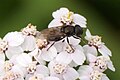 A Cheilosia hoverfly, East Links, Dunbar - geograph.org.uk - 5069107.jpg 1,024 × 682; 99 KB
-
 A Curious Little Fortress - geograph.org.uk - 3080895.jpg 640 × 427; 429 KB
-
 A Dutch Yacht in Victoria Harbour beside Dunbar Castle - geograph.org.uk - 6253886.jpg 4,608 × 3,456; 3.85 MB
-
 A fine stack - geograph.org.uk - 4702475.jpg 3,462 × 2,308; 1.71 MB
-

-
 A garden centre and wool shop this way - geograph.org.uk - 2326058.jpg 407 × 640; 155 KB
-
 A Hot Afternoon at Victoria Harbour, Dunbar - geograph.org.uk - 1872716.jpg 2,560 × 1,920; 3.3 MB
-
 A lion on a building in Dunbar - geograph.org.uk - 3356957.jpg 428 × 640; 292 KB
-
 A lively sea at Dunbar - geograph.org.uk - 5967881.jpg 1,024 × 726; 589 KB
-
 A monument to the Battle of Dunbar - geograph.org.uk - 3510541.jpg 640 × 480; 175 KB
-

-
 A pile of Creels at Old Harbour Dunbar - geograph.org.uk - 6248351.jpg 4,592 × 3,448; 3.14 MB
-
 A purple patch, Lauderdale Park - geograph.org.uk - 6305833.jpg 1,024 × 1,024; 769 KB
-
 A receding tide at Dunbar - geograph.org.uk - 3406744.jpg 640 × 480; 230 KB
-
 A rock slab near Catcraig - geograph.org.uk - 916730.jpg 592 × 423; 132 KB
-
 A small green boat at Old Harbour Dunbar - geograph.org.uk - 6248346.jpg 4,438 × 3,332; 2.18 MB
-

-

-
 A sundial on the Town House at Dunbar - geograph.org.uk - 2326069.jpg 640 × 432; 136 KB
-
 A tribute to John Muir at Dunbar - geograph.org.uk - 6331999.jpg 1,943 × 2,595; 1.53 MB
-
 A unicorn on a building in Dunbar - geograph.org.uk - 3356952.jpg 424 × 640; 278 KB
-
 A View from the Promenade in Dunbar - geograph.org.uk - 6253757.jpg 4,608 × 3,456; 4.01 MB
-
 A View Looking Across Victoria Harbour Dunbar - geograph.org.uk - 5812213.jpg 2,048 × 1,536; 1.09 MB
-
 A View of Victoria Harbour Dunbar - geograph.org.uk - 5812212.jpg 2,048 × 1,536; 972 KB
-
 A wheat field at Fuller's Hill - geograph.org.uk - 3098686.jpg 640 × 479; 248 KB
-
 A1 Lay-by near Broxburn - geograph.org.uk - 5523154.jpg 1,024 × 683; 250 KB
-
 A1 Milestone near Dunbar - geograph.org.uk - 6332025.jpg 1,830 × 2,440; 1.77 MB
-
 A1 northbound - geograph.org.uk - 2957004.jpg 640 × 459; 42 KB
-
 A1 northbound - geograph.org.uk - 2957008.jpg 640 × 442; 43 KB
-
 A1 northbound - geograph.org.uk - 2957018.jpg 640 × 469; 48 KB
-
 A1 northbound - geograph.org.uk - 2957027.jpg 640 × 480; 42 KB
-
 A1 northbound - geograph.org.uk - 2957041.jpg 640 × 466; 46 KB
-
 A1 northbound - geograph.org.uk - 2957044.jpg 640 × 454; 39 KB
-
 A1 northbound - geograph.org.uk - 2957048.jpg 640 × 480; 39 KB
-
 A1 northbound - geograph.org.uk - 2957052.jpg 640 × 458; 36 KB
-
 A1 northbound - geograph.org.uk - 2957060.jpg 640 × 438; 52 KB
-

-
 A1 road junction - geograph.org.uk - 4577362.jpg 3,264 × 2,448; 2.71 MB
-
 A1087 at Broxburn - geograph.org.uk - 5829352.jpg 640 × 426; 84 KB
-
 A1087 heading towards Dunbar - geograph.org.uk - 5809614.jpg 640 × 418; 96 KB
-
 A1087 Queen's Road in Dunbar - geograph.org.uk - 5809594.jpg 640 × 371; 86 KB
-
 A1087 towards the A1 - geograph.org.uk - 3007860.jpg 640 × 480; 72 KB
-
 A1087 towards the A1 - geograph.org.uk - 3007865.jpg 640 × 480; 80 KB
-
 A1087 towards the A1 - geograph.org.uk - 3007871.jpg 640 × 480; 70 KB
-
 A1087 towards West Barns - geograph.org.uk - 2954022.jpg 640 × 480; 55 KB
-
 A199 across a ploughed field - geograph.org.uk - 2472990.jpg 640 × 430; 37 KB
-
 A199 crossing Hedderwick Burn - geograph.org.uk - 5892673.jpg 1,024 × 683; 205 KB
-
 A199 heading east - geograph.org.uk - 2953945.jpg 640 × 480; 109 KB
-
 A199 heading east - geograph.org.uk - 2953957.jpg 640 × 480; 53 KB
-
 A199 heading east - geograph.org.uk - 2954014.jpg 640 × 480; 82 KB
-
 A199 near Kirklandhill Cottages - geograph.org.uk - 4879237.jpg 640 × 480; 299 KB
-

-
 Adventure playground - geograph.org.uk - 4699650.jpg 3,462 × 2,308; 3.42 MB
-
 Agapanthus flowering at Bayswell Park Dunbar - geograph.org.uk - 6236335.jpg 3,448 × 4,592; 3.06 MB
-

-
 Allotments near West Barns, Dunbar - geograph.org.uk - 6275692.jpg 1,024 × 512; 159 KB
-
 Almost a Silhouette - geograph.org.uk - 4706528.jpg 2,308 × 3,462; 1.41 MB
-

-
 An ice cream van at Dunbar - geograph.org.uk - 4212961.jpg 640 × 427; 182 KB
-
 An incoming tide at Catcraig - geograph.org.uk - 916710.jpg 640 × 427; 147 KB
-
 An opium poppy (Papaver somniferum) - geograph.org.uk - 2508302.jpg 430 × 640; 313 KB
-

-

-

-
 Approaching Spott Roundabout (A1) - geograph.org.uk - 4470004.jpg 640 × 480; 64 KB
-
 Approaching the A1 at Broxburn - geograph.org.uk - 2696615.jpg 1,600 × 1,367; 401 KB
-
 Approaching West Barns - geograph.org.uk - 2416651.jpg 640 × 359; 260 KB
-
 Arcturus and other Boats in Old Harbour Dunbar - geograph.org.uk - 6322950.jpg 4,608 × 3,456; 2.52 MB
-
 Are we nearly there yet^ - geograph.org.uk - 5868975.jpg 3,264 × 2,448; 4.75 MB
-
 Arrowhead at Hedderwick, East Lothian - geograph.org.uk - 1856548.jpg 4,000 × 3,000; 6.81 MB
-
 Asda at Dunbar - geograph.org.uk - 2685406.jpg 640 × 480; 44 KB
-
 Asda supermarket, Dunbar - geograph.org.uk - 4468136.jpg 640 × 445; 53 KB
-
 Asda Superstore on Spott Road - geograph.org.uk - 4880037.jpg 640 × 480; 233 KB
-
 Ash tree below The Brunt - geograph.org.uk - 5905936.jpg 2,448 × 3,264; 3.71 MB
-
 Attractive House at Bowmont Terrace Dunbar - geograph.org.uk - 6376353.jpg 1,600 × 1,200; 383 KB
-
 Autumn in East Lothian , 2 ^ 4 Winterfield Mains, Belhaven - geograph.org.uk - 2179985.jpg 2,560 × 1,920; 3.27 MB
-
 Autumn in East Lothian , 6 Winterfield Mains, Belhaven - geograph.org.uk - 2179969.jpg 2,560 × 1,920; 3.41 MB
-
 B6370 heading south - geograph.org.uk - 3665720.jpg 640 × 480; 84 KB
-
 Back of North Street, Belhaven - geograph.org.uk - 6078576.jpg 1,024 × 768; 486 KB
-
 Bank erosion, Hedderwick Burn - geograph.org.uk - 2084984.jpg 800 × 530; 191 KB
-
 Bank of Scotland in Dunbar High Street - geograph.org.uk - 6200655.jpg 2,048 × 1,536; 1,000 KB
-
 Barley harvest, Pinkerton - geograph.org.uk - 946958.jpg 640 × 359; 76 KB
-
 Barley on Doon Hill - geograph.org.uk - 3096553.jpg 3,264 × 2,448; 3.96 MB
-
 Barleyscape from Doon Hill - geograph.org.uk - 3096786.jpg 3,264 × 2,448; 3.91 MB
-
 Barnes Ness lighthouse - geograph.org.uk - 2002357.jpg 1,024 × 683; 90 KB
-
 Barns Ness - geograph.org.uk - 5767789.jpg 1,024 × 576; 246 KB
-
 Barns Ness Lighthouse - geograph.org.uk - 3899235.jpg 3,264 × 2,448; 3.62 MB
-
 Barns Ness Lighthouse - geograph.org.uk - 3899258.jpg 3,264 × 2,448; 3.56 MB
-
 Barns Ness Lighthouse - geograph.org.uk - 4403385.jpg 1,066 × 800; 135 KB
-
 Barns Ness Lighthouse - geograph.org.uk - 4876706.jpg 640 × 480; 266 KB
-
 Barns Ness Lighthouse - geograph.org.uk - 5764542.jpg 800 × 604; 141 KB
-
 Barns Ness Lighthouse - geograph.org.uk - 5767801.jpg 1,024 × 576; 166 KB
-
 Barns Ness Lighthouse - geograph.org.uk - 5768923.jpg 1,024 × 576; 282 KB
-
 Barns Ness Lighthouse - geograph.org.uk - 5826582.jpg 640 × 433; 53 KB
-
 Barns Ness Lighthouse - geograph.org.uk - 5828063.jpg 640 × 486; 70 KB
-
 Barns Ness Lighthouse - geograph.org.uk - 6261214.jpg 1,600 × 1,067; 520 KB
-
 Barns Ness Lighthouse - geograph.org.uk - 6261219.jpg 1,600 × 1,067; 471 KB
-
 Barns Ness lighthouse and keepers houses - geograph.org.uk - 3899260.jpg 2,448 × 3,264; 3.64 MB
-
 Barns Ness Lighthouse Dunbar - geograph.org.uk - 6192599.jpg 4,592 × 3,448; 3.08 MB
-
 Barns Ness Lighthouse, East Lothian - geograph.org.uk - 1850436.jpg 2,560 × 1,920; 3.06 MB
-
 Barns Ness Lighthouse, East Lothian - geograph.org.uk - 1850486.jpg 2,560 × 1,920; 2.9 MB
-
 Barns Ness Lighthouse, near Dunbar - geograph.org.uk - 5949920.jpg 1,024 × 768; 131 KB
-

-
 Bathe Rock - geograph.org.uk - 5093992.jpg 1,024 × 683; 333 KB
-
 Battle of Dunbar 1650 Re-enactment - geograph.org.uk - 6323483.jpg 4,608 × 3,456; 3.2 MB
-
 Battle of Dunbar 1650 Re-enactment 10 - geograph.org.uk - 6321473.jpg 4,608 × 3,456; 3.64 MB
-
 Battle of Dunbar 1650 Re-enactment 11 - geograph.org.uk - 6321474.jpg 4,608 × 3,456; 2.77 MB
-
 Battle of Dunbar 1650 Re-enactment 12 - geograph.org.uk - 6321478.jpg 4,608 × 3,456; 2.73 MB
-
 Battle of Dunbar 1650 Re-enactment 13 - geograph.org.uk - 6321480.jpg 4,608 × 3,456; 3.25 MB
-
 Battle of Dunbar 1650 Re-enactment 14 - geograph.org.uk - 6321482.jpg 4,608 × 3,456; 2.07 MB
-
 Battle of Dunbar 1650 Re-enactment 15 - geograph.org.uk - 6324161.jpg 4,608 × 3,456; 3.83 MB
-
 Battle of Dunbar 1650 Re-enactment 16 - geograph.org.uk - 6324172.jpg 4,608 × 3,456; 3.25 MB
-
 Battle of Dunbar 1650 Re-enactment 17 - geograph.org.uk - 6324185.jpg 4,608 × 3,456; 3.12 MB
-
 Battle of Dunbar 1650 Re-enactment 18 - geograph.org.uk - 6324299.jpg 4,608 × 3,456; 4.02 MB
-
 Battle of Dunbar 1650 Re-enactment 19 - geograph.org.uk - 6324390.jpg 4,608 × 3,456; 3.9 MB
-
 Battle of Dunbar 1650 Re-enactment 2 - geograph.org.uk - 6321428.jpg 4,608 × 3,456; 2.66 MB
-
 Battle of Dunbar 1650 Re-enactment 20 - geograph.org.uk - 6324403.jpg 4,608 × 3,456; 2.54 MB
-
 Battle of Dunbar 1650 Re-enactment 21 - geograph.org.uk - 6324431.jpg 4,608 × 3,456; 2.76 MB
-
 Battle of Dunbar 1650 Re-enactment 22 - geograph.org.uk - 6324434.jpg 4,608 × 3,456; 3.1 MB
-
 Battle of Dunbar 1650 Re-enactment 23 - geograph.org.uk - 6324501.jpg 4,608 × 3,456; 3.11 MB
-
 Battle of Dunbar 1650 Re-enactment 24 - geograph.org.uk - 6324514.jpg 4,608 × 3,456; 2.85 MB
-
 Battle of Dunbar 1650 Re-enactment 25 - geograph.org.uk - 6324523.jpg 4,608 × 3,456; 2.91 MB
-
 Battle of Dunbar 1650 Re-enactment 26 - geograph.org.uk - 6326376.jpg 4,608 × 3,456; 3.08 MB
-
 Battle of Dunbar 1650 Re-enactment 27 - geograph.org.uk - 6326432.jpg 4,608 × 3,456; 2.96 MB
-
 Battle of Dunbar 1650 Re-enactment 28 - geograph.org.uk - 6326436.jpg 4,608 × 3,456; 2.87 MB
-
 Battle of Dunbar 1650 Re-enactment 29 - geograph.org.uk - 6326439.jpg 4,608 × 3,456; 3.17 MB
-
 Battle of Dunbar 1650 Re-enactment 3 - geograph.org.uk - 6321421.jpg 4,608 × 3,456; 2.99 MB
-
 Battle of Dunbar 1650 Re-enactment 30 - geograph.org.uk - 6326443.jpg 4,608 × 3,456; 2.63 MB
-
 Battle of Dunbar 1650 Re-enactment 31 - geograph.org.uk - 6326446.jpg 4,608 × 3,456; 2.98 MB
-
 Battle of Dunbar 1650 Re-enactment 32 - geograph.org.uk - 6326450.jpg 4,608 × 3,456; 2.99 MB
-
 Battle of Dunbar 1650 Re-enactment 4 - geograph.org.uk - 6321442.jpg 3,456 × 4,608; 3.61 MB
-
 Battle of Dunbar 1650 Re-enactment 5 - geograph.org.uk - 6321449.jpg 3,456 × 4,608; 3.33 MB
-
 Battle of Dunbar 1650 Re-enactment 6 - geograph.org.uk - 6321454.jpg 4,608 × 3,456; 3.33 MB
-
 Battle of Dunbar 1650 Re-enactment 7 - geograph.org.uk - 6321456.jpg 4,608 × 3,456; 3.26 MB
-
 Battle of Dunbar 1650 Re-enactment 8 - geograph.org.uk - 6321465.jpg 4,608 × 3,456; 2.73 MB
-
 Battle of Dunbar 1650 Re-enactment 9 - geograph.org.uk - 6321467.jpg 4,608 × 3,456; 3.12 MB
-
 Battle of Dunbar monument - geograph.org.uk - 5829294.jpg 640 × 511; 92 KB
-
 Battle of Dunbar Re enactment - geograph.org.uk - 6270880.jpg 2,048 × 1,536; 791 KB
-
 Bayswell Road, Dunbar - geograph.org.uk - 5523718.jpg 1,024 × 683; 201 KB
-
 Beach at the Dunbar Golf Course - geograph.org.uk - 5816941.jpg 640 × 480; 106 KB
-
 Beach Houses at Winterfield Mains, Belhaven, East Lothian - geograph.org.uk - 1847216.jpg 2,560 × 1,920; 3.25 MB
-
 Beach near Dunbar Golf Course - geograph.org.uk - 4970548.jpg 4,608 × 3,072; 1 MB
-
 Beach off Lamer Street, Dunbar - geograph.org.uk - 2695136.jpg 1,600 × 1,200; 293 KB
-
 Beach south of Barns Ness - geograph.org.uk - 4876704.jpg 640 × 480; 204 KB
-
 Beach, Barns Ness - geograph.org.uk - 1270644.jpg 640 × 480; 112 KB
-
 Beach, Barns Ness - geograph.org.uk - 1270647.jpg 640 × 480; 95 KB
-
 Beach, Barns Ness - geograph.org.uk - 5768916.jpg 1,024 × 576; 255 KB
-
 Beach, Barns Ness - geograph.org.uk - 6416428.jpg 1,024 × 683; 210 KB
-
 Beach, Tyne Estuary - geograph.org.uk - 3771250.jpg 640 × 480; 299 KB
-
 Beach, White Sands - geograph.org.uk - 6416499.jpg 1,024 × 576; 240 KB
-
 Beautiful Agapanthus at Bayswell Park Dunbar - geograph.org.uk - 6234840.jpg 2,048 × 1,536; 1.22 MB
-
 Beautiful Bed of Daffodils at Parsons Pool Dunbar - geograph.org.uk - 6129573.jpg 2,048 × 1,536; 1.44 MB
-
 Beautiful Flower Bed by Station Road Dunbar - geograph.org.uk - 6215001.jpg 1,536 × 2,048; 1.43 MB
-
 Beautiful Flower Beds at Winterfield Park Dunbar - geograph.org.uk - 6235939.jpg 4,592 × 3,448; 4.89 MB
-
 Beehive Doocot at Meikle Pinkerton - geograph.org.uk - 5877616.jpg 2,448 × 3,264; 3.58 MB
-
 Behind Warrender Crescent, Dunbar - geograph.org.uk - 4917174.jpg 1,024 × 768; 365 KB
-
 Belhaven - geograph.org.uk - 3579633.jpg 3,211 × 2,202; 876 KB
-
 Belhaven Bay - geograph.org.uk - 3797175.jpg 640 × 422; 190 KB
-
 Belhaven Bay at Dunbar - geograph.org.uk - 5812292.jpg 640 × 480; 87 KB
-
 Belhaven Bay Caravan Park - geograph.org.uk - 5811126.jpg 640 × 390; 57 KB
-
 Belhaven Beach Dunbar - geograph.org.uk - 6192571.jpg 4,592 × 3,448; 3.26 MB
-
 Belhaven Parish Church - geograph.org.uk - 5093984.jpg 1,024 × 683; 335 KB
-
 Belhaven Parish Church - geograph.org.uk - 5189403.jpg 4,000 × 3,000; 3.16 MB
-
 Belhaven Road, Dunbar - geograph.org.uk - 5523732.jpg 1,024 × 683; 260 KB
-
 Belhaven Sands Airfield 1918 - geograph.org.uk - 6393105.jpg 1,600 × 1,200; 431 KB
-
 Belhaven seen from Doon Hill - geograph.org.uk - 4118520.jpg 640 × 480; 224 KB
-
 Belhaven Surf Centre near Dunbar - geograph.org.uk - 6236371.jpg 4,592 × 3,448; 2.2 MB
-
 Belhaven Trout Farm near Beltonford, East Lothian - geograph.org.uk - 1855552.jpg 2,560 × 1,920; 3.13 MB
-
 Bellhaven - geograph.org.uk - 4403547.jpg 1,066 × 800; 155 KB
-
 Bench overlooking the Tyne estuary - geograph.org.uk - 5094226.jpg 1,024 × 683; 384 KB
-
 Benches on Queen's Road, Dunbar - geograph.org.uk - 4518973.jpg 1,280 × 851; 379 KB
-
 Bend in the road below The Brunt - geograph.org.uk - 5905929.jpg 3,264 × 2,448; 4.98 MB
-
 Bend in the road near The Brunt - geograph.org.uk - 5905932.jpg 3,264 × 2,448; 4.84 MB
-
 Beside Shore Road, Belhaven - geograph.org.uk - 6078580.jpg 1,024 × 768; 353 KB
-
 Between Skateraw and Barns Ness - geograph.org.uk - 5767876.jpg 1,024 × 576; 297 KB
-
 Biel Water - geograph.org.uk - 6078780.jpg 1,024 × 768; 264 KB
-
 Biel Water at West Barns - geograph.org.uk - 5811100.jpg 640 × 480; 62 KB
-
 Biel Water in Flood between West Barns and Belhaven - geograph.org.uk - 1843416.jpg 2,560 × 1,920; 3.17 MB
-
 Biel Water, West Barns - geograph.org.uk - 2954028.jpg 640 × 480; 90 KB
-
 Biel Water, West Barns - geograph.org.uk - 6078568.jpg 1,024 × 768; 407 KB
-
 Birthplace of John Muir - geograph.org.uk - 5397095.jpg 768 × 1,024; 304 KB
-
 Block of flats off Spott Road - geograph.org.uk - 4467940.jpg 640 × 480; 43 KB
-
 Blue Beach House at Winterfield Mains, Belhaven - geograph.org.uk - 1847197.jpg 2,560 × 1,920; 2.86 MB
-
 Blue Boats in the Old Harbour Dunbar - geograph.org.uk - 6322823.jpg 3,456 × 4,608; 2.71 MB
-

-
 Bluebells in an Oak Wood - geograph.org.uk - 6152475.jpg 4,592 × 3,448; 5.78 MB
-
 Bluebells in an Oak Wood - geograph.org.uk - 6152483.jpg 4,592 × 3,448; 6.18 MB
-
 Boarded up building, Dunbar High Street - geograph.org.uk - 4118545.jpg 640 × 480; 269 KB
-
 Boat in Cromwell Harbour - geograph.org.uk - 2648673.jpg 640 × 480; 83 KB


_-_geograph.org.uk_-_2508302.jpg)


_-_geograph.org.uk_-_4470004.jpg)


&filefrom=Boats+and+Barometer+at+Cromwell+Harbour%2C+Dunbar+-+geograph.org.uk+-+1847741.jpg#mw-category-media)