Category:Duinoordkerk
Jump to navigation
Jump to search
| Object location | | View all coordinates using: OpenStreetMap |
|---|
Nederlands: 's-Gravenhage, Adriaan Goekooplaan - Duinoordkerk (1920 - 1942) - Kerk gesloopt op last van de Duitse bezetter
Media in category "Duinoordkerk"
The following 13 files are in this category, out of 13 total.
-
 BC856 HUI-1066.jpg 3,526 × 2,456; 1.59 MB
-
 BC856 HUI-1067.jpg 3,522 × 2,436; 1.49 MB
-
 BC856 HUI-1087.jpg 3,534 × 2,444; 1.44 MB
-
 BC856 HUI-1095.jpg 3,549 × 2,456; 1.46 MB
-
 BC856 HUI-1096.jpg 3,514 × 2,412; 1.55 MB
-
 BC856 HUI-1097.jpg 3,526 × 2,440; 1.33 MB
-
 BC856 HUI-1098.jpg 3,549 × 2,456; 1.24 MB
-
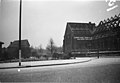
 Duinoordkerk sloop.png 748 × 516; 376 KB
-
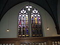
 Glas-in-loodraam, Kloosterkerk, Den Haag.jpg 5,472 × 3,648; 5.16 MB
-
 Kloosterkersk apostelkapel (cropped).jpg 1,346 × 1,795; 1.07 MB
-
 Kloosterkersk apostelkapel (cropped2).jpg 2,675 × 2,006; 2.09 MB
-
 Kloosterkersk apostelkapel.jpg 2,816 × 2,112; 2.44 MB
-
Nieuwe bestemming voor mozaïek uit de verwoeste Duinoordkerk-524923.ogv 1 min 18 s, 384 × 288; 9.39 MB


.jpg)
.jpg)
