Category:Drumbo
Jump to navigation
Jump to search
village in the United Kingdom  | |||||
| Upload media | |||||
| Instance of | |||||
|---|---|---|---|---|---|
| Location | County Down, Northern Ireland | ||||
 | |||||
English: Drumbo is a small village in County Down, Northern Ireland, about 6 miles (10 km) south of Belfast city centre, 3 miles (5 km) east of Lisburn and 3 miles west of Carryduff. According to the 2001 Census it had a population of 408 people. It is situated in the Lisburn City Council area. In the traditional system of land division in Ireland, Drumbo is the name of the of the townland in which the modern village is situated and the civil parish covering the surrounding area. Church of Ireland and Roman Catholic parishes also take their names from the district although their parish churches are at Ballylesson and Carryduff respectively.
Italiano: Drumbo (In irlandese: Druim Bo) è un piccolo villaggio nella contea Down, nell'Irlanda del Nord; dista 5 km a est da Lisburn e 12 km a sud da Belfast. Secondo il censimento del 2001 possiede 401 abitanti.
Subcategories
This category has the following 2 subcategories, out of 2 total.
D
- Drumbo Round Tower (4 F)
T
- Holy Trinity Church, Drumbo (7 F)
Media in category "Drumbo"
The following 44 files are in this category, out of 44 total.
-
 Back Road, Drumbo - geograph.org.uk - 1627436.jpg 640 × 480; 106 KB
-
 Back Road, Drumbo - geograph.org.uk - 1627440.jpg 640 × 480; 85 KB
-
 Ballycoan Road near Carryduff (1) - geograph.org.uk - 791516.jpg 640 × 480; 386 KB
-
 Bench Mark, Drumbo - geograph.org.uk - 1746615.jpg 640 × 483; 555 KB
-
 Bus, Drumbo - geograph.org.uk - 1746644.jpg 640 × 449; 262 KB
-
 Christmas tree and snow, Drumbo - geograph.org.uk - 1627370.jpg 640 × 480; 99 KB
-
 Drumbo Orange Hall - geograph.org.uk - 1746632.jpg 640 × 421; 266 KB
-
 Drumbo Presbyterian Church - geograph.org.uk - 60758.jpg 480 × 640; 80 KB
-
 Drumbo Presbyterian Church - geograph.org.uk - 841376.jpg 640 × 563; 329 KB
-
 Drumbo Road near Drumbo - geograph.org.uk - 841716.jpg 640 × 430; 316 KB
-
 Drumbo village - geograph.org.uk - 1627378.jpg 640 × 480; 103 KB
-
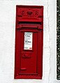 Edward VII postbox, Drumbo - geograph.org.uk - 841612.jpg 458 × 640; 294 KB
-
 Fields near Drumbo - geograph.org.uk - 841699.jpg 640 × 480; 376 KB
-
 Front Road, Drumbo - geograph.org.uk - 1627447.jpg 640 × 480; 123 KB
-
 Front Road, Drumbo - geograph.org.uk - 841382.jpg 640 × 480; 53 KB
-
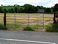 Gate near Drumbo - geograph.org.uk - 841708.jpg 640 × 480; 367 KB
-

-

-
 Lane near Drumbo - geograph.org.uk - 841704.jpg 640 × 480; 392 KB
-
 Mealough Road, Drumbo - geograph.org.uk - 1627385.jpg 640 × 480; 108 KB
-
 Old pump, Drumbo - geograph.org.uk - 2365509.jpg 640 × 480; 105 KB
-
 Old pump, Drumbo - geograph.org.uk - 2365518.jpg 640 × 599; 147 KB
-
 Old water pump, Drumbo - geograph.org.uk - 841616.jpg 618 × 640; 531 KB
-
 Pinehill Road, Drumbo - geograph.org.uk - 1627384.jpg 640 × 480; 112 KB
-
 Sheep off the Ballycoan Road (2) - geograph.org.uk - 791585.jpg 640 × 480; 483 KB
-
 Sheep off the Ballycoan Road - geograph.org.uk - 791582.jpg 640 × 480; 395 KB
-
 Sign near Drumbo - geograph.org.uk - 1627366.jpg 640 × 480; 132 KB
-
 Signs near Drumbo - geograph.org.uk - 1627362.jpg 640 × 480; 121 KB
-
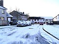
 Snow at Drumbo Townland - geograph.org.uk - 1627438.jpg 640 × 480; 86 KB
-
 Snow at Titterington Gardens, Drumbo - geograph.org.uk - 1627430.jpg 640 × 480; 99 KB
-
 Titterington Gardens, Drumbo - geograph.org.uk - 1627388.jpg 640 × 480; 91 KB
-
 Tullyard Hill - geograph.org.uk - 1627327.jpg 640 × 480; 116 KB
-
 Tullyard Road, Drumbo - geograph.org.uk - 1627353.jpg 640 × 480; 103 KB
-
 Tullyard Road, Drumbo - geograph.org.uk - 1627354.jpg 640 × 480; 120 KB
-

-
 War memorial, Drumbo Presbyterian Church - geograph.org.uk - 841677.jpg 457 × 640; 247 KB
-
 Ballylesson Road, Ballylesson - geograph.org.uk - 756934.jpg 640 × 480; 125 KB
-
 Bungalow - geograph.org.uk - 86566.jpg 640 × 480; 77 KB
-
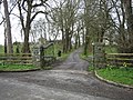 Gateway to Braidujle House - geograph.org.uk - 373588.jpg 640 × 480; 185 KB
-
 Nameplate for Braidujle House - geograph.org.uk - 373591.jpg 640 × 480; 169 KB
-
 New House - geograph.org.uk - 94166.jpg 640 × 480; 89 KB
-
 New House in rural surroundings - geograph.org.uk - 87708.jpg 640 × 480; 68 KB
-

-
 The house on the hill - geograph.org.uk - 85045.jpg 640 × 480; 92 KB


_-_geograph.org.uk_-_791516.jpg)


_-_geograph.org.uk_-_791585.jpg)


