Category:Drayton, Cherwell
Jump to navigation
Jump to search
village and civil parish in Cherwell, Oxfordshire, United Kingdom  | |||||
| Upload media | |||||
| Instance of | |||||
|---|---|---|---|---|---|
| Location | Cherwell, Oxfordshire, South East England, England | ||||
| Population |
| ||||
| Area |
| ||||
| Different from | |||||
| Said to be the same as | Drayton (Wikimedia duplicated page, civil parish) | ||||
 | |||||
English: Drayton is a village and civil parish in the valley of the Sor Brook in Oxfordshire, about northwest of Banbury.
Subcategories
This category has the following 3 subcategories, out of 3 total.
Media in category "Drayton, Cherwell"
The following 37 files are in this category, out of 37 total.
-

-

-

-

-
 A midday visit to St Peter, Drayton (E) - geograph.org.uk - 5099002.jpg 640 × 480; 111 KB
-
 Access to Drayton Lodge Farm - geograph.org.uk - 4351717.jpg 640 × 480; 116 KB
-
 Approaching Drayton - geograph.org.uk - 6117169.jpg 3,456 × 2,592; 4.33 MB
-
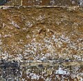 Benchmark on St Peter's Church - geograph.org.uk - 4916877.jpg 1,024 × 993; 475 KB
-
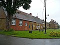
 Cottages, Drayton - geograph.org.uk - 1018757.jpg 640 × 480; 121 KB
-
 Crickle Cottage, Stratford Road - geograph.org.uk - 4917232.jpg 1,024 × 683; 241 KB
-
 Crows in the pine trees - geograph.org.uk - 4351691.jpg 640 × 480; 83 KB
-
 Ivy Cottage, Drayton - geograph.org.uk - 1018742.jpg 640 × 480; 117 KB
-
 Drayton Oxfordshire 2000.JPG 1,536 × 1,024; 396 KB
-
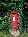 George VI postbox, Drayton - geograph.org.uk - 1018767.jpg 480 × 640; 156 KB
-
 Drayton, St Peter's church - geograph.org.uk - 3960831.jpg 4,320 × 3,240; 5.47 MB
-

-
 Houses in Drayton - geograph.org.uk - 3176537.jpg 640 × 480; 54 KB
-
 OIR Drayton seans.JPG 3,485 × 2,417; 4 MB
-
 OIR Drayton tool shed in 2004.png 2,744 × 1,192; 5.79 MB
-
 OIR track pin at Drayton.JPG 1,724 × 1,172; 2.41 MB
-

-
 Old Schoolhouse on north side of A422 - geograph.org.uk - 4916738.jpg 1,024 × 683; 194 KB
-
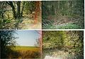
 On the Banbury Fringe walk - geograph.org.uk - 5510572.jpg 640 × 480; 132 KB
-
 On the Banbury Fringe walk - geograph.org.uk - 5510573.jpg 640 × 480; 88 KB
-
 On the Banbury Fringe walk - geograph.org.uk - 5510574.jpg 640 × 480; 74 KB
-
 Private access road - geograph.org.uk - 4351699.jpg 640 × 480; 95 KB
-
 Site of Drayton Crossing - geograph.org.uk - 199182.jpg 640 × 480; 86 KB
-
 St Peter's Church - geograph.org.uk - 4916888.jpg 1,024 × 669; 144 KB
-
 Stratford Road in Drayton - geograph.org.uk - 4505427.jpg 1,500 × 999; 223 KB
-
 View from St Peter's Church, Drayton - geograph.org.uk - 1018740.jpg 640 × 479; 125 KB
-
 Village Hall, Drayton - geograph.org.uk - 1018744.jpg 640 × 480; 98 KB
-
 Warwick Road - geograph.org.uk - 4351710.jpg 640 × 461; 93 KB
-
 Warwick Road - geograph.org.uk - 4351723.jpg 640 × 480; 88 KB
-
 Warwick Road into Banbury - geograph.org.uk - 4537762.jpg 1,500 × 999; 201 KB
-
 Warwick Road to Banbury - geograph.org.uk - 4534514.jpg 1,500 × 999; 202 KB
-
 Warwick Road, Drayton - geograph.org.uk - 6082878.jpg 1,162 × 1,848; 1.21 MB
-
 Weathered benchmark on the old schoolhouse - geograph.org.uk - 4914274.jpg 683 × 1,024; 298 KB
_-_geograph.org.uk_-_5098994.jpg)
_-_geograph.org.uk_-_5098996.jpg)
_-_geograph.org.uk_-_5098997.jpg)
_-_geograph.org.uk_-_5099000.jpg)
_-_geograph.org.uk_-_5099002.jpg)


