Category:Dorstone
Jump to navigation
Jump to search
village in Herefordshire, UK  | |||||
| Upload media | |||||
| Instance of | |||||
|---|---|---|---|---|---|
| Location | Herefordshire, West Midlands, England | ||||
 | |||||
English: Dorstone is a village within the Golden Valley, England. There is a thriving community with a church and public house with restaurant. The Golden Valley area offers excellent hillwalking and horseback riding countryside and is noted for its scenery. It is within the catchment area of the popular Fairfield secondary school.
Nederlands: Dorstone is een plaats en civil parish in het bestuurlijke gebied Herefordshire, in het Engelse graafschap Herefordshire met 200 inwoners.
Polski: Dorstone – wieś w Anglii, w hrabstwie Herefordshire. Leży 20 km na zachód od miasta Hereford i 208 km na zachód od Londynu. Miejscowość liczy 200 mieszkańców.

Subcategories
This category has the following 5 subcategories, out of 5 total.
A
- Arthur's Stone, Herefordshire (55 F)
B
- The Bage (1 F)
C
- Dorstone cheese (2 F)
D
- Dorstone WWI Memorial Tablet (1 F)
Media in category "Dorstone"
The following 200 files are in this category, out of 288 total.
(previous page) (next page)-

-
 A load of hay - geograph.org.uk - 3572303.jpg 1,024 × 680; 237 KB
-
 A rural scene, Dorstone - geograph.org.uk - 3149009.jpg 640 × 586; 130 KB
-
 A track to the woods - geograph.org.uk - 6058544.jpg 1,600 × 900; 381 KB
-
 A tree by Stone Lane - geograph.org.uk - 6058541.jpg 1,600 × 900; 451 KB
-
 A wet field entrance - geograph.org.uk - 6058556.jpg 1,600 × 900; 259 KB
-
 Above the Golden Valley - geograph.org.uk - 3044201.jpg 640 × 480; 74 KB
-
 Access road at Bonny Lands - geograph.org.uk - 2205877.jpg 1,024 × 768; 214 KB
-
 Access to Bonny Lands - geograph.org.uk - 4586863.jpg 800 × 450; 171 KB
-

-
 Arable crops in the Golden Valley - geograph.org.uk - 5972418.jpg 1,987 × 1,491; 1.03 MB
-
 Arable land by Pitt Road - geograph.org.uk - 4586901.jpg 800 × 451; 220 KB
-
 Arable land west of Dorstone - geograph.org.uk - 2747032.jpg 1,024 × 768; 446 KB
-
 Arthur's Stone (Dorstone) - geograph.org.uk - 6130041.jpg 3,648 × 2,056; 3.64 MB
-
 Arthur's Stone (Dorstone) - geograph.org.uk - 6130071.jpg 3,648 × 2,056; 3.84 MB
-
 Arthur's Stone (Dorstone) - geograph.org.uk - 6130083.jpg 3,648 × 2,056; 2.53 MB
-
 Arthur's Stone - geograph.org.uk - 4941608.jpg 800 × 600; 144 KB
-
 Arthur's Stone - geograph.org.uk - 5859522.jpg 1,024 × 768; 327 KB
-
 Arthurs Stone Neolithic Burial Chamber - geograph.org.uk - 4353469.jpg 569 × 687; 372 KB
-
 Arthurs Stone Neolithic Burial Chamber 2 - geograph.org.uk - 4353474.jpg 864 × 544; 368 KB
-
 B4348 at Llanafon - geograph.org.uk - 2749043.jpg 1,024 × 577; 353 KB
-
 B4348, Dorstone - geograph.org.uk - 3148592.jpg 640 × 413; 56 KB
-
 Barn near Dorstone Court, Dorstone - geograph.org.uk - 3704160.jpg 800 × 582; 126 KB
-
 Bends ahead on the B4348 in Dorstone - geograph.org.uk - 3148985.jpg 640 × 549; 110 KB
-
 Bethesda Primitive Methodist Chapel, Dorstone - geograph.org.uk - 3521840.jpg 2,889 × 2,398; 1.18 MB
-
 Blue barns - geograph.org.uk - 2747098.jpg 1,024 × 768; 460 KB
-
 Bluebells in the hedgerow, Llanrosser - geograph.org.uk - 178514.jpg 426 × 640; 146 KB
-
 Bodcott Lane - geograph.org.uk - 2747116.jpg 1,024 × 768; 469 KB
-
 Bonny Lands - geograph.org.uk - 891333.jpg 640 × 481; 55 KB
-
 Bridge over Pont-y-Weston, Dorstone - geograph.org.uk - 3523044.jpg 3,289 × 2,110; 1.89 MB
-
 Bridleway this way - geograph.org.uk - 4598532.jpg 800 × 451; 210 KB
-
 Brook flows under Church Road, Dorstone - geograph.org.uk - 3704293.jpg 800 × 754; 221 KB
-

-

-
 Brynspeard Wood - geograph.org.uk - 1905181.jpg 640 × 480; 247 KB
-
 Building site in Dorstone - geograph.org.uk - 3704340.jpg 800 × 616; 104 KB
-

-
 Chapel Lane, Dorstone - geograph.org.uk - 3704174.jpg 800 × 667; 109 KB
-
 Church Road (Dorstone) - geograph.org.uk - 5851393.jpg 3,648 × 2,736; 4.62 MB
-
 Churchyard path, Dorstone - geograph.org.uk - 3148473.jpg 640 × 519; 97 KB
-
 Common Bach - geograph.org.uk - 4586892.jpg 800 × 451; 195 KB
-
 Communications mast on Vagar Hill - geograph.org.uk - 3632072.jpg 640 × 480; 97 KB
-
 Corrugated building at Dorstone - geograph.org.uk - 6366279.jpg 640 × 480; 79 KB
-
 Cottage at Common Bach - geograph.org.uk - 1986081.jpg 640 × 480; 241 KB
-
 Country crossroads - geograph.org.uk - 1986113.jpg 640 × 480; 244 KB
-
 Court House, Dorstone - geograph.org.uk - 3521756.jpg 3,108 × 1,945; 1.47 MB
-
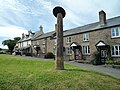
 Cross shaft and sundial, Dorstone - geograph.org.uk - 3136583.jpg 640 × 480; 90 KB
-
 Cross Shaft Sundial on Village Green (Dorstone) - geograph.org.uk - 5851396.jpg 3,648 × 2,736; 4.76 MB
-
 Dawn over the Dore - geograph.org.uk - 4797796.jpg 1,600 × 1,600; 1.25 MB
-
 Sundial in the village of Dorstone - geograph.org.uk - 45991.jpg 426 × 640; 116 KB
-
 Dorstone bowling green and pavilion - geograph.org.uk - 3148982.jpg 640 × 480; 58 KB
-
 Dorstone bus stop - geograph.org.uk - 3704303.jpg 800 × 600; 116 KB
-
 Dorstone Castle (VCH 1908).png 959 × 551; 220 KB
-
 Dorstone Castle - geograph.org.uk - 45963.jpg 640 × 426; 142 KB
-
 Dorstone Castle - geograph.org.uk - 5819490.jpg 1,920 × 1,080; 1.03 MB
-
 Dorstone Castle - geograph.org.uk - 5851413.jpg 3,648 × 2,736; 4.75 MB
-
 Dorstone Castle - geograph.org.uk - 5851416.jpg 3,648 × 2,736; 5.09 MB
-
 Dorstone castle.JPG 3,264 × 2,448; 2.94 MB
-
 Dorstone cottages - geograph.org.uk - 3704197.jpg 800 × 640; 129 KB
-
 Dorstone dawn - geograph.org.uk - 4797772.jpg 1,600 × 901; 740 KB
-
 Dorstone milepost - geograph.org.uk - 3149022.jpg 640 × 448; 69 KB
-
 Dorstone playing field - geograph.org.uk - 3148983.jpg 640 × 503; 57 KB
-
 Dorstone public toilets - geograph.org.uk - 3136456.jpg 640 × 504; 89 KB
-
 Dorstone station site geograph-3418188-by-Ben-Brooksbank.jpg 2,389 × 1,314; 5.22 MB
-
 Dorstone village hall - geograph.org.uk - 3136329.jpg 640 × 480; 75 KB
-
 Dorstone Village Hall - geograph.org.uk - 5819489.jpg 1,920 × 1,080; 1.07 MB
-
 Dorstone Village Hall - geograph.org.uk - 5851410.jpg 4,096 × 3,072; 4.63 MB
-
 Dorstone Village Hall - geograph.org.uk - 5851412.jpg 3,648 × 2,736; 4.28 MB
-

-
 East along the B4348 in Dorstone - geograph.org.uk - 3704223.jpg 800 × 491; 83 KB
-

-
 Entrance to a hay field - geograph.org.uk - 3569282.jpg 1,024 × 680; 213 KB
-
 Farm roll at Bonny Lands - geograph.org.uk - 178504.jpg 640 × 426; 120 KB
-

-
 Farmland below Dorestone Hill Wood - geograph.org.uk - 3810534.jpg 1,024 × 680; 307 KB
-
 Farmland in the Golden Valley - geograph.org.uk - 3810539.jpg 1,024 × 680; 354 KB
-

-
 Field entrance - geograph.org.uk - 3569545.jpg 1,024 × 680; 236 KB
-
 Field to the west of Dorstone - geograph.org.uk - 3135941.jpg 640 × 419; 72 KB
-
 Footpath across meadows - geograph.org.uk - 3044165.jpg 640 × 480; 108 KB
-
 Footpath from Tomkyn's Lane - geograph.org.uk - 4821637.jpg 1,600 × 901; 702 KB
-
 Ford in Cwm Garw - geograph.org.uk - 4598538.jpg 800 × 451; 236 KB
-
 Gated road at Bonny Lands - geograph.org.uk - 2205883.jpg 1,024 × 768; 215 KB
-
 Golden Valley scenery - geograph.org.uk - 809130.jpg 640 × 330; 63 KB
-

-
 Harvest time near Dorstone - geograph.org.uk - 3136143.jpg 640 × 412; 47 KB
-
 Hay bales near Cwm Farm - geograph.org.uk - 3568934.jpg 1,024 × 680; 210 KB
-
 Hay crop recently taken - geograph.org.uk - 4598515.jpg 800 × 451; 205 KB
-
 Hay field - geograph.org.uk - 3569548.jpg 1,024 × 680; 211 KB
-
 Hay trailer at the edge of Dorstone - geograph.org.uk - 3136132.jpg 640 × 427; 61 KB
-
 Herefordshire Trail - geograph.org.uk - 4497334.jpg 640 × 427; 97 KB
-
 High level lane - geograph.org.uk - 1986159.jpg 640 × 480; 222 KB
-
 Highland cattle in Herefordshire - geograph.org.uk - 178420.jpg 640 × 426; 120 KB
-

-

-
 In Bodcott Lane in summer - geograph.org.uk - 3044143.jpg 640 × 480; 112 KB
-

-

-
 Lane between Dorstone and Mynyddbrydd - geograph.org.uk - 1905174.jpg 640 × 480; 269 KB
-
 Lane junction at Bonny Lands - geograph.org.uk - 2205890.jpg 1,024 × 768; 215 KB
-
 Lane junction near Upper Bodcott - geograph.org.uk - 3044151.jpg 640 × 480; 108 KB
-
 Lane to Dorstone - geograph.org.uk - 2205996.jpg 1,024 × 768; 203 KB
-
 Lane to Little Mountain - geograph.org.uk - 1905188.jpg 640 × 480; 212 KB
-
 Lane to Llan Farm, Dorstone - geograph.org.uk - 3704081.jpg 555 × 800; 154 KB
-
 Little Llanafon Farm - geograph.org.uk - 2749045.jpg 1,024 × 768; 437 KB
-
 Long lane to Llanarch Farm - geograph.org.uk - 4598337.jpg 800 × 451; 193 KB
-
 Looking up Scar Lane - geograph.org.uk - 3942416.jpg 4,320 × 3,240; 4.22 MB
-
 Lower Crossway - geograph.org.uk - 2747121.jpg 1,024 × 768; 440 KB
-
 Lower Crossway Farm, Dorstone - geograph.org.uk - 3149004.jpg 640 × 374; 78 KB
-
 Lower Crossway Farm, Dorstone - geograph.org.uk - 3704054.jpg 800 × 476; 70 KB
-
 Mast on Vagar Hill - geograph.org.uk - 3632078.jpg 640 × 480; 68 KB
-
 May blossom in June - geograph.org.uk - 1987478.jpg 640 × 480; 232 KB
-
 Methodist chapel in Dorstone - geograph.org.uk - 3704187.jpg 800 × 761; 174 KB
-

-
 Minor country road - geograph.org.uk - 6058548.jpg 1,600 × 900; 279 KB
-
 Moccas Court and Park - geograph.org.uk - 3810478.jpg 800 × 531; 101 KB
-
 Moccas Hill Wood - geograph.org.uk - 3810382.jpg 1,024 × 680; 334 KB
-
 Muddy lane at Llanarch Farm - geograph.org.uk - 2205981.jpg 1,024 × 768; 239 KB
-
 Mynydd Brith - geograph.org.uk - 1986145.jpg 640 × 480; 283 KB
-
 Mynydd Brith - geograph.org.uk - 4598156.jpg 800 × 451; 184 KB
-
 Nant-y-bar Motte Castle - geograph.org.uk - 3570472.jpg 1,024 × 680; 168 KB
-
 Nettles in a field entrance - geograph.org.uk - 3568961.jpg 1,024 × 680; 227 KB
-
 No footway for 350 yards in Dorstone - geograph.org.uk - 3704108.jpg 800 × 589; 127 KB
-

-
 No through lane - geograph.org.uk - 1986086.jpg 640 × 480; 268 KB
-
 Oak on the edge of common land - geograph.org.uk - 1657039.jpg 640 × 480; 224 KB
-
 Oak tree at Upper Bodcott - geograph.org.uk - 2747112.jpg 1,024 × 768; 447 KB
-
 Oaks by the B4348 - geograph.org.uk - 318062.jpg 640 × 480; 88 KB
-
 Old Milepost by the B4348, Asper Wood, Dorstone Parish (geograph 6044067).jpg 1,421 × 1,704; 478 KB
-

-
 Old threshing machine on Vagar Hill - geograph.org.uk - 2205876.jpg 1,024 × 768; 192 KB
-

-
 Pandy Inn - geograph.org.uk - 946242.jpg 640 × 480; 86 KB
-
 Part of Bodcott Lane - geograph.org.uk - 3044136.jpg 640 × 480; 127 KB
-

-
 Part of Merbach Hill in July - geograph.org.uk - 3044207.jpg 640 × 480; 55 KB
-
 Pastoral byway near Draen Farm - geograph.org.uk - 1986127.jpg 640 × 480; 254 KB
-
 Pastoral byway near Draen Farm, 2015 - geograph.org.uk - 4584850.jpg 800 × 451; 271 KB
-
 Pasture land near the top of Merbach Hill - geograph.org.uk - 4791413.jpg 1,600 × 901; 698 KB
-

-
 Pentre Lane - geograph.org.uk - 4791424.jpg 1,600 × 901; 739 KB
-
 Pile of sugar beets at Scar Lane - geograph.org.uk - 3942395.jpg 4,320 × 3,240; 4.8 MB
-
 Pitt Road - geograph.org.uk - 1905161.jpg 640 × 480; 241 KB
-
 Pitt Road - geograph.org.uk - 1986076.jpg 640 × 480; 262 KB
-
 Pitt Road - geograph.org.uk - 2203542.jpg 1,024 × 768; 232 KB
-
 Pitt Road - geograph.org.uk - 2203544.jpg 1,024 × 768; 322 KB
-

-

-
 Pont-y-Weston Bridge (Dorstone) - geograph.org.uk - 5851422.jpg 1,920 × 1,080; 1.05 MB
-
 Pont-y-Weston Brook (Dorstone) - geograph.org.uk - 5851375.jpg 3,648 × 2,736; 5.09 MB
-
-

-
 Pont-y-Weston Brook near Mynyddbrydd - geograph.org.uk - 1905184.jpg 640 × 480; 235 KB
-

-
 Potatoes this way, Dorstone - geograph.org.uk - 3704056.jpg 800 × 594; 112 KB
-

-
 Red phonebox in Dorstone - geograph.org.uk - 3704298.jpg 800 × 796; 149 KB
-
 River Dore valley floor - geograph.org.uk - 2747089.jpg 1,024 × 768; 444 KB
-
 River Dore, Dorstone - geograph.org.uk - 3149002.jpg 640 × 480; 136 KB
-
 River Wye near Locksters Pool - geograph.org.uk - 471037.jpg 640 × 480; 80 KB
-

-
 Road from Dorstone to Mynyddbrith - geograph.org.uk - 3136288.jpg 640 × 370; 46 KB
-
 Rusting old farm machine - geograph.org.uk - 178500.jpg 640 × 426; 120 KB
-
 Scar Cottage - geograph.org.uk - 2747092.jpg 1,024 × 768; 471 KB
-
 Scar Cottage, Scar Lane - geograph.org.uk - 4929548.jpg 800 × 600; 150 KB
-
 Sharp bend ahead, Dorstone - geograph.org.uk - 3704037.jpg 800 × 799; 197 KB
-
 Sheep below Dorstone Hill Wood - geograph.org.uk - 5972412.jpg 2,560 × 1,920; 2.39 MB
-
 Sheep in a field to the south of Little Mountain - geograph.org.uk - 4821633.jpg 1,600 × 1,143; 836 KB
-
 Sheep pasture - geograph.org.uk - 2747087.jpg 1,024 × 768; 406 KB
-
 Sheep pasture above Draen - geograph.org.uk - 4598335.jpg 800 × 451; 208 KB
-
 Sheep pasture at Penlan Farm - geograph.org.uk - 1986102.jpg 640 × 480; 262 KB
-
 Sheep pastures near Cwm Farm - geograph.org.uk - 2205933.jpg 1,024 × 768; 182 KB
-
 Sign at Arthur's Stone (Dorstone) - geograph.org.uk - 6130048.jpg 3,648 × 2,736; 4.74 MB
-
 Sign at Arthur's Stone (Dorstone) - geograph.org.uk - 6130081.jpg 3,648 × 2,056; 3.49 MB
-
 Sign at St. Faith's Church (Dorstone) - geograph.org.uk - 5850889.jpg 3,648 × 2,736; 4.71 MB
-
 Sign at The Pandy Inn (Dorstone) - geograph.org.uk - 5851404.jpg 3,648 × 2,736; 3.01 MB
-
 Sign inside St. Faith's Church (Dorstone) - geograph.org.uk - 5851309.jpg 3,648 × 2,736; 2.7 MB
-
 Signpost at a road junction in Dorstone - geograph.org.uk - 3704178.jpg 800 × 589; 102 KB
-

-

-
 Spoon Lane - geograph.org.uk - 2747094.jpg 1,024 × 768; 441 KB
-
 St Faith's Church - geograph.org.uk - 4941604.jpg 800 × 600; 158 KB
-
 St Faith's Church Dorstone - geograph.org.uk - 4355387.jpg 1,176 × 792; 945 KB
-
 St. Faith's Church (Bell Tower ^ Dorstone) - geograph.org.uk - 5850913.jpg 3,648 × 2,736; 4.5 MB
-
 St. Faith's Church (Bell Tower ^ Dorstone) - geograph.org.uk - 5851342.jpg 3,648 × 2,736; 4.74 MB
-
 St. Faith's Church (Bell Tower ^ Dorstone) - geograph.org.uk - 5851354.jpg 3,648 × 2,736; 4.96 MB
-
 St. Faith's Church (Chancel ^ Dorstone) - geograph.org.uk - 5850954.jpg 4,096 × 3,072; 4.33 MB
-
 St. Faith's Church (Cross ^ Dorstone) - geograph.org.uk - 5851371.jpg 3,648 × 2,736; 4.72 MB
-
 St. Faith's Church (Dorstone) - geograph.org.uk - 5817106.jpg 3,648 × 2,736; 4.67 MB
-
 St. Faith's Church (Dorstone) - geograph.org.uk - 5819485.jpg 1,920 × 1,080; 1,011 KB
-
 St. Faith's Church (Dorstone) - geograph.org.uk - 5850886.jpg 4,096 × 3,072; 5.82 MB
-
 St. Faith's Church (Dorstone) - geograph.org.uk - 5851324.jpg 3,648 × 2,736; 2.63 MB
-
 St. Faith's Church (Dorstone) - geograph.org.uk - 5851362.jpg 3,648 × 2,736; 4.62 MB
-
 St. Faith's Church (Dorstone) - geograph.org.uk - 5851365.jpg 3,648 × 2,736; 4.61 MB
-
 St. Faith's Church (Lectern ^ Dorstone) - geograph.org.uk - 5851292.jpg 3,648 × 2,736; 3.23 MB
-
 St. Faith's Church (Nave ^ Dorstone) - geograph.org.uk - 5850926.jpg 3,648 × 2,736; 2.53 MB
-
 St. Faith's Church (Porch ^ Dorstone) - geograph.org.uk - 5850897.jpg 3,648 × 2,736; 4.67 MB
-
 St. Faith's Church (Porch ^ Dorstone) - geograph.org.uk - 5851319.jpg 3,648 × 2,736; 3.41 MB
-
 St. Faith's Church (Porch ^ Dorstone) - geograph.org.uk - 5851346.jpg 3,648 × 2,736; 4.76 MB
-
 St. Faith's Church (Pulpit ^ Dorstone) - geograph.org.uk - 5850962.jpg 3,648 × 2,736; 2.7 MB


_-_geograph.org.uk_-_6130041.jpg)
_-_geograph.org.uk_-_6130071.jpg)
_-_geograph.org.uk_-_6130083.jpg)


_-_geograph.org.uk_-_5851393.jpg)


_-_geograph.org.uk_-_5851396.jpg)


.png)


.jpg)


_-_geograph.org.uk_-_5851422.jpg)
_-_geograph.org.uk_-_5851375.jpg)


_-_geograph.org.uk_-_6130048.jpg)
_-_geograph.org.uk_-_6130081.jpg)
_-_geograph.org.uk_-_5850889.jpg)
_-_geograph.org.uk_-_5851404.jpg)
_-_geograph.org.uk_-_5851309.jpg)


_-_geograph.org.uk_-_5850913.jpg)
_-_geograph.org.uk_-_5851342.jpg)
_-_geograph.org.uk_-_5851354.jpg)
_-_geograph.org.uk_-_5850954.jpg)
_-_geograph.org.uk_-_5851371.jpg)
_-_geograph.org.uk_-_5817106.jpg)
_-_geograph.org.uk_-_5819485.jpg)
_-_geograph.org.uk_-_5850886.jpg)
_-_geograph.org.uk_-_5851324.jpg)
_-_geograph.org.uk_-_5851362.jpg)
_-_geograph.org.uk_-_5851365.jpg)
_-_geograph.org.uk_-_5851292.jpg)
_-_geograph.org.uk_-_5850926.jpg)
_-_geograph.org.uk_-_5850897.jpg)
_-_geograph.org.uk_-_5851319.jpg)
_-_geograph.org.uk_-_5851346.jpg)
_-_geograph.org.uk_-_5850962.jpg)