Category:Dorfkirche Schmerkendorf
Jump to navigation
Jump to search
| Object location | | View all coordinates using: OpenStreetMap |
|---|
This is the category of the Brandenburger Baudenkmal (cultural heritage monument) with the ID 09135238 (Wikidata)
|
church building in Brandenburg state, Germany  | |||||
| Upload media | |||||
| Instance of | |||||
|---|---|---|---|---|---|
| Location | Schmerkendorf, Falkenberg/Elster, Elbe-Elster District, Brandenburg, Germany | ||||
| Street address |
| ||||
| Heritage designation | |||||
| Inception |
| ||||
| Religion or worldview | |||||
 | |||||
English: Pictures of the church in Schmerkendorf, Falkenberg/Elster municipality, Elbe-Elster district, Brandenburg state, Deutschland.
Deutsch: Ansichten der Kirche in Schmerkendorf, Stadt Falkenberg/Elster , Landkreis Elbe-Elster , Land Brandenburg , Germany.
Français : Photos de l'église à Schmerkendorf, ville de Falkenberg/Elster, , arrondissement de Elbe-Elster , état federé de Brandebourg , Allemagne.
Español: Vistas de la iglesia en Schmerkendorf, ciudad de Falkenberg/Elster, , distrito de Elbe-Elster , estado federado de Brandeburgo , Alemania.
Address: Hauptstraße 26a, Schmerkendorf, 04895 Falkenberg/Elster
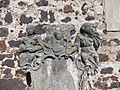
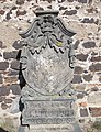
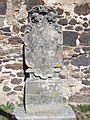
Media in category "Dorfkirche Schmerkendorf"
The following 12 files are in this category, out of 12 total.
-
 Dorfkirche Schmerkendorf IMG 1536.jpg 3,448 × 4,146; 1.52 MB
-
 Kirche Schmerkendorf.JPG 4,752 × 3,168; 6.09 MB
-
 Schmerkendorf Kirche.jpg 6,000 × 4,000; 3.14 MB
-
 SchmerkendorfKirche1.JPG 2,649 × 3,599; 756 KB
-
 SchmerkendorfKirche2.JPG 2,651 × 3,586; 1.25 MB
-
 SchmerkendorfKirche3.JPG 3,489 × 2,634; 1.28 MB
-
 SchmerkendorfKirche4.JPG 3,594 × 2,685; 1.68 MB
-
 SchmerkendorfKirche5.JPG 3,648 × 2,736; 1.99 MB
-
 SchmerkendorfKirche6.JPG 2,707 × 3,538; 1.61 MB
-
 SchmerkendorfKirche7.JPG 2,736 × 3,648; 1.83 MB
-
 SchmerkendorfKirche8.JPG 3,648 × 2,736; 2.13 MB
-
 SchmerkendorfKircheN.JPG 2,864 × 2,144; 1.04 MB


