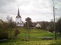
Category:Dorfkirche Niedersteinbach (Penig)
Jump to navigation
Jump to search
| Object location | | View all coordinates using: OpenStreetMap |
|---|
| (Wikidata) |
 | |||||
| Upload media | |||||
| Instance of | |||||
|---|---|---|---|---|---|
| Location | Penig, Mittelsachsen, Saxony, Germany | ||||
| Heritage designation | |||||
 | |||||
Media in category "Dorfkirche Niedersteinbach (Penig)"
The following 4 files are in this category, out of 4 total.
-
 Kirche Niedersteinbach (Penig) (2).jpg 3,000 × 4,000; 1.64 MB
-
 Kirche Niedersteinbach.JPG 2,048 × 1,536; 783 KB
-
 Kirche Niedersteinbach.jpg 1,134 × 2,121; 852 KB
-
 Niedersteinbach (Penig), die Dorfkirche.jpg 2,551 × 1,701; 862 KB
_(2).jpg)

,_die_Dorfkirche.jpg)