Category:Dorfkirche Mahlsdorf
Jump to navigation
Jump to search
| Object location | | View all coordinates using: OpenStreetMap |
|---|
church _gesamt.jpg) | |||||
| Upload media | |||||
| Instance of | |||||
|---|---|---|---|---|---|
| Made from material | |||||
| Location | Mahlsdorf, Marzahn-Hellersdorf, Berlin, Germany | ||||
| Heritage designation | |||||
 | |||||
This is the category of the Berliner Kulturdenkmal (cultural monument) with the ID 09045350 (Wikidata)
|
Deutsch: Die Dorfkirche Mahlsdorf in Berlin-Mahlsdorf dient einer Gemeinde der unierten Evangelischen Kirche Berlin-Brandenburg-Schlesische Oberlausitz.
English: The village church of Mahlsdorf, Berlin, Germany, serves a congregation within the Evangelical Church of Berlin-Brandenburg-Silesian Upper Lusatia, a united Protestant church body of Calvinist, Lutheran and united congregations.
Media in category "Dorfkirche Mahlsdorf"
The following 97 files are in this category, out of 97 total.
-
 2019-06-29 Mahlsdorfer Linde 1.jpg 4,608 × 3,456; 7.59 MB
-
 2019-06-29 Mahlsdorfer Linde 2.jpg 4,608 × 3,456; 7.74 MB
-
 2019-06-29 Mahlsdorfer Linde 3.jpg 4,608 × 3,456; 7.69 MB
-
 2019-06-29 Mahlsdorfer Linde 4.jpg 3,456 × 4,608; 7.93 MB
-
 Altar Kirche Mdf 2012-3-22 ama fec (18).JPG 2,333 × 3,306; 1.33 MB
-
 Berlin-Mahlsdorf, Alte Pfarrkirche, Innenraum.jpg 1,727 × 1,295; 424 KB
-
 Berlin-Mahlsdorf, Alte Pfarrkirche, Orgel, Firmenschild.jpg 982 × 736; 145 KB
-
 Berlin-Mahlsdorf, Alte Pfarrkirche, Orgel, Spieltisch.jpg 2,048 × 1,536; 765 KB
-
 Berlin-Mahlsdorf, Alte Pfarrkirche, Orgel-Prospekt.jpg 1,920 × 1,440; 569 KB
-
 Berlin-Mahlsdorf, Alte Pfarrkirche, Orgel-Register.jpg 1,431 × 1,909; 714 KB
-
 Berlin-Mahlsdorf, Alte Pfarrkirche.jpg 1,967 × 1,474; 1.4 MB
-
 Dorfkirche M'df 2012-05-03 ama fec Friedhof Grab schrobsdorff.JPG 2,560 × 1,920; 1.23 MB
-
 Dorfkirche M'df 2012-05-03 ama fec Gemeindehaus.JPG 2,560 × 1,920; 1.12 MB
-
 Dorfkirche M'df 2012-05-03 ama fec Kanzelbild1.JPG 1,920 × 2,560; 1.07 MB
-
 Dorfkirche M'df 2012-05-03 ama fec Kanzelbild2.JPG 1,920 × 2,560; 1.07 MB
-
 Dorfkirche M'df 2012-05-03 ama fec Kanzelbild3.JPG 1,867 × 2,597; 1.07 MB
-
 Dorfkirche M'df 2012-05-03 ama fec Linde (1).JPG 2,560 × 1,920; 1.2 MB
-
 Dorfkirche M'df 2012-05-03 ama fec Turm (1).JPG 1,920 × 2,560; 897 KB
-
 Dorfkirche M'df 2012-05-03 ama fec Wetterhahn und Knauf.JPG 1,234 × 1,886; 570 KB
-
 Dorfkirche Mahlsdorf 02.jpg 533 × 800; 268 KB
-
 Drei Glocken (Montage) Kirche Mdf ama fec.jpg 10,062 × 3,752; 15.47 MB
-
 Gedenkstein Hönower Str 15 (Mahld) Kriesopfer.jpg 3,916 × 2,842; 10.87 MB
-
 Gedenktafel Hönower Str 13 (Mahld) Carl Julius Gustav Bausdorf.jpg 3,037 × 1,578; 4.01 MB
-
 Gedenktafel Hönower Str 13 (Mahld) Ernst Julius Hermann Grunow.jpg 3,473 × 1,897; 5.58 MB
-
 Gedenktafel Hönower Str 13 (Mahld) Gustav August Gottfried Lange.jpg 2,984 × 1,663; 4.47 MB
-
 Gedenktafel Hönower Str 13 (Mahld) Hermann Götze.jpg 1,884 × 1,121; 1.8 MB
-
 Gedenktafel Hönower Str 13 (Mahld) Hermann Schrobsdorff.jpg 2,600 × 2,295; 5.2 MB
-
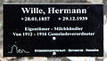 Gedenktafel Hönower Str 13 (Mahld) Hermann Wille.jpg 2,505 × 1,450; 2.78 MB
-
 Gedenktafel Hönower Str 13 (Mahld) Johannes Paul Friedrich Rohrlach.jpg 3,172 × 1,538; 4.34 MB
-
 Gedenktafel Hönower Str 13 (Mahld) Josef Gobes.jpg 2,857 × 1,572; 3.84 MB
-
 Gedenktafel Hönower Str 13 (Mahld) Otto Anders.jpg 3,253 × 2,015; 5.17 MB
-
 Gedenktafel Hönower Str 13 (Mahld) Otto Karl.jpg 3,346 × 1,853; 5.28 MB
-
 Gedenktafel Hönower Str 13 (Mahld) Wilhelm Buchholz.jpg 2,705 × 1,495; 2.84 MB
-
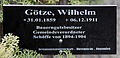 Gedenktafel Hönower Str 13 (Mahld) Wilhelm Götze.jpg 3,378 × 1,622; 3.89 MB
-
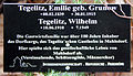 Gedenktafel Hönower Str 13 (Mahld) Wilhelm Tegelitz.jpg 3,333 × 1,930; 5.68 MB
-
 Gedenktafel Hönower Str 13 (Mahld) Wilhelm Toussaint.jpg 3,226 × 1,721; 4.53 MB
-
 Grab Schrobsdorff Kirche Mdf 2012-3-22 ama fec (73s).jpg 3,040 × 2,795; 2.67 MB
-
 Grabstätte Hönower Str 13 (Mahld) Carl Julius Gustav Bausdorf.jpg 3,605 × 2,560; 7.61 MB
-
 Grabstätte Hönower Str 13 (Mahld) Ernst Julius Hermann Grunow.jpg 4,378 × 3,051; 13.09 MB
-
 Grabstätte Hönower Str 13 (Mahld) Gustav August Gottfried Lange.jpg 4,378 × 3,051; 12.68 MB
-
 Grabstätte Hönower Str 13 (Mahld) Hermann Götze.jpg 2,508 × 3,991; 8.28 MB
-
 Grabstätte Hönower Str 13 (Mahld) Hermann Schrobsdorff.jpg 3,308 × 4,962; 13.86 MB
-
 Grabstätte Hönower Str 13 (Mahld) Hermann Wille.jpg 3,311 × 2,869; 9.98 MB
-
 Grabstätte Hönower Str 13 (Mahld) Johannes Paul Friedrich Rohrlach.jpg 1,992 × 4,431; 8.05 MB
-
 Grabstätte Hönower Str 13 (Mahld) Josef Gobes.jpg 3,181 × 2,617; 6.61 MB
-
 Grabstätte Hönower Str 13 (Mahld) Karl Otto.jpg 3,346 × 2,991; 8.4 MB
-
 Grabstätte Hönower Str 13 (Mahld) Otto Anders.jpg 3,382 × 3,322; 11.62 MB
-
 Grabstätte Hönower Str 13 (Mahld) Wilhelm Buchholz.jpg 3,091 × 2,907; 9.22 MB
-
 Grabstätte Hönower Str 13 (Mahld) Wilhelm Götze.jpg 2,246 × 4,370; 7.31 MB
-
 Grabstätte Hönower Str 13 (Mahld) Wilhelm Tegelitz.jpg 3,405 × 3,454; 9.97 MB
-
 Grabstätte Hönower Str 13 (Mahld) Wilhelm Toussaint.jpg 3,226 × 3,971; 12.96 MB
-
 Kirche Mdf 2012-3-22 ama fec (1).JPG 2,991 × 2,277; 1.93 MB
-
 Kirche Mdf 2012-3-22 ama fec (10).JPG 2,420 × 3,243; 2.23 MB
-
 Kirche Mdf 2012-3-22 ama fec (13) gesamt.jpg 3,998 × 2,842; 2.56 MB
-
 Kirche Mdf 2012-3-22 ama fec (15).JPG 3,159 × 2,583; 1.86 MB
-
 Kirche Mdf 2012-3-22 ama fec (16).JPG 3,264 × 2,448; 1.37 MB
-
 Kirche Mdf 2012-3-22 ama fec (17).JPG 2,448 × 3,150; 1.32 MB
-
 Kirche Mdf 2012-3-22 ama fec (19).JPG 3,264 × 2,448; 1.37 MB
-
 Kirche Mdf 2012-3-22 ama fec (20).JPG 3,264 × 2,448; 1.2 MB
-
 Kirche Mdf 2012-3-22 ama fec (21).JPG 2,448 × 3,264; 1.33 MB
-
 Kirche Mdf 2012-3-22 ama fec (23).JPG 3,213 × 2,401; 1.39 MB
-
 Kirche Mdf 2012-3-22 ama fec (24).JPG 2,407 × 3,240; 1.35 MB
-
 Kirche Mdf 2012-3-22 ama fec (25).JPG 2,279 × 3,264; 1.08 MB
-
 Kirche Mdf 2012-3-22 ama fec (26).JPG 2,091 × 2,871; 950 KB
-
 Kirche Mdf 2012-3-22 ama fec (28).JPG 1,893 × 3,258; 926 KB
-
 Kirche Mdf 2012-3-22 ama fec (29).JPG 2,448 × 3,264; 1.4 MB
-
 Kirche Mdf 2012-3-22 ama fec (3) gesamt.jpg 3,013 × 2,313; 1.93 MB
-
 Kirche Mdf 2012-3-22 ama fec (32).JPG 1,077 × 3,264; 870 KB
-
 Kirche Mdf 2012-3-22 ama fec (34).JPG 3,264 × 2,448; 1.56 MB
-
 Kirche Mdf 2012-3-22 ama fec (35).JPG 2,448 × 3,264; 3.4 MB
-
 Kirche Mdf 2012-3-22 ama fec (36).JPG 2,167 × 3,365; 1.23 MB
-
 Kirche Mdf 2012-3-22 ama fec (37s).jpg 3,090 × 2,048; 795 KB
-
 Kirche Mdf 2012-3-22 ama fec (38).JPG 3,238 × 2,407; 1.06 MB
-
 Kirche Mdf 2012-3-22 ama fec (39).JPG 2,079 × 3,258; 990 KB
-
 Kirche Mdf 2012-3-22 ama fec (4).JPG 2,215 × 3,098; 1.87 MB
-
 Kirche Mdf 2012-3-22 ama fec (40).JPG 2,349 × 3,108; 1,014 KB
-
 Kirche Mdf 2012-3-22 ama fec (41).JPG 2,459 × 3,324; 1.14 MB
-
 Kirche Mdf 2012-3-22 ama fec (45).JPG 2,919 × 2,425; 965 KB
-
 Kirche Mdf 2012-3-22 ama fec (49).JPG 3,264 × 2,448; 1.5 MB
-
 Kirche Mdf 2012-3-22 ama fec (5).JPG 3,264 × 2,448; 999 KB
-
 Kirche Mdf 2012-3-22 ama fec (50).JPG 3,264 × 2,448; 1.24 MB
-
 Kirche Mdf 2012-3-22 ama fec (57).JPG 3,264 × 2,448; 1.42 MB
-
 Kirche Mdf 2012-3-22 ama fec (59)nördlAltarfenster.jpg 1,581 × 5,630; 1.7 MB
-
 Kirche Mdf 2012-3-22 ama fec (61).JPG 2,193 × 3,075; 1.02 MB
-
 Kirche Mdf 2012-3-22 ama fec (66).JPG 2,139 × 2,661; 1.04 MB
-
 Kirche Mdf 2012-3-22 ama fec (7).JPG 3,180 × 2,413; 2.1 MB
-
 Kirche Mdf 2012-3-22 ama fec (70).JPG 3,056 × 2,382; 1.58 MB
-
 Kirche Mdf 2012-3-22 ama fec (71markiert).JPG 2,435 × 3,275; 1.49 MB
-
 Kirche Mdf 2012-3-22 ama fec (8).JPG 3,313 × 2,442; 2.01 MB
-
 Kirche Mdf grGlocke 2012-3-22 ama fec (54).JPG 2,753 × 2,800; 1.25 MB
-
 Kirche Mdf klGlocke 2012-3-22 ama fec (52).JPG 2,677 × 2,607; 1.09 MB
-
 Kirche Mdf Marienglocke 2012-3-22 ama fec (53).jpg 1,609 × 2,151; 711 KB
-
 Kirche Mdf Marienglocke Krone 2012-3-22 ama fec (56).JPG 3,264 × 2,448; 1.69 MB
-
 Kirche Mdf Nordfenster chor 2012-3-22 amafec.jpg 2,699 × 2,694; 1.54 MB
-
 Kirche Mdf Südfenster chor 2012-3-22 ama fec.jpg 3,072 × 2,690; 1.63 MB
-
 Pfarr+gemeindehaus Mdf 2012-3-22 ama fec.JPG 3,264 × 2,448; 1.83 MB
-


.JPG)


.JPG)
.JPG)


_Kriesopfer.jpg)
_Carl_Julius_Gustav_Bausdorf.jpg)
_Ernst_Julius_Hermann_Grunow.jpg)
_Gustav_August_Gottfried_Lange.jpg)
_Hermann_G%C3%B6tze.jpg)
_Hermann_Schrobsdorff.jpg)
_Hermann_Wille.jpg)
_Johannes_Paul_Friedrich_Rohrlach.jpg)
_Josef_Gobes.jpg)
_Otto_Anders.jpg)
_Otto_Karl.jpg)
_Wilhelm_Buchholz.jpg)
_Wilhelm_G%C3%B6tze.jpg)
_Wilhelm_Tegelitz.jpg)
_Wilhelm_Toussaint.jpg)
.jpg)
_Carl_Julius_Gustav_Bausdorf.jpg)
_Ernst_Julius_Hermann_Grunow.jpg)
_Gustav_August_Gottfried_Lange.jpg)
_Hermann_G%C3%B6tze.jpg)
_Hermann_Schrobsdorff.jpg)
_Hermann_Wille.jpg)
_Johannes_Paul_Friedrich_Rohrlach.jpg)
_Josef_Gobes.jpg)
_Karl_Otto.jpg)
_Otto_Anders.jpg)
_Wilhelm_Buchholz.jpg)
_Wilhelm_G%C3%B6tze.jpg)
_Wilhelm_Tegelitz.jpg)
_Wilhelm_Toussaint.jpg)
.JPG)
.JPG)
.JPG)
.JPG)
.JPG)
.JPG)
.JPG)
.JPG)
.JPG)
.JPG)
.JPG)
.JPG)
.JPG)
.JPG)
_gesamt.jpg)
.JPG)
.JPG)
.JPG)
.jpg)
.JPG)
.JPG)
.JPG)
.JPG)
.JPG)
.JPG)
.JPG)
.JPG)
.JPG)
.JPG)
.JPG)
.JPG)
.JPG)
.JPG)
.JPG)
.JPG)
.JPG)
.JPG)
.jpg)
.JPG)


_Kirche_Mdf_ama_fec.jpg)
.JPG)
n%C3%B6rdlAltarfenster.jpg)