Category:Dorfkirche Lugau
Jump to navigation
Jump to search
| Object location | | View all coordinates using: OpenStreetMap |
|---|
church building in Brandenburg state, Germany .jpg) | |||||
| Upload media | |||||
| Instance of | |||||
|---|---|---|---|---|---|
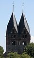
| Location | Lugau, Doberlug-Kirchhain, Elbe-Elster District, Brandenburg, Germany | ||||
| Street address |
| ||||
| Heritage designation | |||||
| Inception |
| ||||
| Religion or worldview | |||||
 | |||||
This is the category of the Brandenburger Baudenkmal (cultural heritage monument) with the ID 09135070 (Wikidata)
|
Media in category "Dorfkirche Lugau"
This category contains only the following file.
-
 Church of Lugau (Doberlug-Kirchhain).jpg 854 × 1,464; 242 KB
Categories:
- Churches in Doberlug-Kirchhain
- Cultural heritage monuments in Doberlug-Kirchhain
- Lugau (Doberlug-Kirchhain)
- Churches in Kirchenkreis Niederlausitz
- Lutheran churches in Brandenburg
- Twin church towers in Germany
- Fieldstone churches in Brandenburg
- 13th-century churches in Brandenburg
- Village churches in Germany