Category:Dorfkirche Ließen
Jump to navigation
Jump to search
| Object location | | View all coordinates using: OpenStreetMap |
|---|
This is the category of the Brandenburger Baudenkmal (cultural heritage monument) with the ID 09105386 (Wikidata)
|
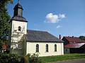
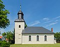
church building in Ließen, Germany  | |||||
| Upload media | |||||
| Instance of | |||||
|---|---|---|---|---|---|
| Location | Baruth/Mark, Teltow-Fläming District, Brandenburg, Germany | ||||
| Heritage designation | |||||
 | |||||
Media in category "Dorfkirche Ließen"
The following 27 files are in this category, out of 27 total.
-
 Dorfkirche Ließen - Deutschland - panoramio.jpg 2,592 × 1,944; 1.93 MB
-
 Dorfkirche Ließen - Germany - panoramio.jpg 2,592 × 1,944; 1.56 MB
-
 Dorfkirche ließen 2019-08-04 (1).jpg 4,896 × 3,672; 6.7 MB
-
 Dorfkirche Ließen 2019-08-04 (2).jpg 4,896 × 3,672; 6.04 MB
-
 Dorfkirche ließen 2019-08-04 (3).jpg 4,896 × 3,672; 4.97 MB
-
 Dorfkirche ließen 2019-08-04 (4).jpg 4,896 × 3,672; 4.14 MB
-
 Dorfkirche ließen 2019-08-04 (5).jpg 4,896 × 3,672; 5.48 MB
-
 Dorfkirche Ließen Altar.jpg 4,032 × 3,024; 1.61 MB
-
 Dorfkirche Ließen Denkmal Gefallene Weltkriege.jpg 4,032 × 3,024; 3.12 MB
-
 Dorfkirche Ließen Kirchenschiff Nordansicht.jpg 4,032 × 3,024; 2.15 MB
-
 Dorfkirche Ließen Kirchenschiff Südansicht.jpg 4,032 × 3,024; 1.78 MB
-
 Dorfkirche Ließen Nordansicht.jpg 4,032 × 3,024; 3.25 MB
-
 Dorfkirche Ließen Nordostansicht.jpg 4,032 × 3,024; 1.73 MB
-
 Dorfkirche Ließen Orgelempore.jpg 4,032 × 3,024; 2.09 MB
-
 Dorfkirche Ließen Ostansicht.jpg 3,024 × 4,032; 1.71 MB
-
 Dorfkirche Ließen Südostansicht Oktober 2019.jpg 4,032 × 3,024; 2.56 MB
-
 Dorfkirche Ließen Südostansicht.jpg 4,032 × 3,024; 2.55 MB
-
 Dorfkirche Ließen Taufengel.jpg 3,024 × 4,032; 2.07 MB
-
 Dorfkirche Ließen Westturm Südostansicht.jpg 3,024 × 4,032; 1.7 MB
-
 Dorfkirche Ließen Westturm Westansicht.jpg 3,024 × 4,032; 2.96 MB
-
 Liessen 03.jpg 5,352 × 3,349; 13.52 MB
-
 Liessen Dorfkirche 03.jpg 5,351 × 3,453; 11.51 MB
-
 Liessen Dorfkirche 04.jpg 4,575 × 3,573; 9.15 MB
-
 Liessen Dorfkirche 06.jpg 3,360 × 5,143; 10.96 MB
-
 Naturdenkmal linde ließen 2019-08-04 (3).jpg 4,896 × 3,672; 6.2 MB
-
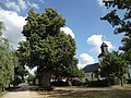 Naturdenkmal linde ließen 2019-08-04 (4).jpg 4,896 × 3,672; 5.93 MB
-
 Naturdenkmal linde ließen 2019-08-04 (5).jpg 4,896 × 3,672; 5.8 MB

.jpg)
.jpg)
.jpg)
.jpg)
.jpg)


.jpg)
.jpg)
.jpg)