Category:Dorfkirche Legde
Jump to navigation
Jump to search
| Object location | | View all coordinates using: OpenStreetMap |
|---|
This is the category of the Brandenburger Baudenkmal (cultural heritage monument) with the ID 09160236 (Wikidata)
|
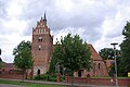
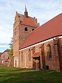
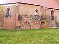
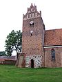
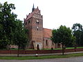
church building in Legde/Quitzöbel, Germany  | |||||
| Upload media | |||||
| Instance of | |||||
|---|---|---|---|---|---|
| Location | Legde/Quitzöbel, Prignitz District, Brandenburg, Germany | ||||
 | |||||
English: Church in Legde, Legde/Quitzöbel municipality, Prignitz district, Brandenburg state, Germany
Deutsch: Kirche in Legde, Gemeinde Legde/Quitzöbel, Landkreis Prignitz, Land Brandenburg, Deutschland.
Français : Église de Legde, commune de Legde/Quitzöbel, arrondissement Prignitz, état fédéral de Brandebourg, Allemagne
Media in category "Dorfkirche Legde"
The following 11 files are in this category, out of 11 total.
-
 Kirche Legde Quitzöbel.jpg 3,872 × 2,592; 4.41 MB
-
 L1050062 Legde.jpg 3,634 × 2,903; 7.4 MB
-
 L1050063 Legde.JPG 3,000 × 4,000; 4.97 MB
-
 L1050064 Legde.JPG 3,000 × 4,000; 5.01 MB
-
 L1050065 Legde.JPG 3,000 × 4,000; 4.86 MB
-
 L1050066 Legde.JPG 4,000 × 3,000; 5.19 MB
-
 L1050067 Legde.JPG 3,000 × 4,000; 4.79 MB
-
 Legde Dorfkirche 3.JPG 4,000 × 3,000; 3.19 MB
-
 Legde Dorfkirche 6.JPG 3,000 × 4,000; 2.89 MB
-
 Legde Dorfkirche 7.JPG 3,000 × 4,000; 3.04 MB
-
 Legde Dorfkirche 8.JPG 4,000 × 3,000; 3.09 MB


