Category:Dorfkirche Klein Kienitz
Jump to navigation
Jump to search
| Object location | | View all coordinates using: OpenStreetMap |
|---|
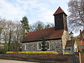
church church building in Brandenburg state, Germany | |||||
| Upload media | |||||
| Instance of | |||||
|---|---|---|---|---|---|
| Location | Klein Kienitz, Rangsdorf, Teltow-Fläming District, Brandenburg, Germany | ||||
| Heritage designation | |||||
 | |||||
This is the category of the Brandenburger Baudenkmal (cultural heritage monument) with the ID 09105477 (Wikidata)
|
Media in category "Dorfkirche Klein Kienitz"
The following 9 files are in this category, out of 9 total.
-
 Dorfkirche Klein Kienitz - Germany - panoramio.jpg 1,944 × 2,592; 2.37 MB
-
 Dorfkirche Klein Kienitz 01.jpg 3,648 × 2,736; 3.66 MB
-
 Dorfkirche Klein Kienitz Nordansicht.jpg 2,592 × 1,944; 2.05 MB
-
 Dorfkirche Klein Kienitz Nordostansicht.jpg 2,592 × 1,944; 2.88 MB
-
 Dorfkirche Klein Kienitz Suedostansicht.jpg 2,592 × 1,944; 3.1 MB
-
 Dorfkirche Klein Kienitz Suedportal.jpg 2,592 × 1,944; 3.62 MB
-
 Dorfkirche Klein Kienitz Suedwestansicht.jpg 2,592 × 1,944; 2.88 MB
-
 Dorfkirche Klein Kienitz Vorhalle.jpg 1,944 × 2,592; 1.9 MB
-
 Dorfkirche Klein Kienitz Westturm.jpg 1,944 × 2,592; 1.27 MB


