Category:Donyatt
Jump to navigation
Jump to search
English: Donyatt is a village and civil parish in Somerset, England, situated at the source of the River Isle north of Chard in the South Somerset district. The village has a population of 368.
village and civil parish in Somerset, United Kingdom  | |||||
| Upload media | |||||
| Instance of | |||||
|---|---|---|---|---|---|
| Location | South Somerset, Somerset, South West England, England | ||||
 | |||||
Subcategories
This category has the following 4 subcategories, out of 4 total.
Media in category "Donyatt"
The following 69 files are in this category, out of 69 total.
-
 A303 heading west - geograph.org.uk - 6262012.jpg 1,024 × 684; 174 KB
-
 A358 approaching Horton Cross - geograph.org.uk - 1471192.jpg 640 × 415; 181 KB
-
 A358 approaching Peasmarsh - geograph.org.uk - 4107951.jpg 2,863 × 1,904; 2.94 MB
-
 A358 junction - geograph.org.uk - 4107959.jpg 1,600 × 1,017; 395 KB
-
 Almshouses and church at Donyatt - geograph.org.uk - 2753175.jpg 3,888 × 2,592; 1.06 MB
-
 Almshouses and churchyard at Donyatt - geograph.org.uk - 2753179.jpg 3,888 × 2,592; 1.08 MB
-
 Almshouses, Donyatt - geograph.org.uk - 5024900.jpg 1,024 × 824; 246 KB
-
 Barrier on Watery Lane - geograph.org.uk - 4803179.jpg 1,024 × 792; 223 KB
-
 Bridge over Whitney Hill - geograph.org.uk - 2930843.jpg 800 × 601; 251 KB
-
 Bridge under the A303 - geograph.org.uk - 3820149.jpg 1,024 × 768; 226 KB
-
 Broom's Lane Track - geograph.org.uk - 3823251.jpg 640 × 480; 85 KB
-
 Broom's Lane, Horton - geograph.org.uk - 3820166.jpg 1,024 × 768; 207 KB
-
 Building work at Peasemarsh Farm - geograph.org.uk - 4803198.jpg 1,024 × 768; 213 KB
-
 Chard Branch - geograph.org.uk - 2473563.jpg 640 × 480; 164 KB
-
 Chard Branch - geograph.org.uk - 2473566.jpg 640 × 480; 174 KB
-
 Chard branch line, Donyatt - geograph.org.uk - 2473546.jpg 640 × 480; 107 KB
-
 Clayhanger Common - geograph.org.uk - 481655.jpg 640 × 470; 107 KB
-
 Crock Street - geograph.org.uk - 4569857.jpg 640 × 428; 70 KB
-
 Crock Street Farm - geograph.org.uk - 4746394.jpg 1,024 × 768; 209 KB
-
 Depth gauge, Stibbear Lane - geograph.org.uk - 2473536.jpg 640 × 480; 108 KB
-
 Disused railway cycleway, Donyatt - geograph.org.uk - 156980.jpg 640 × 480; 135 KB
-
 Disused railway. Ilminster to Donyatt - geograph.org.uk - 2753209.jpg 3,888 × 2,592; 1.52 MB
-
 Donyatt from Park Lane - geograph.org.uk - 2753220.jpg 3,888 × 2,592; 986 KB
-
 Donyatt Halt - geograph.org.uk - 2473553.jpg 640 × 480; 142 KB
-
 Donyatt Halt - geograph.org.uk - 2753212.jpg 3,888 × 2,592; 1.2 MB
-
 Donyatt Halt - geograph.org.uk - 2753215.jpg 2,592 × 3,888; 4.38 MB
-
 Donyatt Halt.jpg 598 × 433; 59 KB
-
 Donyatt, Somerset, Blessed Virgin Mary - geograph.org.uk - 5914618.jpg 3,456 × 4,608; 5.18 MB
-
 Field, Donyatt - geograph.org.uk - 2473530.jpg 640 × 480; 136 KB
-
 Fields at Four Lanes Farm - geograph.org.uk - 4802621.jpg 1,024 × 768; 220 KB
-
 Fields, Crock Street - geograph.org.uk - 2473043.jpg 640 × 480; 94 KB
-
 Footbridge on the River Isle - geograph.org.uk - 2753182.jpg 3,888 × 2,592; 2.2 MB
-
 Footbridge over the River Isle - geograph.org.uk - 2753187.jpg 3,888 × 2,592; 6.75 MB
-
 Footpath through Rose Mills - geograph.org.uk - 2753188.jpg 2,592 × 3,888; 984 KB
-
 Former railway halt at Donyatt - geograph.org.uk - 5024880.jpg 1,024 × 768; 280 KB
-
 Grassland, Crock Street - geograph.org.uk - 2473044.jpg 640 × 480; 90 KB
-
 Haines Farm - geograph.org.uk - 4746959.jpg 1,024 × 781; 189 KB
-
 Helliar's Copse and Ilminster - geograph.org.uk - 3055665.jpg 3,888 × 2,592; 1.23 MB
-
 Here be mud - geograph.org.uk - 3820932.jpg 1,024 × 768; 239 KB
-
 Hillcombe Farm - geograph.org.uk - 5097010.jpg 1,024 × 854; 201 KB
-
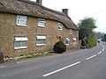
 Houses near Donyatt, on the A358 - geograph.org.uk - 5024909.jpg 1,024 × 852; 159 KB
-
 Interior, St Mary's church, Donyatt - geograph.org.uk - 4108327.jpg 3,634 × 2,407; 4.36 MB
-
 Minor road approaching Crock Street - geograph.org.uk - 2473049.jpg 640 × 480; 131 KB
-
 Old schoolhouse at Donyatt - geograph.org.uk - 2753180.jpg 3,888 × 2,592; 986 KB
-
 Park Lane - geograph.org.uk - 5024892.jpg 1,024 × 828; 234 KB
-
 Post Medieval South Somerset Donyatt Jug (FindID 214991).jpg 1,134 × 1,734; 1.07 MB
-
 Railway bridge at Donyatt - geograph.org.uk - 5024884.jpg 640 × 480; 134 KB
-
 Remains of Chard Canal near Dowlish Ford - geograph.org.uk - 156917.jpg 640 × 480; 174 KB
-
 Road closure at Crock Street - geograph.org.uk - 3821171.jpg 1,024 × 768; 272 KB
-
 St Mary's church, Donyatt - geograph.org.uk - 4108315.jpg 3,188 × 4,750; 5.59 MB
-
 St Mary's Church, Donyatt, from the north-west - geograph.org.uk - 4075251.jpg 768 × 1,024; 491 KB
-
 Stibbear Farm - geograph.org.uk - 4746941.jpg 1,024 × 804; 266 KB
-
 Stibbear Lane - geograph.org.uk - 4746916.jpg 1,024 × 795; 207 KB
-
 Tank defences at Donyatt Halt - geograph.org.uk - 2753217.jpg 3,888 × 2,592; 1.02 MB
-
 Thatched cottage, Donyatt - geograph.org.uk - 157018.jpg 640 × 480; 101 KB
-
 The George Inn, Donyatt - geograph.org.uk - 1279084.jpg 640 × 480; 191 KB
-
 The George Inn, Donyatt - geograph.org.uk - 4746972.jpg 1,024 × 798; 168 KB
-
 The River Isle at Donyatt - geograph.org.uk - 1175246.jpg 640 × 480; 132 KB
-
 The River Isle at Donyatt - geograph.org.uk - 1175247.jpg 640 × 480; 107 KB
-

-
 Valve and Hydrant - geograph.org.uk - 4569881.jpg 640 × 428; 98 KB
-
 Weir on the River Isle - geograph.org.uk - 2753184.jpg 3,888 × 2,592; 6.32 MB
-
 WW2 Tank defences at Donyatt Halt - geograph.org.uk - 5024886.jpg 1,024 × 837; 302 KB
-
 Chard, Hornsbury Watermill - geograph.org.uk - 154705.jpg 640 × 427; 181 KB
-
 Church tower and almshouse, Donyatt - geograph.org.uk - 157012.jpg 480 × 640; 104 KB
-
 Granary, Park Farm - geograph.org.uk - 156998.jpg 640 × 480; 110 KB
-
 Herne Hill - geograph.org.uk - 156923.jpg 640 × 480; 88 KB
-
 Ilminster, Horton Cross - geograph.org.uk - 352524.jpg 640 × 427; 159 KB
-
 Widgery Farm - geograph.org.uk - 245030.jpg 640 × 480; 102 KB


.jpg)


