Category:Donington, Lincolnshire
Jump to navigation
Jump to search
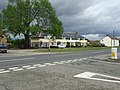
English: Donington is a village lying north of the market town of Spalding, on the A152, and bypassed by the A52. It is the birthplace of the explorer Matthew Flinders. His former school, the Thomas Cowley High School is also the alma mater of Lord (Donald) Bruce of Donington, a Labour peer who helped establish the NHS.
village and civil parish in Lincolnshire, England, UK  | |||||
| Upload media | |||||
| Instance of | |||||
|---|---|---|---|---|---|
| Location | South Holland, Lincolnshire, East Midlands, England | ||||
| Population |
| ||||
| Said to be the same as | Donington (Wikimedia duplicated page, civil parish) | ||||
 | |||||
Subcategories
This category has the following 17 subcategories, out of 17 total.
Media in category "Donington, Lincolnshire"
The following 142 files are in this category, out of 142 total.
-
 A52 Bypassing Donington - geograph.org.uk - 4950400.jpg 640 × 427; 370 KB
-
 A52 lay-by - geograph.org.uk - 5551557.jpg 640 × 480; 70 KB
-
 A52 lay-by - geograph.org.uk - 5551560.jpg 640 × 480; 82 KB
-
 A52 near Bicker, Donington Road - geograph.org.uk - 4950379.jpg 640 × 480; 354 KB
-
 A52 westbound - geograph.org.uk - 5551567.jpg 640 × 368; 45 KB
-
 A52, Bicker Road - geograph.org.uk - 4950389.jpg 640 × 427; 371 KB
-
 A52, Bridge End Causeway - geograph.org.uk - 4956188.jpg 640 × 427; 450 KB
-
 A52, Entrance to Layby West of Donington - geograph.org.uk - 4956184.jpg 640 × 427; 391 KB
-
 A52, West of Donington - geograph.org.uk - 4956180.jpg 640 × 480; 424 KB
-
 Acres of glass - geograph.org.uk - 434325.jpg 640 × 480; 59 KB
-
 Allotments in Church Street, Donington - geograph.org.uk - 4943947.jpg 640 × 480; 279 KB
-

-
 Barn, Ing Farm - geograph.org.uk - 3619802.jpg 640 × 480; 77 KB
-
 Beech Grove, Donington - geograph.org.uk - 3619810.jpg 640 × 480; 59 KB
-
 Bend in Bull's Bank - geograph.org.uk - 2743121.jpg 1,280 × 960; 389 KB
-
 Bicker Road (A52) from Junction with Day's Lane - geograph.org.uk - 2756121.jpg 1,175 × 821; 967 KB
-
 Bicker Road - geograph.org.uk - 433086.jpg 640 × 480; 80 KB
-
 Bicker Road - geograph.org.uk - 437034.jpg 640 × 480; 71 KB
-
 Bicker Road, Donington - geograph.org.uk - 4950396.jpg 640 × 427; 355 KB
-
 Brussels sprouts in spring sunshine near Donington - geograph.org.uk - 4392219.jpg 4,320 × 3,240; 5.56 MB
-
 Bull's Bank, Donington South Ing - geograph.org.uk - 3619783.jpg 640 × 480; 60 KB
-
 Bulrushes bursting open - geograph.org.uk - 4163541.jpg 4,320 × 3,240; 6.14 MB
-
 Cabbage field - geograph.org.uk - 3619878.jpg 640 × 480; 123 KB
-
 Church End, Quadring, aerial 2018 - geograph.org.uk - 5935096.jpg 683 × 1,024; 146 KB
-
 Church Lane Gate Box - geograph.org.uk - 2845149.jpg 640 × 393; 58 KB
-
 Churchyard path, Donington - geograph.org.uk - 6240479.jpg 1,024 × 768; 288 KB
-
 Converted chapel - geograph.org.uk - 4943942.jpg 640 × 480; 291 KB
-
 Crop field and drain near Donington - geograph.org.uk - 4546418.jpg 640 × 421; 71 KB
-
 Crop field off Eaudike Road - geograph.org.uk - 3619875.jpg 640 × 480; 76 KB
-
 Crop field south of Washdike Lane - geograph.org.uk - 3619855.jpg 640 × 480; 66 KB
-
 Crop field west of Donington - geograph.org.uk - 4548285.jpg 640 × 436; 44 KB
-
 Crop field, Donington South Ing - geograph.org.uk - 3619780.jpg 640 × 480; 88 KB
-
 Donington - panoramio (2).jpg 2,816 × 2,112; 2.29 MB
-
 Donington - panoramio.jpg 2,816 × 2,112; 2.59 MB
-
 Donington High Bridge and Gauging Station - geograph.org.uk - 2752130.jpg 1,280 × 853; 486 KB
-
 Donington North Fen - geograph.org.uk - 6240339.jpg 1,024 × 768; 259 KB
-
 Donington South Ing - geograph.org.uk - 4163591.jpg 4,320 × 3,240; 5.5 MB
-
 Donington Westdale - geograph.org.uk - 6240473.jpg 1,024 × 768; 207 KB
-
 St Mary and the Holy Rood at Dawn - geograph.org.uk - 355762.jpg 640 × 480; 32 KB
-
 Eagerly pointing sign - geograph.org.uk - 472126.jpg 533 × 640; 92 KB
-
 Eaudike Farm - geograph.org.uk - 3619877.jpg 640 × 480; 94 KB
-
 Eaudike Road - geograph.org.uk - 3619876.jpg 640 × 480; 70 KB
-
 Eaudike Road - geograph.org.uk - 3619880.jpg 640 × 480; 73 KB
-
 Farm buildings on the A52 - geograph.org.uk - 4943953.jpg 640 × 481; 222 KB
-
 Farm track and Manure heap, Donington Westdale - geograph.org.uk - 2752303.jpg 1,280 × 853; 457 KB
-
 Farm track at Shoff Hills - geograph.org.uk - 6240463.jpg 1,024 × 768; 263 KB
-
 Farm track at the end of Shoff road - geograph.org.uk - 3228971.jpg 3,088 × 2,056; 1.37 MB
-
 Farmland near Donington South Ing - geograph.org.uk - 3619792.jpg 640 × 480; 73 KB
-
 Farmland, North Ing - geograph.org.uk - 4546412.jpg 640 × 425; 40 KB
-
 Farmland, Washdyke Farm - geograph.org.uk - 3619861.jpg 640 × 480; 64 KB
-
 Farmland, Wikes Manor Farm - geograph.org.uk - 3619869.jpg 640 × 480; 76 KB
-
 Farmland, Wykes Farm - geograph.org.uk - 3619873.jpg 640 × 480; 64 KB
-
 Fenland Sunset - geograph.org.uk - 440412.jpg 640 × 480; 40 KB
-
 Field of canary grass - geograph.org.uk - 6241099.jpg 1,024 × 743; 203 KB
-
 Field of Cauliflowers near Northorpe Dairy Farm - geograph.org.uk - 4223645.jpg 4,320 × 3,240; 5.7 MB
-
 Flat farmland, North Ing - geograph.org.uk - 4548278.jpg 640 × 449; 40 KB
-
 Flinders plaque - geograph.org.uk - 669501.jpg 640 × 427; 81 KB
-
 Flinders Road - geograph.org.uk - 6345504.jpg 599 × 640; 99 KB
-
 Flinders Road - geograph.org.uk - 6345506.jpg 480 × 640; 47 KB
-
 Footbridge over Hammond Beck - geograph.org.uk - 2753304.jpg 1,280 × 853; 480 KB
-
 Footpath in Gibbet Fen - geograph.org.uk - 6240453.jpg 1,024 × 768; 170 KB
-
 Footpath off Church Lane, Donington - geograph.org.uk - 6240483.jpg 1,024 × 768; 243 KB
-
 Frozen Drain off Wykes Lane - geograph.org.uk - 2766611.jpg 682 × 1,024; 236 KB
-

-
 Glass Horizon - geograph.org.uk - 434385.jpg 640 × 377; 44 KB
-

-
 Goxhill Avenue - geograph.org.uk - 2654574.jpg 640 × 427; 77 KB
-
 Hammond Beck - geograph.org.uk - 2753307.jpg 682 × 1,024; 194 KB
-
 Harvesting potatoes, Donington South Ing - geograph.org.uk - 4163741.jpg 4,188 × 3,056; 5.03 MB
-

-
 High Street (A152), Donington - geograph.org.uk - 3619834.jpg 640 × 480; 65 KB
-
 High Street Donington - geograph.org.uk - 2458082.jpg 640 × 480; 64 KB
-
 High Street, Donington. - geograph.org.uk - 434482.jpg 640 × 480; 59 KB
-
 Houses on Malting Lane - geograph.org.uk - 3619817.jpg 640 × 480; 71 KB
-
 Junction of Shoff Drove and A52 - geograph.org.uk - 2757486.jpg 1,198 × 782; 744 KB
-
 Layby Exit on A52, near Hammond Beck Bridge - geograph.org.uk - 2752327.jpg 1,280 × 853; 548 KB
-
 Level crossing on Church End Drove - geograph.org.uk - 3619279.jpg 640 × 480; 86 KB
-
 Level crossing on Ing Drove - geograph.org.uk - 3619805.jpg 640 × 480; 60 KB
-
 Mallard Drove - geograph.org.uk - 6240468.jpg 1,024 × 768; 214 KB
-
 Mallard Hurn near Dovecote Farm - geograph.org.uk - 6240470.jpg 1,024 × 768; 236 KB
-
 Mallard Hurn Pumping Station - geograph.org.uk - 2752136.jpg 682 × 1,024; 242 KB
-
 Malting Lane Level Crossing - geograph.org.uk - 2757521.jpg 1,280 × 853; 344 KB
-
 Malting Lane, Donington - geograph.org.uk - 3619813.jpg 640 × 480; 76 KB
-
 Matthew Flinders, born in Donington 1774 - geograph.org.uk - 4392344.jpg 4,320 × 3,240; 5.28 MB
-
 Middle Fen Drove - geograph.org.uk - 2754596.jpg 1,280 × 853; 359 KB
-
 Middle Fen Drove - geograph.org.uk - 6240352.jpg 1,024 × 768; 274 KB
-
 Middle Fen Drove - geograph.org.uk - 6240444.jpg 1,024 × 768; 179 KB
-
 Mill Lane - geograph.org.uk - 5187824.jpg 640 × 480; 51 KB
-
 New automatic barriers on Cowdale's Drove - geograph.org.uk - 4161389.jpg 4,320 × 3,240; 5.25 MB
-
 North Fen Drove - geograph.org.uk - 6240344.jpg 1,024 × 768; 254 KB
-
 North Fen Drove - geograph.org.uk - 6240348.jpg 1,024 × 768; 258 KB
-
 North Fen Drove, Northorpe - geograph.org.uk - 4223656.jpg 4,320 × 3,240; 5.29 MB
-
 North Ing Drove - geograph.org.uk - 2752308.jpg 1,280 × 853; 203 KB
-
 Northorpe - geograph.org.uk - 2654562.jpg 640 × 427; 77 KB
-
 Northorpe Road, near Donington - geograph.org.uk - 2754602.jpg 1,280 × 853; 346 KB
-
 Old mill off Quadring Road - geograph.org.uk - 3619850.jpg 640 × 480; 52 KB
-
 Parallel Brassicas - geograph.org.uk - 434364.jpg 640 × 480; 61 KB
-
 Potato harvesting at Donington South Ing, Lincolnshire - geograph.org.uk - 4163768.jpg 3,950 × 2,632; 4.09 MB
-
 Power lines near The Red House on Wykes Road - geograph.org.uk - 4392202.jpg 4,320 × 3,240; 5.1 MB
-
 Quadring Road (A152) - geograph.org.uk - 3619838.jpg 640 × 480; 85 KB
-
 Quadring Road (A152) - geograph.org.uk - 3619851.jpg 640 × 480; 52 KB
-

-

-

-
 Returned to Grass - geograph.org.uk - 434445.jpg 640 × 480; 86 KB
-
 Rushy Drove at Wykes Road - geograph.org.uk - 2574510.jpg 800 × 600; 209 KB
-
 Salt workings in the Lincolnshire fens near The Red House - geograph.org.uk - 4392164.jpg 4,320 × 3,240; 5.74 MB
-
 Salters Way - geograph.org.uk - 5187833.jpg 640 × 480; 37 KB
-
 School playing field in Donington, Lincolnshire - geograph.org.uk - 4163525.jpg 4,320 × 3,240; 6.12 MB
-
 Shoff Drove - geograph.org.uk - 6240458.jpg 1,024 × 768; 170 KB
-
 Shoff Drove and Sewage Works - geograph.org.uk - 2753312.jpg 1,280 × 853; 279 KB
-
 Shoff Drove near Donington - geograph.org.uk - 5307688.jpg 640 × 478; 108 KB
-
 Shoff Road - geograph.org.uk - 3619797.jpg 640 × 480; 68 KB
-
 Small Drove - geograph.org.uk - 6240448.jpg 1,024 × 768; 165 KB
-
 St. Heliers' (geograph 6634092).jpg 6,252 × 4,164; 3.96 MB
-
 Stapled Stones - geograph.org.uk - 433083.jpg 640 × 480; 94 KB
-
 Stubble field near Northorpe - geograph.org.uk - 4223652.jpg 4,320 × 3,240; 5.75 MB
-
 Sugar beet field off Days Lane - geograph.org.uk - 6240342.jpg 1,024 × 768; 196 KB
-
 The Vicar's Bridge - geograph.org.uk - 437093.jpg 640 × 480; 115 KB
-
 Toward the village - geograph.org.uk - 472133.jpg 640 × 427; 76 KB
-
 Town Dam Lane - geograph.org.uk - 2758540.jpg 1,280 × 853; 315 KB
-
 Town Farm House (geograph 6634079).jpg 6,252 × 4,164; 4.21 MB
-
 Town Farm House - geograph.org.uk - 4943930.jpg 640 × 480; 296 KB
-
 Track to Mallard House Farm - geograph.org.uk - 2752286.jpg 1,280 × 853; 281 KB
-
 Washdike Farm - geograph.org.uk - 3619867.jpg 640 × 480; 75 KB
-
 Washdike Lane - geograph.org.uk - 3619858.jpg 640 × 480; 85 KB
-
 Washdike Lane - geograph.org.uk - 3619863.jpg 640 × 480; 60 KB
-
 Washdyke Lane near New Holland Plant Centre - geograph.org.uk - 2766607.jpg 1,280 × 853; 310 KB
-
 Westbopund A52 near to Donington - geograph.org.uk - 4950393.jpg 640 × 427; 336 KB
-
 Westbound A52 - geograph.org.uk - 4956186.jpg 640 × 427; 340 KB
-
 Westbound A52 near to Donington - geograph.org.uk - 4950404.jpg 640 × 480; 549 KB
-
 Westbound A52, Shoff Drove Junction - geograph.org.uk - 4956183.jpg 640 × 480; 357 KB
-
 Westdale Donington - geograph.org.uk - 357828.jpg 640 × 480; 70 KB
-
 Westdale Drove - geograph.org.uk - 6240477.jpg 1,024 × 768; 206 KB
-
 Wykes Lane - geograph.org.uk - 3619874.jpg 640 × 480; 57 KB
-
 Wykes Road - geograph.org.uk - 2766618.jpg 682 × 1,024; 241 KB
-
 Wykes Road - geograph.org.uk - 3619870.jpg 640 × 480; 80 KB
-
 Wykes Road near The Red House - geograph.org.uk - 4392186.jpg 4,320 × 3,240; 5.55 MB
-
 Requires Work - geograph.org.uk - 432987.jpg 640 × 420; 72 KB
-

-
 The Brick Pit - geograph.org.uk - 434427.jpg 640 × 480; 66 KB
-
 Tourist Info' - geograph.org.uk - 414846.jpg 640 × 598; 95 KB


_from_Junction_with_Day%27s_Lane_-_geograph.org.uk_-_2756121.jpg)


.jpg)


,_Donington_-_geograph.org.uk_-_3619834.jpg)


_-_geograph.org.uk_-_3619838.jpg)
_-_geograph.org.uk_-_3619851.jpg)


.jpg)


.jpg)


