Category:Distant views of the Pentland Hills
Jump to navigation
Jump to search
Media in category "Distant views of the Pentland Hills"
The following 49 files are in this category, out of 49 total.
-
 A kame below Wull Muir - geograph.org.uk - 571471.jpg 640 × 480; 74 KB
-

-
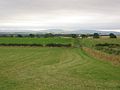
 Autumn farmland near Whitehill - geograph.org.uk - 1565113.jpg 640 × 480; 104 KB
-
 Botanics at Easter 2010 (4499808880).jpg 3,648 × 2,736; 922 KB
-

-
 Broxburn and the Pentland Hills - geograph.org.uk - 781553.jpg 640 × 166; 22 KB
-
 Cauldstane Slap from Bangour. - geograph.org.uk - 65444.jpg 640 × 391; 73 KB
-
 Chapel Hill. - geograph.org.uk - 56090.jpg 640 × 480; 59 KB
-
 Cobbinshaw Reservoir - geograph.org.uk - 1531992.jpg 640 × 480; 83 KB
-
 Distant Pentlands from Kippilaw - geograph.org.uk - 1204478.jpg 640 × 480; 86 KB
-
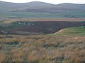
 Disused road, East Broadlaw. - geograph.org.uk - 56095.jpg 640 × 480; 53 KB
-
 Edge of Auchencorth Moss. - geograph.org.uk - 72719.jpg 640 × 480; 51 KB
-
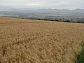
 Farmland near Mount Lothian - geograph.org.uk - 710951.jpg 640 × 480; 80 KB
-
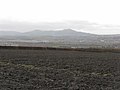
 Farmland, Ochiltree. - geograph.org.uk - 65436.jpg 640 × 480; 105 KB
-

-
 Gore Glen woodland - geograph.org.uk - 1431001.jpg 640 × 480; 96 KB
-
 Harlaw Muir, and the North Esk Valley - geograph.org.uk - 750094.jpg 640 × 480; 86 KB
-
 Hedges and Hills near Roslin - geograph.org.uk - 1210925.jpg 640 × 480; 101 KB
-

-
 Looking north from Wellington School - geograph.org.uk - 1592604.jpg 640 × 480; 106 KB
-
 Looking south-east from Overshiel - geograph.org.uk - 1307641.jpg 640 × 480; 70 KB
-
 Looking to the Pentland Hills - geograph.org.uk - 1597461.jpg 640 × 480; 52 KB
-

-
 Looking towards the Pentlands - geograph.org.uk - 1225499.jpg 640 × 480; 101 KB
-

-
 Mauldslie - geograph.org.uk - 219984.jpg 640 × 480; 87 KB
-
 Milkhall Pond and Cottages - geograph.org.uk - 1592646.jpg 640 × 480; 74 KB
-
 Moorfoot hills - geograph.org.uk - 25048.jpg 640 × 480; 234 KB
-
 Moorland at Auchencorth - geograph.org.uk - 1615111.jpg 640 × 480; 83 KB
-
 Newly cultivated field near Totleywells - geograph.org.uk - 1298433.jpg 640 × 480; 103 KB
-
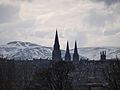
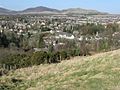 Penicuik.jpg 640 × 480; 104 KB
-
 Pentland Hills 2000-05-14.jpg 2,856 × 1,016; 976 KB
-

-
 Pentland Hills2 2000-05-14.jpg 1,800 × 1,200; 458 KB
-
 Pentlands from Mauldslie Hill - geograph.org.uk - 115497.jpg 640 × 472; 64 KB
-
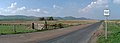
 Road off Rawburn Head - geograph.org.uk - 292946.jpg 640 × 480; 78 KB
-
 Roslin Institute - geograph.org.uk - 903298.jpg 640 × 427; 68 KB
-
-

-
 The Pentland Hills viewed from Mars - geograph.org.uk - 1758766.jpg 1,024 × 768; 174 KB
-
 The Pentlands from Broomy Law - geograph.org.uk - 202164.jpg 640 × 480; 68 KB
-

-
 Torphin - geograph.org.uk - 97200.jpg 640 × 480; 79 KB
-
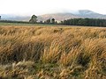
 Tussocks - geograph.org.uk - 115506.jpg 640 × 480; 59 KB
-
 View from D'Arcy - geograph.org.uk - 1460930.jpg 640 × 480; 81 KB
-
 View north from Dundreich summit - geograph.org.uk - 212343.jpg 640 × 480; 222 KB
-
 Winter cereals near Gowkshill - geograph.org.uk - 1597236.jpg 640 × 480; 78 KB
-
 Woodland conversion. - geograph.org.uk - 91230.jpg 640 × 480; 95 KB
-
 Wyndford Place - geograph.org.uk - 1303256.jpg 640 × 480; 78 KB


.jpg)


