Category:Distant views of Swatte Fell
Jump to navigation
Jump to search
Media in category "Distant views of Swatte Fell"
The following 12 files are in this category, out of 12 total.
-
 Birnock Water - geograph.org.uk - 385919.jpg 480 × 640; 106 KB
-
 Blackhope - geograph.org.uk - 68511.jpg 640 × 411; 84 KB
-
 Broken Back from Croft Head - geograph.org.uk - 1063700.jpg 640 × 359; 52 KB
-
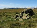 Cairn near Ferny Hill - geograph.org.uk - 550121.jpg 640 × 483; 138 KB
-
 East side of Blackhope. - geograph.org.uk - 68505.jpg 640 × 420; 54 KB
-
 Gap in the fence on Black Knowe Head - geograph.org.uk - 550211.jpg 640 × 480; 117 KB
-
 Gate, fence, and wall, Blue Cairn - geograph.org.uk - 385968.jpg 640 × 480; 95 KB
-
 Gates, walls and fences, Stot Knowe - geograph.org.uk - 385878.jpg 640 × 480; 86 KB
-
 Looking over the Devil's Beef Tub - geograph.org.uk - 564015.jpg 640 × 480; 62 KB
-

-
 Plantation, Pirnie Ridge - geograph.org.uk - 386012.jpg 640 × 480; 68 KB
-
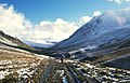
 Valley of the Birnock Water - geograph.org.uk - 385939.jpg 640 × 480; 67 KB


