Category:Distant views of Hart Fell, Moffat
Jump to navigation
Jump to search
Media in category "Distant views of Hart Fell, Moffat"
The following 21 files are in this category, out of 21 total.
-
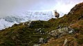 Baa ^ - geograph.org.uk - 652287.jpg 640 × 360; 57 KB
-
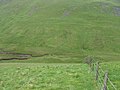
 Black Craig - geograph.org.uk - 68110.jpg 640 × 480; 242 KB
-
 Blackhope. - geograph.org.uk - 68502.jpg 640 × 415; 72 KB
-
 Carrifran Gans, cairn - geograph.org.uk - 467378.jpg 640 × 480; 65 KB
-
 Flecket Hill - geograph.org.uk - 74579.jpg 600 × 450; 91 KB
-
-
 Gate near Meikleholmside - geograph.org.uk - 378201.jpg 640 × 480; 98 KB
-
 Grassy ridge, Peat Knowe - geograph.org.uk - 1737213.jpg 800 × 530; 206 KB
-
 Hart Fell - geograph.org.uk - 1706752.jpg 1,024 × 768; 104 KB
-
 Hart Fell - geograph.org.uk - 467382.jpg 640 × 480; 22 KB
-
 Hartfell from Saddle Yoke in the Moffat hills.jpg 900 × 474; 67 KB
-
 Lochan Burn - geograph.org.uk - 1188166.jpg 640 × 480; 74 KB
-
 Looking over the Devil's Beef Tub - geograph.org.uk - 564015.jpg 640 × 480; 62 KB
-

-
 Path into Annandale - geograph.org.uk - 1107236.jpg 640 × 480; 90 KB
-
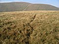 Sheep track, Swatte Fell - geograph.org.uk - 68086.jpg 640 × 480; 294 KB
-
 Summit of Great Hill - geograph.org.uk - 1507835.jpg 640 × 480; 55 KB
-

-

-
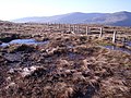 Wet ground, Mid Rig - geograph.org.uk - 684779.jpg 640 × 480; 156 KB
-
 Wintry conditions on Firthhope Rig - geograph.org.uk - 726003.jpg 640 × 480; 151 KB


