Category:Distant views of Erskine Bridge
Jump to navigation
Jump to search
Media in category "Distant views of Erskine Bridge"
The following 19 files are in this category, out of 19 total.
-
 Bowling Harbour - geograph.org.uk - 712825.jpg 640 × 374; 54 KB
-
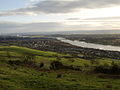 Clydebank from Kilpatrick Hills - geograph.org.uk - 326607.jpg 640 × 480; 72 KB
-
 Depth gauge - geograph.org.uk - 712862.jpg 480 × 640; 82 KB
-
 Erskine Bridge from Bowling - geograph.org.uk - 326589.jpg 640 × 480; 76 KB
-
 Erskine Bridge from Kilbowie Hill - geograph.org.uk - 1354050.jpg 640 × 480; 101 KB
-
 Erskine Bridge from NW.JPG 2,592 × 1,944; 2.18 MB
-
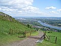
 Fine view from the Kilpatrick Hills - geograph.org.uk - 829027.jpg 640 × 480; 79 KB
-
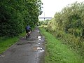
 Footpath above the shore at Bowling - geograph.org.uk - 1481096.jpg 640 × 480; 108 KB
-
 Forth and Clyde Canal - geograph.org.uk - 1469795.jpg 640 × 480; 116 KB
-
 Forth and Clyde Canal - geograph.org.uk - 1470772.jpg 640 × 480; 106 KB
-
 Gate on the walk to Loch Humphrey - geograph.org.uk - 830288.jpg 640 × 480; 85 KB
-
 River Clyde at Bowling - geograph.org.uk - 713085.jpg 640 × 480; 82 KB
-
 River Clyde at Clydebank - geograph.org.uk - 757845.jpg 640 × 480; 55 KB
-
 Shore near Bowling Outer Basin - geograph.org.uk - 1481086.jpg 640 × 360; 58 KB
-

-
 View across Bowling Harbour - geograph.org.uk - 304336.jpg 640 × 480; 66 KB
-

-

-
 West along canal, Dalmuir - geograph.org.uk - 326604.jpg 640 × 480; 84 KB


