Category:Distant views of Ben Macdui
Jump to navigation
Jump to search
Media in category "Distant views of Ben Macdui"
The following 47 files are in this category, out of 47 total.
-
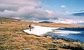
 A frozen Loch Etchachan - geograph.org.uk - 1717586.jpg 800 × 532; 103 KB
-

-
 Approaching Ben Macdui - geograph.org.uk - 281485.jpg 640 × 480; 106 KB
-
 Beinn a ghlo 012.jpg 1,496 × 1,122; 329 KB
-
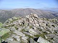
 Beinn a' Chaorainn summit cairn - geograph.org.uk - 207326.jpg 640 × 436; 73 KB
-
 Ben Macdui - Flickr - Graham Grinner Lewis.jpg 3,648 × 2,736; 2.6 MB
-
 Ben Macdui from Cairn Gorm - geograph.org.uk - 38380.jpg 640 × 442; 75 KB
-
 Ben Macdui from Derry Cairngorm.jpg 1,290 × 917; 81 KB
-

-
 Ben-macdui-from-carn-liath.jpg 800 × 566; 83 KB
-
 Braeriach , Munro No 3 - geograph.org.uk - 24084.jpg 640 × 480; 206 KB
-
 Cairn Gorm Plateau (geograph 4020899).jpg 640 × 480; 77 KB
-
 Cairn Toul and Ben Macdui.jpg 1,600 × 1,200; 273 KB
-
 Carn a' Mhaim , Munro No 95 - geograph.org.uk - 72944.jpg 640 × 480; 220 KB
-
 Carn a' Mhaim - North Ridge - geograph.org.uk - 567201.jpg 480 × 640; 68 KB
-
 Craig Derry - geograph.org.uk - 207348.jpg 640 × 416; 57 KB
-
 Creag Mhor plateau. - geograph.org.uk - 91076.jpg 640 × 404; 58 KB
-
 Derry Cairngorm , Munro No 20 - geograph.org.uk - 69858.jpg 640 × 480; 204 KB
-

-
 Glen Geusachan - geograph.org.uk - 683688.jpg 640 × 422; 61 KB
-
 Late crop - geograph.org.uk - 236898.jpg 640 × 556; 106 KB
-
 Looking across the Lairig Ghru (geograph 4587204).jpg 4,608 × 3,456; 4.99 MB
-
 Looking SW from Beinn a Chaorainn.jpg 2,022 × 1,410; 269 KB
-
 Looking up Glen Luibeg - geograph.org.uk - 778395.jpg 1,024 × 688; 843 KB
-
-
 On Sgor Mor above Glen Luibeg - geograph.org.uk - 1580081.jpg 640 × 428; 140 KB
-
 On the way to Ben Macdui - geograph.org.uk - 833185.jpg 554 × 327; 78 KB
-
 Path above the Larig Ghru. - geograph.org.uk - 50999.jpg 640 × 480; 64 KB
-
 Path from the Lairig Ghru to Braeriach - geograph.org.uk - 24384.jpg 640 × 480; 221 KB
-
 Path into the Lairig Ghru - geograph.org.uk - 778414.jpg 1,024 × 688; 948 KB
-
 Path to Ben MacDhui - geograph.org.uk - 263766.jpg 640 × 480; 116 KB
-

-
 Sgor an Lochain Uaine , Munro No 5 - geograph.org.uk - 239548.jpg 640 × 480; 140 KB
-
 Sron Riach Path - geograph.org.uk - 230939.jpg 640 × 480; 49 KB
-
 Summit of Beinn a' Chaorainn Bheag - geograph.org.uk - 207319.jpg 640 × 443; 66 KB
-
 The Cairngorms from An Socach - geograph.org.uk - 495476.jpg 800 × 600; 174 KB
-
 The descent to Carrbridge, near Ess - geograph.org.uk - 157384.jpg 640 × 480; 54 KB
-
 The Devil's Point , Munro No 130 - geograph.org.uk - 239563.jpg 640 × 480; 152 KB
-
 The summit ridge of Derry Cairngorm - geograph.org.uk - 777224.jpg 640 × 381; 55 KB
-
 To the south west of Beinn a'Chaorainn - geograph.org.uk - 232045.jpg 640 × 480; 147 KB
-
-
 View north west from the summit of Beinn Bhreac - geograph.org.uk - 760977.jpg 1,000 × 663; 1.19 MB
-
 View southwest from Bynack More - geograph.org.uk - 662652.jpg 640 × 424; 58 KB
-

-
 Western side of Beinn Mheadhoin - geograph.org.uk - 202575.jpg 640 × 480; 70 KB
-
 Western slopes of Beinn Mheadhoin - geograph.org.uk - 886032.jpg 640 × 480; 97 KB
-
 Winter view - geograph.org.uk - 101533.jpg 640 × 480; 95 KB


.jpg)


,_RP-F-2001-7-1092-40.jpg)


.jpg)


