Category:Dipton, County Durham
Jump to navigation
Jump to search
village in County Durham, United Kingdom  | |||||
| Upload media | |||||
| Instance of | |||||
|---|---|---|---|---|---|
| Location | County Durham, North East England, England | ||||
 | |||||
Subcategories
This category has only the following subcategory.
Media in category "Dipton, County Durham"
The following 86 files are in this category, out of 86 total.
-
 Approaching the main road at Pontop - geograph.org.uk - 3708745.jpg 1,024 × 768; 262 KB
-
 Bridge over the Pikewell Burn - geograph.org.uk - 5598143.jpg 3,070 × 2,304; 3.8 MB
-
 Cemetery near to Dipton - geograph.org.uk - 5556585.jpg 1,500 × 1,006; 1.51 MB
-
 Cemetery on Pontop Pike Lane, Dipton - geograph.org.uk - 3872191.jpg 640 × 480; 90 KB
-
 Children's playground, Pontop Park - geograph.org.uk - 2247833.jpg 1,024 × 769; 233 KB
-
 Co-operative Terrace, Dipton - geograph.org.uk - 2239168.jpg 1,024 × 768; 181 KB
-
 Collierley Farm, Dipton - geograph.org.uk - 3903866.jpg 4,608 × 3,456; 6.63 MB
-
 Delight Cottage, Delight Bank, Dipton - geograph.org.uk - 2239190.jpg 1,024 × 768; 232 KB
-
 Delight Court, Dipton - geograph.org.uk - 3872199.jpg 640 × 480; 81 KB
-
 Delight Row ^ Wordsworth Gardens, Dipton - geograph.org.uk - 2239316.jpg 1,024 × 768; 190 KB
-
 Dipton Manor Care Home, Front Street, Dipton - geograph.org.uk - 3716485.jpg 1,024 × 768; 185 KB
-
 Dipton Manor Care Home, Front Street, Dipton - geograph.org.uk - 3716490.jpg 1,024 × 768; 200 KB
-
 East window, St John's Church, Dipton - geograph.org.uk - 3716295.jpg 770 × 1,024; 299 KB
-
 Edwards's Buildings, Front Street, Dipton - geograph.org.uk - 3723645.jpg 1,024 × 768; 172 KB
-
 Fields and woods west of Pontop Hall - geograph.org.uk - 2810725.jpg 3,264 × 2,448; 1.27 MB
-
 Fields below Pontop Pike - geograph.org.uk - 3872180.jpg 640 × 480; 92 KB
-
 Flush Bracket, Pontop Pike Triangulation Pillar - geograph.org.uk - 4993862.jpg 3,000 × 4,000; 2.65 MB
-
 Fondly Set farmhouse - geograph.org.uk - 4769115.jpg 3,074 × 2,304; 2.99 MB
-
 Fondly Set farmhouse - geograph.org.uk - 5211246.jpg 4,602 × 3,448; 6.98 MB
-
 Footpath north-west of Pontop Hall - geograph.org.uk - 3706973.jpg 1,024 × 768; 185 KB
-
 Former Red Lion pub, Dipton - geograph.org.uk - 2239140.jpg 1,024 × 768; 199 KB
-
 Former tramway north of Pontop - geograph.org.uk - 3707401.jpg 1,024 × 768; 394 KB
-
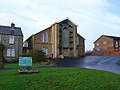
 Front Street, Dipton - geograph.org.uk - 2239125.jpg 1,024 × 768; 209 KB
-
 Front Street, Dipton - geograph.org.uk - 3708749.jpg 1,024 × 768; 183 KB
-
 Front Street, Dipton - geograph.org.uk - 3723620.jpg 1,024 × 768; 204 KB
-
 Front Street, Dipton - geograph.org.uk - 84067.jpg 640 × 556; 92 KB
-

-
 Gate into the wood - geograph.org.uk - 5598176.jpg 4,608 × 3,456; 5.65 MB
-
 Horses in the Snow.jpg 4,000 × 6,000; 15.84 MB
-
 Houses on Delight Bank, Dipton - geograph.org.uk - 2248144.jpg 1,024 × 768; 236 KB
-
 Houses, Catchwell Road, Dipton - geograph.org.uk - 2239182.jpg 1,024 × 768; 185 KB
-
 Housing estate, Dipton - geograph.org.uk - 2248129.jpg 1,024 × 768; 216 KB
-
 Jubilee Hall, Dipton - geograph.org.uk - 2239107.jpg 1,024 × 768; 221 KB
-

-
 Lane End Farm, Pontop Pike Lane - geograph.org.uk - 337887.jpg 640 × 480; 143 KB
-
 Looking along Front Street - geograph.org.uk - 6100732.jpg 4,351 × 3,263; 2.17 MB
-
 Looking up Pontop Pike Lane, Dipton - geograph.org.uk - 4770959.jpg 4,608 × 3,456; 4.34 MB
-
 New farm on Pontop Pike Lane, Dipton - geograph.org.uk - 4770075.jpg 4,608 × 3,456; 4.85 MB
-
 Oak trees - geograph.org.uk - 5598013.jpg 4,608 × 3,456; 5.69 MB
-
 Old buildings south-west of Pontop Hall - geograph.org.uk - 3707371.jpg 1,024 × 768; 263 KB
-
 Old ruins - geograph.org.uk - 5598169.jpg 4,608 × 3,456; 5.76 MB
-
 Old waggonway - geograph.org.uk - 2808211.jpg 3,264 × 2,448; 2.15 MB
-
 Open space on Front Street, Dipton - geograph.org.uk - 6103910.jpg 4,318 × 2,752; 1.38 MB
-
 Path above Beech Grove - geograph.org.uk - 2247845.jpg 1,024 × 768; 209 KB
-
 Path east of Dipton - geograph.org.uk - 2245750.jpg 1,024 × 768; 320 KB
-
 Path to smallholding - geograph.org.uk - 6348700.jpg 4,608 × 3,456; 5.65 MB
-
 Path west of Delight Bank, Dipton - geograph.org.uk - 2248187.jpg 1,024 × 768; 285 KB
-
 Pontop Cottage, Dipton - geograph.org.uk - 6348671.jpg 4,608 × 3,456; 3.49 MB
-
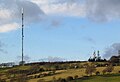
 Pontop Pike - geograph.org.uk - 337119.jpg 640 × 480; 84 KB
-
 Pontop Pike - geograph.org.uk - 614112.jpg 640 × 480; 47 KB
-
 Pontop Pike from the lane - geograph.org.uk - 5212018.jpg 4,452 × 3,238; 3.87 MB
-
 Pontop Pike hilltop - geograph.org.uk - 2247801.jpg 1,024 × 768; 246 KB
-
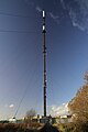
 Pontop Pike mast from the east - geograph.org.uk - 4762227.jpg 4,608 × 3,456; 5.28 MB
-
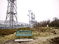
 Pontop Pike Park - geograph.org.uk - 2247809.jpg 1,024 × 768; 334 KB
-
 Pontop Pike Park - geograph.org.uk - 2247821.jpg 1,024 × 768; 287 KB
-
 Pontop Pike Summit - geograph.org.uk - 4993835.jpg 4,000 × 3,000; 2.65 MB
-
 Pontop Pike Transmitting Station.jpg 1,000 × 1,500; 242 KB
-
 Pontop Pike Triangulation Pillar - geograph.org.uk - 4993845.jpg 4,000 × 3,000; 2.72 MB
-
 Pontop Pike.jpg 1,000 × 682; 140 KB
-
 Pontop-Pike antenna and farm.jpg 3,375 × 2,168; 9.85 MB
-

-
 Rear view of Fondley Set farmhouse - geograph.org.uk - 4769129.jpg 4,608 × 3,456; 5.07 MB
-
 Site of the Stob Pit near Fondleyset Lane - geograph.org.uk - 2245812.jpg 1,024 × 768; 324 KB
-
 St Patrick's R C Church, Dipton - geograph.org.uk - 4771029.jpg 4,608 × 3,456; 4.27 MB
-
 St Patrick's RC Primary School - geograph.org.uk - 4771056.jpg 4,608 × 3,456; 4.98 MB
-
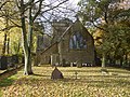
 St Patricks Catholic Church, Dipton - geograph.org.uk - 84069.jpg 640 × 480; 87 KB
-

-
 Terraced houses, Front Street, Dipton - geograph.org.uk - 3723634.jpg 1,024 × 768; 211 KB
-
 The Avenue, Dipton - geograph.org.uk - 4771313.jpg 4,608 × 3,456; 5.29 MB
-
 The Derwent Valley from Pikeside - geograph.org.uk - 6350814.jpg 4,608 × 3,456; 6.48 MB
-
-
 The track of Catchwell Road, Dipton - geograph.org.uk - 2239224.jpg 1,024 × 768; 298 KB
-
 Track at Pikeside, Dipton - geograph.org.uk - 6348691.jpg 4,421 × 3,315; 4.15 MB
-
 Track east of Dipton - geograph.org.uk - 2245767.jpg 1,024 × 768; 241 KB
-
 Track north of Stob House - geograph.org.uk - 2245780.jpg 1,024 × 768; 211 KB
-
 Track south of Pontop Hall - geograph.org.uk - 3706720.jpg 1,024 × 768; 187 KB
-
 Track west of old stables - geograph.org.uk - 3723614.jpg 1,024 × 768; 246 KB
-
 Trees along the Avenue - geograph.org.uk - 5211955.jpg 4,024 × 3,368; 7.05 MB
-
 Trig pillar on Pontop Pike - geograph.org.uk - 4762889.jpg 4,608 × 3,456; 7.5 MB
-
 Trig pillar, Pontop Pike - geograph.org.uk - 2830845.jpg 640 × 480; 60 KB
-
 View East from the top of Pontop Pike - geograph.org.uk - 2810804.jpg 3,264 × 2,448; 1.61 MB
-
 View from the woodland edge - geograph.org.uk - 5598130.jpg 4,608 × 3,456; 5.53 MB
-
 View looking east towards Pontop Hall - geograph.org.uk - 4816275.jpg 4,608 × 3,456; 6.11 MB
-
 View of Raisenside Farm from Pontop Pike Lane - geograph.org.uk - 4770376.jpg 4,608 × 3,456; 5 MB
-
 View over the woods at Dipton - geograph.org.uk - 6348679.jpg 4,608 × 3,456; 4.47 MB
-
 Woodland, Pontop Pike Park - geograph.org.uk - 2247812.jpg 1,024 × 768; 316 KB


