Category:Diprotodontia distribution maps
Jump to navigation
Jump to search
Subcategories
This category has only the following subcategory.
Media in category "Diprotodontia distribution maps"
The following 181 files are in this category, out of 181 total.
-
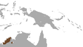
 Admiralty Island Cuscus area.png 412 × 208; 6 KB
-
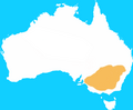
 Aepyprymnus rufescens map.png 692 × 605; 11 KB
-
 Agile Wallaby area.png 301 × 301; 6 KB
-
 Ailurops melanotis map.png 520 × 491; 14 KB
-
 Ailurops ursinus map.png 520 × 491; 14 KB
-
 Allied Rock Wallaby area.png 684 × 612; 8 KB
-
 Antilopine Wallaroo area.png 684 × 612; 10 KB
-
 Banded Hare Wallaby area.png 684 × 612; 8 KB
-
 Banggai Cuscus area.png 684 × 388; 11 KB
-
 Bennett's Tree Kangaroo area.png 684 × 612; 10 KB
-
 Bettongia anhydra.png 692 × 605; 11 KB
-
 Bettongia gaimardi map.png 692 × 605; 11 KB
-
 Bettongia lesueur map.png 684 × 612; 13 KB
-
 Bettongia penicillata map.png 684 × 612; 14 KB
-
 Biak Glider area.png 412 × 208; 6 KB
-
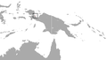
 Black Dorcopsis area.png 412 × 208; 4 KB
-
 Black-flanked Rock Wallaby area.png 684 × 612; 9 KB
-
 Black-spotted Cuscus area.png 412 × 208; 5 KB
-
 Black-striped Wallaby area.png 684 × 612; 10 KB
-
 Blue-eyed Cuscus area.png 684 × 388; 9 KB
-
 Blue-eyed Spotted Cuscus area.png 412 × 208; 4 KB
-
 Boodie area.png 684 × 612; 8 KB
-
 Bridled Nail-tail Wallaby area.png 684 × 612; 8 KB
-
 Brown Dorcopsis area.png 412 × 208; 5 KB
-
 Brown's Pademelon area.png 412 × 208; 5 KB
-
 Brush-tailed Rock Wallaby area.png 684 × 612; 9 KB
-
 Calaby's Pademelon area.png 412 × 208; 4 KB
-
 Caloprymnus campestris map.png 692 × 605; 10 KB
-
 Cape York Rock Wallaby area.png 684 × 612; 8 KB
-
 Cinereus Ringtail Possum area.png 684 × 388; 11 KB
-
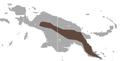
 Combined range of 8 tree kangaroos.jpg 1,920 × 1,080; 1.27 MB
-
 Common Brushtail Possum area.png 684 × 612; 14 KB
-
 Common Ringtail Possum area.png 301 × 301; 8 KB
-
 Common Spotted Cuscus area.png 301 × 301; 5 KB
-
 Common Wallaroo area.png 684 × 612; 13 KB
-
 Common Wombat area.png 684 × 612; 10 KB
-
 Coppery Ringtail Possum area.png 412 × 208; 5 KB
-
 D'Albertis' Ringtail Possum area.png 412 × 208; 4 KB
-
 Dendrolagus mayri map.png 684 × 388; 14 KB
-
 Dingiso area.png 412 × 208; 4 KB
-
 Distribution Map Bettongia penicillata AUS (2).PNG 800 × 576; 78 KB
-
 Distribution of the honey possum on the wheat belt.jpg 3,944 × 3,976; 2.8 MB
-
 Doria's Tree Kangaroo area.png 412 × 208; 4 KB
-
 Dusky Pademelon area.png 412 × 208; 4 KB
-
 Eastern Common Cuscus area.png 684 × 388; 10 KB
-
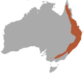
 Eastern Grey Kangaroo area.png 684 × 612; 11 KB
-
 Eastern Hare Wallaby Distribution Map.png 1,149 × 948; 36 KB
-
 Eastern Pygmy Possum area.png 684 × 612; 10 KB
-
 Feather-tailed Possum area.png 684 × 388; 10 KB
-
 Gebe Cuscus area.png 412 × 208; 4 KB
-
 Gilbert's Potoroo area.png 684 × 612; 8 KB
-
 Godman's Rock Wallaby area.png 684 × 612; 8 KB
-
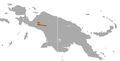
 Golden-mantled Tree Kangaroo area.png 412 × 208; 4 KB
-
 Goodfellow's Tree Kangaroo area.png 412 × 208; 4 KB
-
 Greater Glider area.png 684 × 612; 11 KB
-
 Green Ringtail Possum area.png 684 × 612; 10 KB
-
 Grey Dorcopsis area.png 412 × 208; 5 KB
-
 Grizzled Tree Kangaroo area.png 412 × 208; 5 KB
-
 Ground Cuscus area.png 684 × 388; 11 KB
-
 Herbert River Ringtail Possum area.png 684 × 612; 10 KB
-
 Herbert's Rock Wallaby area.png 684 × 612; 9 KB
-
 Honey Possum area.png 684 × 612; 9 KB
-
 Ifola Tree-kangaroo area.png 412 × 208; 4 KB
-
 Kangourou roux map.png 2,190 × 1,577; 148 KB
-
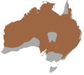
 Koala area.png 684 × 612; 12 KB
-
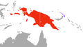
 Koala dist map.png 2,190 × 1,577; 125 KB
-
 Koala Range.jpg 3,841 × 3,133; 1.51 MB
-
 Lagorchestes asomatus map.png 692 × 605; 10 KB
-
 Lagorchestes hirsutus map.png 684 × 612; 12 KB
-
 Lagorchestes leporides map.png 692 × 605; 11 KB
-
 Lagostrophus fasciatus map.png 684 × 612; 14 KB
-
 Leadbeater's Possum area.png 684 × 612; 10 KB
-
 Leefgebied koala.JPG 347 × 167; 6 KB
-
 Leefgebied voskoesoe.JPG 347 × 167; 7 KB
-
 Lemur-like Ringtail Possum area.png 684 × 612; 10 KB
-
 Long-fingered Triok area.png 412 × 208; 5 KB
-
 Long-tailed Pygmy Possum area.png 301 × 301; 5 KB
-
 Lowland Ringtail Possum area.png 684 × 388; 11 KB
-
 Lowlands Tree Kangaroo area.png 412 × 208; 4 KB
-
 Lumholtz's Tree Kangaroo area.png 684 × 612; 8 KB
-
 Macleay's Dorcopsis area.png 412 × 208; 4 KB
-
 Macropus eugenii map.png 684 × 612; 11 KB
-
 Macropus parryi distribution.svg 200 × 186; 22 KB
-
 Macropus rufus distribution.svg 200 × 186; 23 KB
-
 Macropus Species Density.jpg 4,240 × 4,466; 1.71 MB
-
 Mahogany Glider area.png 684 × 612; 10 KB
-
 Mareeba Rock Wallaby area.png 684 × 612; 8 KB
-
 Masked Ringtail Possum area.png 412 × 208; 4 KB
-
 Matschie's Tree Kangaroo area.png 412 × 208; 4 KB
-
 Monjon area.png 684 × 612; 8 KB
-
 Mount Claro Rock Wallaby area.png 684 × 612; 8 KB
-
 Mountain Brushtail Possum area.png 684 × 612; 9 KB
-
 Mountain Cuscus area.png 412 × 208; 5 KB
-
 Mountain Pademelon area.png 412 × 208; 4 KB
-
 Mountain Pygmy Possum area.png 684 × 612; 10 KB
-
 Musky Rat Kangaroo area.png 684 × 612; 7 KB
-
 Nabarlek area.png 684 × 612; 9 KB
-
 Northern Common Cuscus area.png 684 × 388; 13 KB
-
 Northern Glider area.png 412 × 208; 6 KB
-
 Northern Hairy-nosed Wombat area.png 684 × 612; 9 KB
-
 Northern Nailtail Wallaby area.png 684 × 612; 10 KB
-
 Northern Nailtail Wallaby.jpg 2,137 × 1,807; 414 KB
-
 Onychogalea lunata map.png 692 × 605; 11 KB
-
 Ornate Cuscus area.png 684 × 388; 9 KB
-
 Painted Ringtail Possum area.png 412 × 208; 4 KB
-
 Parma Wallaby area.png 684 × 612; 8 KB
-
 Perameles eremiana map.png 692 × 605; 11 KB
-
 Petaurus breviceps distribution map.png 1,357 × 628; 39 KB
-
 Petaurus breviceps distribution.png 224 × 252; 4 KB
-
 Petrogale brachyotis.png 684 × 612; 10 KB
-
 Petrogale wilkinsi.png 684 × 612; 10 KB
-
 Phalanger alexandrae map.png 431 × 376; 11 KB
-
 Phalanger lullulae map.png 392 × 560; 5 KB
-
 Phalanger matabiru map.png 449 × 369; 11 KB
-
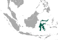
 Phalanger orientalis map.png 684 × 388; 14 KB
-
 Phalanger ornatus map.png 520 × 491; 14 KB
-
 Phalanger rothschildi map.png 458 × 400; 12 KB
-
 Plush-coated Ringtail Possum area.png 412 × 208; 5 KB
-
 Potorous gilbertii map.png 689 × 637; 13 KB
-
 Potorous gilbertii map2.png 791 × 449; 7 KB
-
 Potorous longipes map.png 692 × 605; 11 KB
-
 Potorous platyops map.png 692 × 605; 10 KB
-
 Pretty-faced Wallaby area.png 684 × 612; 9 KB
-
 Proserpine Rock Wallaby area.png 684 × 612; 8 KB
-
 Purple-necked Rock Wallaby area.png 684 × 612; 10 KB
-
 Pygmy Ringtail Possum area.png 412 × 208; 4 KB
-
 Quokka area.png 684 × 612; 8 KB
-
 Range of the green ringtail possum.png 1,000 × 655; 1.3 MB
-
 Reclusive Ringtail Possum area.png 412 × 208; 4 KB
-
 Red Kangaroo area.png 684 × 612; 11 KB
-
 Red-legged Pademelon area.png 301 × 301; 5 KB
-
 Red-necked Pademelon area.png 684 × 612; 8 KB
-
 Red-necked Wallaby area.png 684 × 612; 10 KB
-
 Rock-haunting Ringtail Possum area.png 684 × 612; 9 KB
-
 Rothschild's Cuscus.png 684 × 388; 11 KB
-
 Rothschild's Rock Wallaby area.png 684 × 612; 8 KB
-
 Rufous Hare Wallaby area.png 684 × 612; 8 KB
-
 Scaly-tailed Possum area.png 684 × 388; 10 KB
-
 Seri's Tree Kangaroo area.png 412 × 208; 4 KB
-
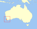 Setonix brachyurus distribution.svg 308 × 246; 81 KB
-
 Short-eared Possum area.png 684 × 612; 9 KB
-
 Short-eared Rock Wallaby area.png 684 × 612; 9 KB
-
 Silky Cuscus area.png 412 × 208; 5 KB
-
 Small Dorcopsis area.png 412 × 208; 5 KB
-
 Southern Common Cuscus area.png 684 × 388; 10 KB
-
 Southern Hairy-nosed Wombat area.png 684 × 612; 9 KB
-
 Southwestern Pygmy Possum area.png 684 × 612; 9 KB
-
 Spectacled Hare Wallaby area.png 301 × 301; 6 KB
-
 Spilocuscus maculatus map.png 684 × 388; 14 KB
-
 Spilocuscus nudicaudatus map.png 684 × 388; 14 KB
-
 Spilocuscus papuensis map.png 574 × 474; 15 KB
-
 Squirrel Glider area.png 684 × 612; 11 KB
-
 Stein's Cuscus area.png 412 × 208; 4 KB
-
 Strigocuscus pelengensis map.png 520 × 491; 15 KB
-
 Sulawesi Bear Cuscus area.png 644 × 452; 13 KB
-
 Sulawesi Dwarf Cuscus area.png 644 × 452; 13 KB
-
 Talaud Bear Cuscus area.png 644 × 452; 14 KB
-
 Tammar Wallaby area.png 684 × 612; 8 KB
-
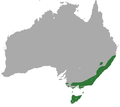
 Tasmanian Pademelon area.png 684 × 612; 8 KB
-
 Tasmanian Pygmy Possum area.png 684 × 612; 9 KB
-
 Tate's Triok area.png 412 × 208; 6 KB
-
 Telefomin Cuscus area.png 412 × 208; 6 KB
-
 Tenkile area.png 412 × 208; 4 KB
-

-

-
 Trichosurus arnhemensis map.png 692 × 605; 10 KB
-
 Trichosurus johnstonii map.png 692 × 605; 11 KB
-
 Tuepfelkuskus p maculatus map.png 1,357 × 628; 20 KB
-
 Unadorned Rock Wallaby area.png 684 × 612; 8 KB
-
 Ursine Tree Kangaroo area.png 412 × 208; 4 KB
-
 Vogelkop Ringtail Possum area.png 412 × 208; 4 KB
-
 Vombatus ursinus distribution.svg 200 × 186; 23 KB
-
 Waigeo Cuscus area.png 412 × 208; 6 KB
-
 Western Brush Wallaby area.png 684 × 612; 9 KB
-
 Western Gray Kangaroo area.png 684 × 612; 11 KB
-
 Western Ringtail Possum area.png 684 × 612; 8 KB
-
 Weyland Ringtail Possum area.png 412 × 208; 4 KB
-
 White-striped Dorcopsis area.png 412 × 208; 4 KB
-
 Woodlark Cuscus area.png 412 × 208; 6 KB
-
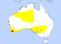
 Woodward's Wallaroo area.png 684 × 388; 9 KB
-
 Woylie area.png 684 × 612; 8 KB


.PNG)


