Category:Dervaig
Jump to navigation
Jump to search
village in Argyll and Bute, Scotland, UK  | |||||
| Upload media | |||||
| Instance of | |||||
|---|---|---|---|---|---|
| Location |
| ||||
 | |||||
Subcategories
This category has the following 3 subcategories, out of 3 total.
Media in category "Dervaig"
The following 62 files are in this category, out of 62 total.
-
 Admiralty Chart No 2832 Treshnish Point to the entrance of the Sound of Mull, Published 1864.jpg 16,317 × 12,057; 48.72 MB
-
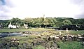
 Dervaig - geograph.org.uk - 682656.jpg 640 × 480; 102 KB
-
 Dervaig - geograph.org.uk - 83134.jpg 640 × 376; 102 KB
-

-
 Forested banks of Loch Frisa - geograph.org.uk - 270433.jpg 640 × 480; 109 KB
-
 Loch a Chumhainn near Dervaig - geograph.org.uk - 3047244.jpg 600 × 450; 79 KB
-
 Loch a' Chumhainn, Dervaig - geograph.org.uk - 4840409.jpg 3,998 × 2,972; 4.25 MB
-
 Moo^ - geograph.org.uk - 328542.jpg 640 × 512; 151 KB
-
 Mull Dervaig Standing Stones 1.jpg 3,968 × 2,976; 7.93 MB
-
 Mull Dervaig Standing Stones 2.jpg 3,968 × 2,976; 9.52 MB
-
 Mull Dervaig.jpg 3,968 × 2,976; 8.27 MB
-
 Mull Kilmore Standing Stones 1.jpg 3,968 × 2,976; 9.34 MB
-
 Mull Kilmore Standing Stones 2.jpg 3,968 × 2,976; 10.24 MB
-
 Mull Kilmore Standing Stones 3.jpg 3,968 × 2,976; 10.4 MB
-
 Pencil church, Dervaig (13928925885).jpg 3,648 × 2,432; 1.48 MB
-
 Post Office and Dervaig Main Street - geograph.org.uk - 183479.jpg 640 × 480; 67 KB
-
-
 Sheep pens ^ - geograph.org.uk - 180826.jpg 640 × 480; 160 KB
-
 Standing Stone, Tostary - geograph.org.uk - 181783.jpg 480 × 640; 104 KB
-
 Torr Aint hill fort - geograph.org.uk - 175583.jpg 640 × 480; 93 KB
-
 View from the Old Schoolhouse - geograph.org.uk - 353723.jpg 640 × 480; 97 KB
-
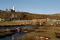
 View of Dervaig from scenic overlook - geograph.org.uk - 718397.jpg 640 × 480; 251 KB
-
 View to Dervaig - geograph.org.uk - 180814.jpg 640 × 480; 103 KB
-
 Western Outskirts of Dervaig - geograph.org.uk - 183473.jpg 640 × 480; 101 KB
-
 Wind-swept Loch a' Chumhainn, Dervaig - geograph.org.uk - 4840876.jpg 2,778 × 1,423; 1.32 MB
-
 A Dervaig BandB - geograph.org.uk - 452900.jpg 640 × 480; 110 KB
-

-
 Bend in the Burn - geograph.org.uk - 488205.jpg 480 × 640; 161 KB
-
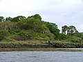
 Cairn, Laorin Bay - geograph.org.uk - 200548.jpg 640 × 480; 91 KB
-
 Coire Sgamadail and the Mishnish lochs - geograph.org.uk - 45599.jpg 640 × 423; 71 KB
-
 Deer under summit of Torr nan Damh - geograph.org.uk - 176972.jpg 640 × 480; 107 KB
-
 Dervaig - geograph.org.uk - 453668.jpg 640 × 480; 139 KB
-
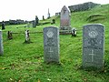 Dervaig burial ground - geograph.org.uk - 665885.jpg 640 × 480; 123 KB
-
 Dervaig Standing Stones - geograph.org.uk - 634569.jpg 500 × 375; 59 KB
-
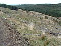
 Deserted village by Torr Aint - geograph.org.uk - 270473.jpg 640 × 480; 73 KB
-
 Forest edge, Tom nam Fitheach - geograph.org.uk - 454877.jpg 640 × 480; 59 KB
-
 Hill, Thrift - geograph.org.uk - 183477.jpg 640 × 480; 77 KB
-
 Houses at Cuin - geograph.org.uk - 180796.jpg 640 × 480; 129 KB
-
 Kilninan - geograph.org.uk - 353730.jpg 640 × 480; 67 KB
-
 Lainne Sgeir - geograph.org.uk - 181676.jpg 640 × 480; 72 KB
-
 Loch Torr - geograph.org.uk - 269198.jpg 640 × 480; 80 KB
-
 Lochan - geograph.org.uk - 488227.jpg 640 × 480; 95 KB
-
 Lochan na h-Earba - geograph.org.uk - 488232.jpg 640 × 480; 105 KB
-
 Mingary Burn - geograph.org.uk - 176985.jpg 640 × 480; 128 KB
-
 Mossy trees and stones - geograph.org.uk - 175590.jpg 640 × 480; 94 KB
-
 Rock Formations - geograph.org.uk - 175556.jpg 640 × 480; 63 KB
-
 Standing stones - geograph.org.uk - 84077.jpg 640 × 431; 124 KB
-
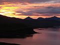 Sunrise, from Tostary - geograph.org.uk - 334139.jpg 640 × 480; 92 KB
-
 Tom nam Fitheach - geograph.org.uk - 454874.jpg 640 × 480; 55 KB
-
 Tom nam Fitheach - geograph.org.uk - 454882.jpg 640 × 480; 66 KB
-
 Torr an Ogha - geograph.org.uk - 82671.jpg 640 × 480; 112 KB
-
 Tostary - geograph.org.uk - 180861.jpg 640 × 480; 94 KB
-
 Tostary Cottage,early morning, October - geograph.org.uk - 334118.jpg 640 × 426; 123 KB
-
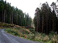
 Track through Glen Aros - geograph.org.uk - 270463.jpg 640 × 480; 94 KB
-
 Trackside waterfalls near Loch Frisa - geograph.org.uk - 270436.jpg 640 × 480; 140 KB
-
 Trees at Cuin - geograph.org.uk - 175949.jpg 640 × 480; 93 KB
-
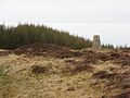 Triangulation pillar above Dervaig. - geograph.org.uk - 452541.jpg 640 × 480; 75 KB
-
 View Across the Upper reaches of Glengorm - geograph.org.uk - 183959.jpg 640 × 480; 103 KB
-
-
 Waterfall above Loch Frisa - geograph.org.uk - 270437.jpg 480 × 640; 120 KB
-
 Waterfall and stream near Loch Frisa - geograph.org.uk - 270438.jpg 480 × 640; 138 KB
-
 Wetland by Loch na Cuilce - geograph.org.uk - 452936.jpg 640 × 450; 72 KB


.jpg)


