Category:Dent, South Lakeland
Jump to navigation
Jump to search
English: Dent is a village and civil parish in Cumbria, England. It lies in Dentdale, a narrow valley on the western slopes of the Pennines within the Yorkshire Dales National Park. It is about north east of Kirkby Lonsdale.
Nederlands: Dent is een plaats en civil parish in het bestuurlijke gebied South Lakeland, in het Engelse graafschap Cumbria met 675 inwoners.
Polski: Dent – wieś w Anglii, w Kumbrii, w dystrykcie South Lakeland. Leży 76 km na południowy wschód od miasta Carlisle i 345 km na północny zachód od Londynu. W 2001 miejscowość liczyła 675 mieszkańców.
Simple English: Dent is a village and civil parish in South Lakeland, Cumbria, England. In 2001 there were 675 people living in Dent.
Svenska: miniatyr|Dent
Main Wikipedia article: Dent, Cumbria.

village and civil parish in Cumbria, England, United Kingdom  | |||||
| Upload media | |||||
| Instance of | |||||
|---|---|---|---|---|---|
| Location | South Lakeland, Cumbria, North West England, England | ||||
| Said to be the same as | Dent (Wikimedia duplicated page, civil parish) | ||||
 | |||||
Subcategories
This category has the following 21 subcategories, out of 21 total.
A
- Arten Gill Viaduct (30 F)
- Aye Gill Pike (8 F)
B
- Brant Nook Ford (2 F)
C
- Crag Hill, Yorkshire Dales (5 F)
D
- Dent Head Viaduct (40 F)
- Dent War Memorial (2 F)
E
- Ease Gill Cave System (3 F)
G
- George and Dragon, Dent (3 F)
- Great Coum, Dent (6 F)
- Great Knoutberry Hill (17 F)
H
- High Hall, Dent (1 F)
L
- Lenacre (4 F)
O
- Occupation Road, Dent (10 F)
R
- Rise Hill Tunnel (1 F)
S
- Stone House, Cumbria (9 F)
- Sun Inn, Dent (4 F)
Media in category "Dent, South Lakeland"
The following 200 files are in this category, out of 2,520 total.
(previous page) (next page)-
 "George and Dragon", Dent - geograph.org.uk - 3502792.jpg 480 × 640; 101 KB
-
 'I'm a Supa lamb' - geograph.org.uk - 2882881.jpg 640 × 480; 134 KB
-
 'I'm watching you' - geograph.org.uk - 3184413.jpg 800 × 600; 179 KB
-
 'Smiling Along' by Kathleen Partridge - geograph.org.uk - 277479.jpg 640 × 480; 95 KB
-
 (Old) Boy Racers- 1 - geograph.org.uk - 4669949.jpg 640 × 480; 80 KB
-
 (Old) Boy Racers- 2 - geograph.org.uk - 4669959.jpg 640 × 480; 121 KB
-
 (Old) Boy Racers- 3 - geograph.org.uk - 4669972.jpg 640 × 480; 137 KB
-
 (Old) Boy Racers- 4 - geograph.org.uk - 4669979.jpg 640 × 480; 59 KB
-
 (Old) Boy Racers- 5 - geograph.org.uk - 4669980.jpg 640 × 480; 63 KB
-
 10-01am, path towards Grain Head - geograph.org.uk - 5430028.jpg 1,200 × 799; 266 KB
-
 19th century benchmark on Bridge End Cottage - geograph.org.uk - 3066022.jpg 683 × 1,024; 221 KB
-
 9-39am, Whernside summit - geograph.org.uk - 5429486.jpg 1,200 × 799; 240 KB
-
 9-43am, Whernside summit - geograph.org.uk - 5429722.jpg 1,200 × 799; 147 KB
-
 9-49am, path towards Knoutberry Hill - geograph.org.uk - 5429724.jpg 1,200 × 799; 152 KB
-
 9-51am, path towards Knoutberry Hill - geograph.org.uk - 5429725.jpg 1,200 × 799; 210 KB
-
 9-54am, path towards Grain Head - geograph.org.uk - 5429727.jpg 1,200 × 799; 233 KB
-
 A 'squeeze stile' on Barth Bridge - geograph.org.uk - 5956393.jpg 1,200 × 1,800; 535 KB
-
 A barn above Dent - geograph.org.uk - 1658007.jpg 640 × 482; 64 KB
-
 A Deepdale meadow - geograph.org.uk - 2997949.jpg 800 × 600; 145 KB
-
 A distant glimpse of Whinfell Beacon - geograph.org.uk - 2676329.jpg 640 × 480; 68 KB
-
 A field in Dentdale - geograph.org.uk - 4611686.jpg 640 × 426; 58 KB
-
 A fine Ash Tree - geograph.org.uk - 2421118.jpg 640 × 480; 98 KB
-
 A ford crossing the River Dee - geograph.org.uk - 4046525.jpg 1,600 × 1,200; 807 KB
-
 A former farm above Cowgill - geograph.org.uk - 5344702.jpg 6,000 × 4,000; 5.13 MB
-
 A former school at Cowgill - geograph.org.uk - 4046439.jpg 1,600 × 1,200; 704 KB
-
 A glimpse up Arten Gill - geograph.org.uk - 6315434.jpg 5,700 × 3,459; 4.46 MB
-

-
 A green hillside - geograph.org.uk - 1655936.jpg 640 × 428; 43 KB
-
 A hare on the Coal Road - geograph.org.uk - 5709051.jpg 1,024 × 683; 274 KB
-
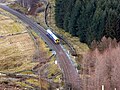
 A Leeds bound train approaching Blea Moor Tunnel - geograph.org.uk - 5719331.jpg 1,024 × 768; 549 KB
-
 A lonesome cow - geograph.org.uk - 4568701.jpg 640 × 426; 81 KB
-
 A misty afternoon at The Crag cairn - geograph.org.uk - 2993509.jpg 800 × 600; 51 KB
-
 A MOST welcome sight - geograph.org.uk - 4670050.jpg 640 × 480; 80 KB
-
 A mucky muckspreader near Birchen Tree Farm - geograph.org.uk - 5344408.jpg 6,000 × 4,000; 5.68 MB
-

-
 A path by the River Dee - geograph.org.uk - 1657293.jpg 640 × 428; 74 KB
-
 A quiet little valley - geograph.org.uk - 1659623.jpg 640 × 482; 67 KB
-

-
 A road through Dent - geograph.org.uk - 2464650.jpg 640 × 480; 123 KB
-
 A seat by the River Dee - geograph.org.uk - 1382679.jpg 640 × 480; 207 KB
-
 A section of dry stone wall - geograph.org.uk - 4568651.jpg 640 × 426; 70 KB
-
 A small scar, Dentdale - geograph.org.uk - 4568611.jpg 640 × 426; 107 KB
-
 A small stream in Dentdale - geograph.org.uk - 4568634.jpg 640 × 426; 131 KB
-
 A track next to the forest - geograph.org.uk - 1656070.jpg 640 × 428; 92 KB
-
 A train approaching Blea Moor Tunnel - geograph.org.uk - 5720911.jpg 1,024 × 768; 484 KB
-
 A trap - geograph.org.uk - 2120611.jpg 640 × 480; 122 KB
-
 A tricky step on the Dales Way - geograph.org.uk - 5956321.jpg 1,600 × 1,067; 491 KB
-
 A view down Dentdale - geograph.org.uk - 6188427.jpg 5,184 × 3,456; 5.7 MB
-
 A View over Deepdale and Dentdale - geograph.org.uk - 5719673.jpg 5,184 × 3,456; 6.2 MB
-
 A View Westwards from Lousegill Wold - geograph.org.uk - 6017193.jpg 5,184 × 3,456; 7.07 MB
-
 A View Westwards to Great Coum - geograph.org.uk - 5719667.jpg 5,184 × 3,456; 6.01 MB
-
 A wall along the hillside - geograph.org.uk - 1659636.jpg 640 × 482; 84 KB
-
 A waterfall in Flinter Gill - geograph.org.uk - 2883457.jpg 480 × 640; 118 KB
-
 A window at Roantree - geograph.org.uk - 3473553.jpg 600 × 800; 146 KB
-

-
 A WR sign - geograph.org.uk - 4047484.jpg 1,600 × 1,200; 839 KB
-
 Above Gate Manor - geograph.org.uk - 2450555.jpg 1,600 × 1,063; 316 KB
-
 Access Lane leading up to Laithbank - geograph.org.uk - 6188417.jpg 5,184 × 3,456; 5.64 MB
-
 Access point - geograph.org.uk - 437393.jpg 640 × 480; 99 KB
-
 Acre - geograph.org.uk - 4563113.jpg 640 × 426; 46 KB
-
 Adam Sedgwick Fountain - geograph.org.uk - 4617077.jpg 426 × 640; 90 KB
-
 Adam Sedgwick memorial stone - geograph.org.uk - 904271.jpg 640 × 479; 97 KB
-
 Air Shaft above Risehill Tunnel - geograph.org.uk - 6017805.jpg 5,184 × 3,456; 5.83 MB
-
 Aldries Gill - geograph.org.uk - 4563040.jpg 640 × 426; 127 KB
-
 Allan Haw - geograph.org.uk - 4563074.jpg 640 × 426; 53 KB
-
 Allen Haw - geograph.org.uk - 1542581.jpg 640 × 359; 96 KB
-
 Allen Haw - geograph.org.uk - 2464705.jpg 640 × 480; 85 KB
-
 Allen Haw, near Dent.jpg 640 × 426; 60 KB
-
 Alleyway to St Andrew's, Dent - geograph.org.uk - 1375629.jpg 480 × 640; 154 KB
-
 Almost lost in the landscape - geograph.org.uk - 5720892.jpg 1,024 × 768; 560 KB
-
 An alternative approach for wild camping^ - geograph.org.uk - 5722101.jpg 768 × 1,024; 451 KB
-
 An enclave in the forest - geograph.org.uk - 1657079.jpg 640 × 428; 60 KB
-
 Ancient Stone Wall - geograph.org.uk - 767467.jpg 480 × 640; 111 KB
-
 Approach to Dent from Church Bridge - geograph.org.uk - 2615221.jpg 1,024 × 769; 206 KB
-
 Approaching Boot of the Wold - geograph.org.uk - 3650915.jpg 1,600 × 1,200; 510 KB
-
 Approaching Cowdub Bridge - geograph.org.uk - 4670055.jpg 640 × 480; 127 KB
-
 Approaching Dent - geograph.org.uk - 4611894.jpg 640 × 426; 68 KB
-
 Approaching Dent Head Farm - geograph.org.uk - 5719298.jpg 1,024 × 768; 547 KB
-
 Approaching Dentdale - geograph.org.uk - 4764570.jpg 3,776 × 2,520; 4.04 MB
-
 Approaching Harbourgill Bridge - geograph.org.uk - 3119554.jpg 2,048 × 1,536; 758 KB
-
 Approaching Helmside from the northeast - geograph.org.uk - 3628059.jpg 1,600 × 1,200; 612 KB
-
 Approaching Large Cairn on the Northern Flanks of Whernside - geograph.org.uk - 5719661.jpg 5,184 × 3,456; 7.06 MB
-
 Approaching One of the Larger Whernside Tarns - geograph.org.uk - 5719642.jpg 5,184 × 3,456; 5.39 MB
-
 Approaching Scow - geograph.org.uk - 4765571.jpg 3,776 × 2,520; 3.99 MB
-
 Approaching Stone Man below the Whernside Tarns - geograph.org.uk - 5719628.jpg 5,184 × 3,456; 7.13 MB
-
 Approaching the ford near Brackensgill - geograph.org.uk - 3203262.jpg 3,872 × 2,592; 6.3 MB
-
 Aqueduct over the railway - geograph.org.uk - 4650904.jpg 640 × 426; 84 KB
-
 Area of disused pits, west of the Coal Road - geograph.org.uk - 3882606.jpg 1,024 × 768; 180 KB
-

-
 Arten Gill and Dent Head Viaducts - geograph.org.uk - 4650814.jpg 640 × 426; 51 KB
-
 Arten Gill and the Pennine Bridleway - geograph.org.uk - 5182789.jpg 1,600 × 1,200; 622 KB
-
 Arten Gill bridleway - geograph.org.uk - 2879586.jpg 3,072 × 2,304; 1.08 MB
-
 Arten Gill Moss - geograph.org.uk - 4563191.jpg 640 × 480; 49 KB
-
 Arten Gill Viaduct (1) - geograph.org.uk - 5119100.jpg 1,600 × 1,067; 574 KB
-
 Arten Gill Viaduct (2) - geograph.org.uk - 5119113.jpg 1,600 × 1,067; 496 KB
-
 Arten Gill Viaduct (3) - geograph.org.uk - 5119124.jpg 1,600 × 1,067; 648 KB
-
 Arten Gill Viaduct - geograph.org.uk - 4650806.jpg 640 × 426; 68 KB
-
 Arten Gill Viaduct - geograph.org.uk - 4650855.jpg 640 × 426; 62 KB
-
 Artengill Beck - geograph.org.uk - 4695371.jpg 640 × 426; 85 KB
-
 Artengill Beck - geograph.org.uk - 4695526.jpg 640 × 426; 59 KB
-
 Artengill Beck - geograph.org.uk - 4699521.jpg 640 × 460; 50 KB
-
 Artengill track beside Dent Fell - geograph.org.uk - 3058201.jpg 1,024 × 683; 213 KB
-
 Artengill Viaduct - geograph.org.uk - 5718593.jpg 1,024 × 768; 768 KB
-

-
 Ascending Whernside - geograph.org.uk - 759839.jpg 640 × 480; 53 KB
-
 Ash tree root, Short Gill - geograph.org.uk - 3351027.jpg 480 × 640; 168 KB
-
 At Bleamoor Tunnel - geograph.org.uk - 1371715.jpg 640 × 480; 76 KB
-
 At Bleamoor Tunnel - geograph.org.uk - 1371721.jpg 640 × 480; 79 KB
-
 Autumn colours over the River Dee - geograph.org.uk - 5957420.jpg 1,200 × 1,800; 603 KB
-
 Autumn trees on Cowclose Hill - geograph.org.uk - 3203287.jpg 3,872 × 2,592; 3.21 MB
-
 Aye Gill Pike - geograph.org.uk - 969852.jpg 640 × 480; 62 KB
-
 Aye Gill Pike, from Dent - geograph.org.uk - 914724.jpg 640 × 480; 141 KB
-
 Back Gill Head, Kingsdale - geograph.org.uk - 3337878.jpg 640 × 480; 123 KB
-
 Back Lane, Dent - geograph.org.uk - 1382674.jpg 640 × 480; 170 KB
-
 Back Lane, Dent - geograph.org.uk - 1383068.jpg 640 × 480; 166 KB
-
 Back of the Houses on Laning, Dent - geograph.org.uk - 6186827.jpg 5,184 × 3,456; 7.04 MB
-
 Backstone Gill - geograph.org.uk - 4522895.jpg 4,317 × 3,279; 1.78 MB
-
 Bankland - geograph.org.uk - 4628399.jpg 640 × 426; 54 KB
-
 Bankland, Dentdale - geograph.org.uk - 4571561.jpg 640 × 426; 54 KB
-
 Barbondale below Calf Top - geograph.org.uk - 2313881.jpg 600 × 450; 277 KB
-
 Barbondale near Fiddler's Hills - geograph.org.uk - 1991115.jpg 1,024 × 768; 264 KB
-
 Barbondale Road - geograph.org.uk - 2341329.jpg 640 × 480; 90 KB
-
 Barbondale Road - geograph.org.uk - 4500490.jpg 5,184 × 3,227; 1.82 MB
-
 Barbondale Road at Fiddler's Hills - geograph.org.uk - 3346664.jpg 640 × 480; 66 KB
-
 Barbondale Road towards Barbon - geograph.org.uk - 2313912.jpg 600 × 450; 168 KB
-
 Barbondale Road towards Dent - geograph.org.uk - 2313892.jpg 600 × 450; 211 KB
-

-
 Barkin Beck, Barbondale - geograph.org.uk - 2313902.jpg 600 × 450; 342 KB
-
 Barkin Beck, Barbondale - geograph.org.uk - 2313906.jpg 600 × 450; 365 KB
-
 Barkin Top from the Barbondale Road - geograph.org.uk - 1989789.jpg 640 × 426; 240 KB
-
 Barn - geograph.org.uk - 436713.jpg 640 × 480; 100 KB
-
 Barn - geograph.org.uk - 436721.jpg 562 × 420; 143 KB
-
 Barn - geograph.org.uk - 440713.jpg 640 × 480; 102 KB
-
 Barn above Gawthrop - geograph.org.uk - 5366978.jpg 800 × 600; 113 KB
-
 Barn at Blackmire - geograph.org.uk - 5172996.jpg 1,600 × 1,200; 730 KB
-
 Barn at Dockle Sike, Deepdale Lane - geograph.org.uk - 2655472.jpg 1,024 × 683; 191 KB
-
 Barn at Low Flats - geograph.org.uk - 2495708.jpg 1,024 × 683; 138 KB
-
 Barn at Mire House - geograph.org.uk - 3465660.jpg 1,024 × 683; 242 KB
-
 Barn below Parks, Dentdale - geograph.org.uk - 5368888.jpg 800 × 600; 148 KB
-
 Barn beside Dales Way at Clint - geograph.org.uk - 2584833.jpg 1,024 × 683; 258 KB
-
 Barn beside Nun House Outrake - geograph.org.uk - 2882880.jpg 800 × 600; 206 KB
-
 Barn by the Dales Way - geograph.org.uk - 4563099.jpg 640 × 426; 93 KB
-
 Barn by the roadside - geograph.org.uk - 4571628.jpg 640 × 426; 106 KB
-
 Barn conversion at Holly Bush - geograph.org.uk - 440702.jpg 640 × 480; 100 KB
-
 Barn in Dentdale - geograph.org.uk - 2514156.jpg 640 × 427; 240 KB
-
 Barn near Cowdub Bridge - geograph.org.uk - 4670031.jpg 640 × 480; 71 KB
-

-
 Barn west of Garlic Lane - geograph.org.uk - 2615314.jpg 1,024 × 768; 178 KB
-
 Barn, Basil Busk - geograph.org.uk - 4630908.jpg 640 × 426; 97 KB
-
 Barn, Gibbs Hall Farm - geograph.org.uk - 4630952.jpg 640 × 426; 63 KB
-
 Barn, Hackergill Farm - geograph.org.uk - 4563131.jpg 640 × 426; 83 KB
-
 Barn, Hill Farm - geograph.org.uk - 4650793.jpg 640 × 426; 54 KB
-
 Barn, Lea Yeat Brow - geograph.org.uk - 4559611.jpg 640 × 426; 72 KB
-
 Barn, Manor Farm - geograph.org.uk - 4571657.jpg 640 × 426; 78 KB
-
 Barn, Near Helks - geograph.org.uk - 4611764.jpg 640 × 426; 61 KB
-
 Barn, Spice Gill Farm - geograph.org.uk - 4643616.jpg 640 × 426; 64 KB
-
 Barns in Dentdale (6460).jpg 4,288 × 2,848; 5.92 MB
-
 Barns in Dentdale (6461).jpg 4,288 × 2,848; 5.65 MB
-
 Barns near High Chapel - geograph.org.uk - 2615197.jpg 1,024 × 768; 217 KB
-
 Barns, Croft House Farm - geograph.org.uk - 4643649.jpg 640 × 426; 55 KB
-
 Barns, Cross House Farm - geograph.org.uk - 4571563.jpg 640 × 426; 63 KB
-
 Barns, Cross House Farm - geograph.org.uk - 4628385.jpg 640 × 426; 69 KB
-
 Barth Bridge - geograph.org.uk - 4769319.jpg 3,776 × 2,520; 4.23 MB
-
 Barth Bridge over River Dee - geograph.org.uk - 5173582.jpg 1,600 × 1,201; 801 KB
-
 Barth Bridge over the River Dee - geograph.org.uk - 5956399.jpg 1,600 × 1,650; 548 KB
-
 Barth Bridge, outside Dent - geograph.org.uk - 4526983.jpg 1,024 × 768; 675 KB
-
 Basil Busk - geograph.org.uk - 4568712.jpg 640 × 426; 59 KB
-
 Basil Busk - geograph.org.uk - 4571555.jpg 640 × 426; 65 KB
-
 Beck near Stonehouse Farm - geograph.org.uk - 4670004.jpg 640 × 480; 128 KB
-
 Beck on Dent Head Farm - geograph.org.uk - 1371701.jpg 640 × 480; 143 KB
-
 Beckwell, Dent.jpg 640 × 426; 87 KB
-
 Beech Hill - geograph.org.uk - 4617106.jpg 640 × 426; 78 KB
-
 Beech Hill - geograph.org.uk - 4622753.jpg 640 × 426; 71 KB
-
 Beech Hill - geograph.org.uk - 4622761.jpg 640 × 426; 64 KB
-
 Beech Hill from Seedsgill Bridge, Dent - geograph.org.uk - 1382672.jpg 640 × 480; 131 KB
-
 Beech Hill, Dent - geograph.org.uk - 5970239.jpg 4,000 × 3,000; 4.59 MB
-

-
 Bench mark on Dent National School - geograph.org.uk - 1375095.jpg 480 × 640; 148 KB
-
 Benchmark at High Foulsyke Farm - geograph.org.uk - 1982227.jpg 800 × 600; 172 KB
-
 Benchmark at Rawridding Farm - geograph.org.uk - 3467572.jpg 683 × 1,024; 273 KB
-
 Benchmark near end of Stone House Bridge parapet - geograph.org.uk - 3057874.jpg 683 × 1,024; 281 KB
-
 Benchmark on 'Low Laning House' - geograph.org.uk - 2586304.jpg 683 × 1,024; 273 KB
-
 Benchmark on Barbondale Road gatepost - geograph.org.uk - 1990100.jpg 768 × 1,024; 332 KB
-
 Benchmark on barn at High Chapel - geograph.org.uk - 2495573.jpg 683 × 1,024; 353 KB
-
 Benchmark on barn at Lea Yeat Brow - geograph.org.uk - 2493789.jpg 683 × 1,024; 304 KB
-
 Benchmark on barn at Low Flats - geograph.org.uk - 2495685.jpg 1,024 × 683; 337 KB
-
 Benchmark on barn near Green Cottage - geograph.org.uk - 3465655.jpg 683 × 1,024; 325 KB
-
 Benchmark on barn opposite Gate Foot - geograph.org.uk - 2495507.jpg 1,024 × 683; 301 KB
-
 Benchmark on barn opposite Gibbs Hall - geograph.org.uk - 2495481.jpg 683 × 1,024; 327 KB
-
 Benchmark on boulder beside road at Mother Rigg - geograph.org.uk - 2657078.jpg 683 × 1,024; 312 KB
-

-
 Benchmark on cowshed opposite Rash House - geograph.org.uk - 3465336.jpg 683 × 1,024; 266 KB
-
 Benchmark on culvert at Monkeybeck Grains - geograph.org.uk - 2978668.jpg 683 × 1,024; 304 KB
-
 Benchmark on Dent Head railway bridge - geograph.org.uk - 3073102.jpg 1,024 × 683; 350 KB
-
 Benchmark on discarded gatepost - geograph.org.uk - 1990068.jpg 768 × 1,024; 307 KB
-
 Benchmark on gatepost at Cow Dub - geograph.org.uk - 3057826.jpg 683 × 1,024; 273 KB
-

-
 Benchmark on gatepost at Gastack Beck Bottom - geograph.org.uk - 2570730.jpg 683 × 1,024; 286 KB
-
 Benchmark on gatepost at Helmside-Holme - geograph.org.uk - 3465755.jpg 683 × 1,024; 299 KB
-
 Benchmark on gatepost at Mill Wood - geograph.org.uk - 3465954.jpg 683 × 1,024; 260 KB


_Boy_Racers-_1_-_geograph.org.uk_-_4669949.jpg)
_Boy_Racers-_2_-_geograph.org.uk_-_4669959.jpg)
_Boy_Racers-_3_-_geograph.org.uk_-_4669972.jpg)
_Boy_Racers-_4_-_geograph.org.uk_-_4669979.jpg)
_Boy_Racers-_5_-_geograph.org.uk_-_4669980.jpg)


_-_geograph.org.uk_-_5119100.jpg)
_-_geograph.org.uk_-_5119113.jpg)
_-_geograph.org.uk_-_5119124.jpg)


.jpg)
.jpg)


