Category:December 2008 in Suffolk
Jump to navigation
Jump to search
Deutsch: Bilder, die im Dezember 2008 in Suffolk aufgenommen worden sind. Bitte beachten Sie, dass dies weder das Datum des Uploads noch das Datum des Scannens eines Fotos ist.
English: Images/pictures taken in Suffolk during December 2008. Note this is not the date of the upload, nor the date a photo was scanned.
Español: Fotografías o imágenes tomadas en Suffolk durante diciembre 2008. No es la fecha de subida ni escaneo, sino la fecha en que las fotografías o imágenes se crearon.
Esperanto: Bildoj faritaj en Suffolk en decembro 2008. Tio ne estas la dato, kiam la bildoj estis alŝutitaj aŭ skanitaj.
Français : Photographies ou images prises en Suffolk durant décembre 2008. Ce n'est pas la date du téléchargement ou du scan.
Galego: Fotografías ou imaxes tomadas en Suffolk durante decembro 2008. Non é a data de subida nin escaneamento, senón a data na que se crearon as fotografías ou imaxes.
Italiano: Fotografie o immagini scattate a Suffolk nel dicembre 2008. Nota bene: la data non si riferisce né a quella di upload né a quella in cui la foto è stata digitalizzata.
Norsk bokmål: Bilder tatt i Suffolk i løpet av desember 2008. Merk at dette ikke er datoen for opplasting, eller når et bilde har blitt skannet.
Norsk nynorsk: Bilete teke i Suffolk i løpet av desember 2008. Merk at dette ikkje er datoen for opplasting, eller når eit bilete har vorte skanna.
Русский: Изображения, сделанные в Suffolk в течение декабрь 2008 (не дата загрузки изображения).
Українська: Зображення, зроблені в Suffolk протягом грудень 2008. Зауважте, що це не дата завантаження чи дата сканування фотографії.
| December 2007 | ← | December 2008 | → | December 2009 | |||||||
| Jan | Feb | Mar | Apr | May | Jun | Jul | Aug | Sep | Oct | Nov | Dec |
| 71 | 49 | 114 | 81 | 204 | 162 | 132 | 199 | 235 | 156 | 82 | 257 |
|---|---|---|---|---|---|---|---|---|---|---|---|
Media in category "December 2008 in Suffolk"
The following 200 files are in this category, out of 257 total.
(previous page) (next page)-
 The Falcon, Bury St Edmunds - geograph.org.uk - 1090740.jpg 640 × 480; 81 KB
-
 Early morning golfers - geograph.org.uk - 1073021.jpg 640 × 427; 61 KB
-
 Frost on the golf course - geograph.org.uk - 1073019.jpg 640 × 427; 74 KB
-
 River Lark at Fornham St Genevieve - geograph.org.uk - 1073023.jpg 640 × 427; 63 KB
-
 A row of houses in Needham Market - geograph.org.uk - 1075628.jpg 640 × 472; 104 KB
-
 Across the River Blyth - geograph.org.uk - 1104217.jpg 640 × 427; 72 KB
-
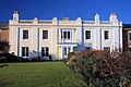
 Albion Villas - geograph.org.uk - 1099295.jpg 640 × 480; 72 KB
-
 Aldeburgh sea front panorama - geograph.org.uk - 1096794.jpg 640 × 245; 57 KB
-
-
 B1118 The Thoroughfare - geograph.org.uk - 1095332.jpg 3,072 × 2,304; 1.45 MB
-
 B1118 The Thoroughfare - geograph.org.uk - 1095350.jpg 3,072 × 2,304; 1.41 MB
-
 B1118 The Thoroughfare - geograph.org.uk - 1095459.jpg 3,072 × 2,304; 1.47 MB
-
 B1118 The Thoroughfare - geograph.org.uk - 1095464.jpg 3,072 × 2,304; 1.45 MB
-
 B1119 Saxmundham Road,Framlingham - geograph.org.uk - 1072263.jpg 3,072 × 2,304; 1.31 MB
-
 B1120 Badingham Road - geograph.org.uk - 1072314.jpg 3,072 × 2,304; 1.55 MB
-
 B1120 Badingham Road - geograph.org.uk - 1072321.jpg 3,072 × 2,304; 1.53 MB
-
 B1120 Badingham Road - geograph.org.uk - 1072333.jpg 3,072 × 2,304; 1.54 MB
-
 B1120 Badingham Road - geograph.org.uk - 1072341.jpg 3,072 × 2,304; 1.45 MB
-
 B1123 Halesworth Road - geograph.org.uk - 1096532.jpg 3,072 × 2,304; 1.3 MB
-
 Barton Mere - geograph.org.uk - 1075632.jpg 640 × 427; 92 KB
-
 Beach at Southwold - geograph.org.uk - 1104075.jpg 640 × 426; 82 KB
-
 Beach huts at Southwold - geograph.org.uk - 1108730.jpg 640 × 427; 70 KB
-
 Beach north of Dunwich - geograph.org.uk - 1102936.jpg 640 × 427; 116 KB
-
 Beccles Town Hall - geograph.org.uk - 1089552.jpg 480 × 640; 74 KB
-
 Benacre beach - geograph.org.uk - 1095985.jpg 640 × 480; 50 KB
-
 Benacre beach and broad - geograph.org.uk - 1096189.jpg 640 × 480; 48 KB
-
 Bent Hill - geograph.org.uk - 1093363.jpg 640 × 480; 243 KB
-
 Blue barrel and slope up to copse - geograph.org.uk - 1071261.jpg 640 × 480; 123 KB
-
 Boat crane at Southwold Harbour - geograph.org.uk - 1104280.jpg 640 × 427; 74 KB
-
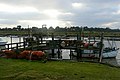
 Boat pontoon, River Blyth - geograph.org.uk - 1073496.jpg 427 × 640; 115 KB
-

-
 Boats at Southwold Harbour - geograph.org.uk - 1073438.jpg 640 × 427; 127 KB
-
 Boats on the Blyth - geograph.org.uk - 1104220.jpg 427 × 640; 55 KB
-
 Brundish Village Sign - geograph.org.uk - 1095318.jpg 3,072 × 2,304; 1.47 MB
-
 Brundish Village Sign - geograph.org.uk - 1095320.jpg 3,072 × 2,304; 1.63 MB
-
 Brundish Village Sign - geograph.org.uk - 1095323.jpg 3,072 × 2,304; 1.66 MB
-
 Buoy and Beacon at Shotley Marina - geograph.org.uk - 1089993.jpg 480 × 640; 42 KB
-
 Bury St Edmunds Station - geograph.org.uk - 1108795.jpg 640 × 427; 64 KB
-

-
 Bury St. Edmunds Asda, Roof in place - geograph.org.uk - 1069853.jpg 640 × 480; 83 KB
-
 Bury St.Edmunds - geograph.org.uk - 1099180.jpg 640 × 480; 127 KB
-
 Bury St.Edmunds railway station - geograph.org.uk - 1099169.jpg 606 × 640; 93 KB
-
 Castle and Fore Streets,Framlingham - geograph.org.uk - 1072259.jpg 3,072 × 2,304; 1.38 MB
-
 Clearly defined footpath - geograph.org.uk - 1071287.jpg 640 × 471; 83 KB
-

-
 Colourful beach huts, Southwold - geograph.org.uk - 1073054.jpg 640 × 367; 92 KB
-
 Container cranes at Felixstowe port - geograph.org.uk - 1070156.jpg 640 × 427; 74 KB
-

-
 Cornfield Road sign - geograph.org.uk - 1099284.jpg 640 × 480; 114 KB
-

-
 Cottages in Yaxley - geograph.org.uk - 1083219.jpg 640 × 403; 56 KB
-
 Covehithe church - geograph.org.uk - 1096237.jpg 640 × 480; 34 KB
-
 Darsham - Church of All Saints.jpg 3,072 × 2,304; 1.66 MB
-
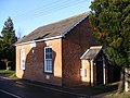
 Darsham Methodist Chapel - geograph.org.uk - 1081699.jpg 3,072 × 2,304; 1.43 MB
-
 Darsham Village Sign - geograph.org.uk - 1081690.jpg 3,072 × 2,304; 1.68 MB
-
 Darsham Village Sign - geograph.org.uk - 1081693.jpg 3,072 × 2,304; 1.62 MB
-
 Dear Row road sign - geograph.org.uk - 1089598.jpg 640 × 480; 87 KB
-
-
 Direction sign - geograph.org.uk - 1088649.jpg 480 × 640; 134 KB
-
 Disused railway bridge - geograph.org.uk - 1075937.jpg 640 × 480; 84 KB
-
 Duck at Southwold - geograph.org.uk - 1104135.jpg 640 × 427; 117 KB
-
 Ducks at Southwold - geograph.org.uk - 1104129.jpg 640 × 426; 112 KB
-
 Earl Stonham Village Sign - geograph.org.uk - 1085109.jpg 3,072 × 2,304; 1.43 MB
-
 Earl Stonham Village Sign - geograph.org.uk - 1085112.jpg 3,072 × 2,304; 1.44 MB
-
 Egyptian geese at Lackford Lakes - geograph.org.uk - 1068714.jpg 640 × 407; 96 KB
-
 End of the Spit - geograph.org.uk - 1082219.jpg 640 × 465; 40 KB
-
 Farm buildings opposite Dairy Farm - geograph.org.uk - 1071078.jpg 640 × 446; 92 KB
-
 Farmland near Blackthorpe - geograph.org.uk - 1075618.jpg 640 × 427; 119 KB
-
 Farmland near Great Barton - geograph.org.uk - 1075643.jpg 640 × 427; 111 KB
-
 Farmland near Great Barton - geograph.org.uk - 1075645.jpg 427 × 640; 120 KB
-
 Felixstowe Beach - geograph.org.uk - 1092530.jpg 640 × 480; 75 KB
-
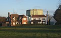
 Felixstowe Conservative Club - geograph.org.uk - 1093353.jpg 640 × 480; 261 KB
-
 Ferry landing stage - geograph.org.uk - 1074578.jpg 640 × 427; 74 KB
-
 Field and trees by Ipswich Road - geograph.org.uk - 1083237.jpg 640 × 430; 83 KB
-
 Field by Bildeston Lane - geograph.org.uk - 1070856.jpg 640 × 461; 83 KB
-
 Field east of New Road - geograph.org.uk - 1070955.jpg 640 × 481; 110 KB
-
 Field looking towards Thornham Parva - geograph.org.uk - 1083007.jpg 640 × 379; 62 KB
-
 Field margin near Trees Farm - geograph.org.uk - 1092108.jpg 640 × 427; 112 KB
-
-
 Field of stubble backed by trees - geograph.org.uk - 1083076.jpg 640 × 443; 82 KB
-
 Field with pylons and tree - geograph.org.uk - 1083211.jpg 640 × 551; 48 KB
-
 Field, fence and hedge - geograph.org.uk - 1071048.jpg 640 × 480; 88 KB
-
 Field-edge footpath from Furneaux Farm - geograph.org.uk - 1070974.jpg 640 × 480; 110 KB
-
 Fields near Yaxley - geograph.org.uk - 1082808.jpg 640 × 475; 85 KB
-
 Fields of the Benacre estate - geograph.org.uk - 1096226.jpg 480 × 640; 66 KB
-
 Fields on the edge - geograph.org.uk - 1096218.jpg 640 × 480; 56 KB
-
 Fields rising towards Prospect Farm - geograph.org.uk - 1071314.jpg 640 × 491; 89 KB
-
 Fields south of Battisford - geograph.org.uk - 1076654.jpg 640 × 388; 62 KB
-

-
 Fish for Sale - geograph.org.uk - 1074580.jpg 445 × 640; 90 KB
-
 Fishermen's huts, Southwold Harbour - geograph.org.uk - 1073320.jpg 640 × 401; 86 KB
-
 Fishing boat at Southwold Harbour - geograph.org.uk - 1073440.jpg 640 × 427; 106 KB
-

-
 Fishing boats at Southwold Harbour - geograph.org.uk - 1104247.jpg 640 × 427; 92 KB
-
 Fishing boats in Southwold Harbour - geograph.org.uk - 1073311.jpg 640 × 427; 101 KB
-

-
 Footpath - geograph.org.uk - 1083715.jpg 640 × 480; 106 KB
-
 Footpath crossing - geograph.org.uk - 1088642.jpg 640 × 480; 138 KB
-
 Footpath near Tollemache Hall - geograph.org.uk - 1070847.jpg 640 × 472; 76 KB
-
 Footpath to Busscreek Marshes - geograph.org.uk - 1073491.jpg 640 × 427; 104 KB
-
 Footpath to Dalham church - geograph.org.uk - 1090494.jpg 640 × 427; 119 KB
-
 Footpath to Lawshall Green - geograph.org.uk - 1092094.jpg 427 × 640; 120 KB
-
 Footpath to Skipper's Farm - geograph.org.uk - 1092124.jpg 427 × 640; 127 KB
-
 Footpath to Squeech Lane - geograph.org.uk - 1097280.jpg 640 × 480; 88 KB
-

-
 Footpath to Walberswick - geograph.org.uk - 1106266.jpg 640 × 427; 75 KB
-
 Footpath towards Naughton - geograph.org.uk - 1071338.jpg 640 × 411; 92 KB
-
 Footpath towards Naughton - geograph.org.uk - 1071350.jpg 640 × 465; 75 KB
-

-
 Former George V Post Box - geograph.org.uk - 1088921.jpg 3,072 × 2,304; 1.48 MB
-
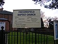 Fressingfield Baptist Church notice board - geograph.org.uk - 1096317.jpg 3,072 × 2,304; 1.31 MB
-
 Fressingfield Methodist Church - geograph.org.uk - 1095800.jpg 3,072 × 2,304; 1.39 MB
-
 Fressingfield Methodist Church notice board - geograph.org.uk - 1095811.jpg 3,072 × 2,304; 1.51 MB
-
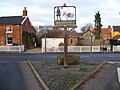 Fressingfield Village Sign - geograph.org.uk - 1095768.jpg 3,072 × 2,304; 1.4 MB
-
 Fressingfield Village Sign - geograph.org.uk - 1095777.jpg 3,072 × 2,304; 1.29 MB
-

-
-
 Gateway to reservoir - geograph.org.uk - 1075622.jpg 640 × 415; 94 KB
-
 Gently sloping farmland near Nedging - geograph.org.uk - 1071241.jpg 640 × 449; 74 KB
-

-
 Heavy seas at Southwold - geograph.org.uk - 1103658.jpg 640 × 427; 74 KB
-
 Heavy seas at Southwold - geograph.org.uk - 1103660.jpg 427 × 640; 81 KB
-
 Homeward bound - geograph.org.uk - 1074592.jpg 640 × 427; 84 KB
-
 Horse tracks near Snailwell - geograph.org.uk - 1067261.jpg 640 × 427; 98 KB
-
 House on Felixstowe Road - geograph.org.uk - 1097525.jpg 640 × 480; 89 KB
-
 House on Southwold promenade - geograph.org.uk - 1073087.jpg 640 × 427; 89 KB
-
 Ipswich Haven Marina - geograph.org.uk - 1077469.jpg 640 × 427; 87 KB
-
 Ipswich Wet Dock redevelopment - geograph.org.uk - 1077471.jpg 640 × 427; 88 KB
-
 Hatfield Road Church - geograph.org.uk - 1082387.jpg 640 × 480; 79 KB
-
 Isaacs, Ipswich Wet Dock - geograph.org.uk - 1077478.jpg 640 × 420; 94 KB
-
 Ivy Cottage, by Mellis Road - geograph.org.uk - 1083215.jpg 640 × 452; 79 KB
-
 Jetties at Southwold - geograph.org.uk - 1104150.jpg 427 × 640; 61 KB
-
 Jetty at Southwold Harbour - geograph.org.uk - 1104226.jpg 640 × 427; 61 KB
-
 Jetty at Southwold Harbour - geograph.org.uk - 1104254.jpg 640 × 427; 114 KB
-

-
 Large field and distant trees - geograph.org.uk - 1082966.jpg 640 × 415; 87 KB
-
 Large tree by footpath - geograph.org.uk - 1071274.jpg 640 × 503; 90 KB
-
 Level crossing and old mill at Mellis - geograph.org.uk - 1083173.jpg 640 × 480; 103 KB
-
 Lichen-covered boardwalk - geograph.org.uk - 1088576.jpg 480 × 640; 197 KB
-
 Little egret at Shotley marina - geograph.org.uk - 1090037.jpg 640 × 480; 69 KB
-
 Local fish and chips - geograph.org.uk - 1104293.jpg 427 × 640; 77 KB
-
 Looking along Dairy Road - geograph.org.uk - 1071093.jpg 640 × 460; 95 KB
-
 Meeting of the currents - geograph.org.uk - 1080085.jpg 640 × 475; 82 KB
-
 Metfield Village Sign - geograph.org.uk - 1096451.jpg 3,072 × 2,304; 1.42 MB
-
 Metfield Village Sign - geograph.org.uk - 1096459.jpg 3,072 × 2,304; 1.41 MB
-
 Metfield Village Sign - geograph.org.uk - 1096466.jpg 3,072 × 2,304; 1.4 MB
-
 Methodist Free Church - geograph.org.uk - 1074725.jpg 3,072 × 2,304; 1.44 MB
-
 Methodist Free Church - geograph.org.uk - 1074726.jpg 3,072 × 2,304; 1.4 MB
-

-
 Muddy footpath, looking towards New Road - geograph.org.uk - 1070965.jpg 640 × 480; 114 KB
-
 Naughton Hall - geograph.org.uk - 1071408.jpg 640 × 402; 56 KB
-
 Ness Point Lowestoft - geograph.org.uk - 1089557.jpg 640 × 480; 73 KB
-
 Northern harbour arm, Southwold - geograph.org.uk - 1074600.jpg 640 × 427; 94 KB
-
 Northern harbour arm, Southwold - geograph.org.uk - 1074601.jpg 427 × 640; 99 KB
-
 Old bollards at Southwold Harbour - geograph.org.uk - 1074589.jpg 427 × 640; 107 KB
-
 Old oak trees by Yaxley Road - geograph.org.uk - 1082983.jpg 480 × 640; 93 KB
-
 On the green at Barking Tye - geograph.org.uk - 1076673.jpg 640 × 408; 51 KB
-
 Open fields near Tollemache Hall - geograph.org.uk - 1070827.jpg 640 × 458; 71 KB
-

-

-
 Path through the willows - geograph.org.uk - 1068707.jpg 427 × 640; 185 KB
-
 Path towards Hall Farm - geograph.org.uk - 1082879.jpg 640 × 458; 79 KB
-
 Petrol station on the A14 - geograph.org.uk - 1099021.jpg 640 × 480; 74 KB
-
 Pier at Shotley Gate - geograph.org.uk - 1089973.jpg 640 × 480; 58 KB
-
 Pier at Shotley Gate - geograph.org.uk - 1089984.jpg 640 × 480; 26 KB
-
-
 Ploughed field beside lane - geograph.org.uk - 1076623.jpg 640 × 372; 69 KB
-

-
 Pond at Lackford Lakes Nature Reserve - geograph.org.uk - 1068710.jpg 640 × 427; 102 KB
-

-
 Pond by Bildeston Road - geograph.org.uk - 1070862.jpg 640 × 447; 93 KB
-
 Pond by Tollemache Hall - geograph.org.uk - 1070838.jpg 640 × 480; 109 KB
-

-

-
 Postbox near Red Barn Farm - geograph.org.uk - 1072350.jpg 3,072 × 2,304; 1.52 MB
-
 Postbox near Ringshall - geograph.org.uk - 1076667.jpg 471 × 640; 92 KB
-
 Promenade, Southwold - geograph.org.uk - 1073097.jpg 427 × 640; 69 KB
-
 Public Footpath Only - geograph.org.uk - 1089117.jpg 480 × 640; 83 KB
-

-
 Rebuilding project - geograph.org.uk - 1104232.jpg 425 × 640; 60 KB
-

-

-
 Rushmere Baptist Church - geograph.org.uk - 1082399.jpg 640 × 480; 65 KB
-
 Rust tipped Coastguard Tower - geograph.org.uk - 1082223.jpg 482 × 640; 39 KB
-
 Rusty Winches - geograph.org.uk - 1082229.jpg 640 × 342; 76 KB
-
 Sand dunes at Southwold harbour - geograph.org.uk - 1074595.jpg 640 × 419; 98 KB
-
 Scraps for a starling - geograph.org.uk - 1074583.jpg 516 × 640; 77 KB
-
 Site of the Framlingham Pump House - geograph.org.uk - 1072295.jpg 3,072 × 2,304; 1.31 MB
-
 Slipway at Southwold Harbour - geograph.org.uk - 1073310.jpg 640 × 431; 119 KB
-
 Slipway at Southwold Harbour - geograph.org.uk - 1073517.jpg 640 × 428; 78 KB
-
 Snape Village Sign - geograph.org.uk - 1069953.jpg 3,072 × 2,304; 1.45 MB
-
 Sole Bay Fish Company - geograph.org.uk - 1104239.jpg 427 × 640; 68 KB
-
 Southwold Harbour - geograph.org.uk - 1074577.jpg 640 × 427; 117 KB
-
 Southwold Harbour entrance - geograph.org.uk - 1074587.jpg 640 × 420; 74 KB
-
 Southwold Harbour entrance - geograph.org.uk - 1074606.jpg 640 × 420; 83 KB
-
 Southwold Harbour Master's Office - geograph.org.uk - 1104299.jpg 640 × 427; 54 KB
-
 Southwold Harbour prices - geograph.org.uk - 1108744.jpg 640 × 392; 61 KB
-
 Southwold Harbour slipway - geograph.org.uk - 1073316.jpg 640 × 427; 90 KB
-
 Southwold Harbourmaster's Office - geograph.org.uk - 1073308.jpg 640 × 427; 78 KB
-
 Southwold Pier - geograph.org.uk - 1073220.jpg 427 × 640; 68 KB


